
Figure 6: Local hydrology positioned on a 3D-image.
The site of ancient Ammaia and its natural hinterland form the background of several geoarchaeological investigations presented here by our team. They concern questions about the topographic and stratigraphic development of the urban centre itself as well as about the human exploitation of natural resources lying within its territory.
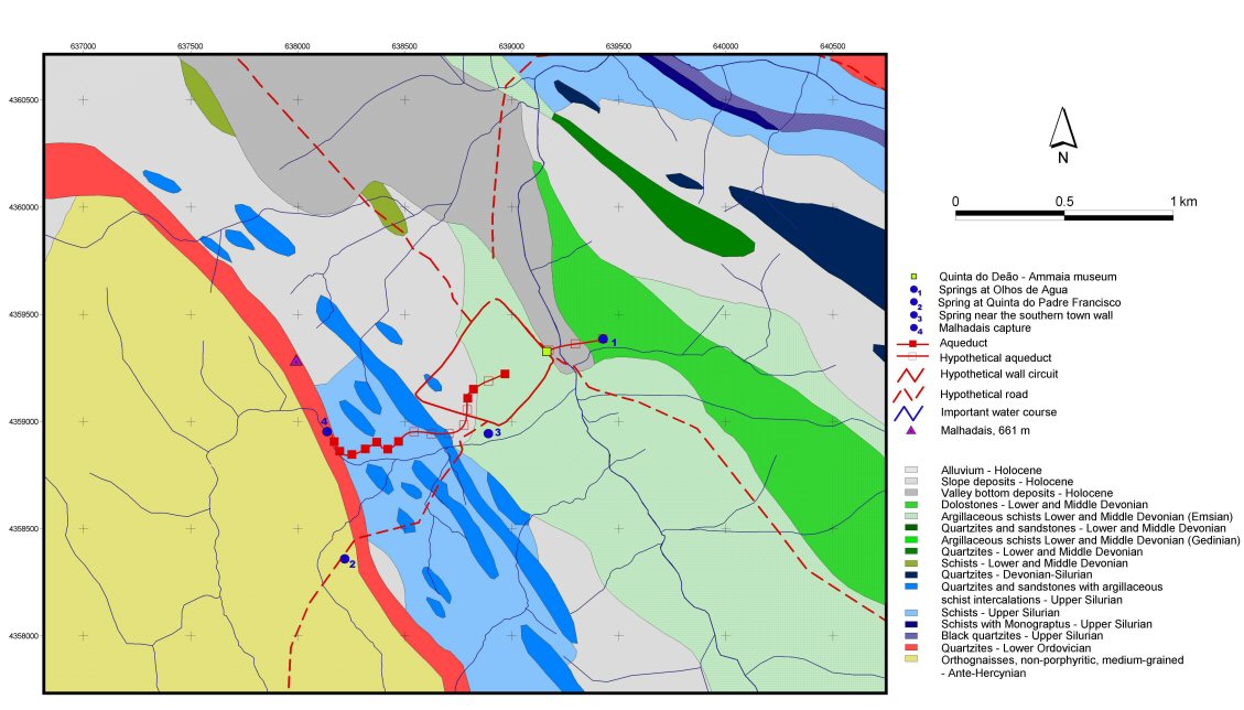
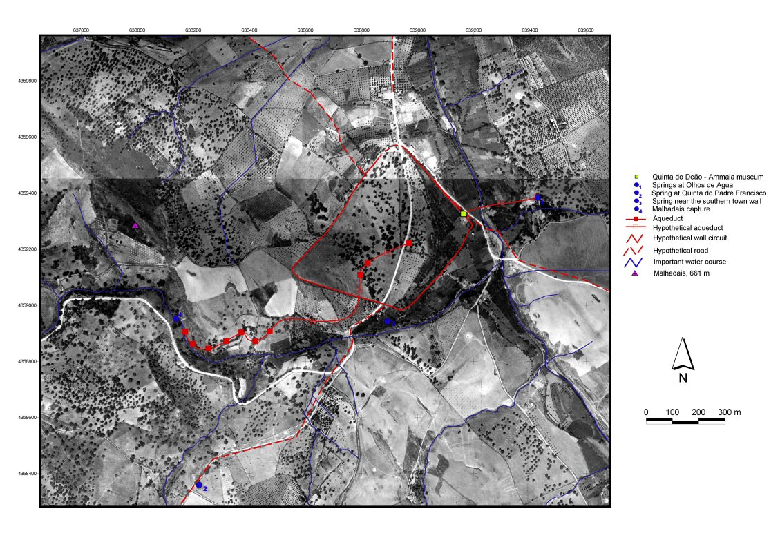
With this study we approach the cultural landscape around Ammaia by means of techniques which combine methods drawn from both geosciences and archaeological survey. The specific problems of assessing and reconstructing a Roman landscape, much altered by physical movements of the soil and by a two-millennia long period of human interference, will therefore be tackled in a multidisciplinary way. This means first of all making use of all relevant cartographic material, such as the 'Carta Geológica de Portugal' (Fig. 4) and the 'Carta Militar de Portugal', available vertical aerial photographs, such as those of the Instituto Português de Cartografia e Cadastro (date: 1952, scale: circa 1:15,000) (Figs 5–7) and relevant satellite images from the Aster and Landsat satellites.
Figure 4: Geological situation of Ammaia. [View static image]
Figure 5: Vertical aerial photograph with indication of the main features of the local hydrography and known Roman springs. [View static image]
All important pre-existing archaeological information (Fig. 8) is inventoried and mapped and new fieldwork organised. This fieldwork, combining traditional archaeological survey techniques and geomorphologic observations, including augerings and the study of stratigraphic sections, is used to build a database of landscape features and sites with archaeological relevance for the period concerned. As many field data and cartographic elements as possible are being assembled in a Geographic Information System (GIS), specifically developed for this project. This GIS will enhance new cartographic material of crucial importance in reconstructing the landmarks of the territory of Ammaia in the first centuries of our era and help to evaluate and interpret the evolution of the landscape shortly before, during, and since Roman times.
Figure 6: Local hydrology positioned on a 3D-image.
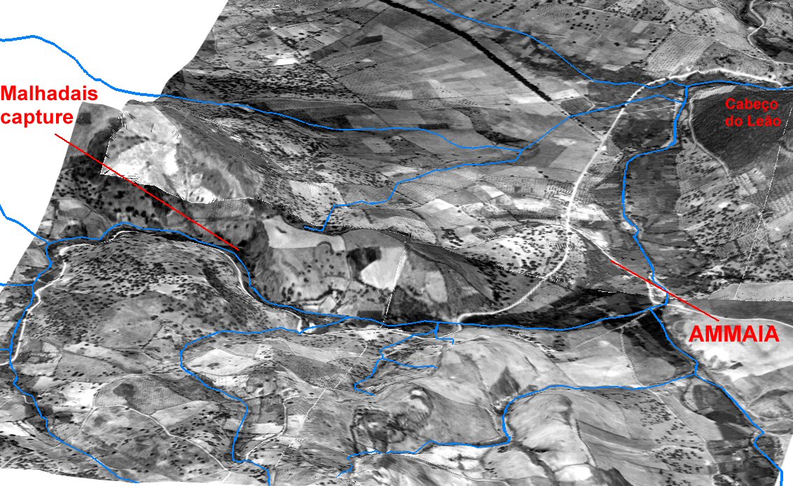
Figure 7: Local hydrology positioned on a 3D-image.
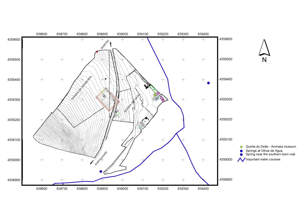
Figure 8: Location of excavated features related to the microtopography of part of the site of Ammaia (cf. Pereira et al. 2000). [View static image]
Several typical geoarchaeological themes have been approached in the project so far. They include:
In this article we will describe some of these investigations and present the most noteworthy results obtained so far.
© Internet Archaeology/Author(s)
University of York legal statements | Terms and Conditions
| Last updated: Mon Nov 21 2005