Back | Forward | Close Window
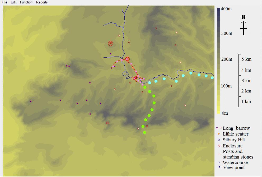
Figure 2: Map of Avebury area showing the paths that will be followed. Green circles represent the best approach from the south, Pewsey and Salisbury Plain, passing Knap Hill causewayed enclosure. Blue circles represent the approach from the east, following the River Kennet. Pink dots represent the path to be followed across the Avebury area.