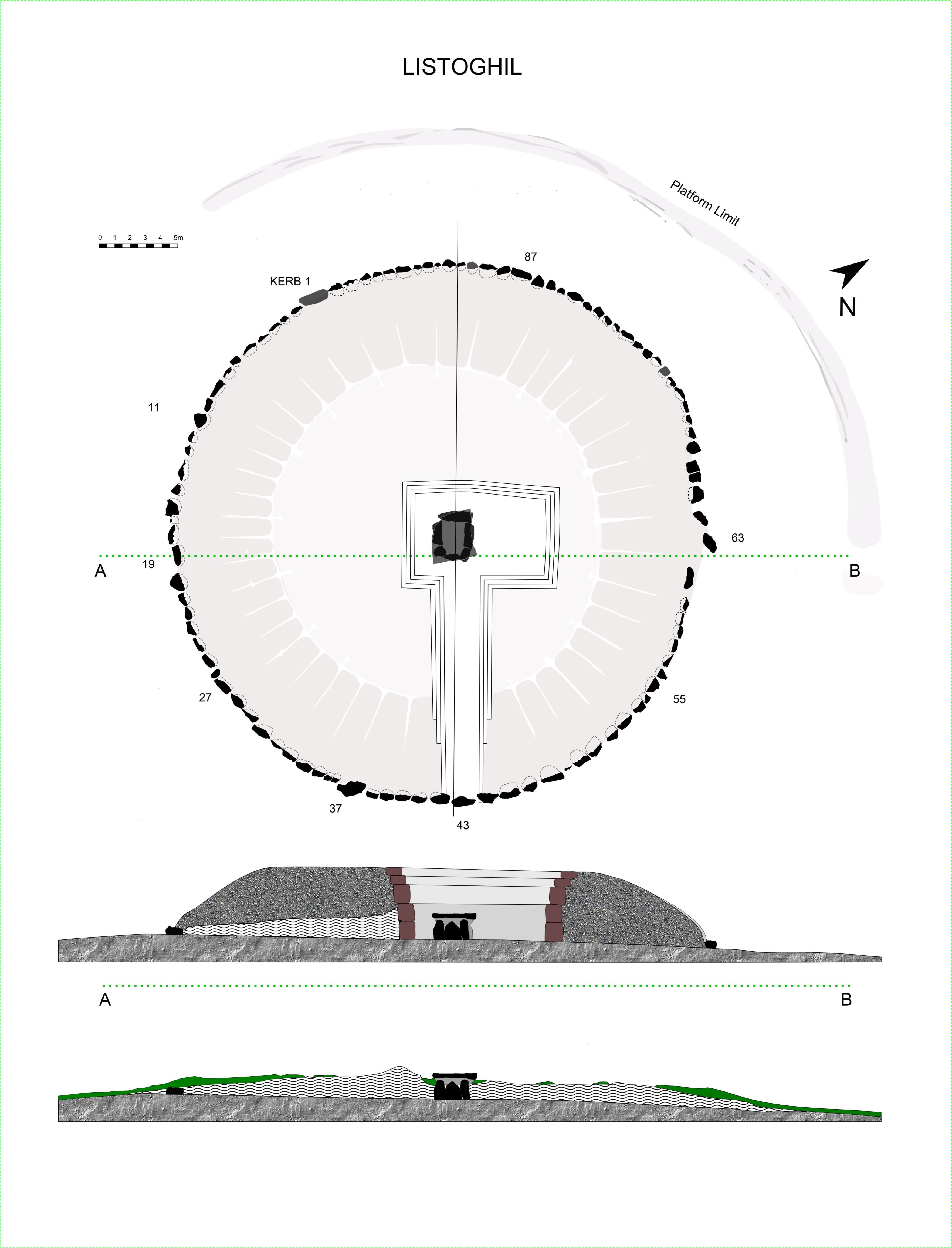
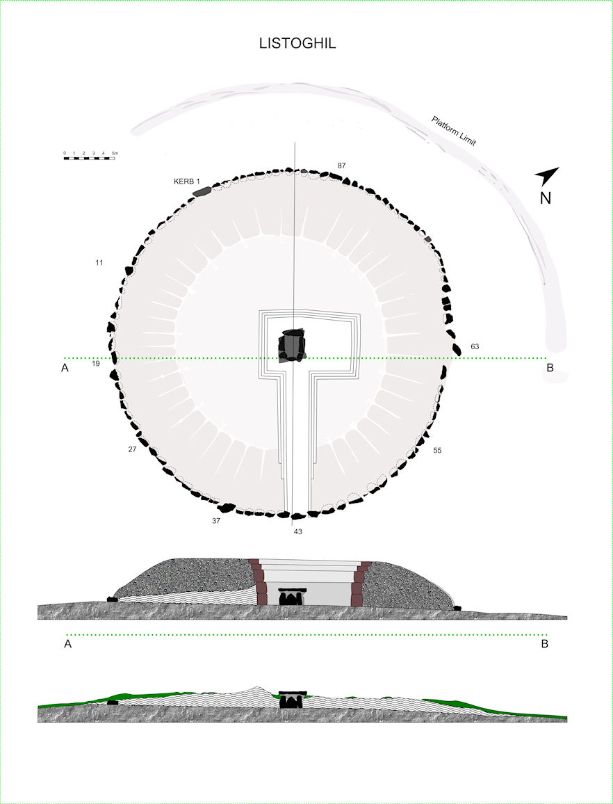
Figure 7: Listoghil plan and section. Bottom section: the mound pre-excavation, based on Burenhult totalstation data (1998b, Fig. 3). [Large size]
Back | Forward | Close Window
Figure 7: Listoghil plan and section. Bottom section: the mound pre-excavation, based on Burenhult totalstation data (1998b, Fig. 3). [Large size]
© Internet Archaeology/Author(s)
University of York legal statements | Terms and Conditions