Wrexham, United Kingdom. Email: g.duckers@hotmail.co.uk ORCID: 0000-0001-6269-3701
Cite this as: Duckers, G. L. (2013). Bridging the “Geospatial Divide” in Archaeology: Community Based Interpretation of LIDAR Data. Internet Archaeology, (35). doi:10.11141/ia.35.10
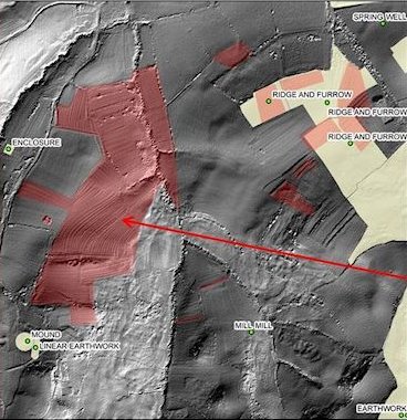
This article describes a project set up to explore the potential of web-based tools for archaeological interpretation of LIDAR data by a non-expert audience. This is accomplished through the creation of bespoke web-based tools designed to facilitate crowdsourced transcription of archaeological features, and trialled through a case study using LIDAR data covering 100km swathe of the Cotswolds, Gloucestershire. A group of non-expert volunteers were tasked with transcribing archaeological features and provided feedback on both the effectiveness of the application and their user experience, in order to tease out potential barriers to public participation.
Go to article Table of Contents
Internet Archaeology is an open access journal based in the Department of Archaeology, University of York. Except where otherwise noted, content from this work may be used under the terms of the Creative Commons Attribution 3.0 (CC BY) Unported licence, which permits unrestricted use, distribution, and reproduction in any medium, provided that attribution to the author(s), the title of the work, the Internet Archaeology journal and the relevant URL/DOI are given.
Terms and Conditions | Legal Statements | Privacy Policy | Cookies Policy | Citing Internet Archaeology
Internet Archaeology content is preserved for the long term with the Archaeology Data Service. Help sustain and support open access publication by donating to our Open Access Archaeology Fund.
File last updated: Wed Oct 23 2013