Forward | Close Window

Figure 1a: Map of Barbados with approximate location of Mount marked. (Washington, D.C.: Central Intelligence Agency, 1980. © Library of Congress, Geography and Map Division. http://hdl.loc.gov/loc.gmd/g5140.ct002725) Figure 1a

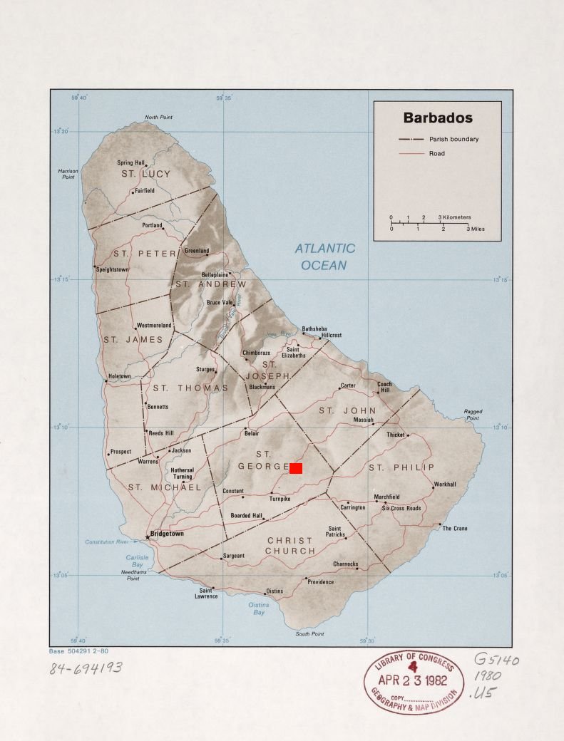
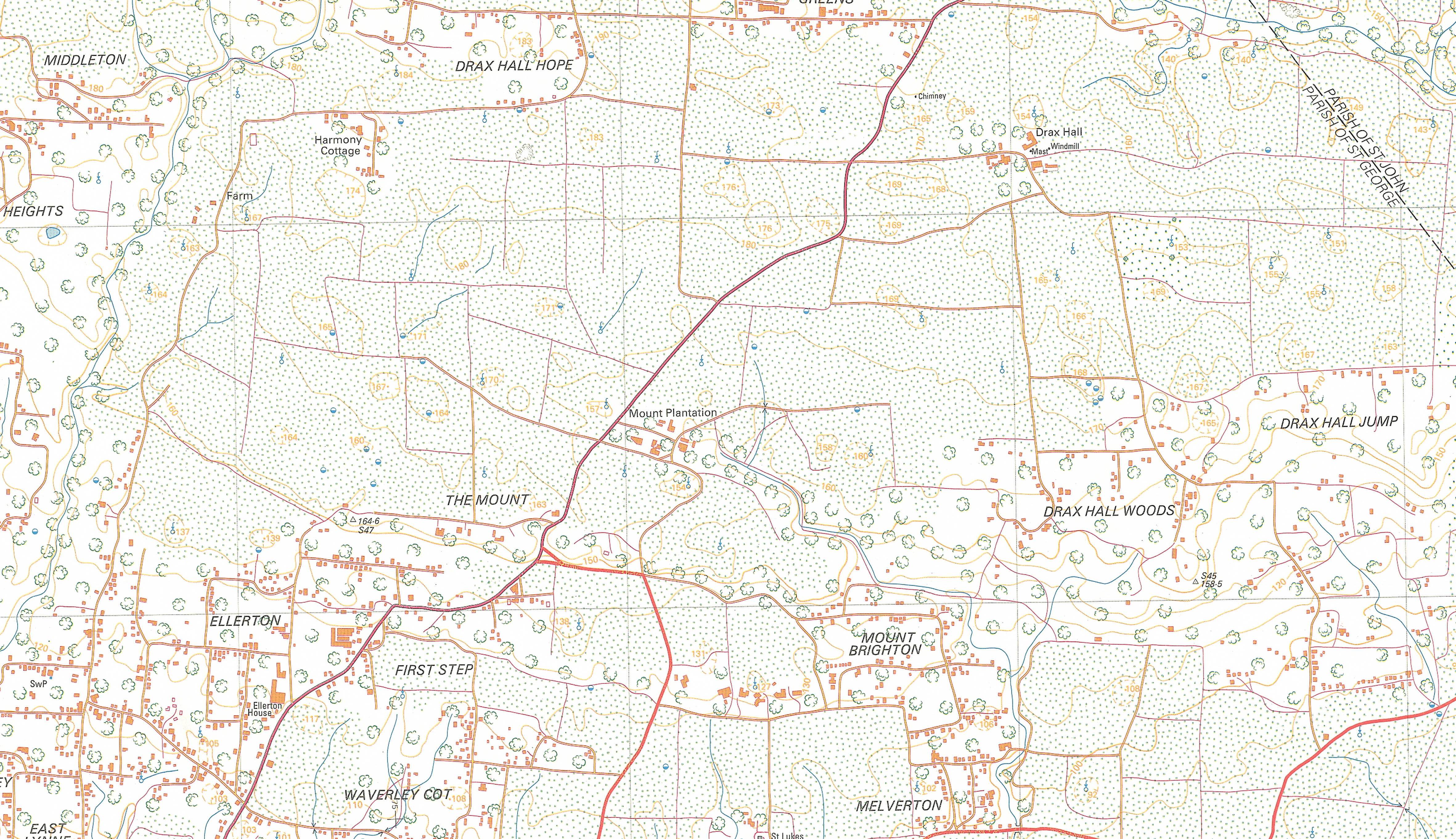
Figure 1b: The Mount Plantation, St George's, Barbados. © Government of Barbados 1988. Overseas Surveys Directorate 218/1. Barbados Sheet 9. 2nd edition. [View static image]

Internet Archaeology is an open access journal based in the Department of Archaeology, University of York. Except where otherwise noted, content from this work may be used under the terms of the Creative Commons Attribution 3.0 (CC BY) Unported licence, which permits unrestricted use, distribution, and reproduction in any medium, provided that attribution to the author(s), the title of the work, the Internet Archaeology journal and the relevant URL/DOI are given.

Terms and Conditions | Legal Statements | Privacy Policy | Cookies Policy | Citing Internet Archaeology

Internet Archaeology content is preserved for the long term with the Archaeology Data Service. Help sustain and support open access publication by donating to our Open Access Archaeology Fund.