Back | Forward | Close Window

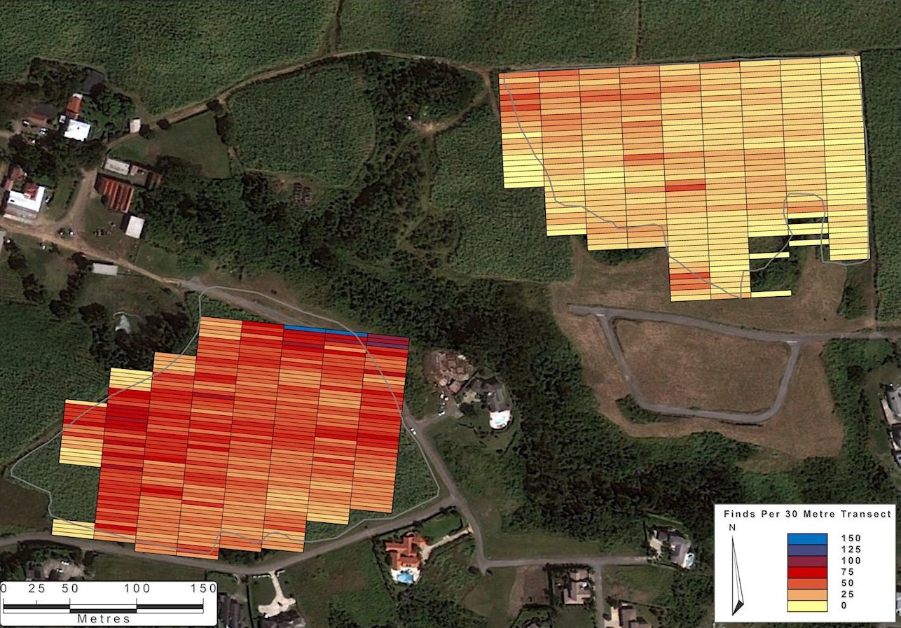
Figure 3: The fieldwalking data collected during the rapid survey of Millfield (bottom left) and Upper Tenantry (top right) at Mount, overlaid on aerial image. The schematic colour bars reflect the density of finds in each 30m section of the furrows. Satellite imagery ©2013 Google and ©2013 DigitalGlobe.

Figure 3

Internet Archaeology is an open access journal based in the Department of Archaeology, University of York. Except where otherwise noted, content from this work may be used under the terms of the Creative Commons Attribution 3.0 (CC BY) Unported licence, which permits unrestricted use, distribution, and reproduction in any medium, provided that attribution to the author(s), the title of the work, the Internet Archaeology journal and the relevant URL/DOI are given.

Terms and Conditions | Legal Statements | Privacy Policy | Cookies Policy | Citing Internet Archaeology

Internet Archaeology content is preserved for the long term with the Archaeology Data Service. Help sustain and support open access publication by donating to our Open Access Archaeology Fund.