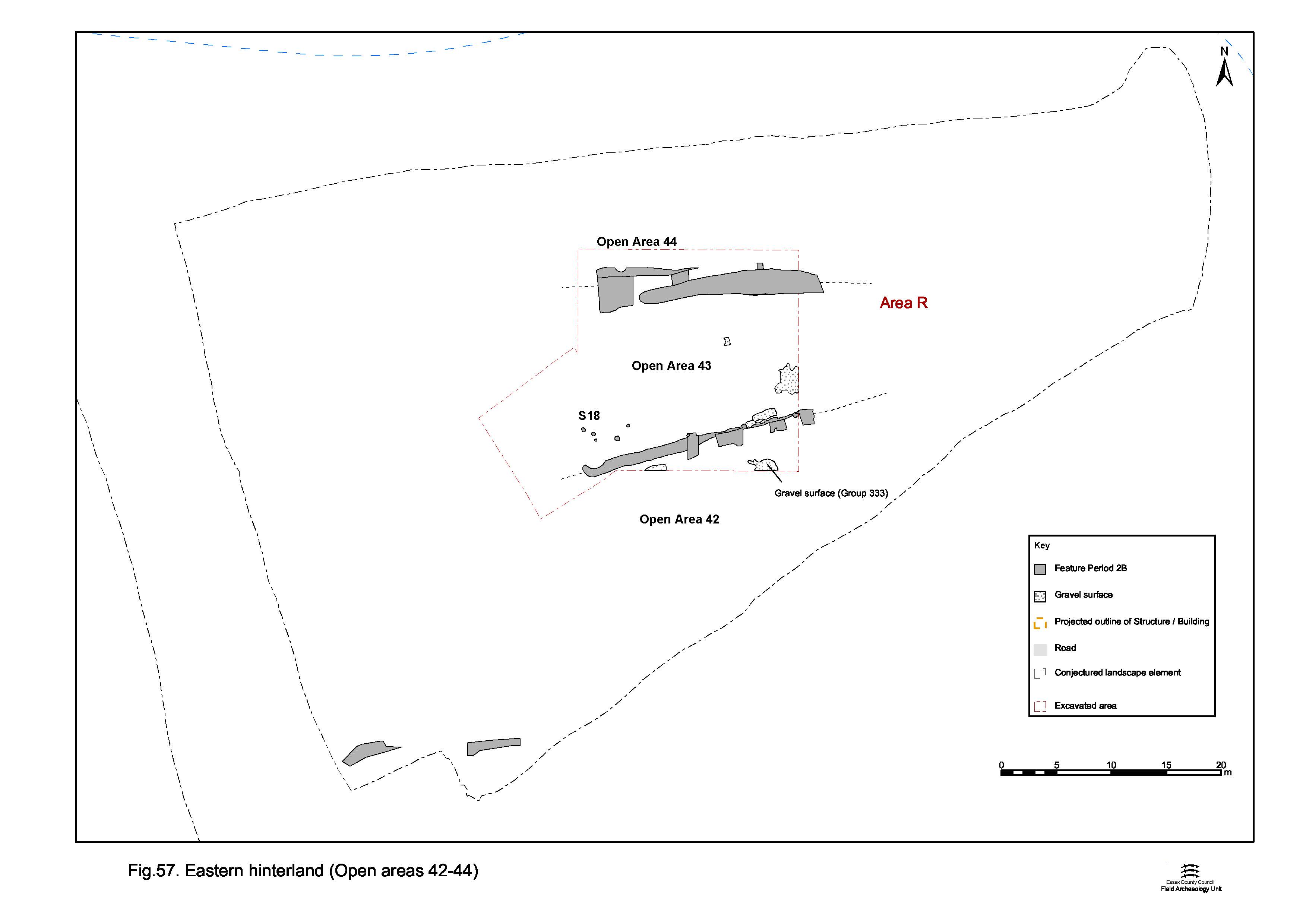
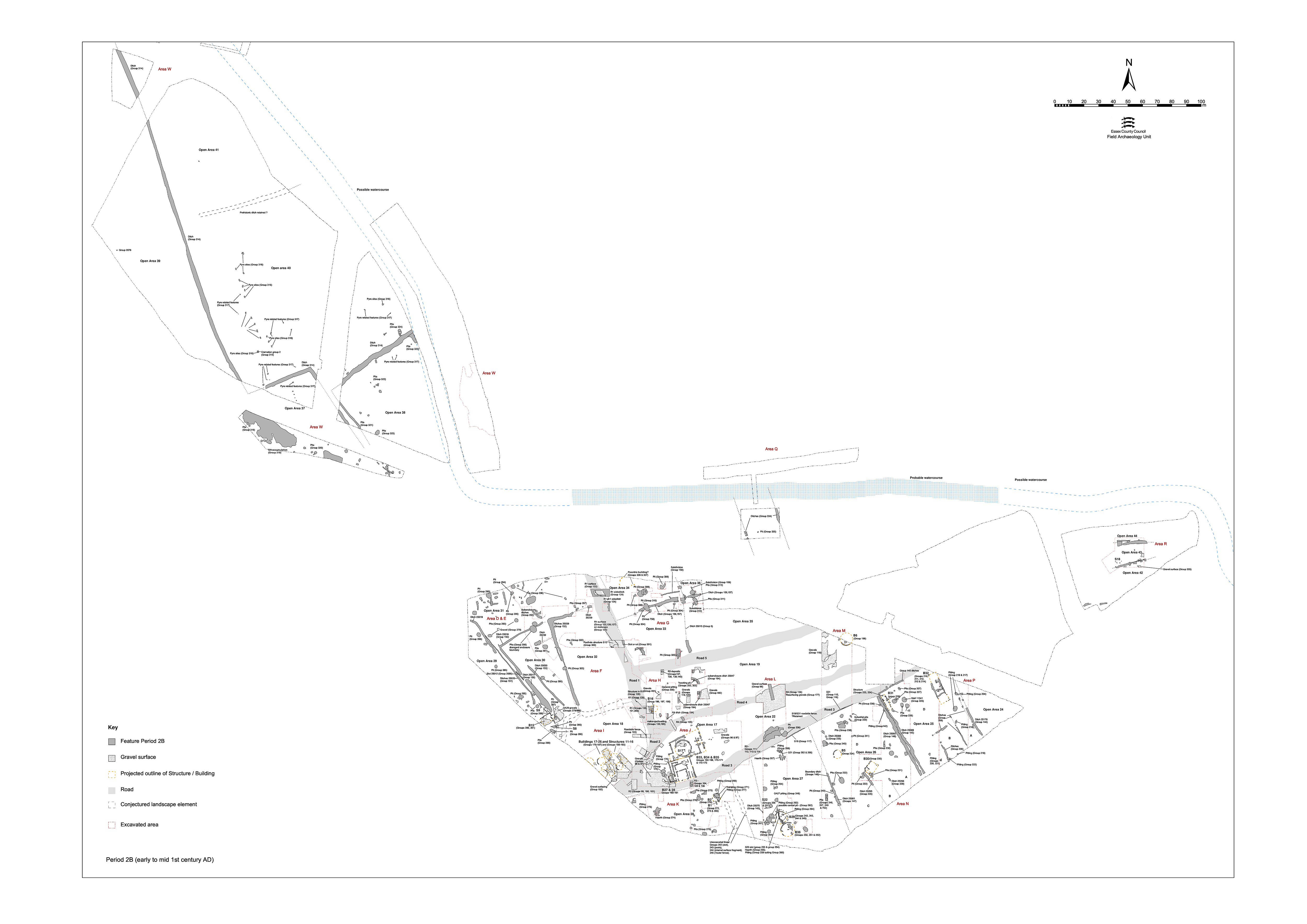
In the easternmost part of the lower terrace (within Excavation Area Q), the Period 2A land-division is replaced by a distinctly different enclosure system, which consists of two substantial and repeatedly re-cut ditch lines running almost east-to-west, some 15m apart (Figure 57). The paucity of contemporary features between the ditches suggests that occupation is sparse this far from the settlement core, although this may simply be a reflection of the small area excavated.
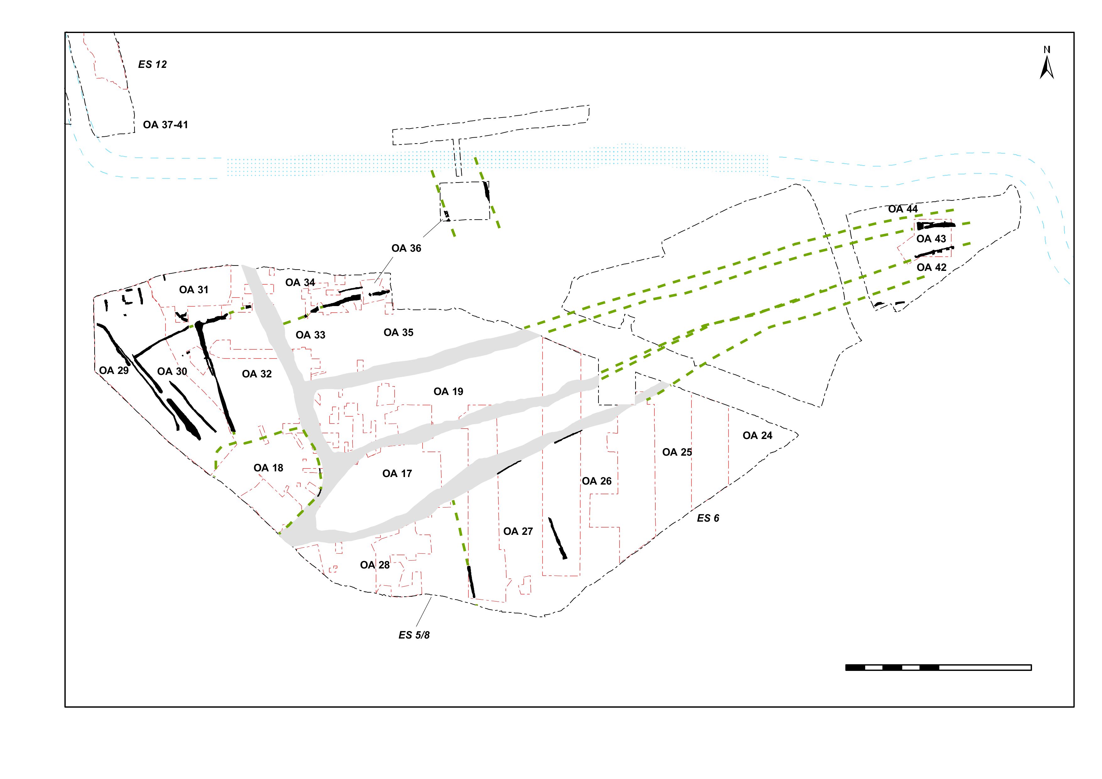
Owing to its relative remoteness from the remainder of the lower terrace, this vicinity is named the Eastern Hinterland. However, in many ways it might be better regarded as the very eastern end of the Central and Northern Zones. The identified ditches may well run alongside the sides of converged Road/track 3/4 and Road/track 5. If this is indeed the case, it may be construed that some or all of the three enclosures delineated by them (Open Areas 42-44) might be continuations of those identified further east. However, given the wide separation imposed by uninvestigated Development Area A3, it is perhaps safest to consider these separate entities. At the very least, these boundaries suggest that Road/tracks 3/4 and 5 converge a short distance further east - perhaps at a crossing-point of the watercourse.
The boundary ditches of this enclosure system are described below. The features occupying the enclosure interiors are described in Eastern hinterland, Open Areas 42, 43 and 44.
Ditch 25009 (segs 1738, 17343, 17364 Group 327) is the earliest phase of a major east-west aligned ditch that runs along the northern edge of Excavation Area Q. Although heavily truncated by later re-cuts 25184 and 25183, it survives to a maximum width of 1.15m and depth of 0.5m. Its original width is estimated to have been in the region of 1.4m.
25184 (segs 17315, 17340, 17344, 17348 Group 329) is as much a re-establishment of the original boundary as a simple re-cut. While largely following the northern edge of ditch 25099, it constitutes a massive enlargement, widening the ditch eastwards to approximately 3.0m and increasing its depth slightly to between 0.6 and 0.85m.
25183 (segs 17257, 17314, 17412 Group 330) is a relatively minor second re-cut within ditch 25184. A western terminal is identified but not excavated, its presence indicating that this feature probably constitutes a partial cleaning out rather than a full re-cutting episode.
The finds assemblage from the fills of re-cut 25184 is dominated by pottery, with only small amounts of briquetage, daub and loomweight. Latest re-cut 25183 contains a significantly larger, though similar, assemblage supplemented by a brooch (SF5970) and iron nail, glass sherd and 72g of imbrex. These latter inclusions, together with some pre-Flavian pottery, indicate a Romanising influence toward the end of the life of this boundary.
The eastern extents of these features were not determined, having been removed by Victorian quarrying. Nor were the western extents of 25099 and 25184. However, together they constitute the presence of a major boundary that has actively been maintained for a period of time; perhaps as late as the later 1st century AD. Some fills were noted to have been water-laid, which may suggest a drainage, as well as boundary, function. Its principal importance is conjectured to be as a boundary feature, defining the line of converging Road/track 5 as it continues beyond the likely eastern edge of the settlement.
Boundary ditch 25181 (segs 17410, 17411 Group 328) runs broadly parallel to, and 15m south of, ditches 25099/25184/25183. This original ditch, although severely truncated by re-cut 25179 (17009, 17055 17198 Group 331), is probably originally only 1.1m wide and survives to a depth of only 0.35m. A terminal, truncated by a later pit, is evident at its west end, while the ditch is truncated by Victorian quarrying 20m to the east.
The line of the ditch seems to have been re-established by re-cut 25179, a more substantial ditch, at 1.4 to 1.9m wide, although no deeper than 25181. This re-cut was not recognised in all of the segments excavated across this feature and it remains possible that this boundary has a more complex history than has been possible to reconstruct, as suggested by the differing fill sequences between the recorded sections. It is possible that re-cut 25179 does not extend to the very end of its predecessor. Although its precise limit is not determined, it may terminate in a broadly parallel location to that of 25183, to the north.
Both phases of this ditch seem to have accumulated fills derived from the reworked brickearth. Whether this is the result of weathering and slippage of this deposit into the partially open features, or the brickearth being actively reworked and moved around during their life, is unclear.
It is possible that ditch 25181 constitutes the boundary alongside converged Road/tracks 3 and 4. If this is the case, then the various post-holes and slots that occur alongside the ditch could be parts of roadside fences.
Internet Archaeology is an open access journal based in the Department of Archaeology, University of York. Except where otherwise noted, content from this work may be used under the terms of the Creative Commons Attribution 3.0 (CC BY) Unported licence, which permits unrestricted use, distribution, and reproduction in any medium, provided that attribution to the author(s), the title of the work, the Internet Archaeology journal and the relevant URL/DOI are given.
Terms and Conditions | Legal Statements | Privacy Policy | Cookies Policy | Citing Internet Archaeology
Internet Archaeology content is preserved for the long term with the Archaeology Data Service. Help sustain and support open access publication by donating to our Open Access Archaeology Fund.