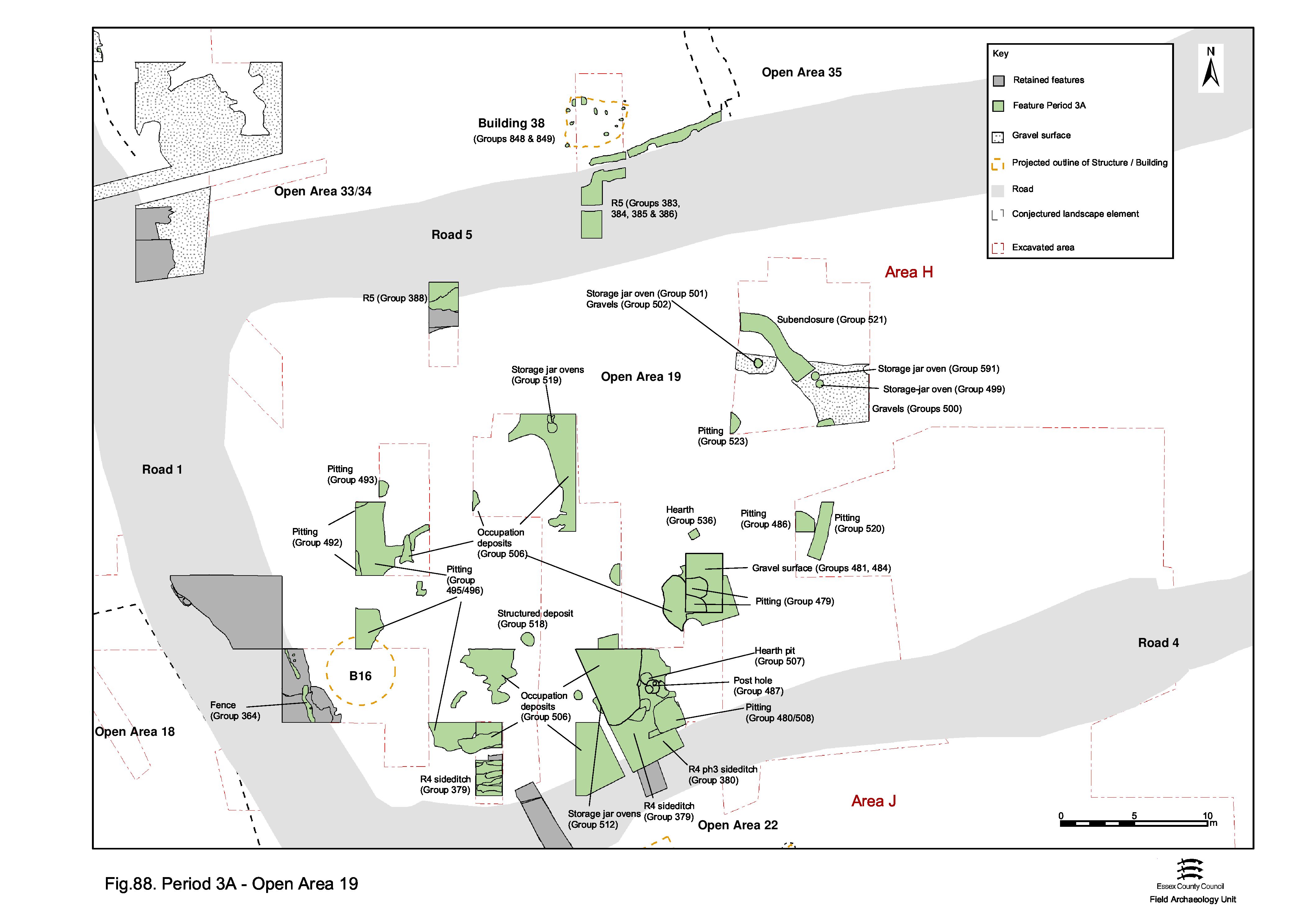
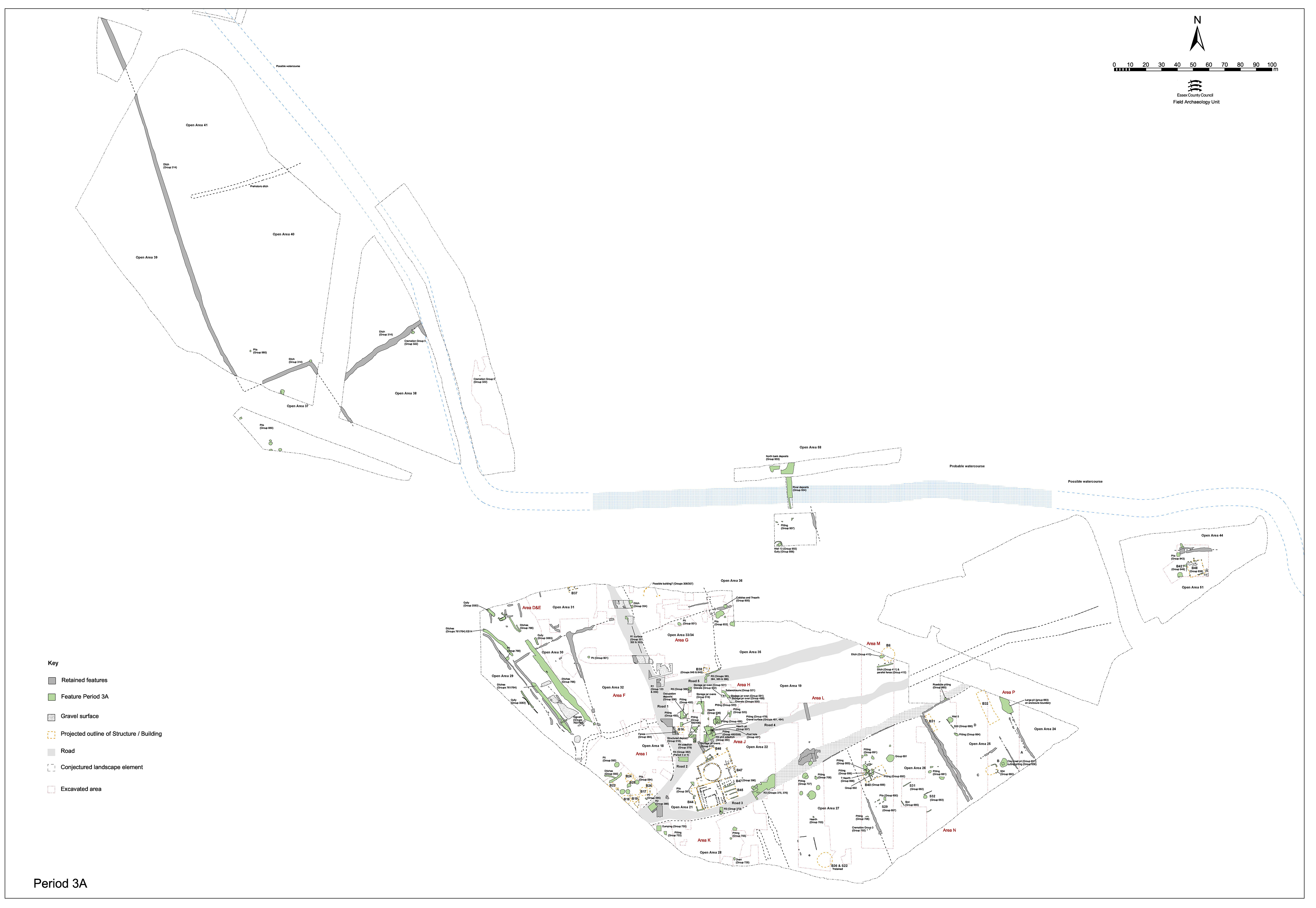
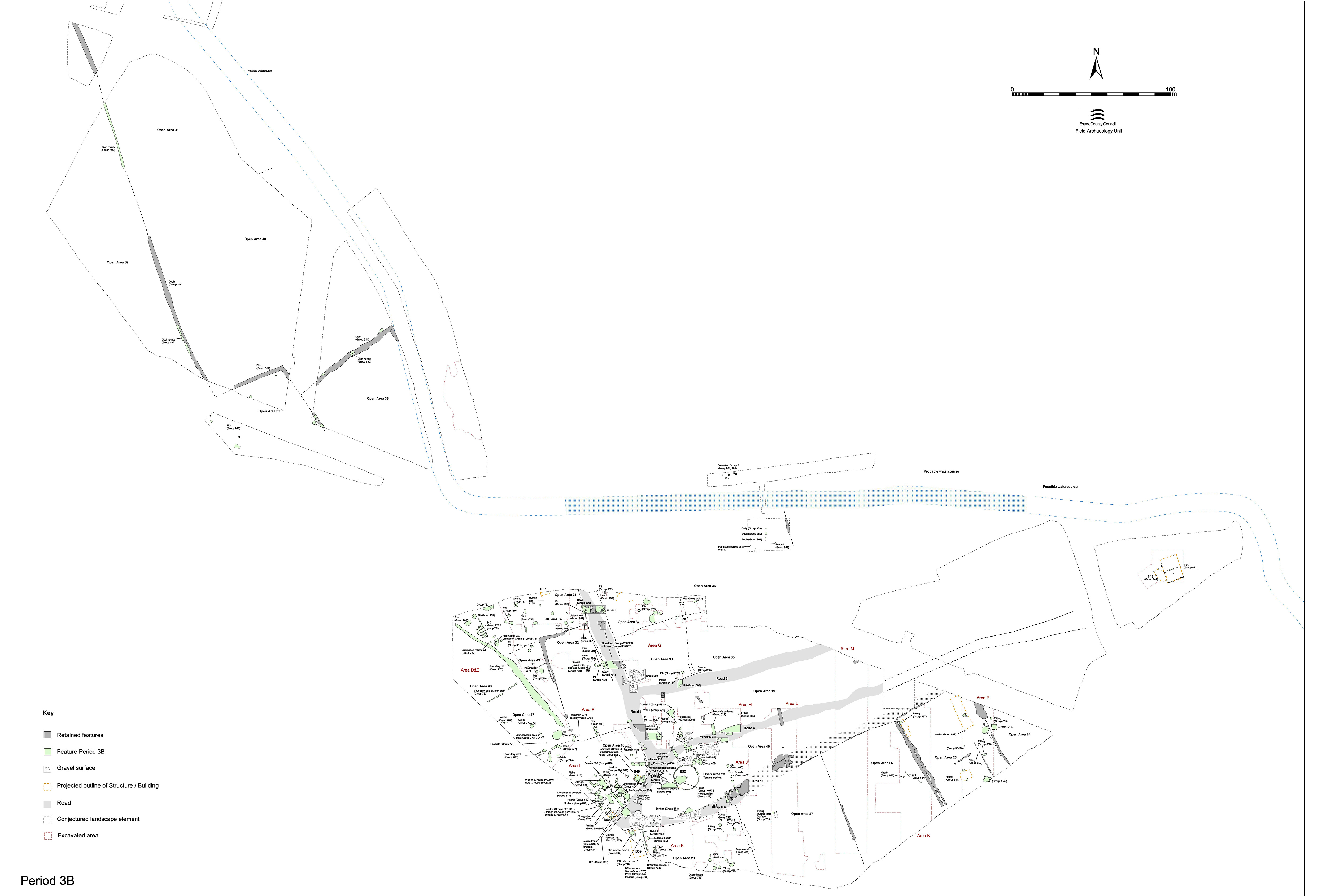
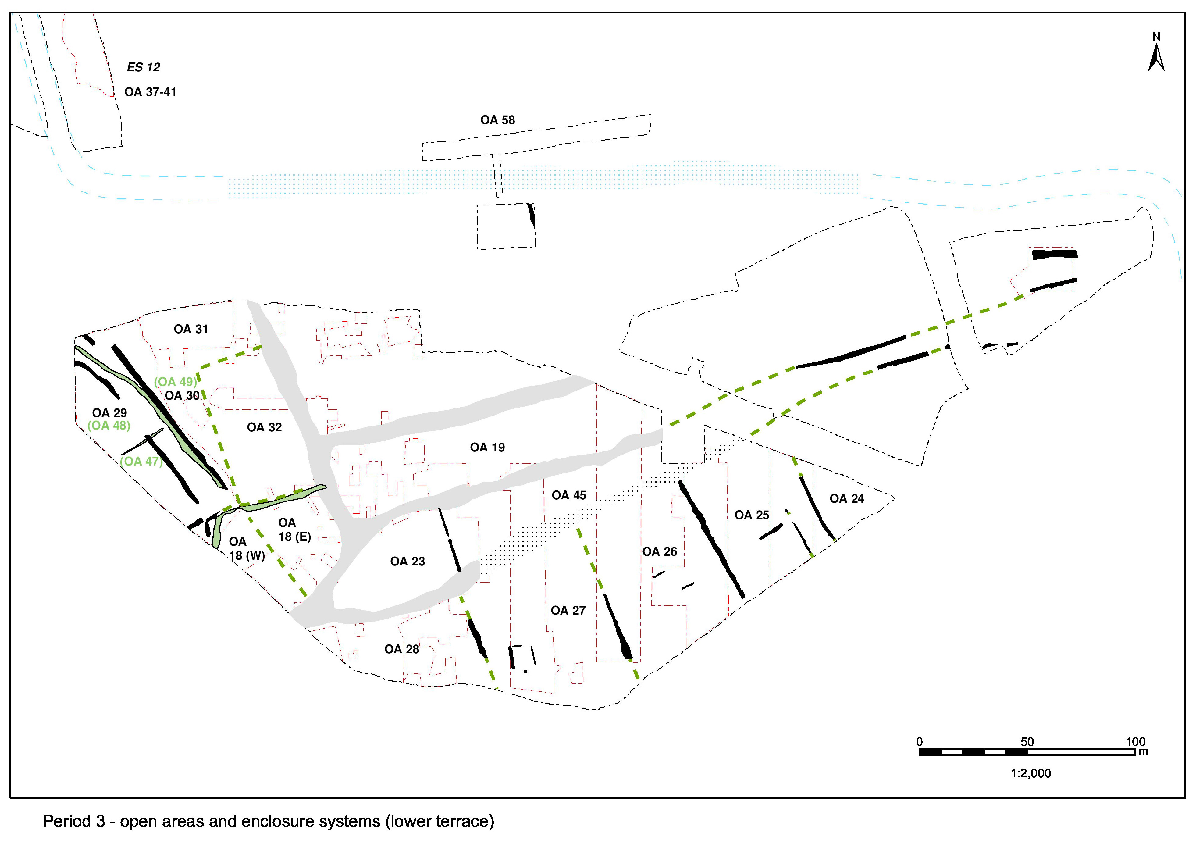
The western part of Open Area 19 seems to continue to be largely occupied by an oval sub-enclosure, now containing pits and ovens (Figure 88). It is notable that its entrance is located at the same eastward point as the adjacent temple precinct wall in OA23. As is the case for OA23/45, there seems to be a clear distinction in land-use either side of this, although not apparently formally marked in OA19. The entire plot as bounded by Roads 1, 4 and 5 is therefore still regarded as a single entity, but practical distinction is made between use of its western end and the eastern remainder. This section describes the Period 3 'preparation' of the open area and its sub-enclosure, while the next sections will discuss pits and ovens. (Period 3B activity is discussed later).
Deposits of greyish-orange brickearths (6724, 6804 Group 495 and 6165, 6778 Group 496) are identified sporadically across the western end of Open Area 19. These layers generally overlie major features of earlier date, probably representing their final levelling and consolidation, and certainly seem to overlie the former site of Building 16. While apparently isolated from one another, these dumps could constitute a single episode of ground levelling of the plot interior adjacent to Road 1.
Fragments of gravel surfacing overlie the earlier Period 2B surface. It is possible that the earlier surface remains in use and that these represent its localised repair. Although the association of these apparently similar layers, revealed within different trenches across Excavation Area H, is largely tentative, gravel layers 6579 and possibly 6857 (Group 488) probably form a single surface with 6565 (Group 490), and with 6612 and 6635 (Group 488) as a gravelly levelling deposit below. The Group 488 gravel surface is post-dated by a storage jar oven 16345 (Group 503), suggesting that this resurfacing occurred early in Period 3.
Group 494 comprises another slight patch of metalling (16112), with a silt build-up (16079) above, followed by a further surface (16072). However, only a limited extent of this sequence is revealed and 16072 may be no more than a repair to 16079. Gravel deposits 6795 and 6767 are more problematical, but are likely to be further gravel levelling and/or surfacing, with 6730 an accumulation of silt over them (Group 497). Later 1st-century pit 6530 (Group 498) cuts the gravels of Groups 494/497.
Two distinct linear features, 25257 and 25258 (Group 521), may form elements of an elliptic enclosure ditch replacing an equivalent Period 2B feature (25047, Group 194). Located immediately to the east of the eastern side of its precursor, these two lengths of ditch broadly follow its curvature, though clearly defining an enclosure of broader north-south extent. As with ditch 25047, only the eastern end of this feature is revealed by excavation - the remainder being conjectural. The square terminals of excavated ditch segments 6389 and 6693 define an entrance some 3.0m wide. It is possible that this second phase of elliptic ditch extends far enough north and south for its sides to closely flank Roads 4 and 5, both of which are probably subsequently removed by later roadside ditches.
Although the ditch is only 1.0-1.5m wide where excavated, it is nevertheless tempting to associate it with the broader ditches, particularly 25256, alongside Road 4 which is of similar date.
No trace of its west end is identified, and it is possible that the sub-enclosure is open to the Road 1 frontage. Ditch 25257 (seg. 6513) contains pottery dating from the late 1st to early 2nd century AD. Two poorly dated storage jar ovens (6441 and 6551, Group 591) have an unrecorded relationship with the curving ditch.
It is likely that the identified Period 3 pits, storage jar ovens and well occupy the interior of this OA19 sub-enclosure.
A number of silty and clayey layers accumulate on top of the early (Period 2B) gravel surfacing of Open Area 19. These soils seem to build up in the later 1st and early 2nd centuries AD, and presumably relate to the use of the west end of OA19 before being covered by a second surfacing over the open area in Period 3B.
Mixed silt layers (Group 506), which are clearly of early Roman date, include roadside wash/runoff (e.g. 6411, 6414, 6416, 6421, 6426, 6435, 6437). These contain few finds, although perhaps a surprising amount of stone (as opposed to flint pebbles and gravels). The late dating for some of these accumulations (6411, 6416) cannot be accepted as they are stratigraphically below perfectly acceptable 2nd-century features; it must be that these extensive layers carry on accumulating material long after their original deposition. This is not quite the same as dismissing the later material as intrusive, only accepting that the histories of these deposits are more complex than single depositional events.
Dark sandy silt 6418 (including lenses 6542, 6585 within it) is a more expansive layer which extends northwards from the edge of Road 4 into the interior of Open Area 19. As thick as 0.3m in places, and overlying uneven gravel surface 6565 (Group 490), this deposit may be a deliberate dump deposited to counter continuing slumping into the earlier Road 4 side-ditch 25254 (Group 379). Unlike the other roadside deposits, it contains large quantities of artefacts indicative of redeposited rubbish. Although less extensive, and containing less cultural material, nearby layers 6220, 6292 and 6378 may be parts of the same levelling activity as 6418.
Clayey silts 6053, 6933, 6965 and 16019 (Group 506), located in the centre of Open Area 19, overlie brickearth levelling and possibly represent the ground surface of this period where there is no clear metalled surface. If so, we may perhaps posit an open grassed area, or possibly even a garden.
Gravelly silt deposit 16021 (Group 481) overlies part of the infilled Period 2B sub-enclosure ditch 25047 (seg. 16046), perhaps accumulating and being preserved in a slump hollow in its top. It is unclear whether or not this is a slumped surface in its own right.
Generally dark brown gravelly silt layers 6071, 6969, 6743, 6788, 6789, 6790, 6914, 6959 (Group 484) all seem to represent further accumulation within slump hollows that form in the gravel surface across the enclosure interior owing to the settling of earlier pits and ditches below.
Internet Archaeology is an open access journal based in the Department of Archaeology, University of York. Except where otherwise noted, content from this work may be used under the terms of the Creative Commons Attribution 3.0 (CC BY) Unported licence, which permits unrestricted use, distribution, and reproduction in any medium, provided that attribution to the author(s), the title of the work, the Internet Archaeology journal and the relevant URL/DOI are given.
Terms and Conditions | Legal Statements | Privacy Policy | Cookies Policy | Citing Internet Archaeology
Internet Archaeology content is preserved for the long term with the Archaeology Data Service. Help sustain and support open access publication by donating to our Open Access Archaeology Fund.