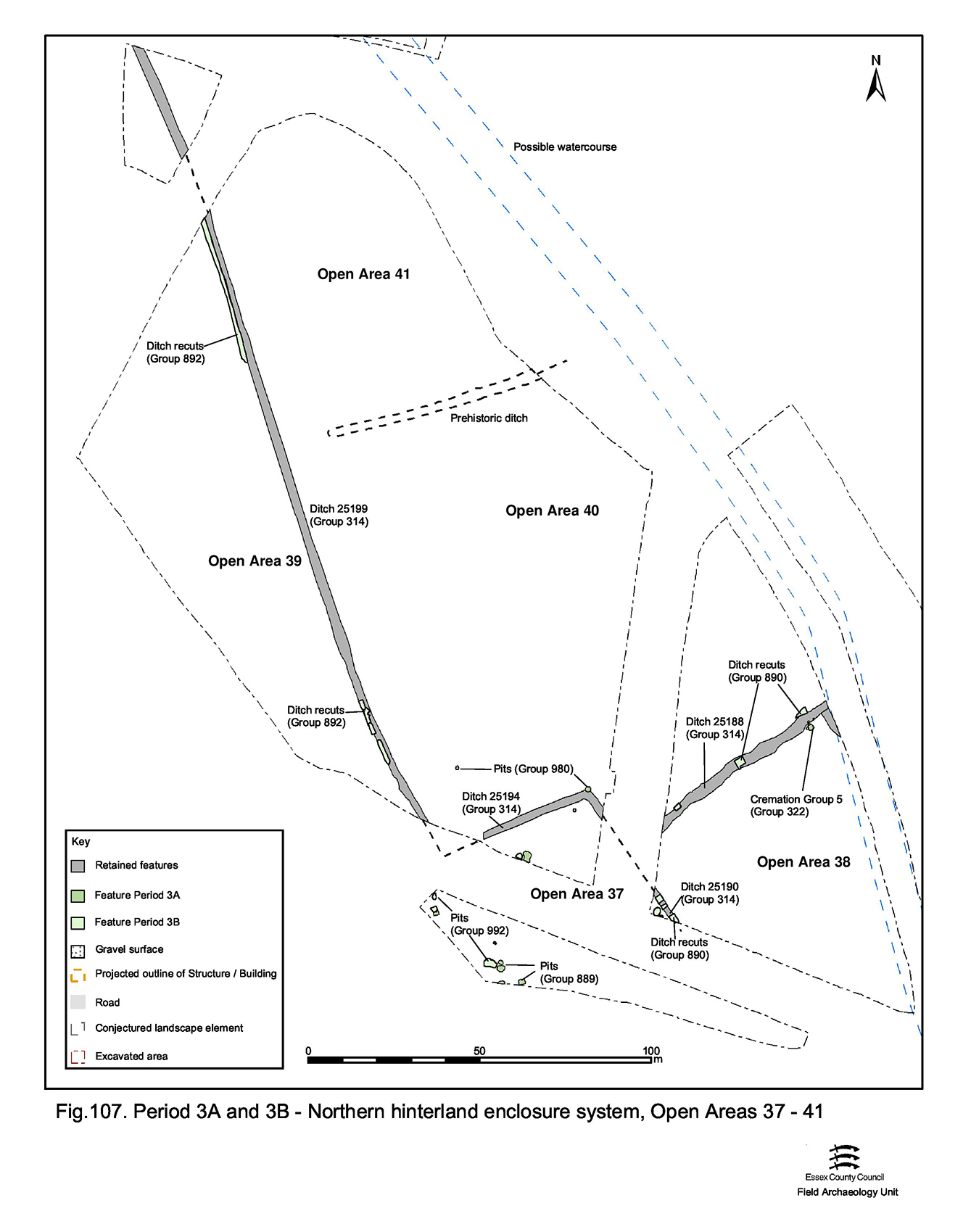
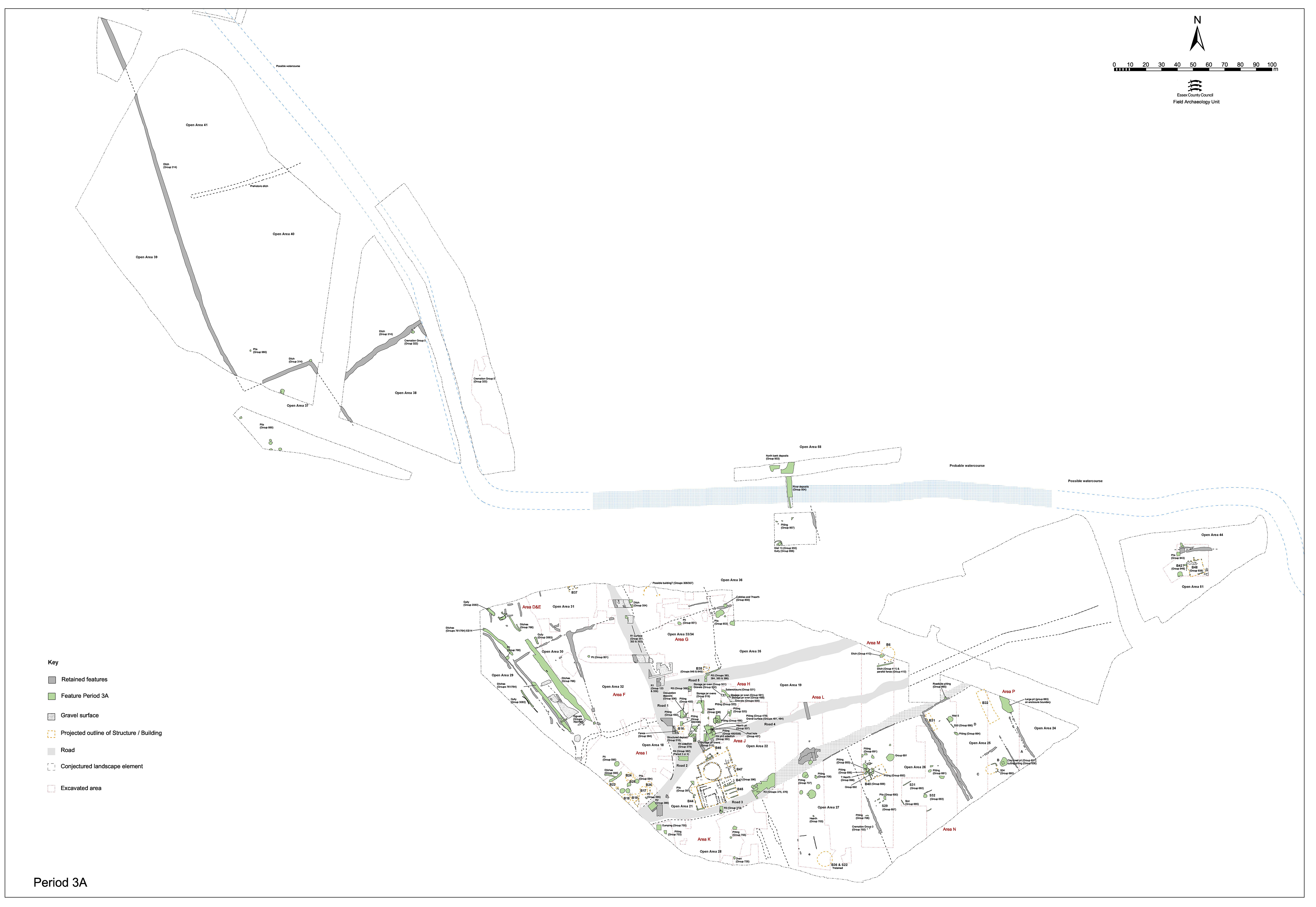
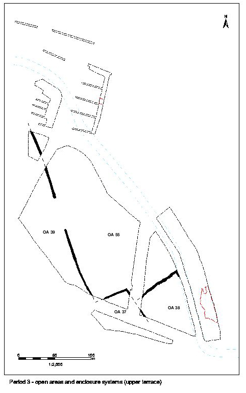
As the basic infrastructure of the Northern Hinterland enclosure system continues unchanged between Periods 2B and the earlier part of Period 3 (nominally ?3A), the remains within its component enclosures west of the posited continuation of Road 1 (OAs 37-41) are collectively described below (Figure 107). It is evident that the distinction in land-use to the north and south of retained boundary ditches 25194 and 25188 becomes increasingly pronounced. Later modifications to the enclosure system are described in Northern hinterland, cremation cemetery, Open Area 58 - Period 3-4 and northern hinterland activity east of Road 1 in Northern hinterland, Open Area 58 and watercourse - Period 3.
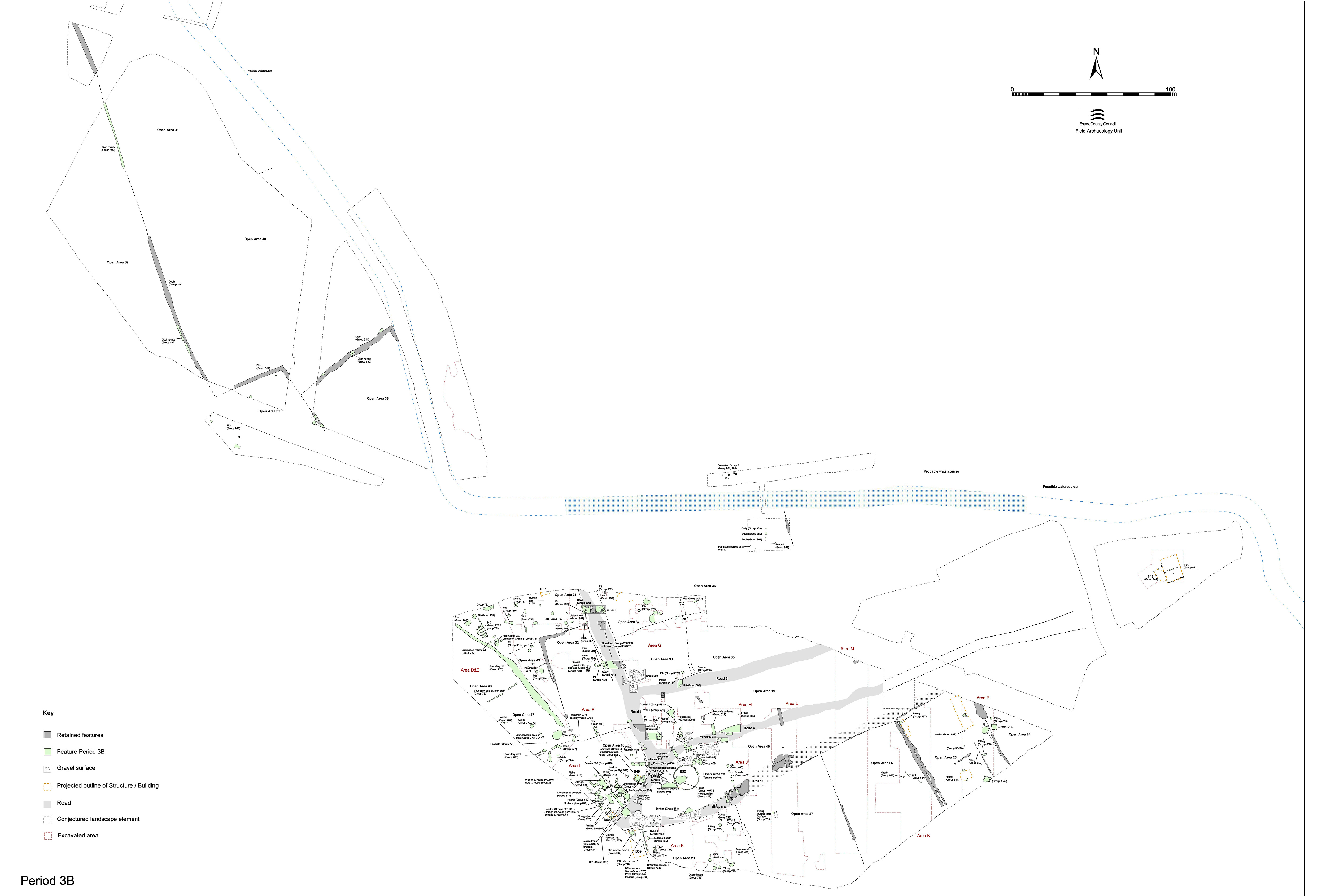
This liminal area, occupying/straddling the gravel terrace step, is conspicuous for the presence of pitting, which is almost exclusive to this particular enclosure of the Northern Hinterland as exposed in Excavation Area W.
The early Roman pits (410, 445, 2131, 2132, 2171, 2190, 3511, 3520, 3565, 3567, 3580, 3597, 3701, 3751, 3769) are relatively few in number compared with those of the preceding period, and become more specifically located within this single enclosure rather than generally along the terrace step as in Period 2B. Although these pits tend to be larger than those of the LIA, their finds assemblages are often smaller, though perhaps slightly more varied, being primarily supplemented by small quantities of tile. Relatively large quantities of slag are also noted to be frequently present.
Adjacent to OA37, and occupying a similarly marginal terrace edge position, OA38 may be tentatively construed to have its own distinct character and function, albeit that much of its interior is obscured by an uninvestigated bland silt deposit. A degree of continuity of this vicinity from Period 2B into Period 3 may perhaps be postulated with the persistence of its function as a place of burial.
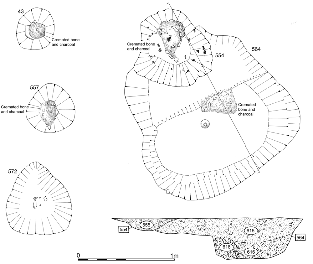
Early Roman cremation burials 554, 557, 559, 564 and 572 form a single tight cluster, seemingly inserted into the corner of the enclosure, alongside ditch 25273 and close to the postulated northward course of the watercourse. Larger and more elaborate burial 564 appears to be the focus of this activity, with burials 554 and 572 cut into its backfills. A degree of continuity of practice, at least as regards the location of burials alongside boundaries, may be indicated by the presence of these funerary features. Burial 43 is a seemingly isolated occurrence to the south-east of this cluster. However, further cremation graves might well be located eastwards along the north bank of the watercourse between here and those in Excavation Area R4. Indeed, further early Roman graves may even be conjectured to be present within OA38 but subsequently removed by agricultural activity, leaving only these few deeper cremation pits. However, no conspicuous spreads of pottery were observed during the topsoil strip of this vicinity of Excavation Area W to suggest their former presence.
Clearly, OA39 loses its function as a pyre-field - perhaps as a consequence of Romanisation/changing practices of the settlement population - and funerary activity within the Northern Hinterland now shifts southwards into OA38, closer to the settlement. The virtual absence of early Roman remains in the interiors of OAs 39, 40 and 41 is striking and it can only be concluded that these function exclusively as fields and are firmly located beyond the settlement peripheries - boundary ditches 25194 and 25188 evidently marking a definite division in land-use (Figure 107).
The few early Roman features located to the north of this watershed in land-use, pits 2213 and 2926 (Group 980), lie within OA40. Shallow pit 2926 is positioned at the corner of the southward return of ditch 25194 - presumably cut into the still-functioning remains of this Period 2B boundary. If not for its shallow depth, this pit could perhaps be regarded as indicating the position of a substantial post marking this corner. It contains a relatively large quantity of pottery, together with briquetage and a piece of Millstone Grit quernstone (SF193).
Pit 2213 is an isolated, shallow, ovoid cut containing pottery and tile positioned toward the south-west corner of OA40.
Internet Archaeology is an open access journal based in the Department of Archaeology, University of York. Except where otherwise noted, content from this work may be used under the terms of the Creative Commons Attribution 3.0 (CC BY) Unported licence, which permits unrestricted use, distribution, and reproduction in any medium, provided that attribution to the author(s), the title of the work, the Internet Archaeology journal and the relevant URL/DOI are given.
Terms and Conditions | Legal Statements | Privacy Policy | Cookies Policy | Citing Internet Archaeology
Internet Archaeology content is preserved for the long term with the Archaeology Data Service. Help sustain and support open access publication by donating to our Open Access Archaeology Fund.