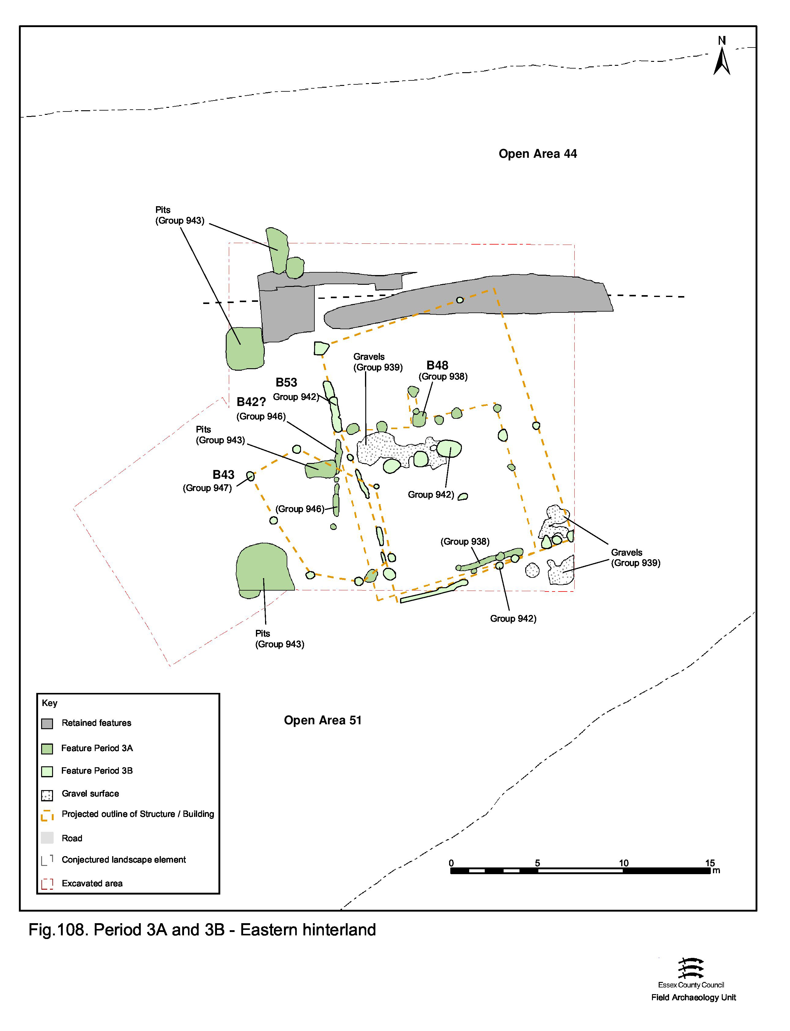
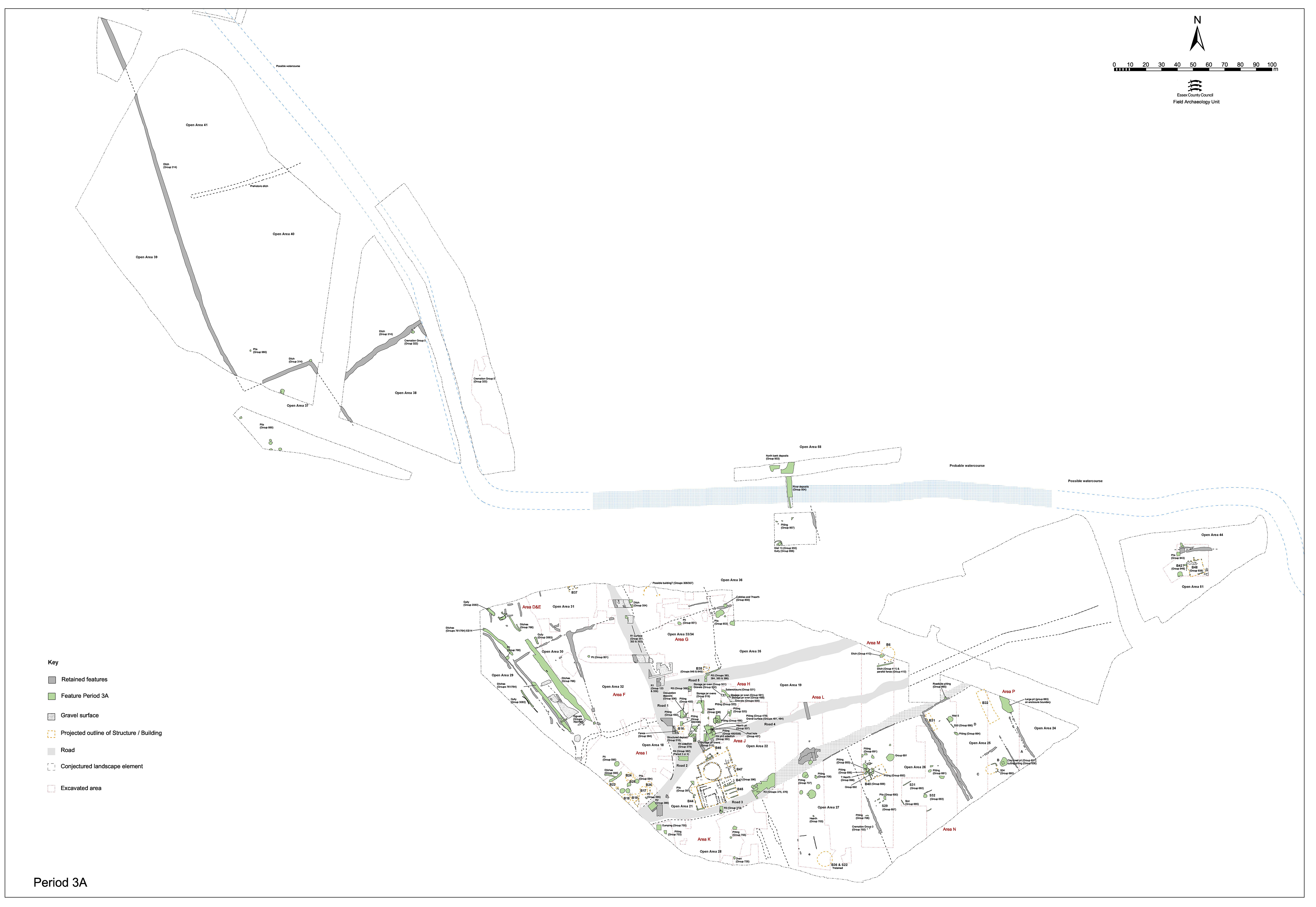
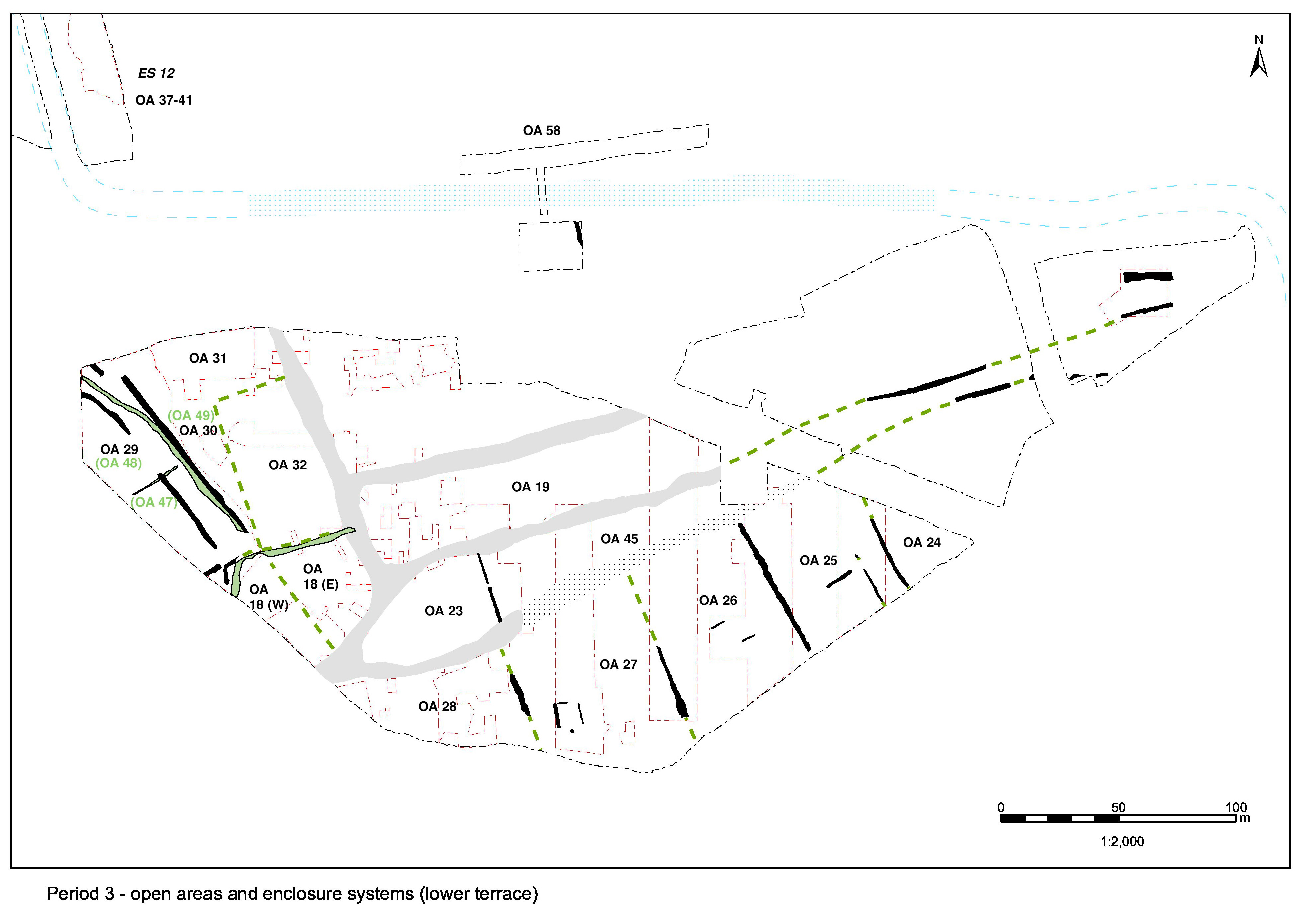
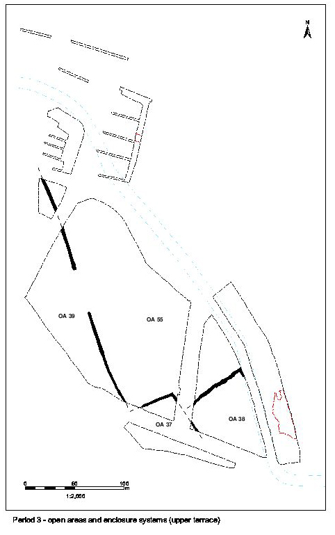
While Excavation Area Q could reasonably be regarded as containing parts of the eastern extremes of the Northern, Central and Southern settlement zones, the term 'eastern hinterland' is perhaps more apposite during Period 3 and later. Although it is assumed that Road/tracks 3, 4 and 5 persist, their convergence seems poorly defined during the early Roman period. The east-west ditches that mark some of the road edges, and thus the divisions between the zones, may become defunct and be superseded by rectilinear buildings of apparent Roman date. As such, there seems little point in attempting to distinguish between different land units (Figure 108).
The structural remains, as interpreted here, suggest at least two sub-phases of early Roman land-use - though some four different structural alignments are identified. The earlier elements are described here and the later elements are in the next section.
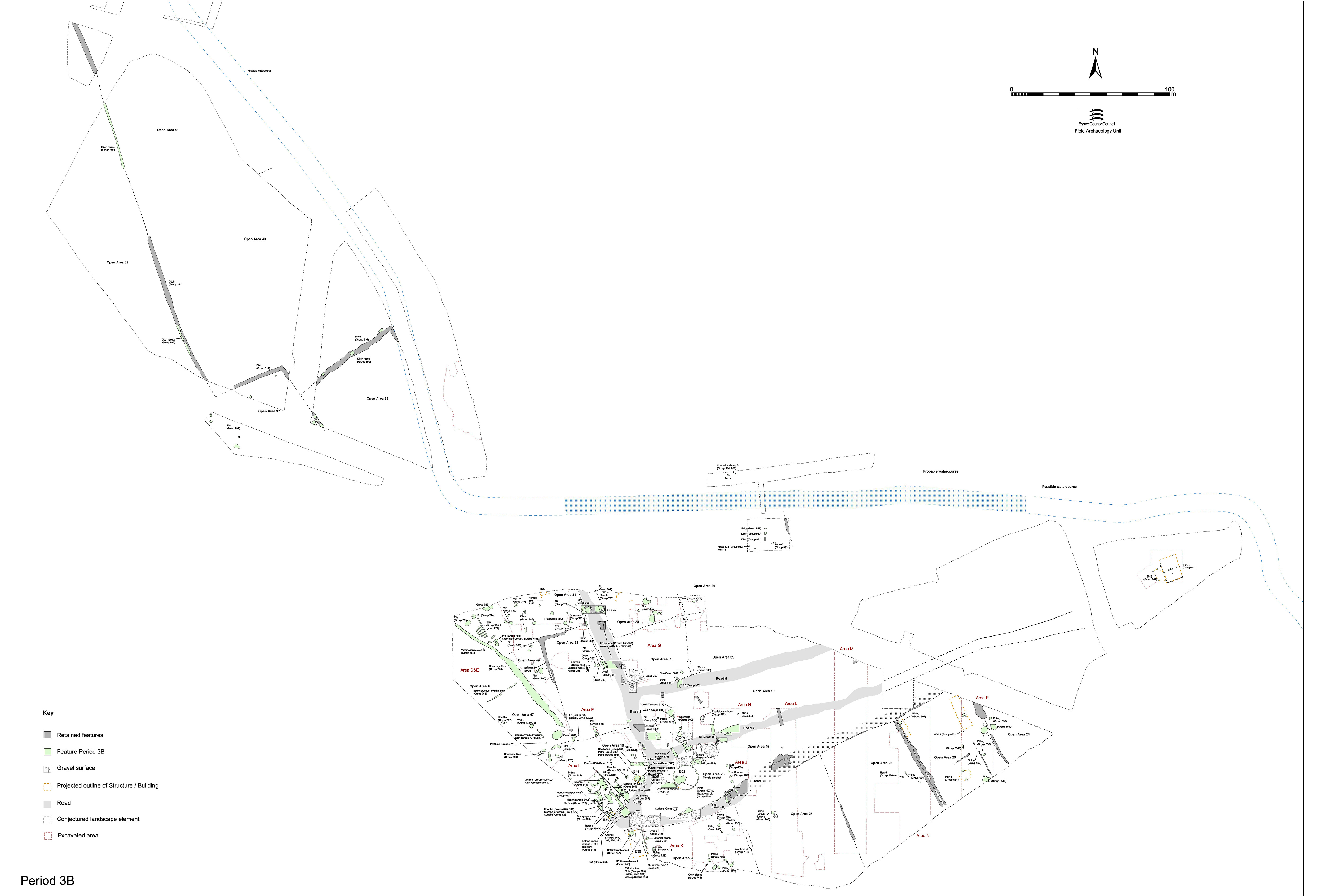
Re-cut ditch 25179 (Group 331 Period 2B) is filled by, or during, Period 3 and the boundary it previously marks (nominally that of the north side of converged Road/tracks 3 and 4) evidently passes out of use and is overlain by Building 48.
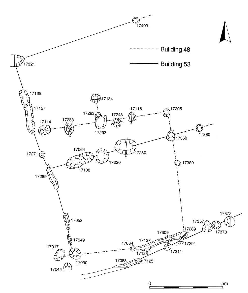
Post-hole and slot alignments (17017, 17027, 17034, 17114, 17116, 17123, 17134, 17205, 17238, 17243, 17283, 17289, 17293, 17309, 17389) are construed to define Building 48 (Figure 109). The layout of the building is uncertain and highly conjectural. Its presumed plan shows it spanning the whole width of the plot previously defined by the parallel east-to-west ditches of Period 2B. Although superseding ditch 25179, Building 48 retains a similar alignment; the building probably reflects the alignment of merged Road/track 3/4 and implies, in turn, that the road is still in use.
The main evidence for Building 48 comprises two wall alignments. The north wall is defined by a line of post-holes all of which contain a distinctive clay packing material. The south wall comprises slot 17027, together with a number of post-holes, none of which contained clay packing. Together, these may define a square building, perhaps with some kind of adjoining structure suggested by post-holes 17283 and 17134 extending off at right angles to the north wall. Clay packing in 17134 would suggest that it is an integral part of the construction of the north wall. Admittedly there is little, if any, sign of east and west walls (except for 17389) and the association of the north and south 'wall' alignments are not certain. However, if these associations can be accepted, these structural features may be taken to form a single-roomed structure 8.5m square (72.25m² floor area).
The pottery collected from one of the component features of this building (post-hole 17205) suggests a 2nd century date but it is probable that this is intrusive material and the building is more likely to be late 1st century/early 2nd century in date, which accords with the remainder of the pottery. Furthermore, post-hole 17289 is cut by 17291 (part of Building 53) and post-hole 17238 is sealed by a gravel patch that might be flooring within Building 53, making Building 53 the later structure. The dating for Building 53 lies in the second half of the 2nd century AD.
It is possible that some of the fragments of gravel deposits 17020, 17190, 17197, 17234, 17345, 17373 (Group 939) may function as flooring within Building 48, or as external surfaces around it. It is, however, equally possible that at least some of these patches of gravel are perhaps later, and more likely to be associated with Building 53.
All of the investigated Period 3 pits (17026, 17100, 17175, 17177, 17193, 17288, 17276, 17297) lie to the west of Building 48 and later Building 53. Most are located in a small inter-cutting cluster on or alongside the now defunct boundary previously defined by ditch 25181/25179 and, perhaps more relevantly, therefore alongside track 3/4. The earliest pit, 17297, may well be purposely dug into the slumped terminal of ditch 25181. The remainder lie along the line of similarly defunct ditch 25184 et al., cutting into its fills.
Pits 17175 and 17297 are of similar proportion at around 1.4m diameter and 0.3-0.4m depth. Pit 17177 is a more substantial oval cut of 3.0m maximum width and 0.9m deep. Pit 17026 is an isolated sub-rectangular cut, 1.8m long, 0.9m wide and only 0.16m deep, located just west of the building remains. Pit 17193 is the largest discrete feature; a roughly sub-rectangular oval cut some 2.4m by 2.15m and 0.55m deep. Its irregular base is covered with a deposit of gravelly clay which has been tentatively interpreted as a lining, rather than a fill, even though it does not extend up the sides of the cut. Whether this feature has a distinct primary function is unclear, though it is subsequently used as a rubbish pit. The artefact assemblage deriving from its fills principally comprises modest amounts of pottery and tile.
Shallow inter-cutting pits 17288 and 17276 are both sealed by gravel surface 17234, north of ditch 25184. No finds are recovered from either.
Collectively, these pits produce the bulk of the Roman material from this area. The finds assemblages are of a domestic character, composed mainly of pottery and animal bone, but also briquetage, tile, slag and a lead dribble (SF5975) from 17177.
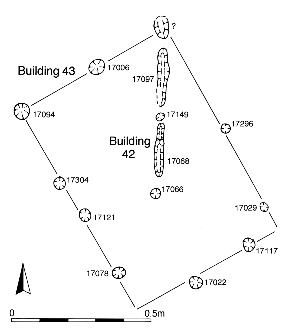
It is possible that the slot-and-post alignment defined by 17066, 17068, 17147 and 17097 is part of a structure - Building 42 - perhaps only part of a fence foundation (Figure 110). Although it seemingly retains the north-south alignment of Period 2A ditch 25098 (Group 12), or else at least runs roughly at right-angles to the Period 2B ditch 25099 (Group 327) rather than observe the alignments of either of the Period 3 buildings (Buildings 48 and 53) immediately to its east, the dating evidence from the fills of its component features is late 1st or early 2nd century in character.
Internet Archaeology is an open access journal based in the Department of Archaeology, University of York. Except where otherwise noted, content from this work may be used under the terms of the Creative Commons Attribution 3.0 (CC BY) Unported licence, which permits unrestricted use, distribution, and reproduction in any medium, provided that attribution to the author(s), the title of the work, the Internet Archaeology journal and the relevant URL/DOI are given.
Terms and Conditions | Legal Statements | Privacy Policy | Cookies Policy | Citing Internet Archaeology
Internet Archaeology content is preserved for the long term with the Archaeology Data Service. Help sustain and support open access publication by donating to our Open Access Archaeology Fund.