SketchUp is a free to use software that allows the user to create accurate 3D models from spatial data gathered within the field. Designed by Google to be integrated with Google Earth, SketchUp provides the user with the functionality to geolocate a model in a spatially correct location as well as providing the correct topographic representation found within Google Earth itself. In 2012, SketchUp was bought by Trimble Navigation, a survey instrument and software manufacturer, along with the online 3D warehouse associated with it. To date, the software remains free to use and Trimble have committed to invest and grow the product, although it is unclear how this change may affect the use of this product in the future.
Google SketchUp 7.1 was used to create 3D reconstructions of the Southern Circle, Bluestonehenge, and one of the Neolithic houses discovered at Durrington Walls. To ensure these contained the correct coordinates when placed within Google Earth, SketchUp 7.1 provides the user with a 'Get Current View' tool. This allows the user to take a screen grab of their current view within Google Earth and place it within SketchUp, georeferencing anything that is created within that project. The advantage of this tool lay with its ability to display previously imported KML shapefiles in Google Earth, overlaying the satellite imagery. By importing a number of digitised excavation plans of the different sites, the user can identify exactly where the reconstruction should be located, ensuring an accurate model. Recent updates to both SketchUp and Google Earth have meant that the functionality described above is no longer available, but is included here for completeness.
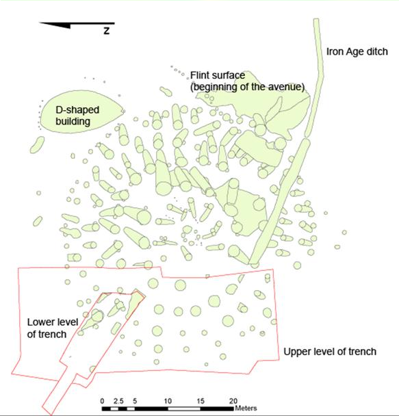
The plans for the Neolithic house platform and Bluestonehenge derived from digitised excavation records created as part of the Stonehenge Riverside Project. However, the data used for the Southern Circle saw a combination of the plan of the eastern half of the monument, recorded during excavations by Wainwright between 1966 and 1968 (Wainwright and Longworth 1971, fig. 9), and the plans of the western half, recorded by the Stonehenge Riverside Project in 2005 and 2006 (Figure 9).
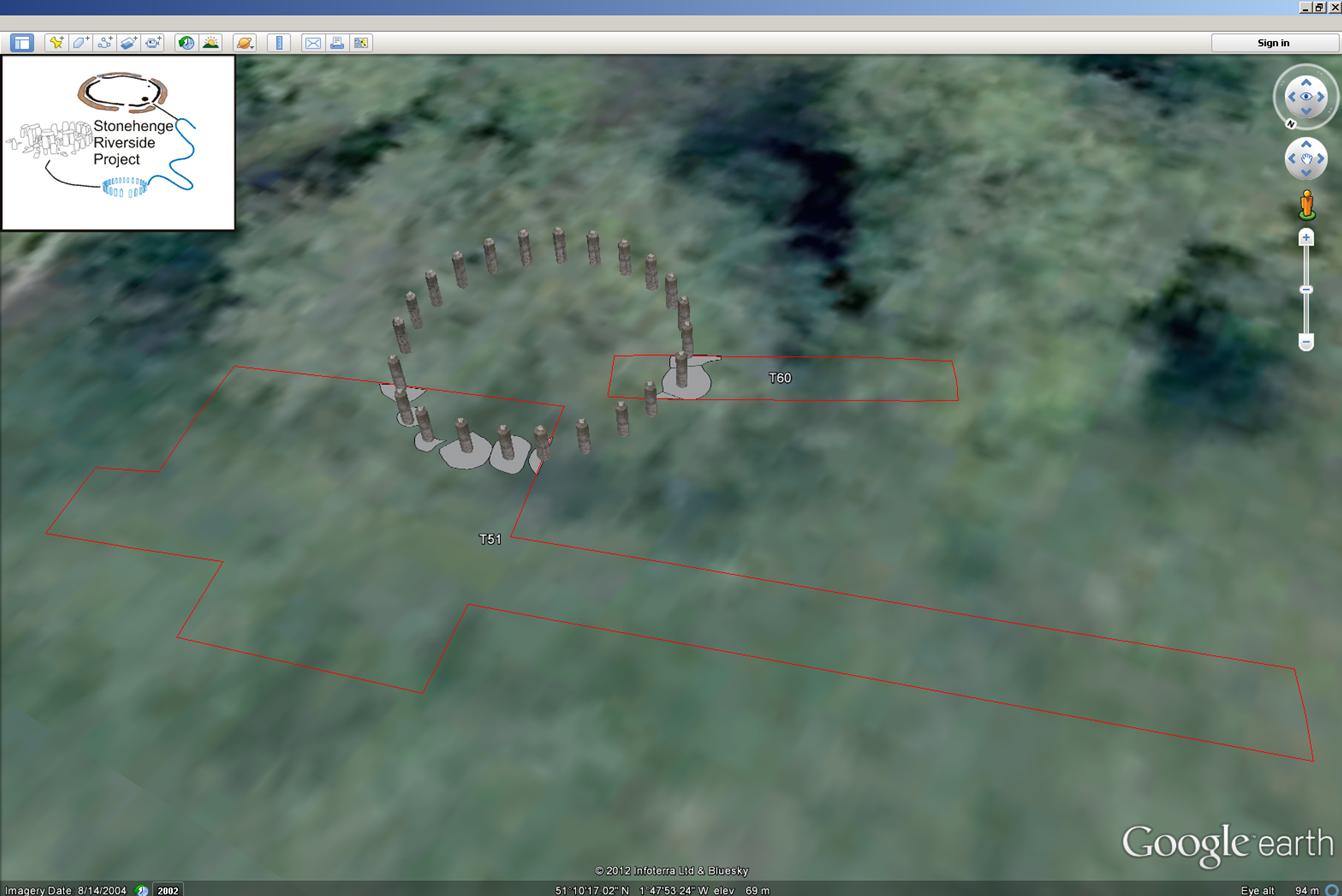
All three models saw an element of interpretation shape their appearance, in particular that of the Neolithic house, which drew from artistic interpretations and excavation plans detailing the location of the postholes. However, both the Southern Circle and Bluestonehenge drew from scientific information recorded during their excavations to try to re-create what they may have looked like. All the section drawings of postholes excavated at the Southern Circle were measured and averaged out to gain an average depth for each ring of postholes. These were then multiplied by three, to gain a standard height for each ring of posts (Gibson 2000). As the whole of the Southern Circle had not been excavated there were a number of postholes which looked to be missing. As a result these were placed within the model but were labelled as 'speculative'. Similarly, research was also undertaken into the standard heights of the bluestones currently standing at Stonehenge to ensure an accurate representation of how Bluestonehenge may have looked (Figure 10).
All three models were created using simple geometry tools and given textures such as stone and wood through those made available in SketchUp. Once complete, the models were exported as Google Earth KMZ files and placed within the application as part of a 3D Models layer.
As well as creating a number of its own models, the application also included two reconstructions of monuments that had already been created and shared on the SketchUp 3D Warehouse. This website provides a repository for all SketchUp users to share their work and download other models that have been created. Those used for this application were Woodhenge, created by Henry Rothwell, and Stonehenge itself, created by Tom Harvey.