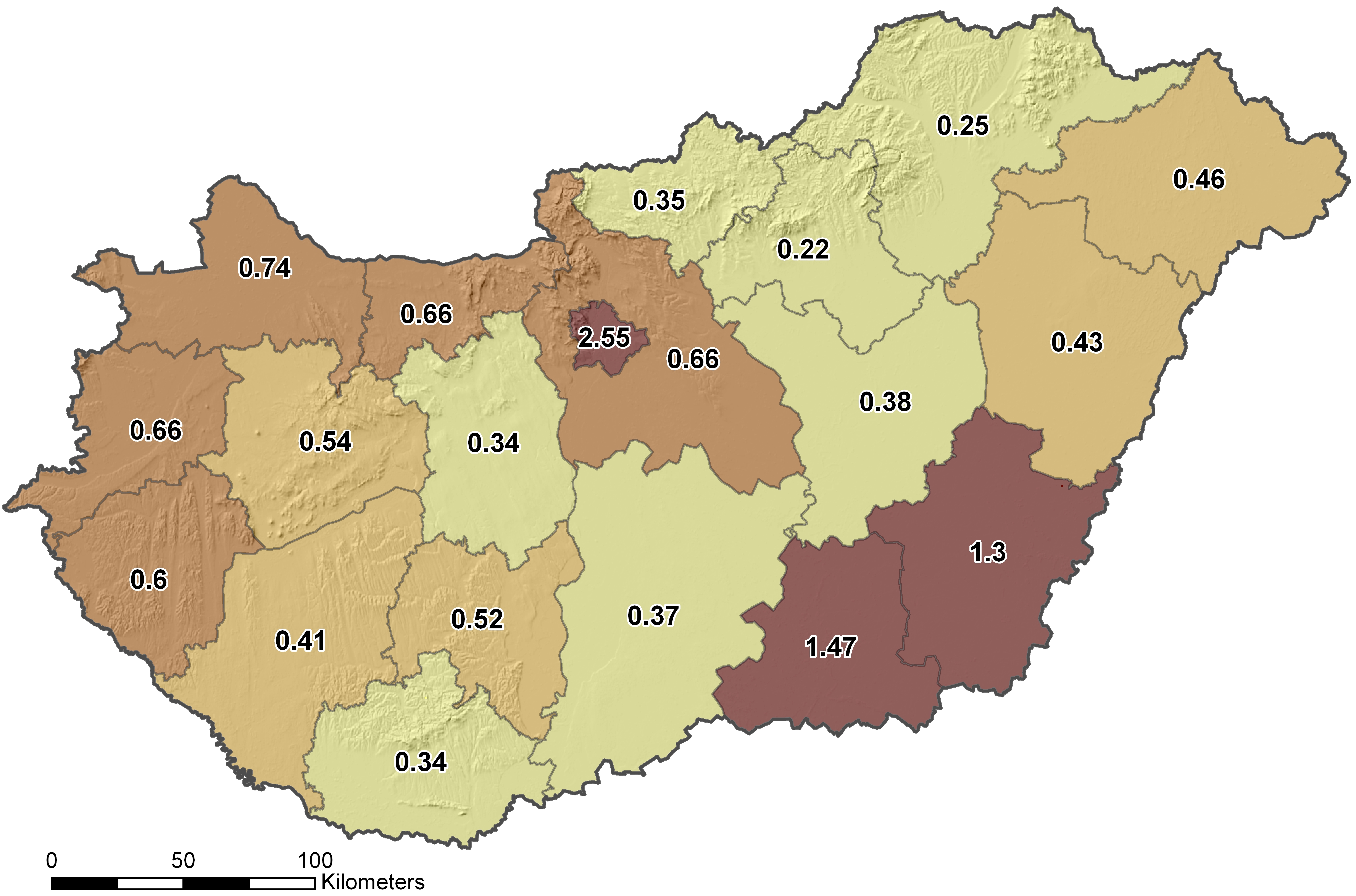
Figure 1: Distribution of known archaeological sites in Hungary in the counties (number of sites/km²). The map shows the uneven distribution of known sites. Based on thoroughly surveyed areas, we should expect to have at least 1-1.5 sites/km²
Figure 2: Distribution of areas available for field survey (plough-walking) in Hungary based on the CORINE land cover map.
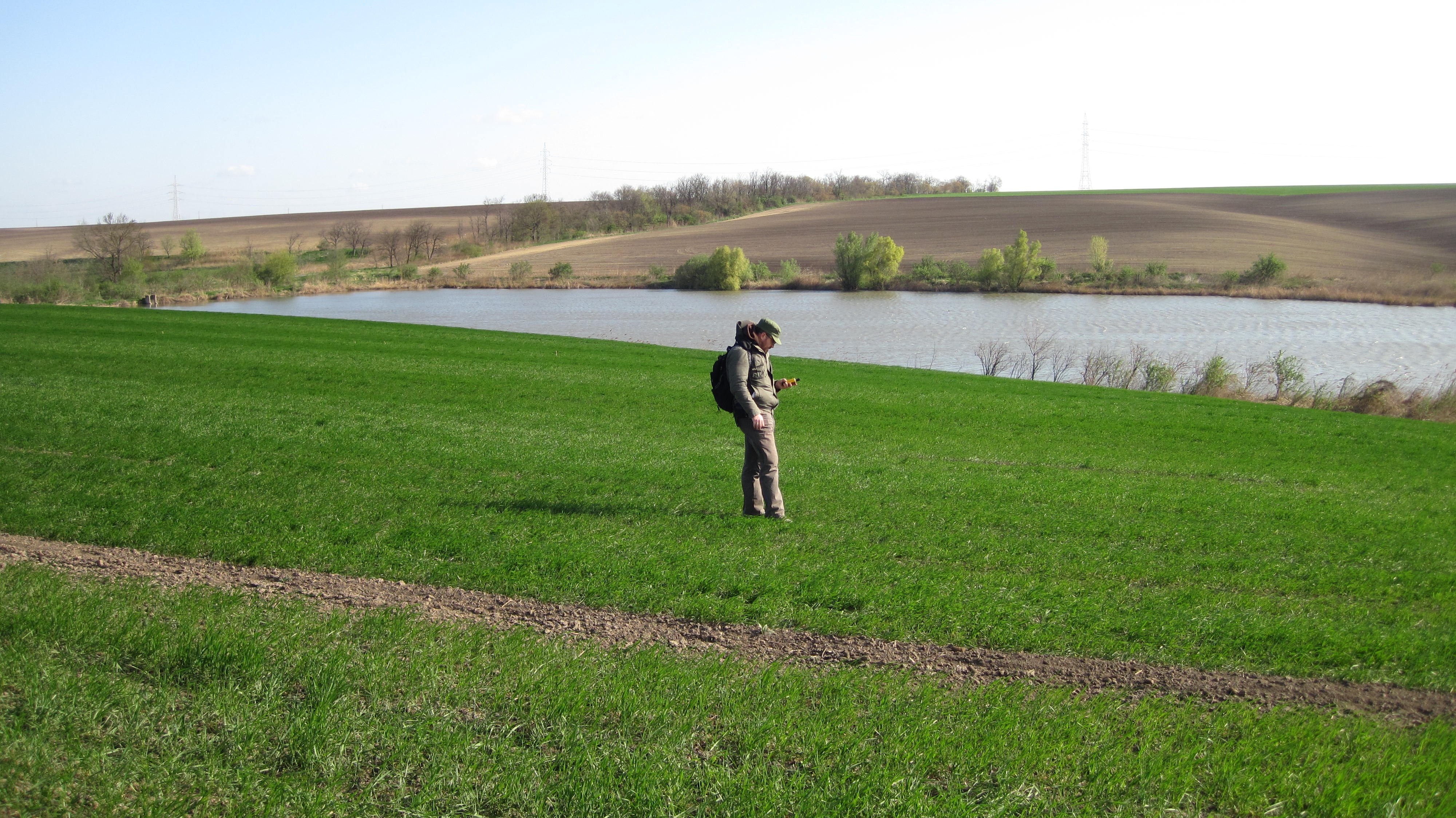
Figure 3: During field survey in Hungary
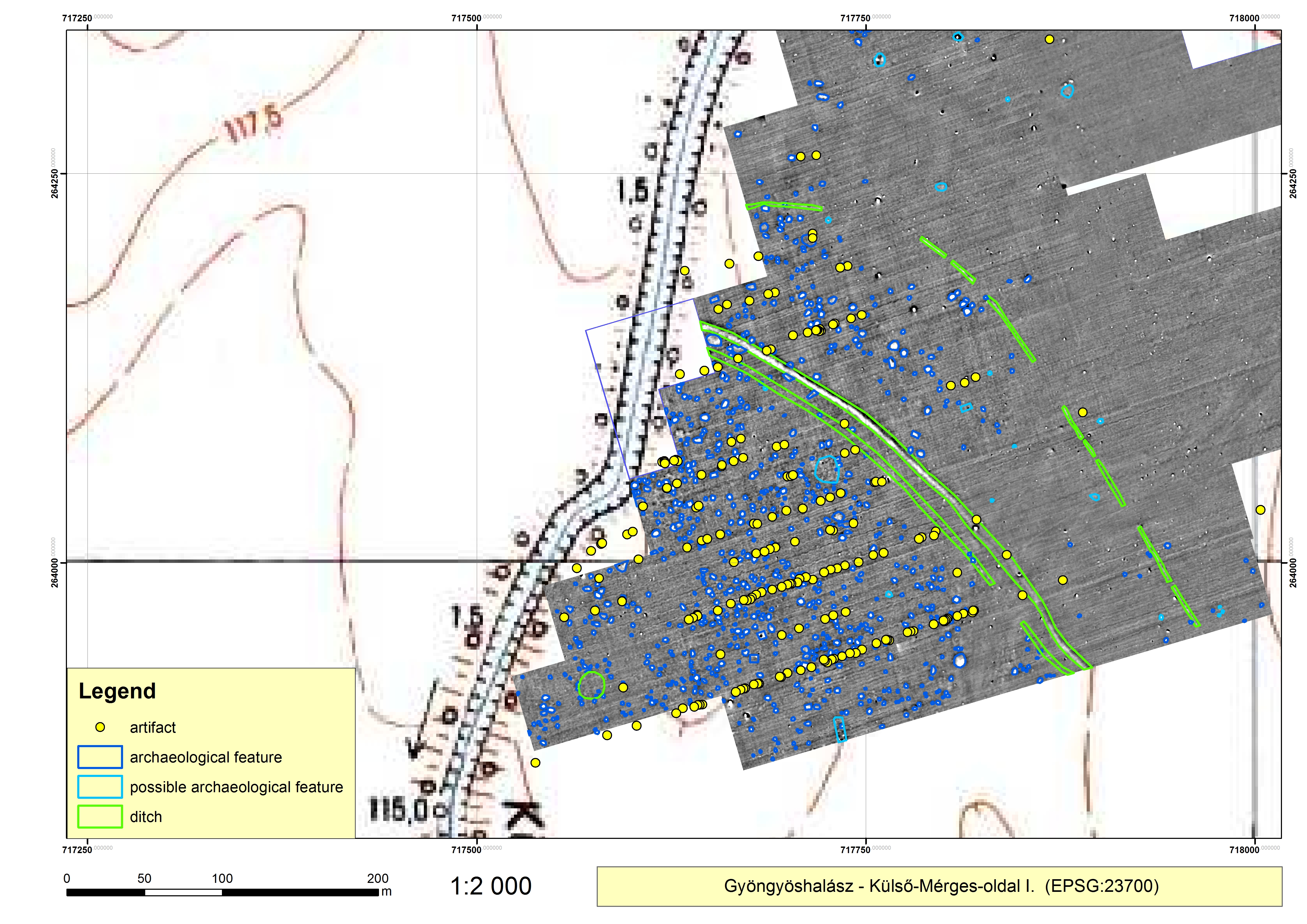
Figure 4: Comparison of surface finds and geophysical survey in Gyöngyöshalász (Heves c., Hungary) The distribution of surface finds is closely connected with the actual distribution of the late Bronze Age settlement
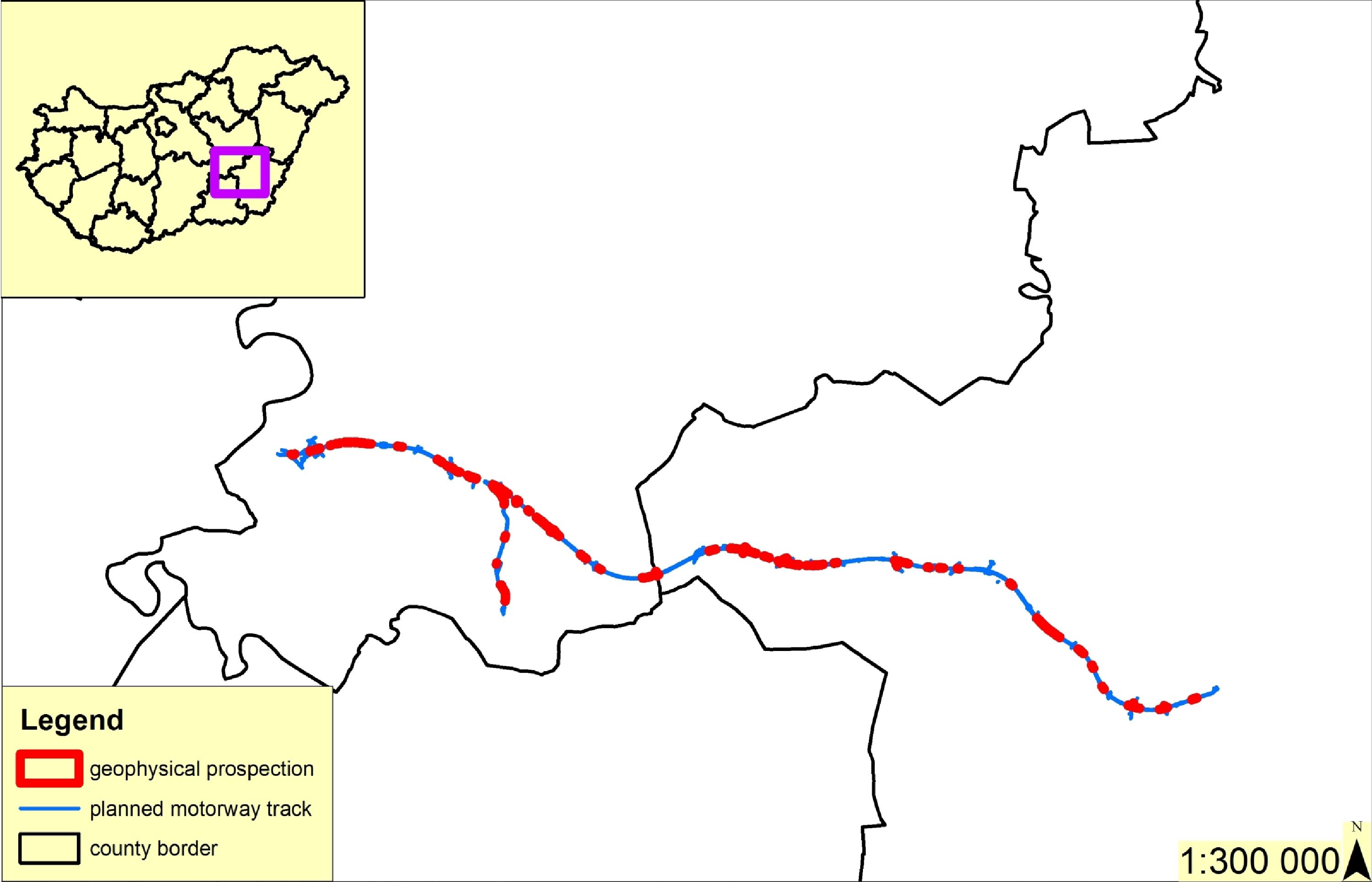
Figure 5: Distribution of areas of geophysical survey along the route of the planned M44 motorway (Békés and Jász-Nagykun-Szolnok c., Hungary)
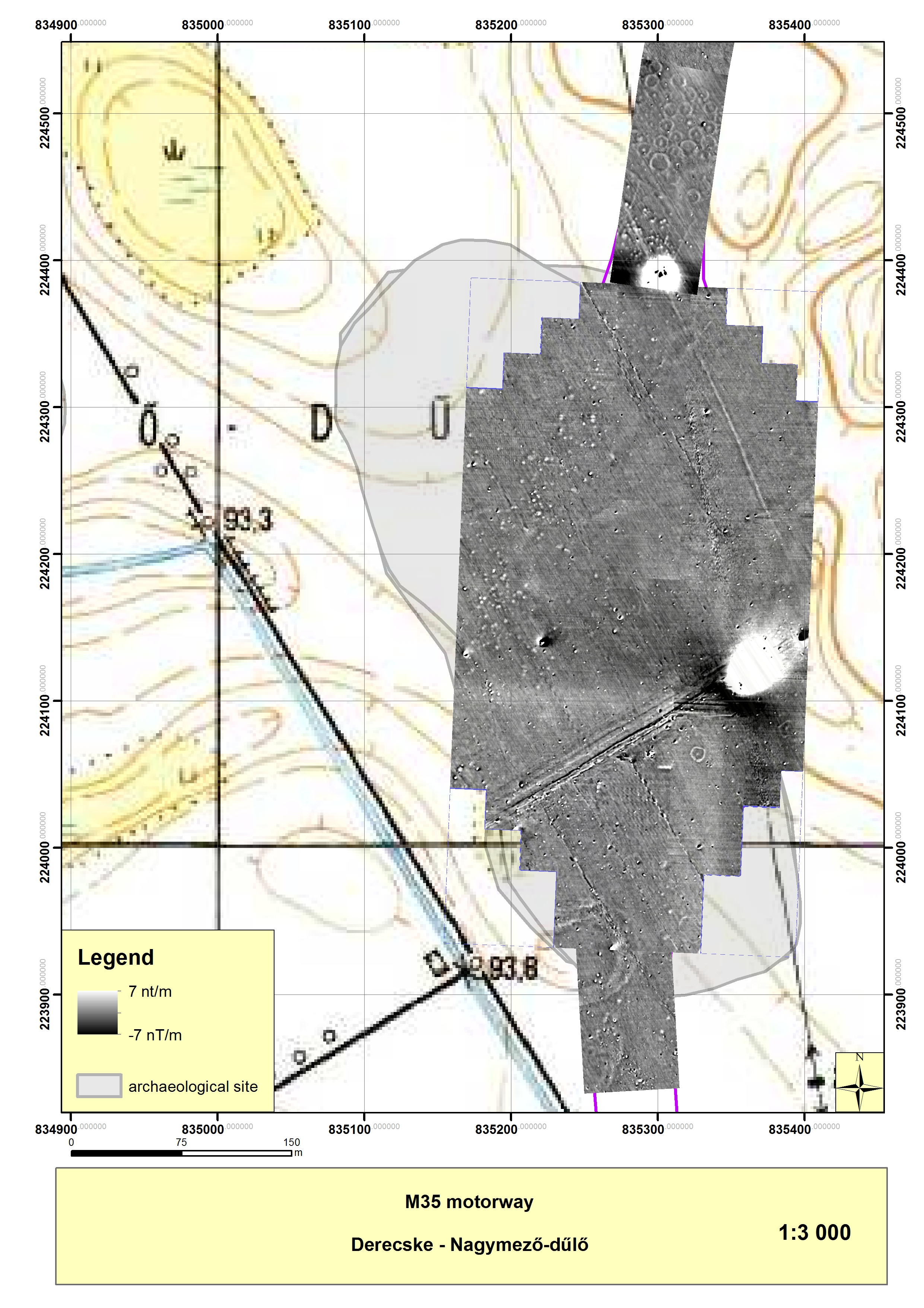
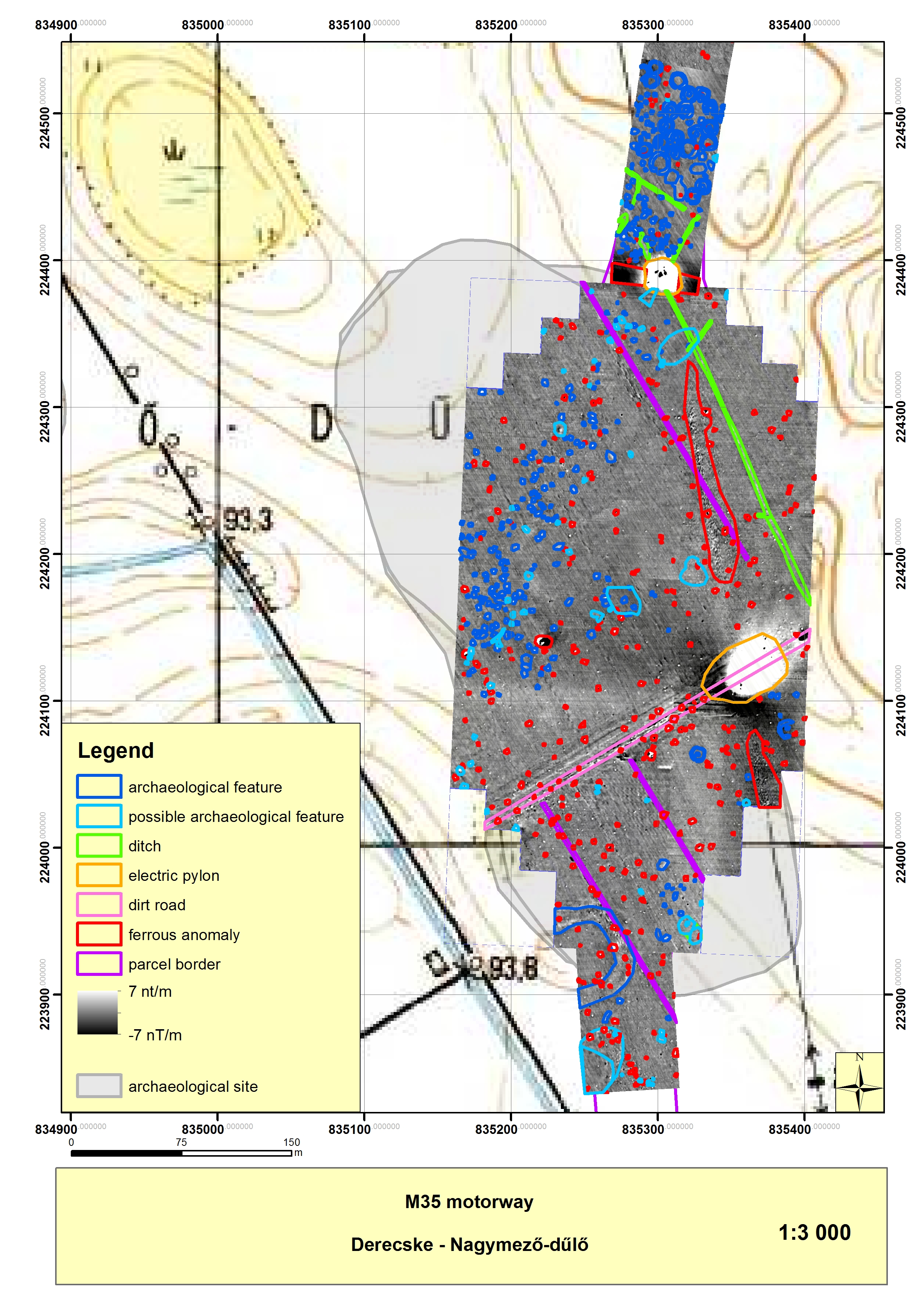
Figure 6a/Figure 6b: Magnetometry survey (6a), and its interpretation (6b) at the planned M35 motorway's route.
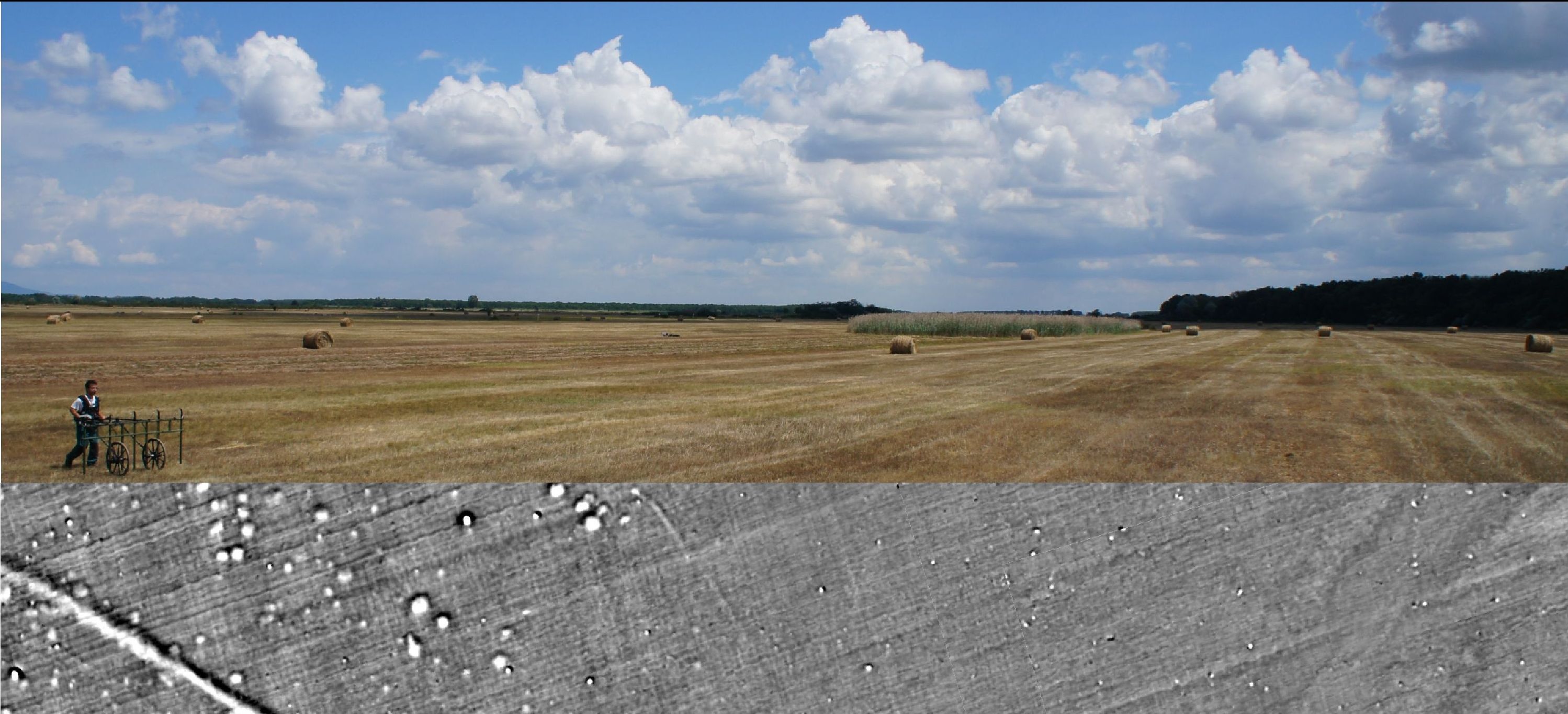
Figure 7: Conducting geophysical survey in the Great Hungarian Plain
Figure 8: Geophysical survey and validation with trial trenching in the planned M4 motorway (Jász-Nagykun-Szolnok c., Hungary
Internet Archaeology is an open access journal based in the Department of Archaeology, University of York. Except where otherwise noted, content from this work may be used under the terms of the Creative Commons Attribution 3.0 (CC BY) Unported licence, which permits unrestricted use, distribution, and reproduction in any medium, provided that attribution to the author(s), the title of the work, the Internet Archaeology journal and the relevant URL/DOI are given.
Terms and Conditions | Legal Statements | Privacy Policy | Cookies Policy | Citing Internet Archaeology
Internet Archaeology content is preserved for the long term with the Archaeology Data Service. Help sustain and support open access publication by donating to our Open Access Archaeology Fund.