The aims of the work at Wade Street were to locate, record and characterise all significant buried archaeology preserved at this location prior to its destruction; important evidence for the existence of built structures and stratified post-medieval activity had already been predicted by the desk-based assessment, and identified by the evaluation. The project also offered a rare opportunity to link the results of the fieldwork to an outline study of a sample of the 19th-century census records, to give a picture of the social dynamics of a highly diverse community in the second half of that century, and which presents a surprisingly mixed picture of both long stability, and incessant change in terms of the movement of people into and out of this part of Wade Street.
The excavation revealed the presence of a complex series of post-medieval structures, deposits and surfaces, with finds also reinforcing the known history of occupation of the site well into the 20th century. The work identified the initial, early 18th-century activity, and thereafter, into the later 18th and 19th centuries, the archaeological narrative was one of a complex, and not always entirely clear, sequence of building and ad hoc additions. The scope of the work was somewhat constrained by the fact that it encompassed three separate areas of excavation, and it was not possible to investigate parts of the site outside the bounds of those excavation areas. The subsequent watching brief was able to add small but important elements of survival scattered across the site, and helped to enhance the wider picture.
The layout of the site, not surprisingly, evolved through time, with the later establishment of cobbled yard surfaces and the arrangement of some of the houses around at least one enclosed courtyard, as reflected on later maps. At least some of the houses were provided from the very outset with cellars, the best example actually excavated having a vaulted brick roof. The later map evidence, however, could not by definition reflect the full complexity of the structural relationships that were hinted at in the earlier evaluation, and revealed to a far greater extent in the subsequent excavation.
The finds for the most part followed pretty much exactly the chronological trajectory that had already been established by the desk-based assessment, the only exception being a few sherds of medieval pottery recovered from some of the lower contexts. The clay pipe material appeared to run from the early to the mid-18th century, and then almost to stop dead, with very little 19th-century material. However, the watching brief revealed a cache of 19th-century pipes, reinforcing the known presence on the site of a pipe maker at that time. The break in the artefact sequence during the second half of the 18th century may relate to the progressive establishment, and then subsequent regular sweeping and cleaning, of hard floor and yard surfaces throughout the dwellings occupying the site. A very large cache of machine-made glass sauce bottles was found within a cellar of a property that fronted Little Anne Street, and may possibly be traced to the vinegar-making works that was established on the south-east side of the road, probably in the early 20th century, as an extension to a malthouse that was already in existence by the latter 19th century.
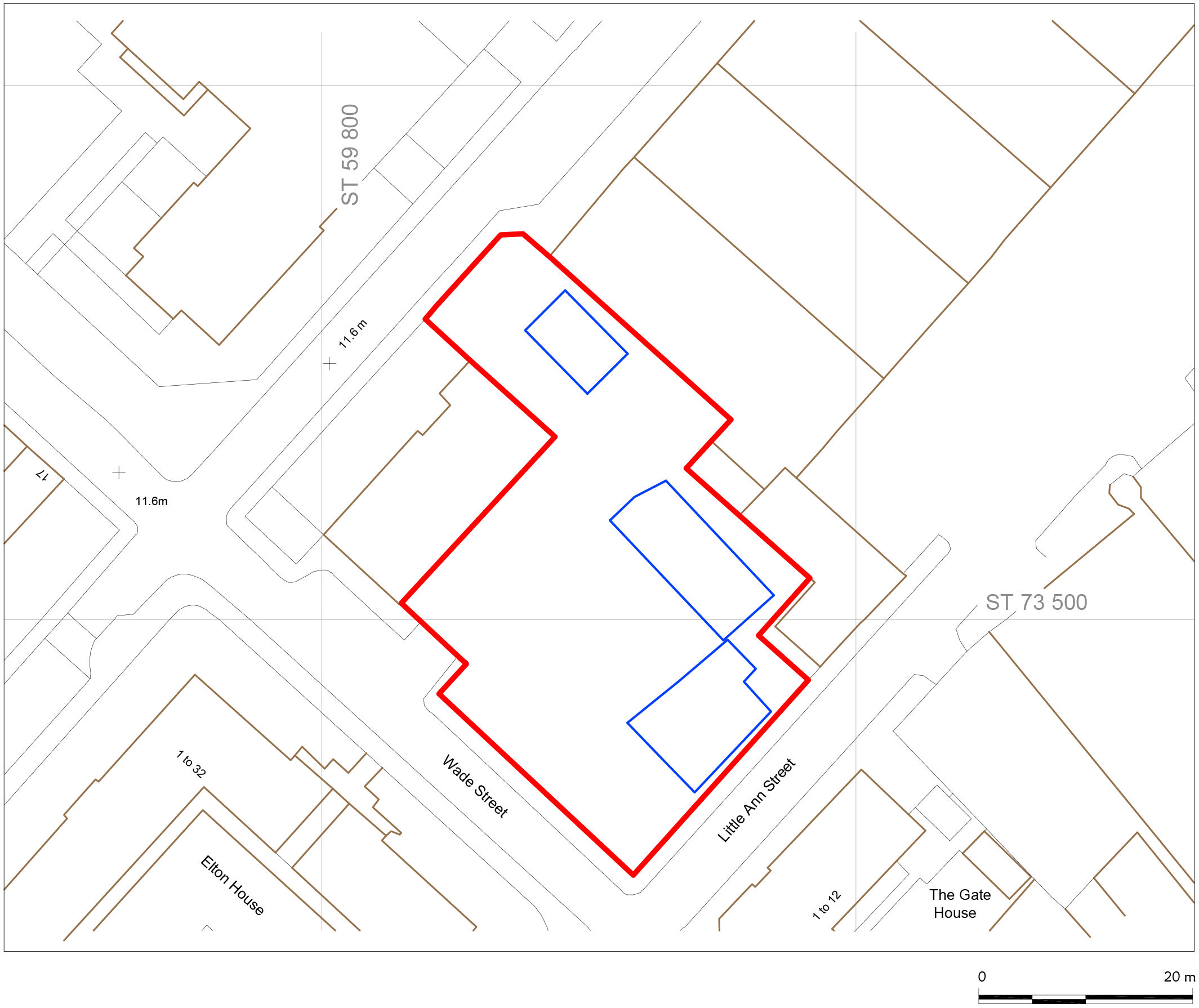
The site lies at the corner of Little Anne Street, and Wade Street, Bristol, on the north-western side of Little Anne Street. The street grid pattern (supposedly all of early 18th-century date) is orientated north-west/south-east (Wade Street) and south-west/north-east (Little Anne Street, Little George Street, Great George Street, Great Anne Street). It is about 800m to the north-east of the ruined church of St Peter in Bristol city centre, and encompasses a total of about 1,260m². The site itself is effectively level, although it sits on the southern flank, and probably within the original valley floodplain of the River Frome, so that the general trend of the land around the site is that of a gentle downward gradient to the north-west. The river is very likely to have been wider, perhaps considerably so, than it is today, and its channel has been progressively constrained as the land around it has become developed. We can be confident that the flood regime of the river was once far more extensive than it is today. This seems to be borne out by the discovery, at the very lowest levels of the excavation, of what appeared to be rather sandy, and slightly gravelly river terrace material, so that it does appear as though the site may sustain a covering of alluvial drift deposits.1. Indeed, at the Frome Bridge, which carries Wade Street across the Frome at the former's north-western end, the river becomes fully culverted as it runs right underneath the city centre. Wade Street is 210m long, from its south-eastern end to the north-western side of the Frome.
Bench marks formerly sited at either end, but both now gone, were at elevations of 14.45m aOD (south-eastern end), and 10.67m aOD (north-western end), representing a fall along the whole street length of only some 3.78m. The site itself lies somewhere in the middle of this range; another benchmark on the southern corner of a former public house, marking part of the site's north-western boundary, had a value of 12.72m aOD. Although this building still stands, it was not possible to locate the benchmark itself (Figures 1, 2 and 3).
The site is part of a rectangular block of land extending to about 2,000m², bounded on its south-western side by Wade Street itself, to the south-east by Little Anne Street, to the north-west by Little George Street, and to the north-east by both a large, modern warehouse building and the Swan With Two Necks pub, the rear yards of which stretch back north-westwards from the main building that fronts onto Little Anne Street, and which partially 'intrude' into the site. In addition, the north-western corner of the site is occupied by a building that is now the Al-Baseera Islamic Centre, but which was formerly the Sportsman's Arms public house. This also intrudes into the site, so that the actual area available for the excavation was considerably less than the notional area of the block of which it was part.
The site's underlying solid geology is thought to be composed, at depth, of the Redcliffe Sandstone series of the Triassic period, a physical description of which is given by the BGS:
Sandstone, distinctive fine- to medium-grained, deep red, calcareous and ferruginous. Commonly decalcified at shallow depths below the surface, giving rise to an uncemented sand.
1. Unfortunately, the recent study of the waterlogged deposits underlying Bristol deals only with the city's historic core, extending westwards from a point just to the east of the castle site, and does not include the area to the north of Old Market/West Street that includes the Wade Street development (Wilkinson et al. 2013). ←
Internet Archaeology is an open access journal based in the Department of Archaeology, University of York. Except where otherwise noted, content from this work may be used under the terms of the Creative Commons Attribution 3.0 (CC BY) Unported licence, which permits unrestricted use, distribution, and reproduction in any medium, provided that attribution to the author(s), the title of the work, the Internet Archaeology journal and the relevant URL/DOI are given.
Terms and Conditions | Legal Statements | Privacy Policy | Cookies Policy | Citing Internet Archaeology
Internet Archaeology content is preserved for the long term with the Archaeology Data Service. Help sustain and support open access publication by donating to our Open Access Archaeology Fund.