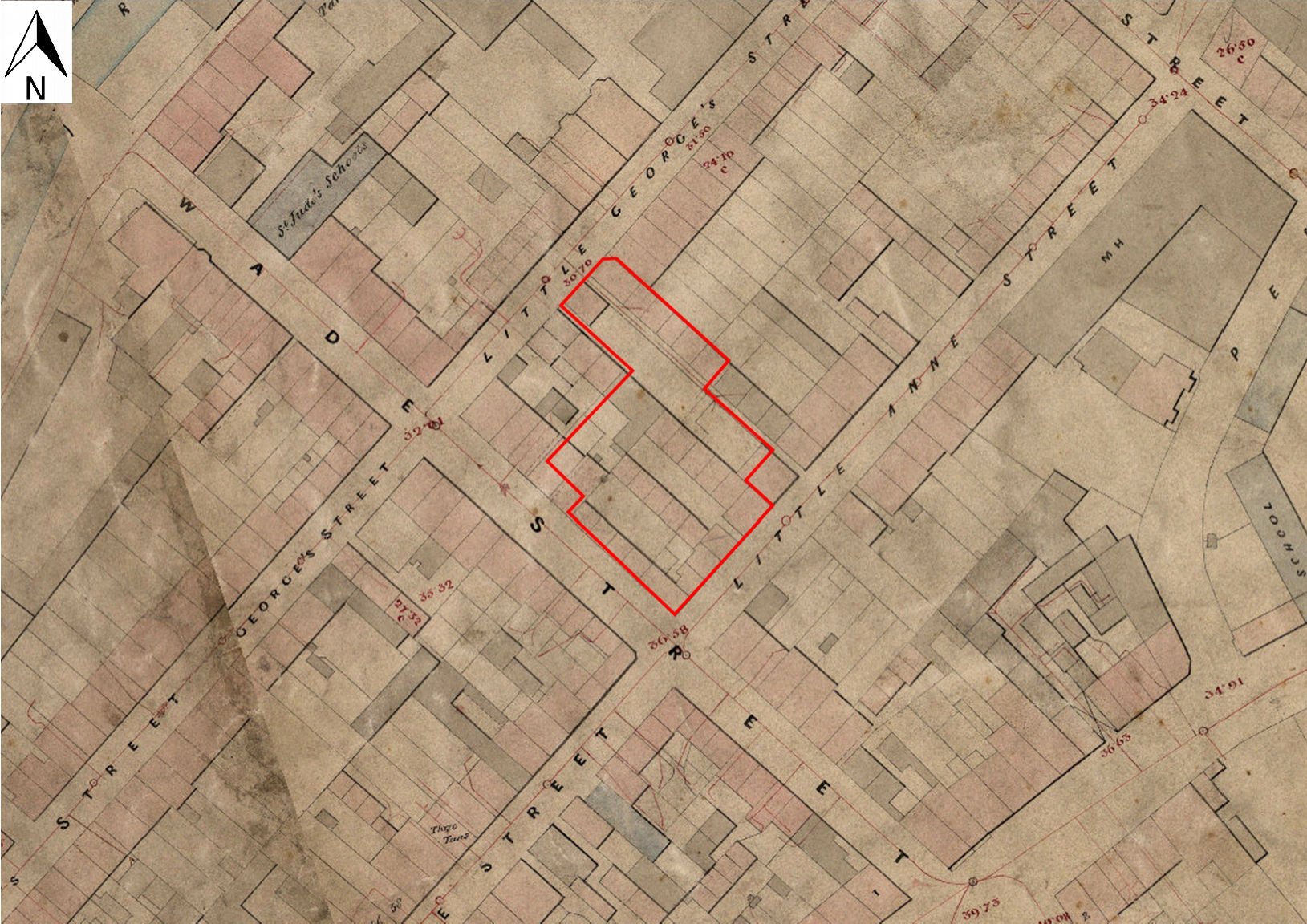
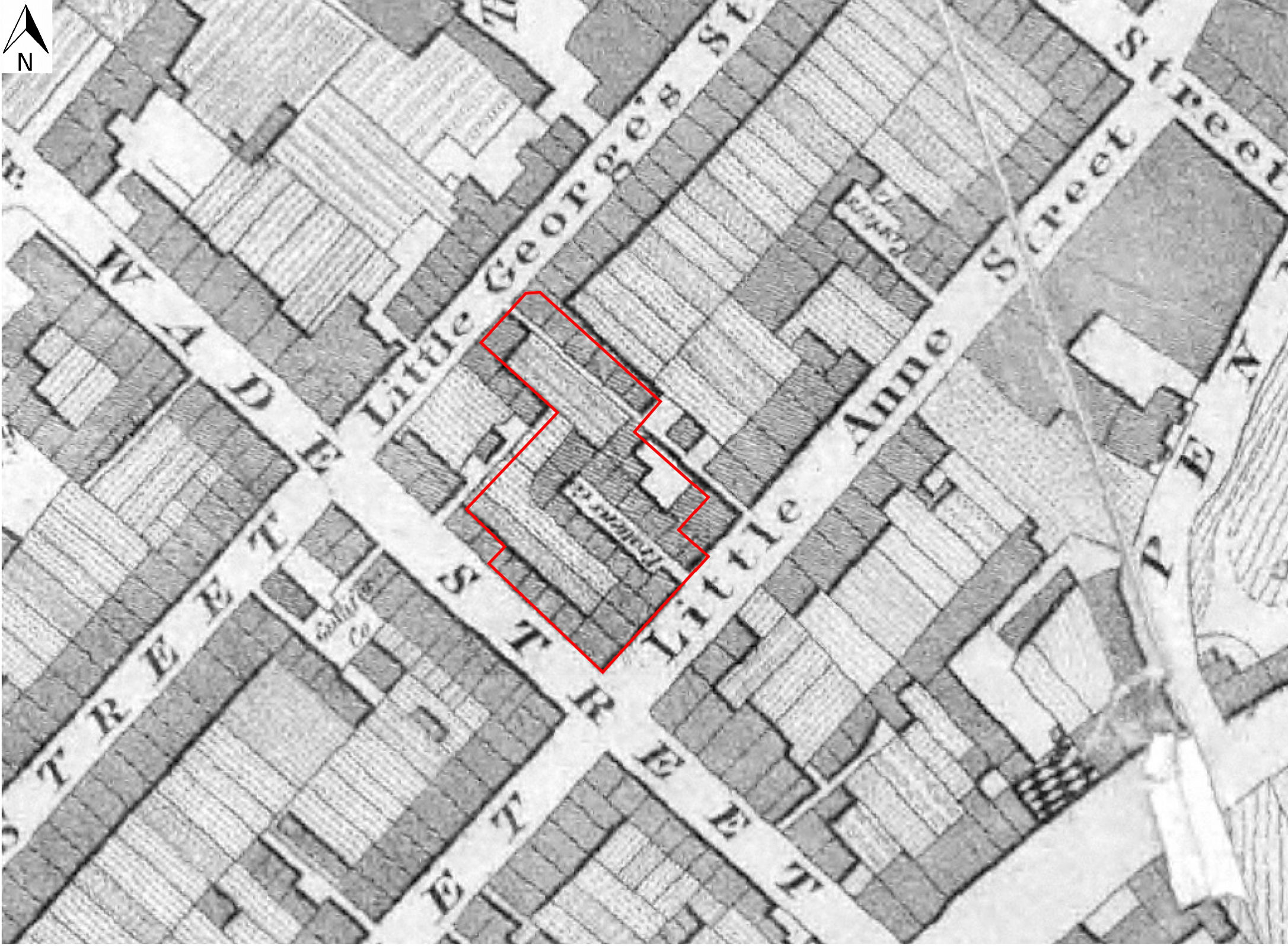
It is likely that the pipe factory first recorded at this location in 1840 (above) was located to the rear of no. 26, and may correspond to the L-shaped industrial buildings shown on the Ashmead plan of 1855, spanning the north-west end of Pratten's Court (Figure 6). The north-west/south-east arm of the 'L' had been at least partially demolished by the time of the Ordnance Survey 1:500 plan of 1881/2 (Figures 8 and 21). It should be noted that both the 1855 plan and that of 1874 (Figure 7) also show two very small buildings, one attached to the rear of the house and one to the shorter arm of the 'L', which may represent the kilns and sheds listed in the document of 1879 (above). It is not clear exactly which of the buildings illustrated represents the 'additional cottage to the rear', unless it is possibly the lightly shaded square building shown immediately to the north-west of 26 Wade Street on the Ashmead plans of 1855 and 1874 (Figures 6 and 7). Possibly this cottage may be the fore-runner to the two messuages to the rear of 24 and 26 Wade Street recorded as 'Buss Court' in a conveyance of 1936 (Smith and Erskine 2000, 5). 29
Several of the structures/deposits recorded during the watching brief may be associated with the aforementioned premises to the rear of 26 Wade Street (Figure 3). Most significantly, the discrete deposit of unsmoked 19th-century tobacco pipes (Context 147) was recovered from within a possible cellar, probably located to the rear (south-west) of the shorter arm of the 'L'-shaped wareroom or manufactory mentioned above. The date of the assemblage would suggest that the pipes had been deposited any time from the early 1840s onwards, either en bloc or over a period of time, and therefore could potentially represent material (possibly wasters) from the businesses of either the White family or of John Wilkey I, particularly since one of the pipes is marked with the initials, 'JW' (above). It should be noted that this was the only deliberate deposit of pipe material recorded during the project, and that no dumps of earlier material, such as those recovered from shallow pits during the Cabot Circus excavation, were recorded (Boyer et al. 2013, 1112-13).
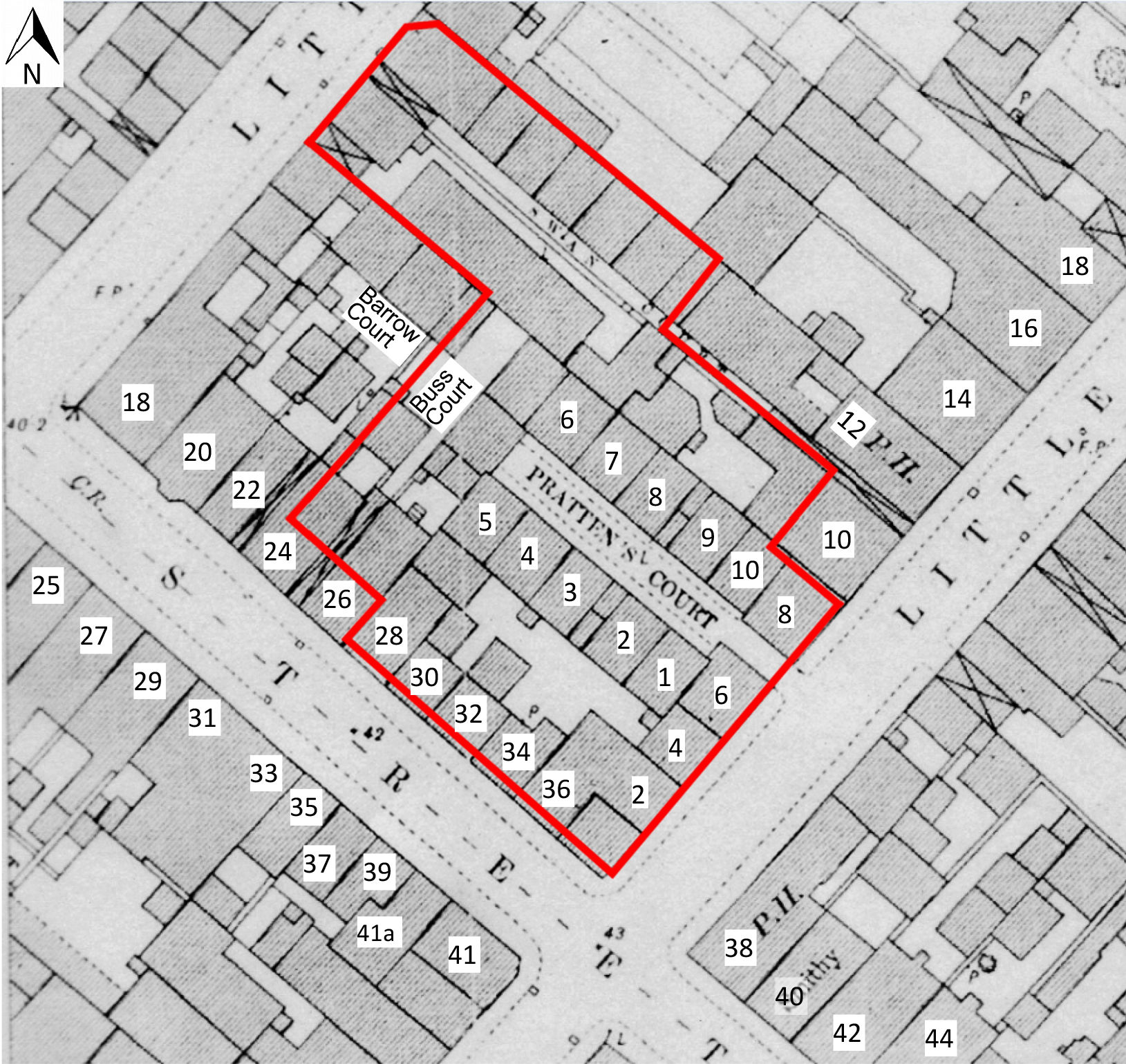
It should also be noted that no actual building is shown at this approximate location (to the north-west of 5 Pratten's Court) until the 1:500 Ordnance Survey plan of 1881/2 (Figures 8 and 21).
Significantly, the leaf decoration on the seams of several of the pipes is similar to that shown on pipes from a kiln waste group retrieved nearby from Wellington Road, St Pauls (NGR ST 59597342; Beckey 2000). The latter assemblage was dated by Beckey to the 1850s, and is likely to be waste from the workshop of the Bye family of Ayers Lane, a similar family-run concern (Beckey 2000). The present deposit should, therefore, not be viewed in isolation, as similar deposits of 19th-century waste pipe manufacturing material have been recovered nearby, Group 1 at 33 Great Anne Street (NGR ST 5975 7342) and Group 2 between 58 Great George Street and 49 Great Anne Street (NGR ST 5977 7345; Beckey 2000, Figure 4). It should also be noted that, in the case of at least one of the above deposits, the dumped material was actually imported onto the site.
Further to the rear of no. 26, at the north-western end of Pratten's Court, the watching brief revealed a series of four walls (Contexts 119, 120, 146 and 137), which delimited two adjoining structures, one containing Well (118) and the second, a possible cistern. The structures were possibly located within the footprint of the 'L'-shaped wareroom/manufactory (Figure 6), but are otherwise undated. The dumped deposits within the cistern appeared to be largely composed of ash, silt and a cess-like material, suggestive of waste disposal, which would suggest the structure's secondary use as a midden/cess-pit, presumably after it had fallen out of use as a cistern. Significantly, no technological residue indicative of pipe manufacture, was noted within these deposits. For similar structures recorded during the nearby Cabot Circus excavations, see Boyer et al. 2013, 112-13, and see main report.
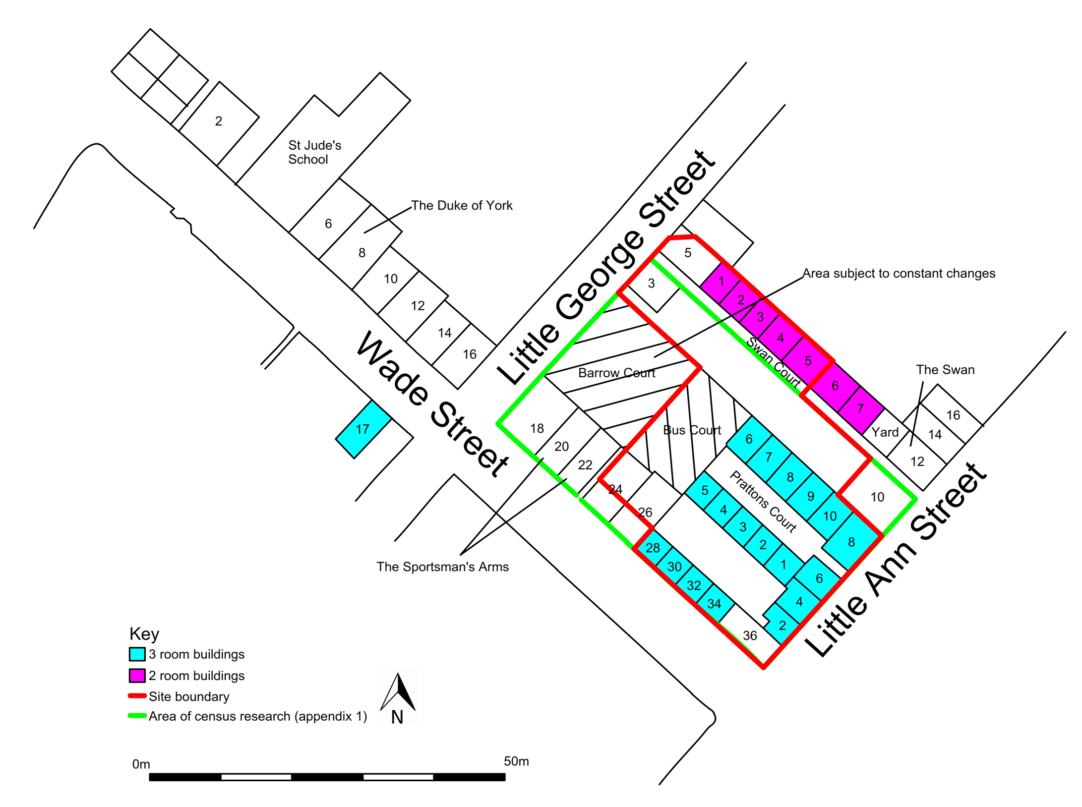
The well is one of three, in relatively close proximity, recorded during the watching brief (Figure 3), at least one of which is likely to have lain within the curtilage of 26 Wade Street. The close proximity of at least two of the wells is somewhat problematic, and may be explained either by the possibility that the wells were not contemporary, and that one later replaced an earlier water supply, or that one of the wells was possibly reserved for the sole use of the inhabitants of no. 26, and that the other two were allocated to the inhabitants of neighbouring properties (see also valuation of 6 Wade Street, main report).
Two further walls recorded during the watching brief (Contexts 169 and 170) may represent the north-western end of the longer arm of the 'L'-shaped building, and were abutted, to the north-east, by a later brick wall (Context 168). In the angle of Walls 169 and 170, a Pennant slab floor (Context 172) was observed, running south-west/north-east for over 7m. It is not known whether this floor formed an external yard surface, or was contained within a contemporary building. No physical evidence was found for the kilns recorded in the garden of 26 Wade Street in the document of 1879 (BRO 4627 (353); Price 2014, 4444), nor were there any associated industrial residues, apart from the deposit of unsmoked pipe fragments (Context 147).
Several of the above structures, in particular the wells, may well have formed a part of Buss Court (above). Although the alleyway leading to the later court is recorded on maps of 1855 onwards (Figures 6, 7, 8 and 21), the court itself is not recorded by name until the census of 1891 (Appendix 1). It is possible that the cottage to the rear of 26 Wade Street, recorded in the 1871 census, was also incorporated into the later court. Possibly the court itself did not come into existence as a separate entity until after the buildings to the rear of no. 26 had ceased to function as a pipe factory.
29. It is possible that structures (wells and a flagstone floor surface) forming part of Buss Court were located during the watching brief.←
Internet Archaeology is an open access journal based in the Department of Archaeology, University of York. Except where otherwise noted, content from this work may be used under the terms of the Creative Commons Attribution 3.0 (CC BY) Unported licence, which permits unrestricted use, distribution, and reproduction in any medium, provided that attribution to the author(s), the title of the work, the Internet Archaeology journal and the relevant URL/DOI are given.
Terms and Conditions | Legal Statements | Privacy Policy | Cookies Policy | Citing Internet Archaeology
Internet Archaeology content is preserved for the long term with the Archaeology Data Service. Help sustain and support open access publication by donating to our Open Access Archaeology Fund.