
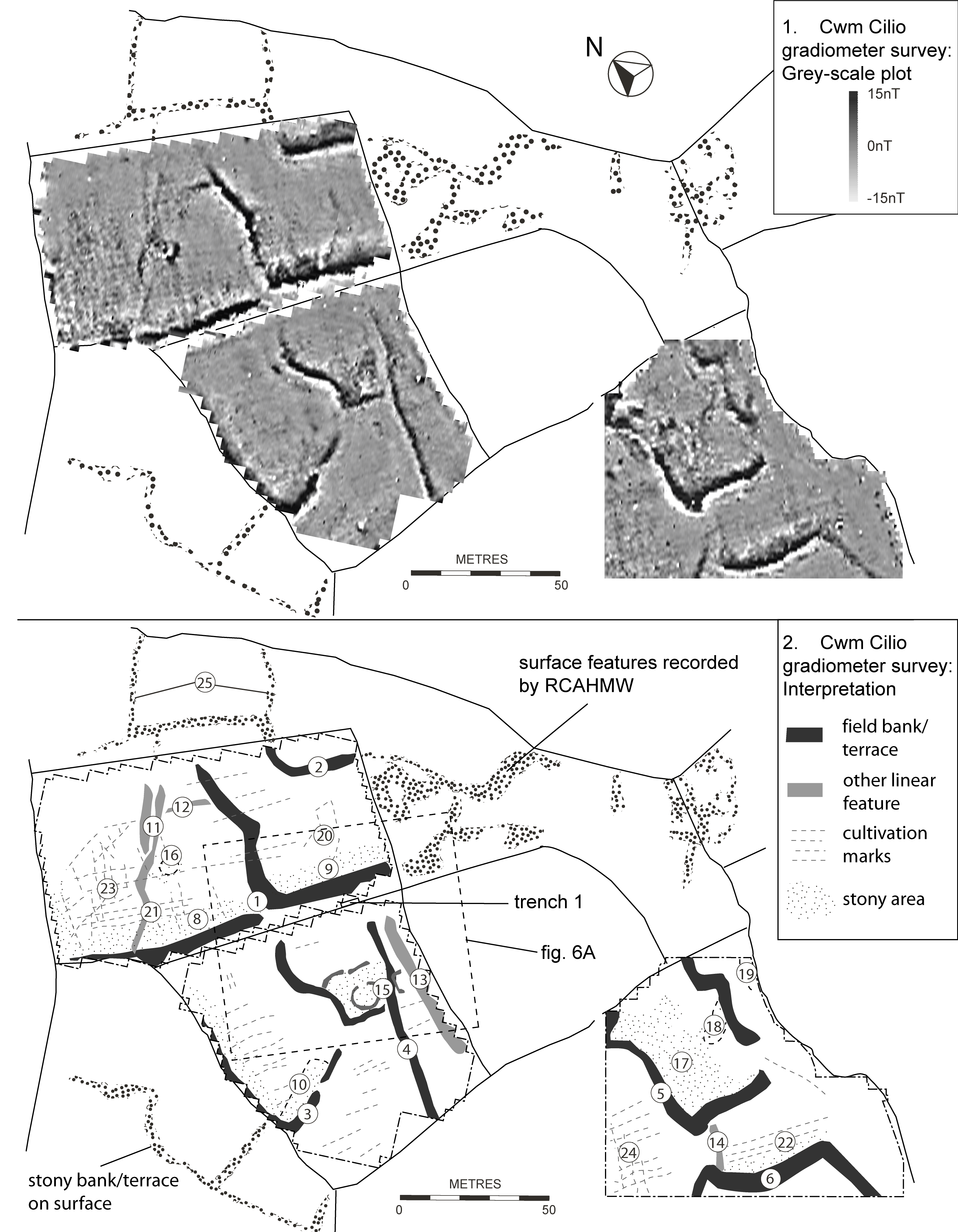
The gradiometer survey produced a detailed plan of the early fields (Figure 5). The generally low, grassed-over terraces produced strong anomalies perhaps as a result of accumulation of magnetically enhanced humic soils along the boundaries. Increased levels of magnetic noise close to the boundaries indicated that the terraces had been deliberately constructed from dumped stony material. The survey also revealed additional details and features including probable earlier sub- divisions (11/21), a roundhouse within a small enclosure (15), and another possible roundhouse or recent stack-stand (16).
The survey also revealed cultivation marks, presumably plough furrows, which were mostly aligned and therefore associated with the overlying post-medieval fields. However, in two areas (23/24), there were cultivation marks on different alignments clearly pointing to earlier, as yet undated, episodes of ploughing. These marks, with a spacing of c.3m, appear to show a form of ridge-and- furrow cultivation.
Internet Archaeology is an open access journal based in the Department of Archaeology, University of York. Except where otherwise noted, content from this work may be used under the terms of the Creative Commons Attribution 3.0 (CC BY) Unported licence, which permits unrestricted use, distribution, and reproduction in any medium, provided that attribution to the author(s), the title of the work, the Internet Archaeology journal and the relevant URL/DOI are given.
Terms and Conditions | Legal Statements | Privacy Policy | Cookies Policy | Citing Internet Archaeology
Internet Archaeology content is preserved for the long term with the Archaeology Data Service. Help sustain and support open access publication by donating to our Open Access Archaeology Fund.