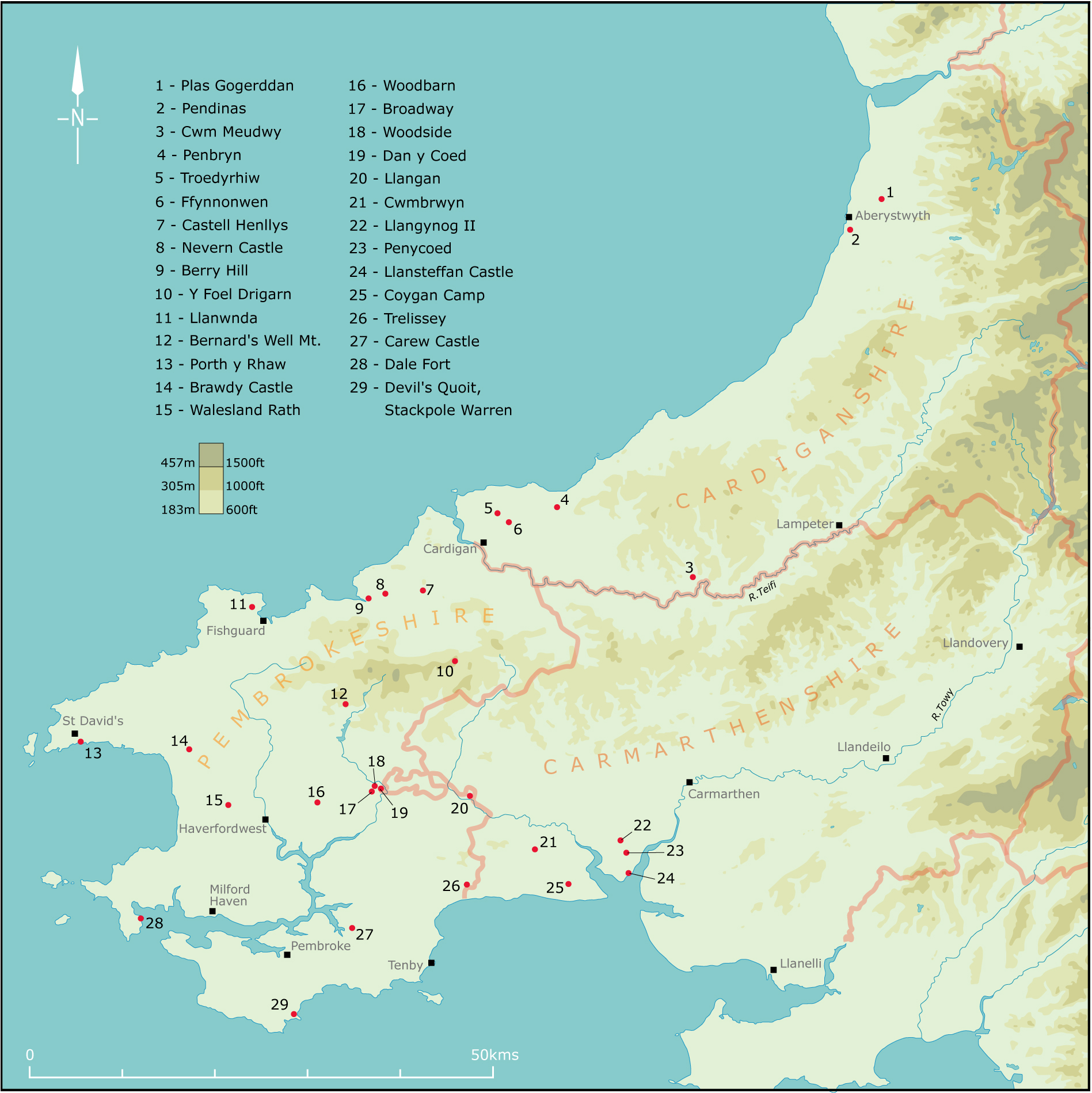
Figure 1: Distribution map of hillforts, defended enclosures and other sites in south-west Wales mentioned in the text
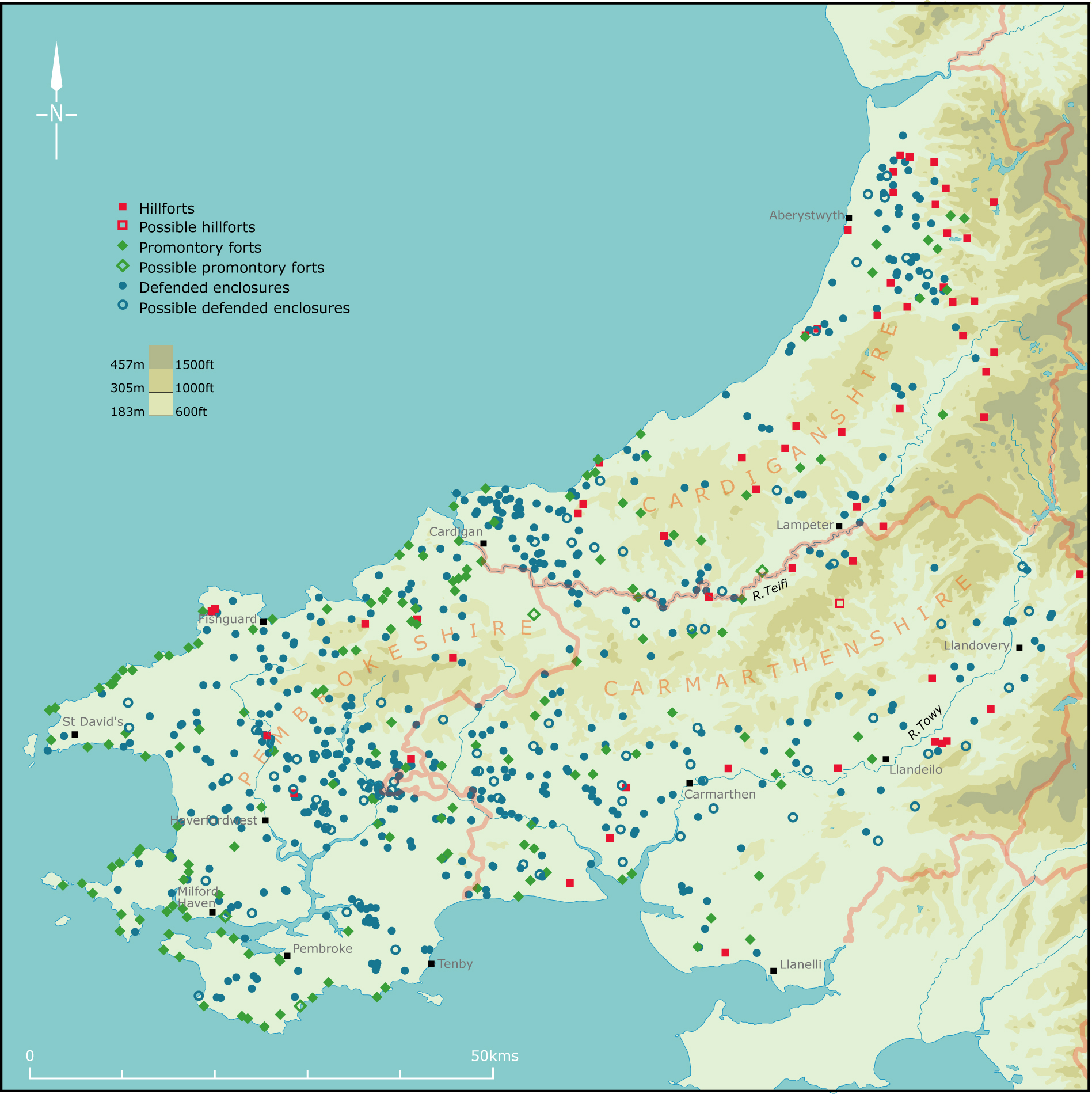
Figure 2: Distribution of hillforts, promontory forts and defended enclosures in south-west Wales
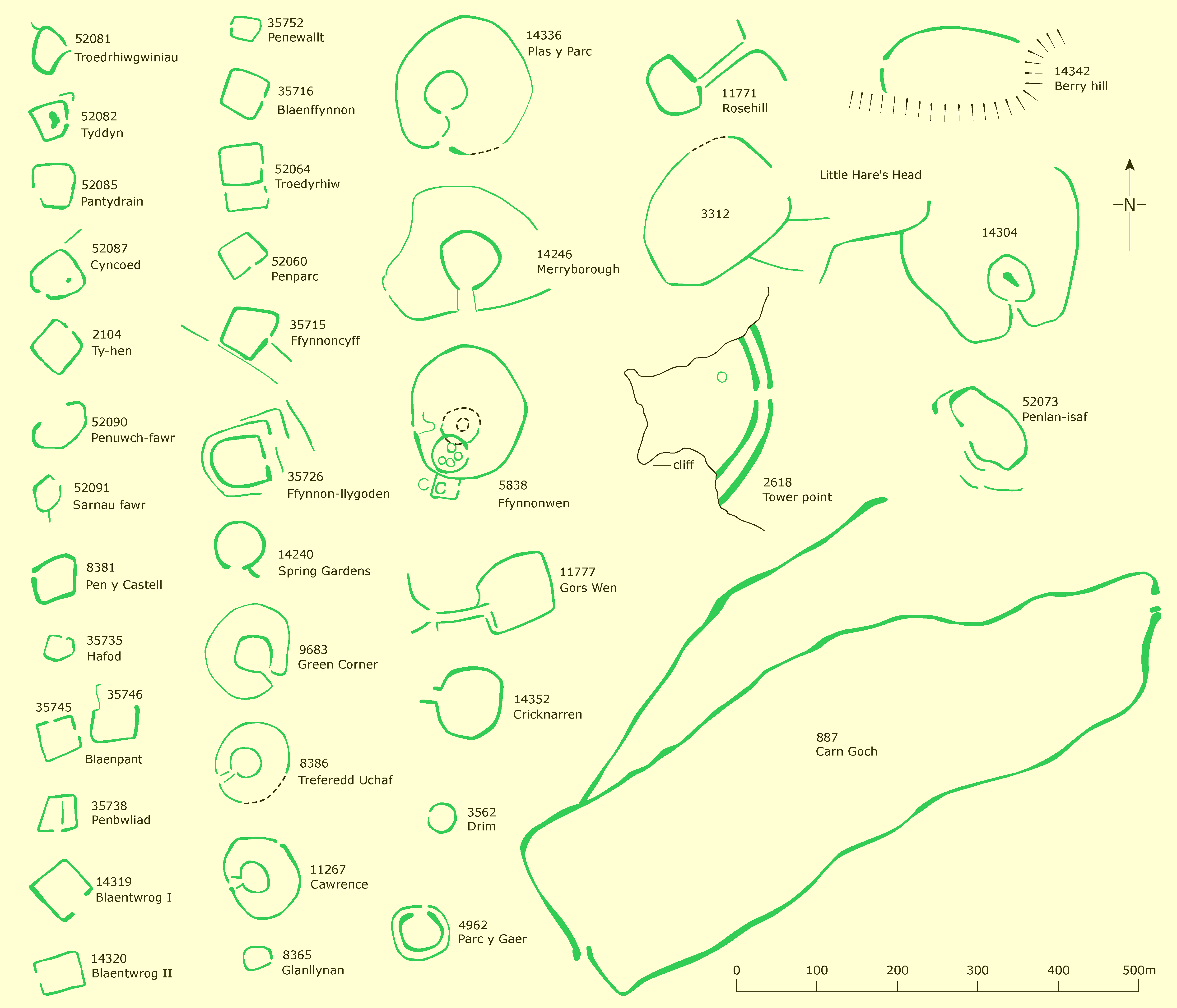
Figure 3a and 3b: A selection of hillforts, promontory forts and defended enclosures in south-west Wales. Numbers are record numbers assigned on the Dyfed Historic Environment Record
Figure 4: Plan of Woodside and Dan-y-Coed defended enclosures/enclosed settlements
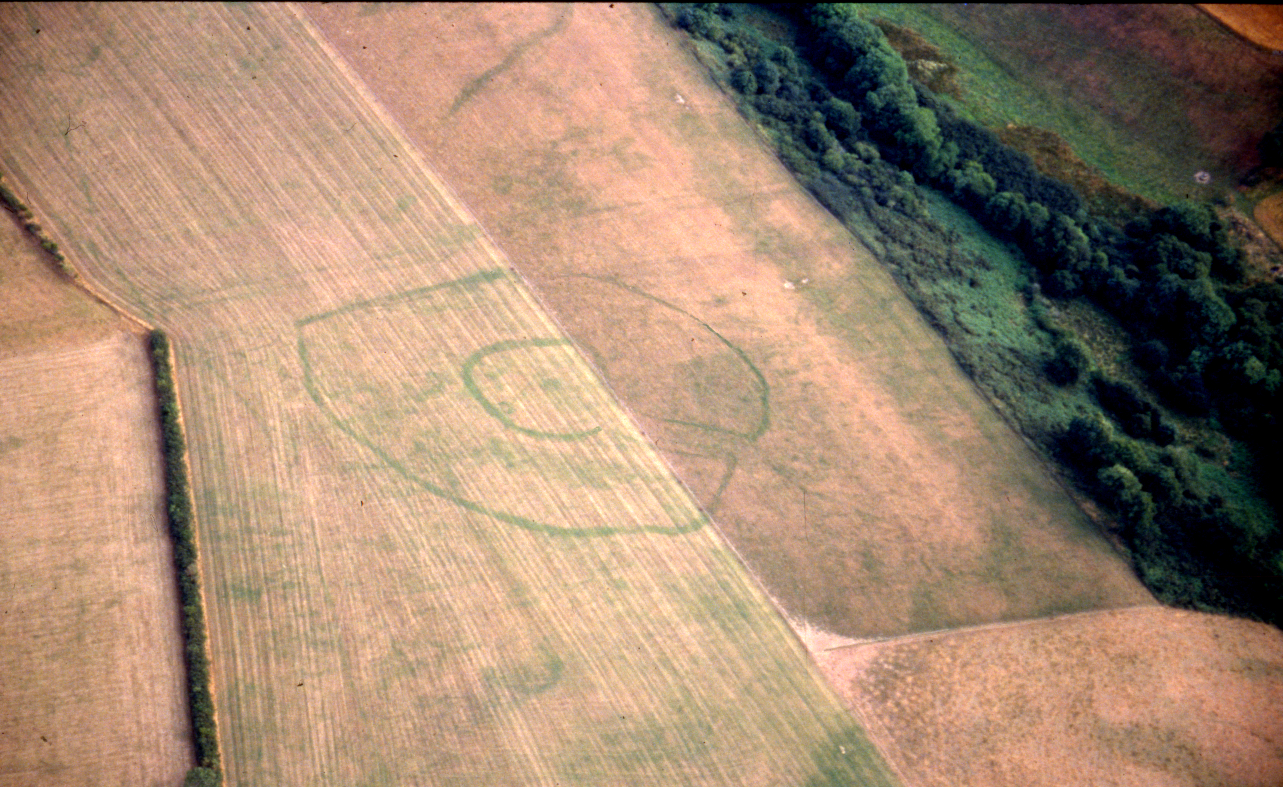
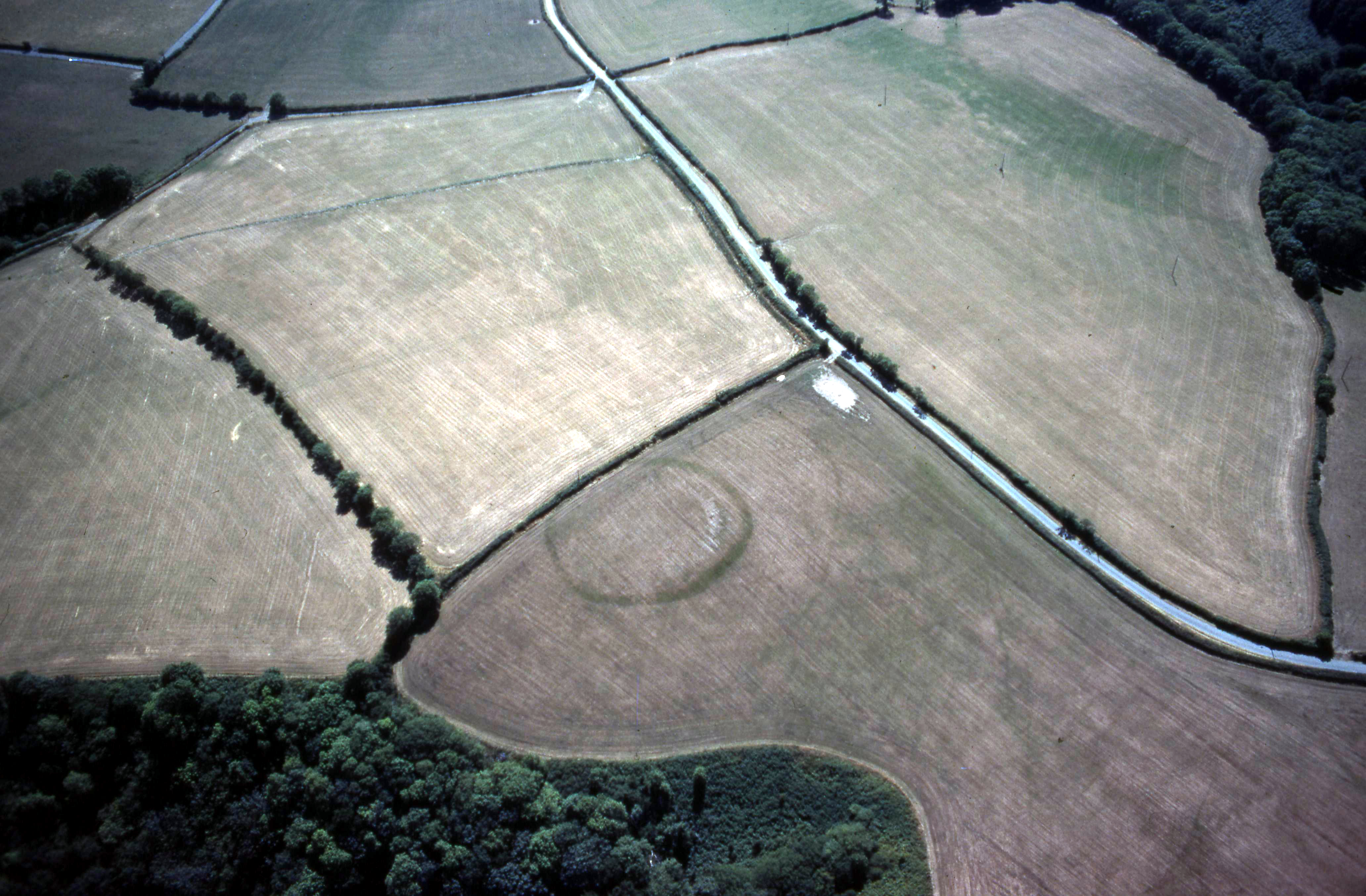
Figure 5a and 5b: Two typical south-west Wales cropmark concentric defended enclosures/enclosed settlements (Dyfed Archaeological Trust)
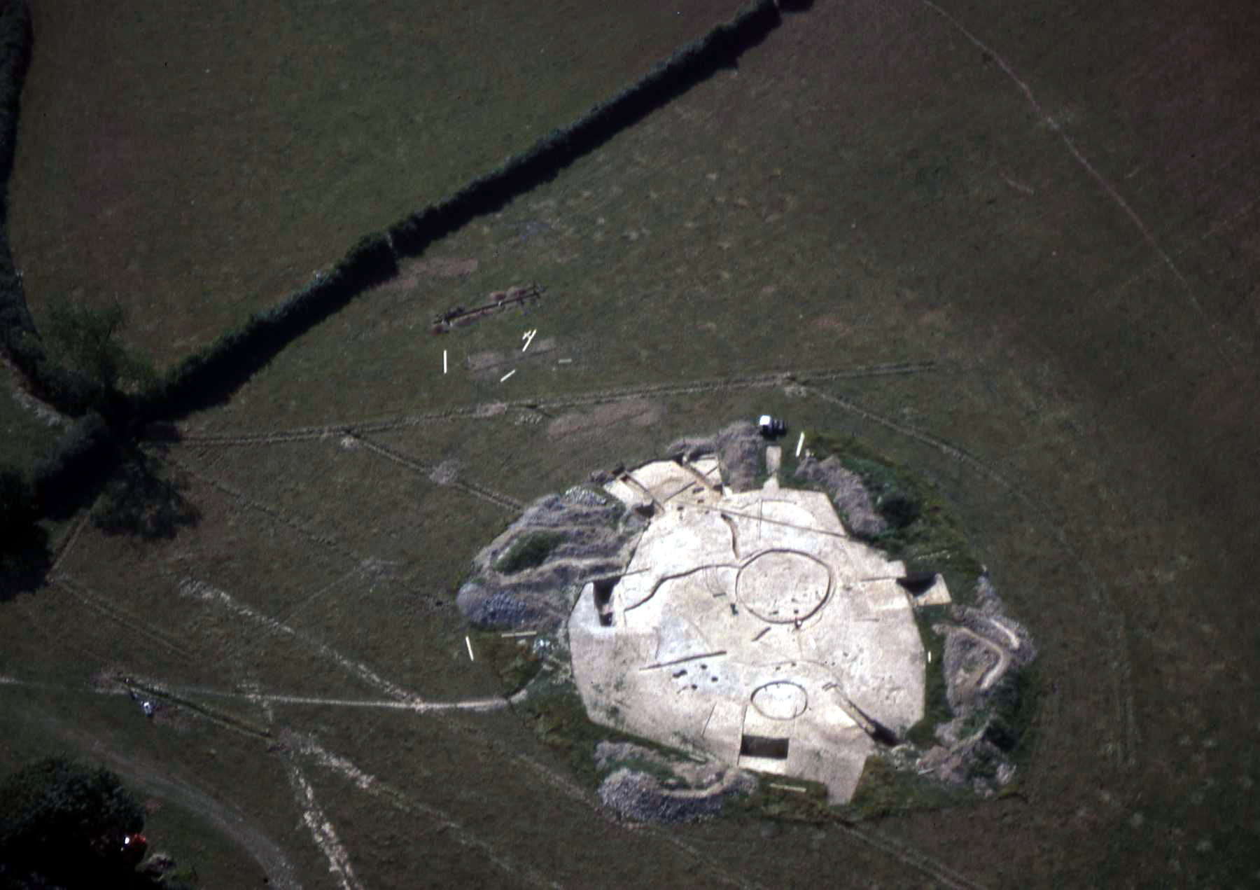
Figure 6: Aerial photograph of Penycoed defended enclosure/enclosed settlement during excavation in 1983 (Dyfed Archaeological Trust)
Figure 7: Moel Trigarn, one of the largest hillforts in south-west Wales. The light dusting of snow has picked out the numerous roundhouse platforms within and outside the defensive circuits (Dyfed Archaeological Trust)
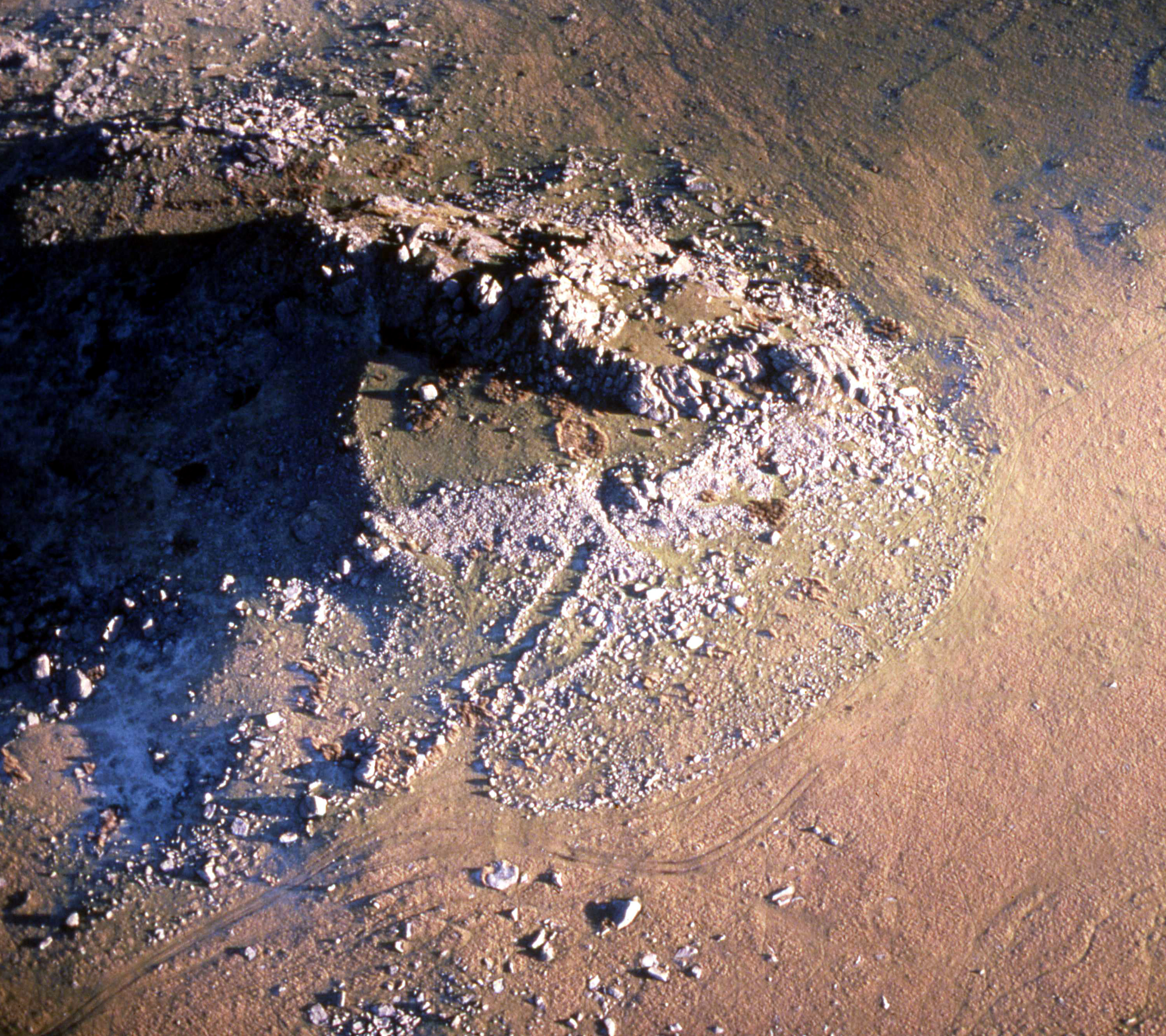
Figure 8: The rubble defensive bank of Carn Alw fort incorporates a rocky outcrop in its circuit. The hundreds of stones comprising the chevaux-de-frise can clearly be seen in this aerial photograph (Dyfed Archaeological Trust)
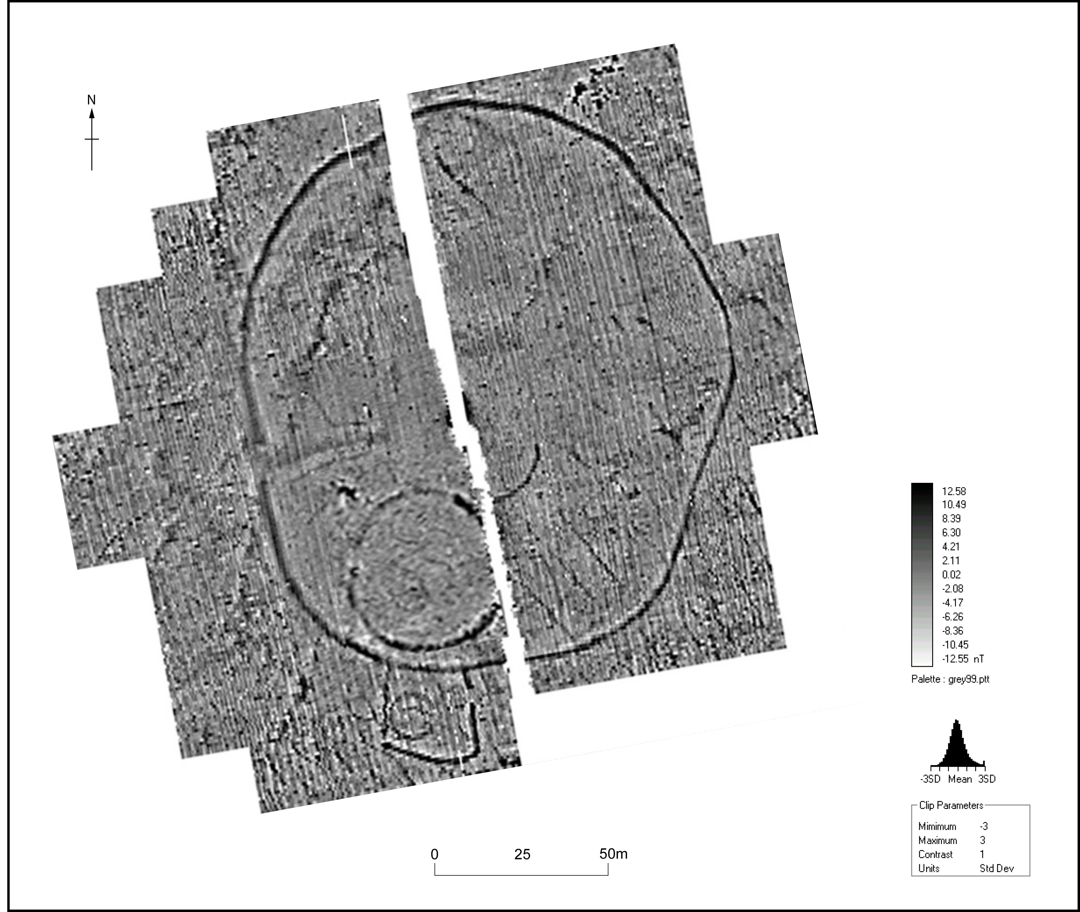
Figure 9: Geophysical survey of Ffynnonwen enclosure
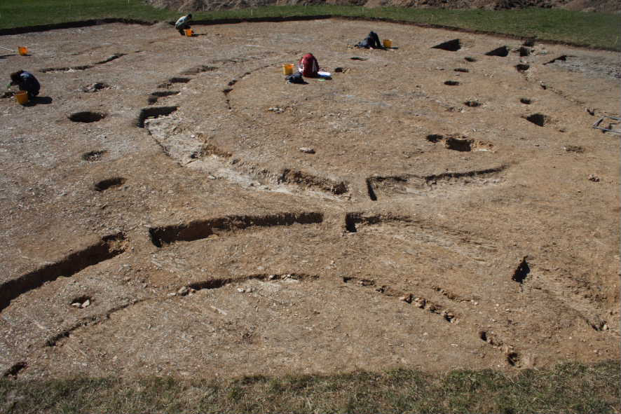
Figure 10: Excavation of Ffynnonwen enclosure showing roundhouse drainage gullies and wall foundations
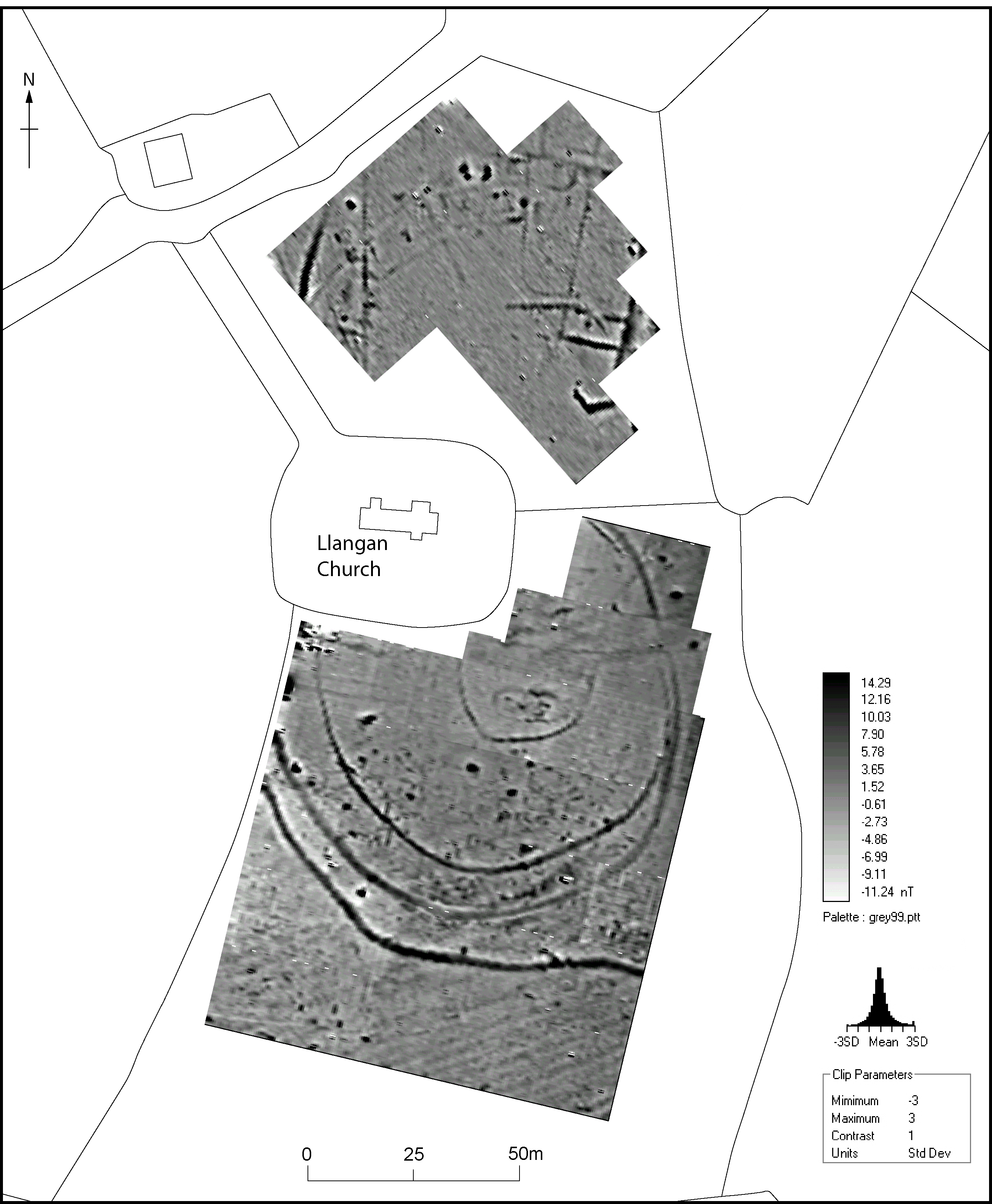
Figure 11: Geophysical survey of Llangan Church showing the concentric ditches of a defended enclosure with a possible rectangular building of earlier medieval date in the inner enclosure to the south-east of the church
Figure 12: Aerial photograph of Llangan Church showing the cropmark of the Iron Age enclosure. Note the circular enclosure to the top of the photograph, probably an earlier prehistoric site (Dyfed Archaeological Trust)
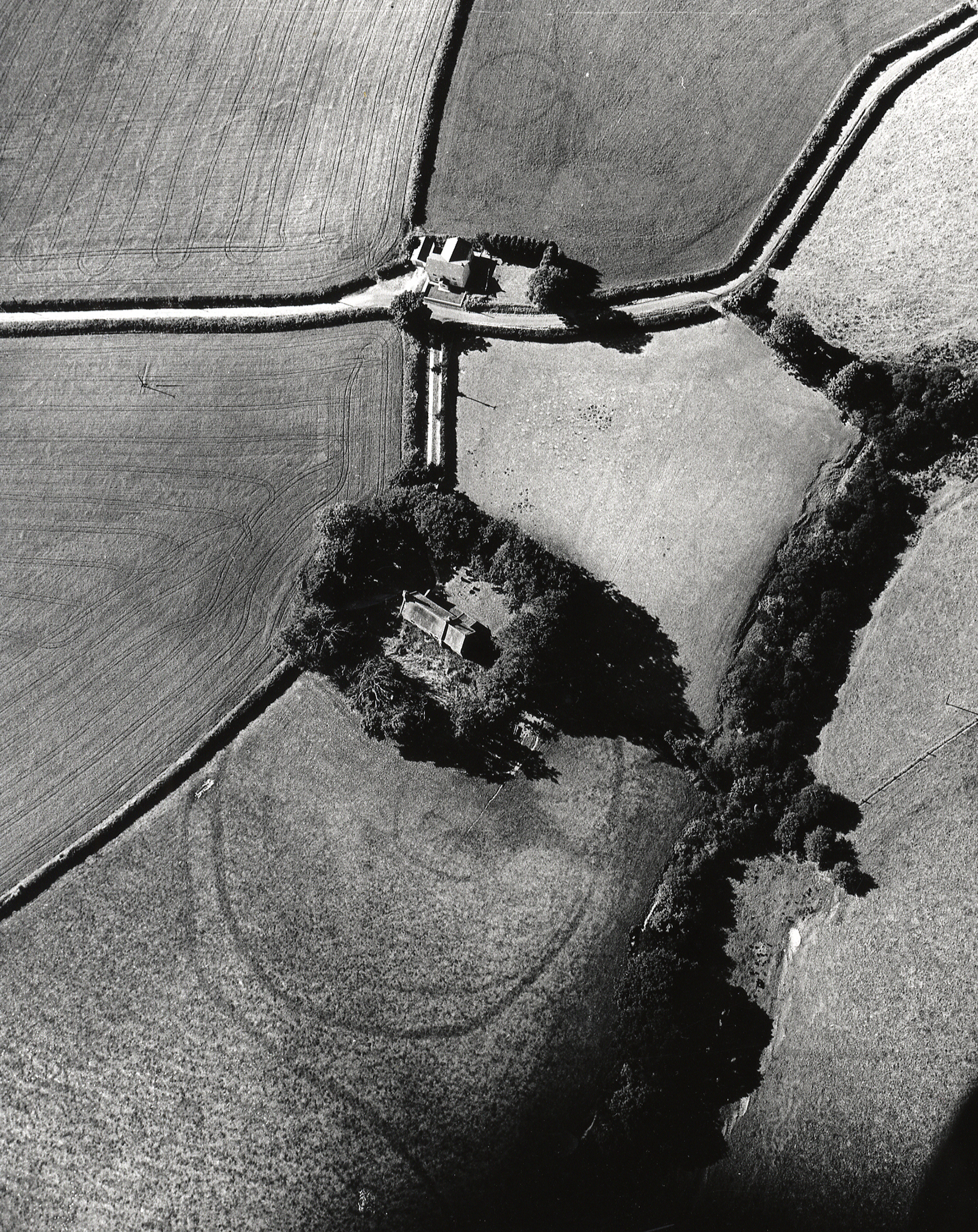
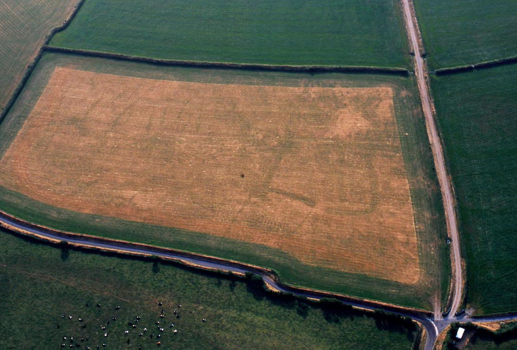
Figure 13: Ffynnoncyff - a typical rectangular defended settlement/enclosed settlement of south Ceredigion (Image: RCAHMW Crown Copyright 89-cs-659)
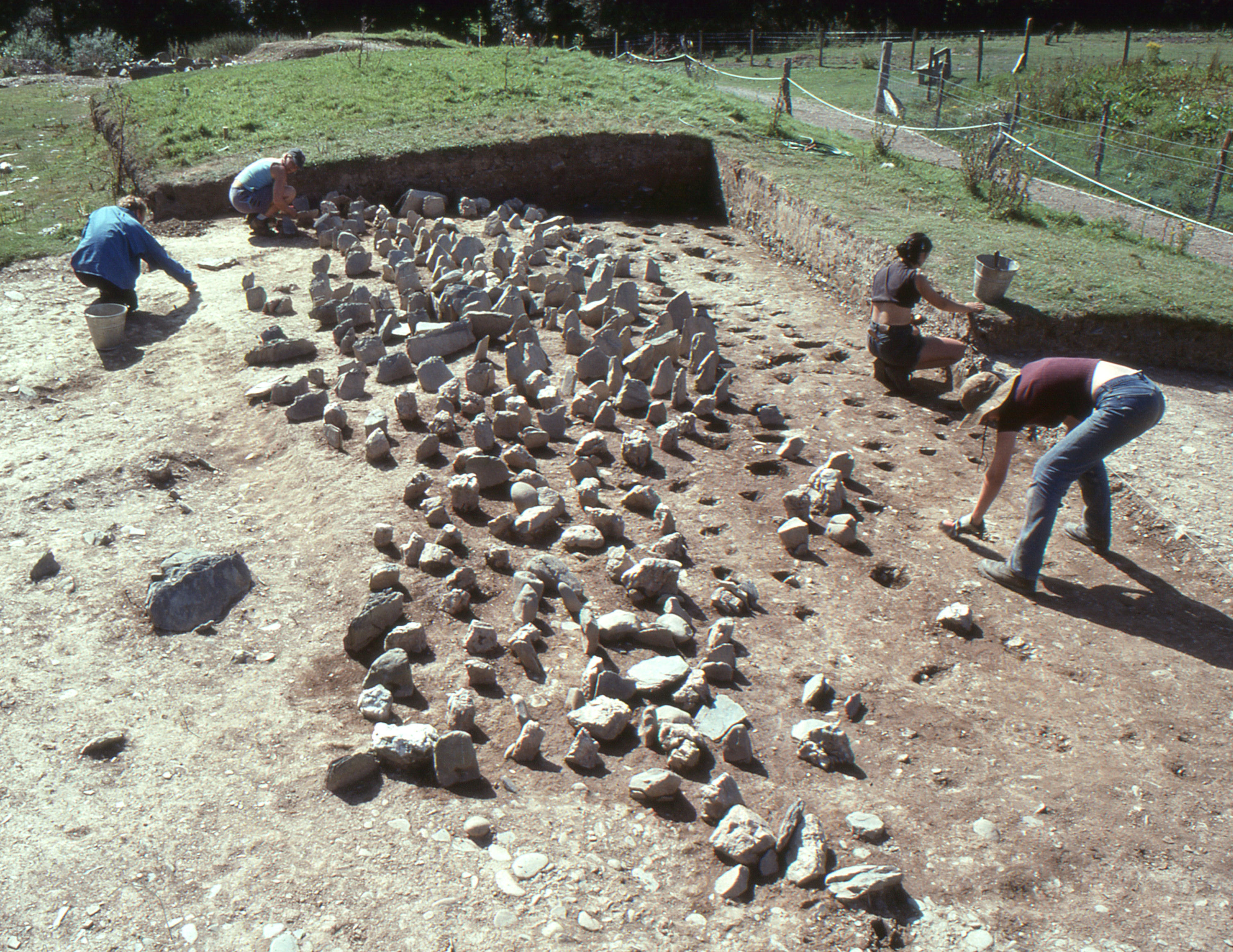
Figure 14: Photograph of Castell Henllys chevaux-de-frise under excavation (Image: H. Mytum)
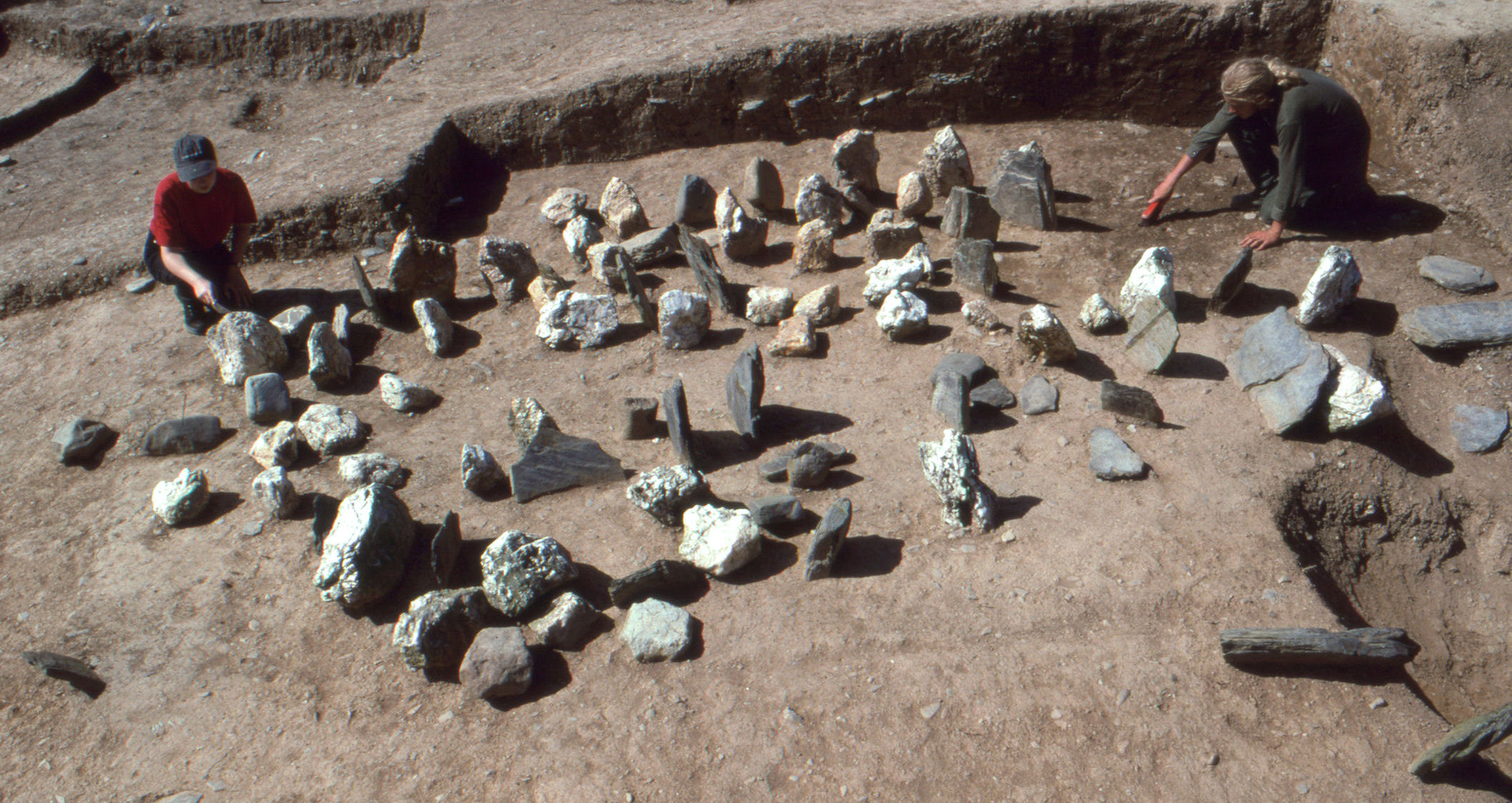
Figure 15: Photograph of the Castell Henllys chevaux-de-frise under excavation (Image: H. Mytum)
Internet Archaeology is an open access journal based in the Department of Archaeology, University of York. Except where otherwise noted, content from this work may be used under the terms of the Creative Commons Attribution 3.0 (CC BY) Unported licence, which permits unrestricted use, distribution, and reproduction in any medium, provided that attribution to the author(s), the title of the work, the Internet Archaeology journal and the relevant URL/DOI are given.
Terms and Conditions | Legal Statements | Privacy Policy | Cookies Policy | Citing Internet Archaeology
Internet Archaeology content is preserved for the long term with the Archaeology Data Service. Help sustain and support open access publication by donating to our Open Access Archaeology Fund.