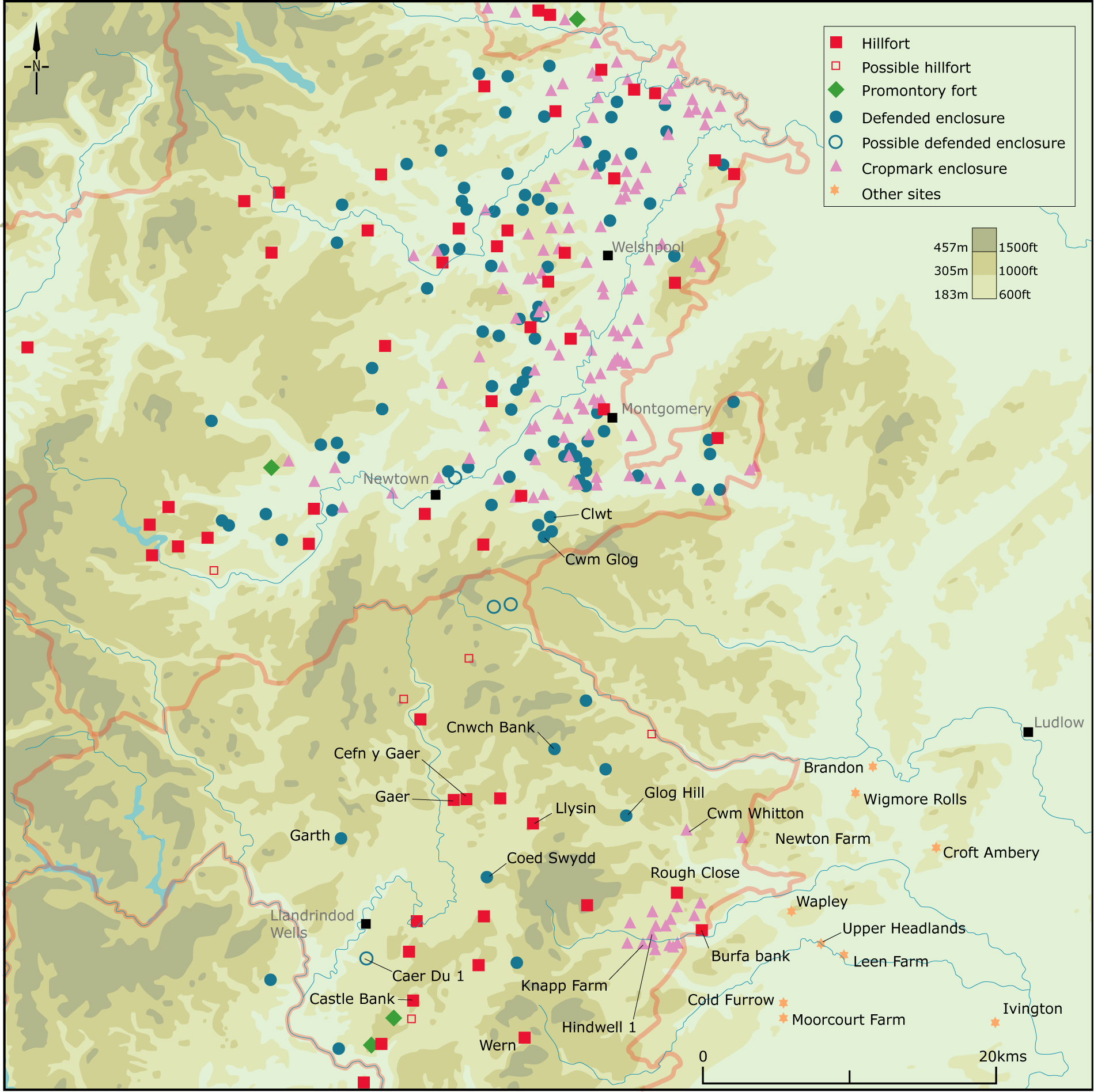
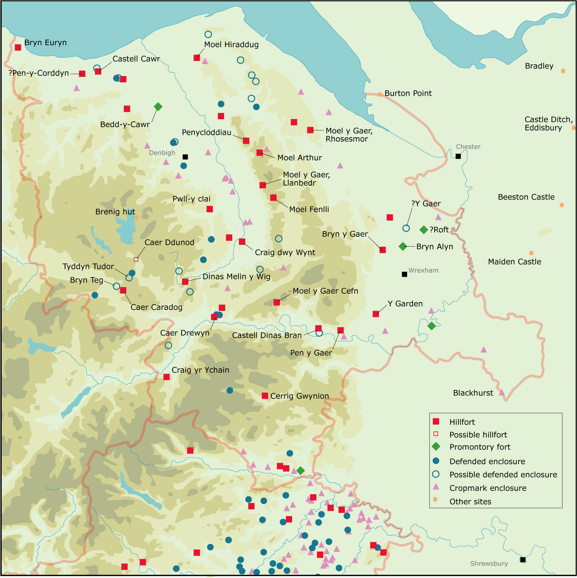
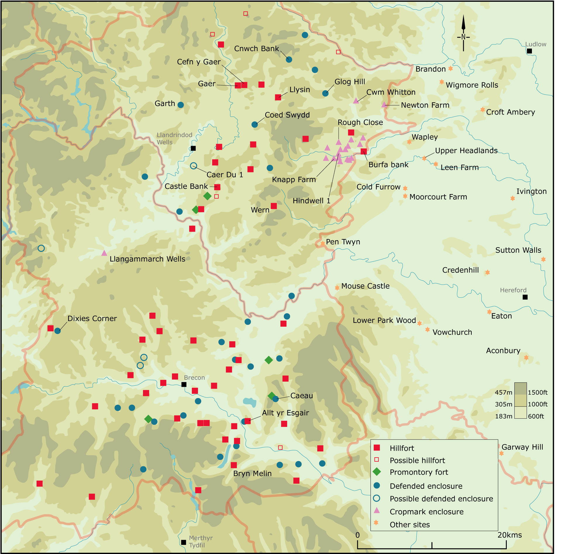
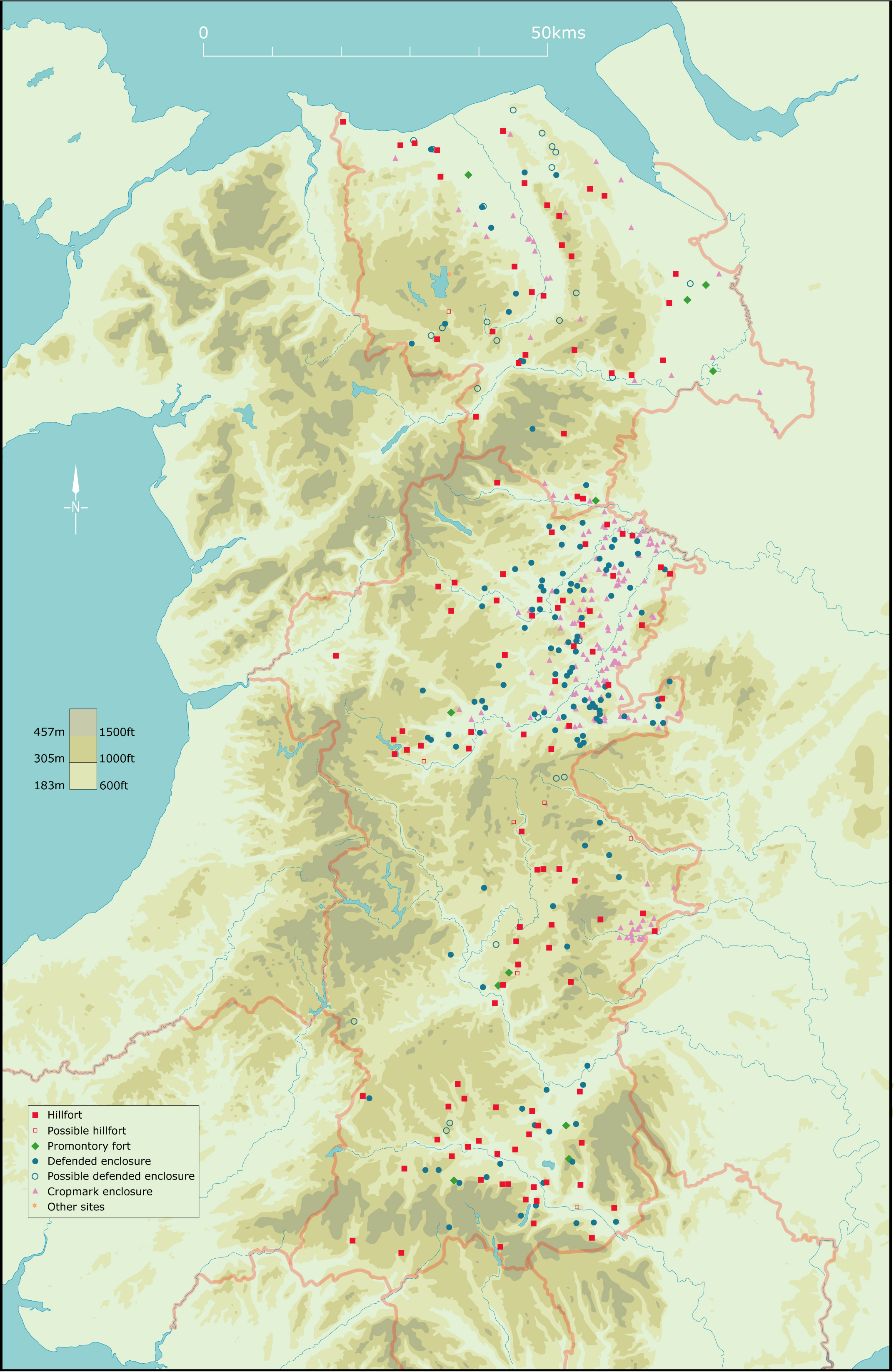
Figure 1a, Figure 1b, Figure 1c and Figure 1d: Location showing extent of region, topography, rivers and principal sites referred to in the text.
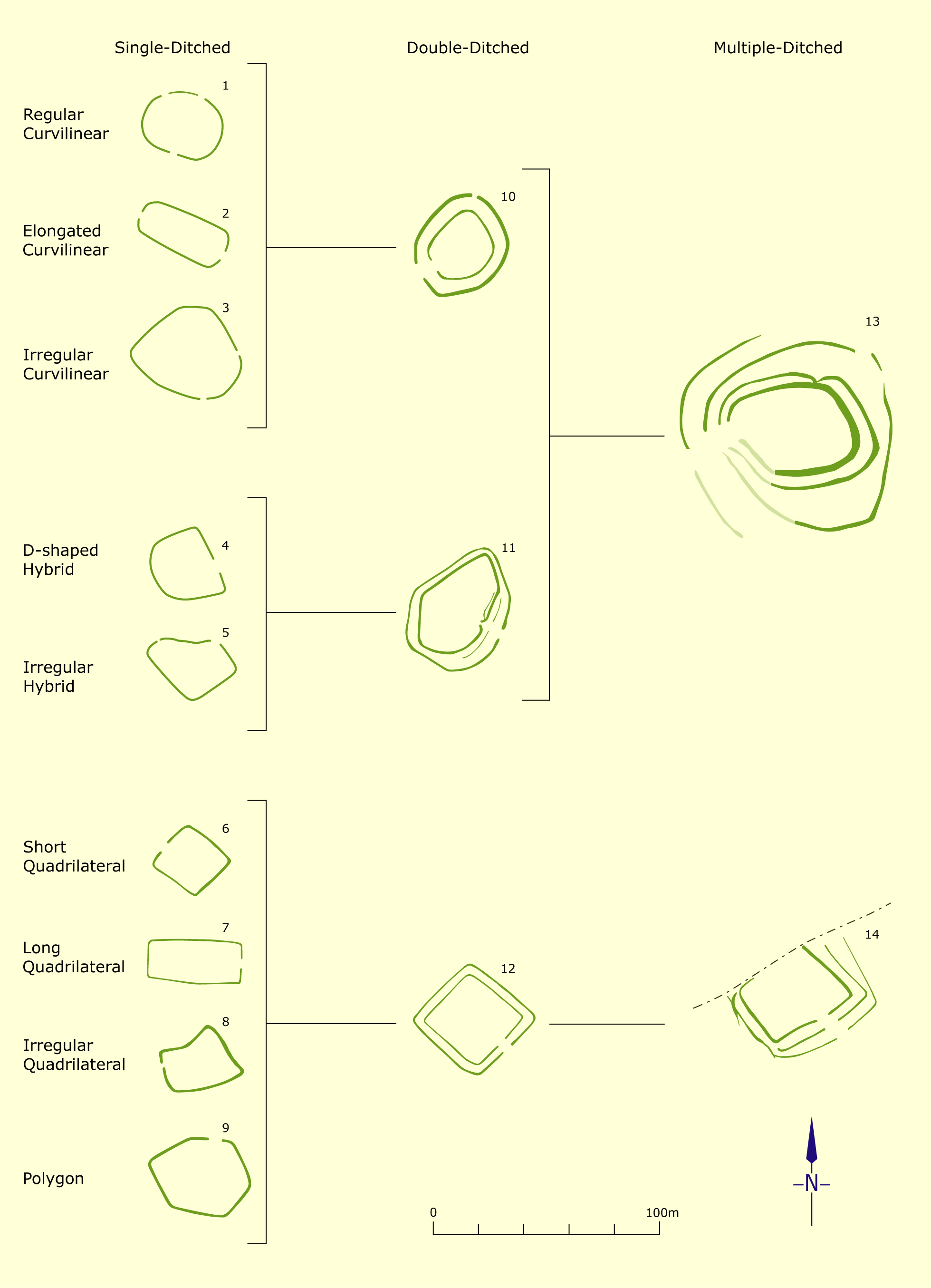
Figure 2: Summary of the morphology of enclosure sites in the Severn valley (Whimster 1989, fig. 19, © RCAHME).
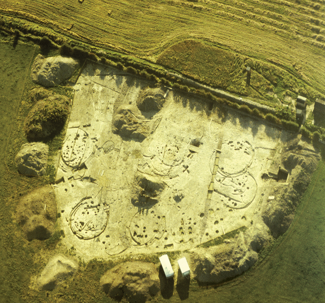
Figure 3a: The Collfryn enclosure near Llansantffraid in the Vyrnwy valley. (a) shows the settlement’s cropmark ditches. Figure 3b shows a closer view of the rescue excavations by the Clwyd-Powys Archaeological Trust in 1982-83 which uncovered drainage ditches of timber-build Iron Age roundhouses and post pits representing rectangular storage buildings. The enclosure was remodelled and continued in occupation into the Roman period (Image: Clwyd-Powys Archaeological Trust 81-c-0214, 82-c-0316).
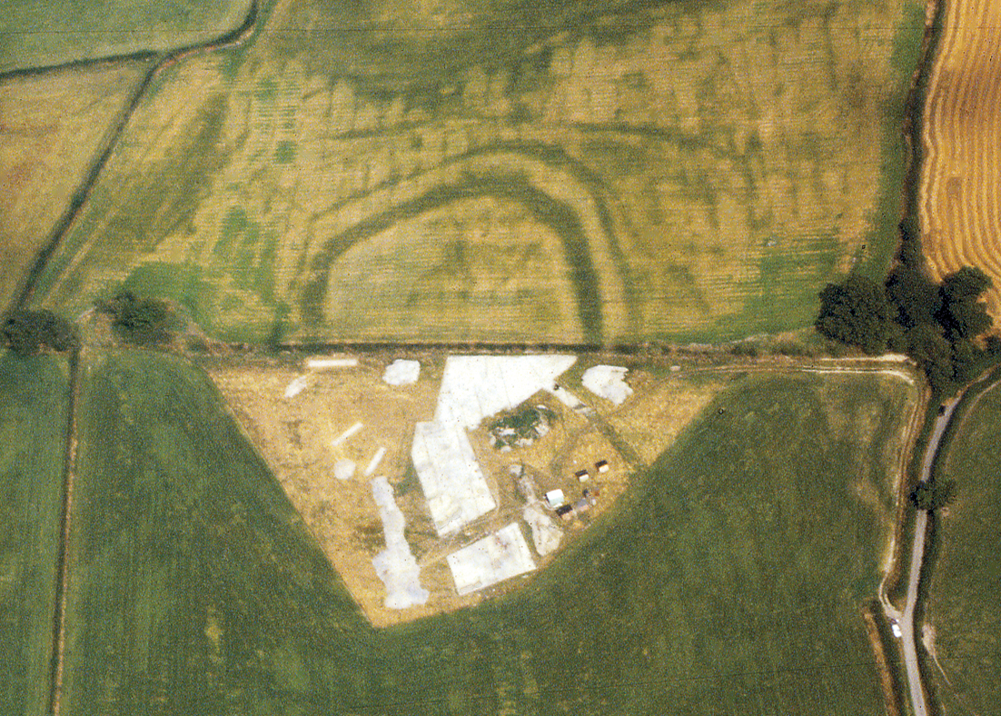
Figure 4: Cropmark enclosure at Varchoel Lane, north-east of Guilsfield. The enclosure is about 100 metres across. (Image: Clwyd-Powys Archaeological Trust, 84-c-0164).
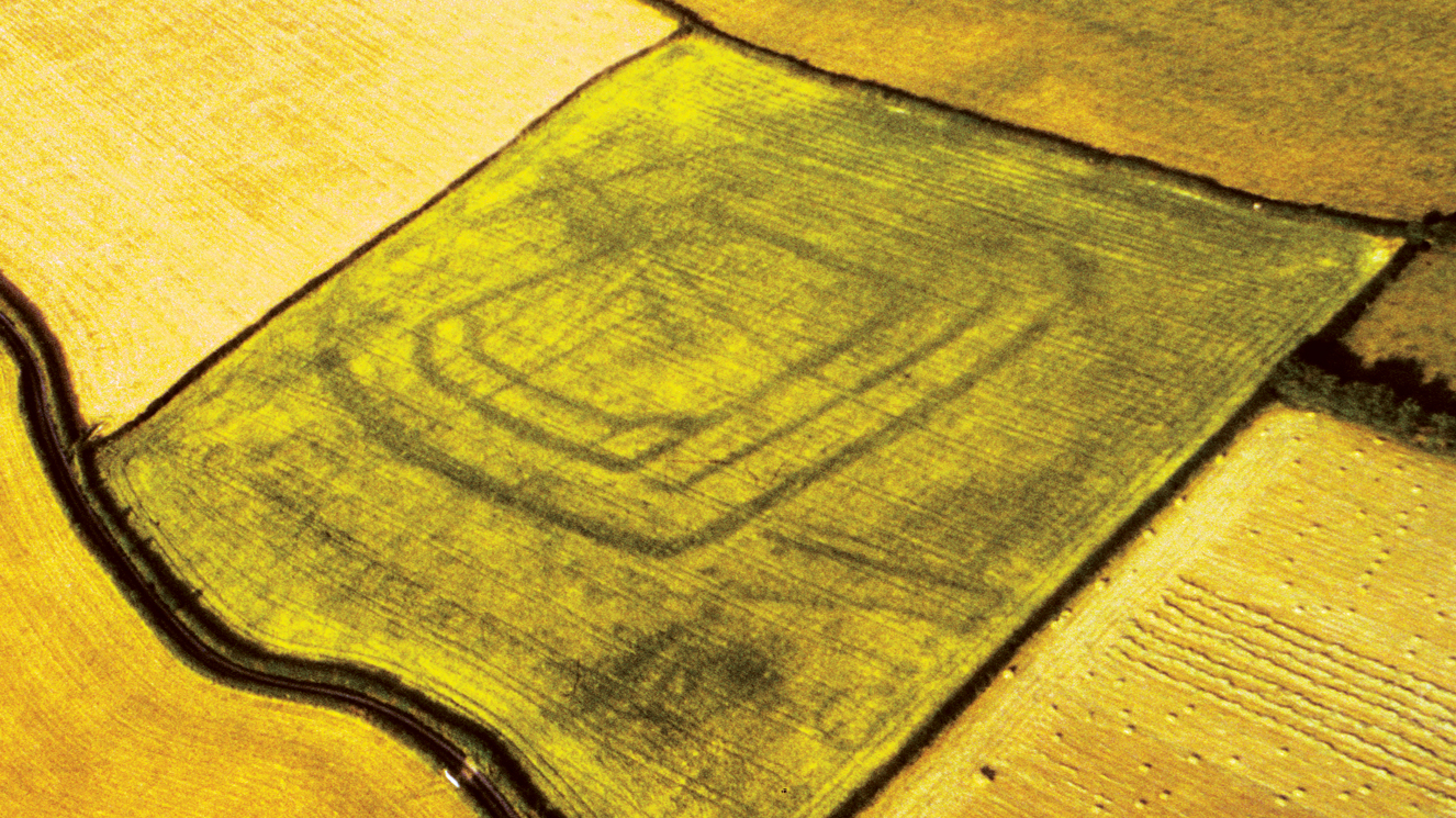
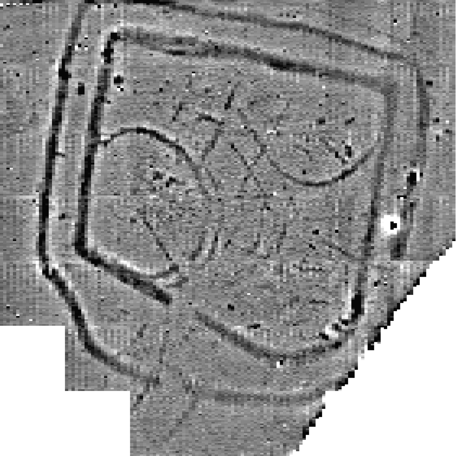
Figure 5: Geophysical survey of the Dol-lâs enclosure, Berriew. The double-ditched enclosure is about 80 metres across internally. Gaps in both ditches indicate an entrance at the bottom. Geophysical survey can prove helpful in identifying internal subdivisions and drainage ditches are probably associated with roundhouses and other structures which may not be visible from aerial photography. North to top. (Survey by R. Hankinson and W. Owen, Image: Clwyd-Powys Archaeological Trust).
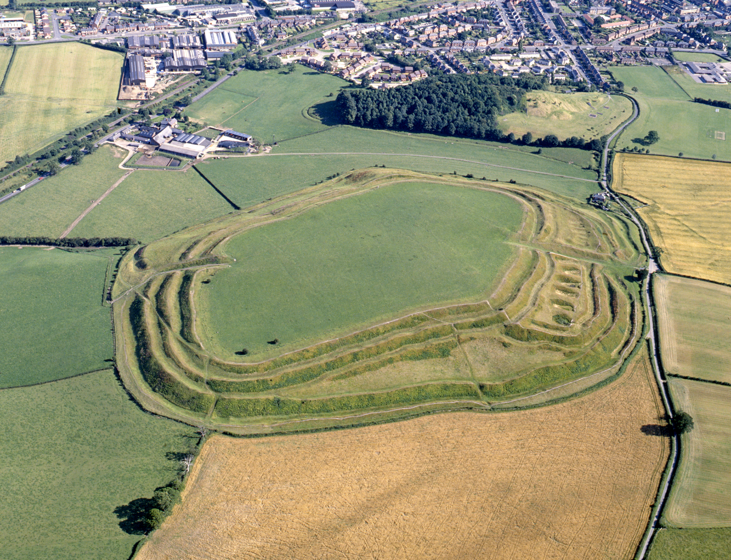
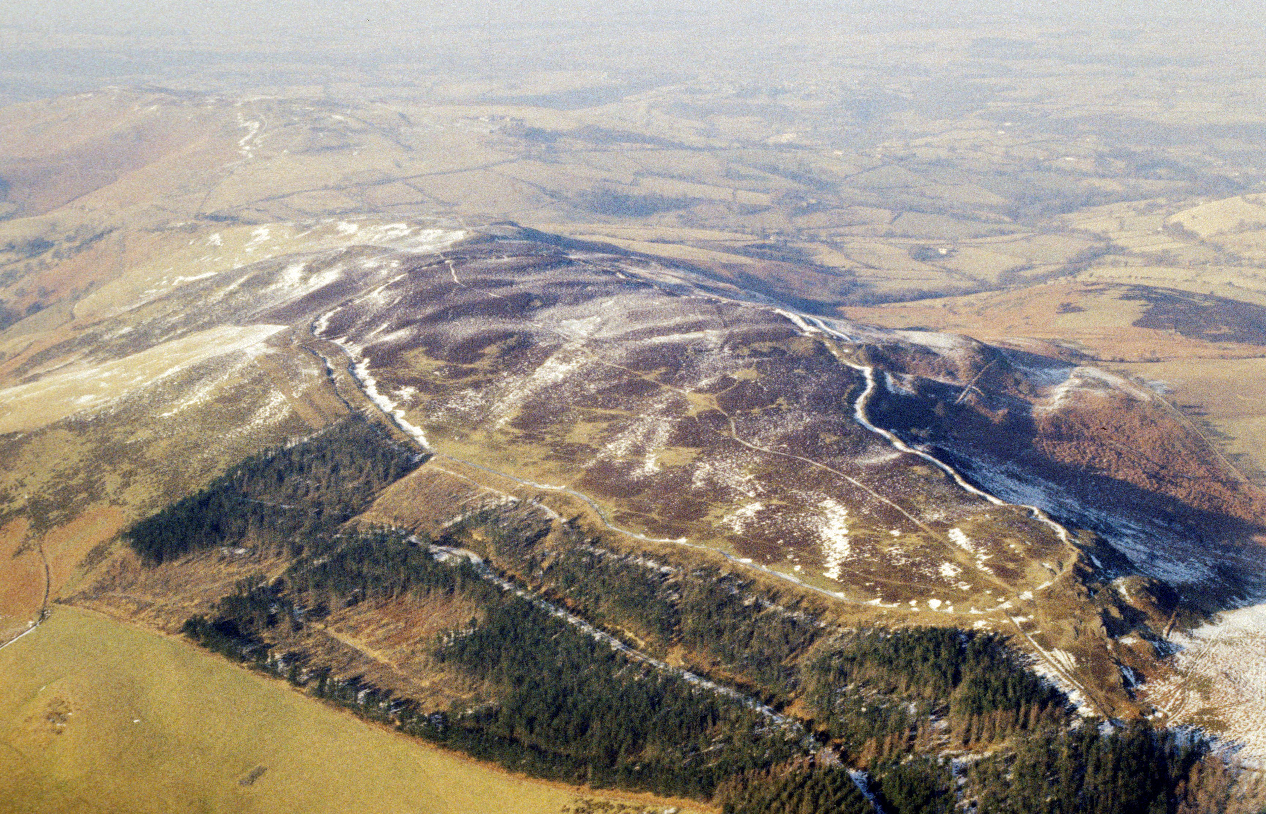
Figure 6: Old Oswestry hillfort, Shropshire. The hillfort, which occupies a lowland site, is one of the most majestic in the region. The internal area is about 5.3ha. (© Clwyd-Powys Archaeological Trust 90-mc6-0009).
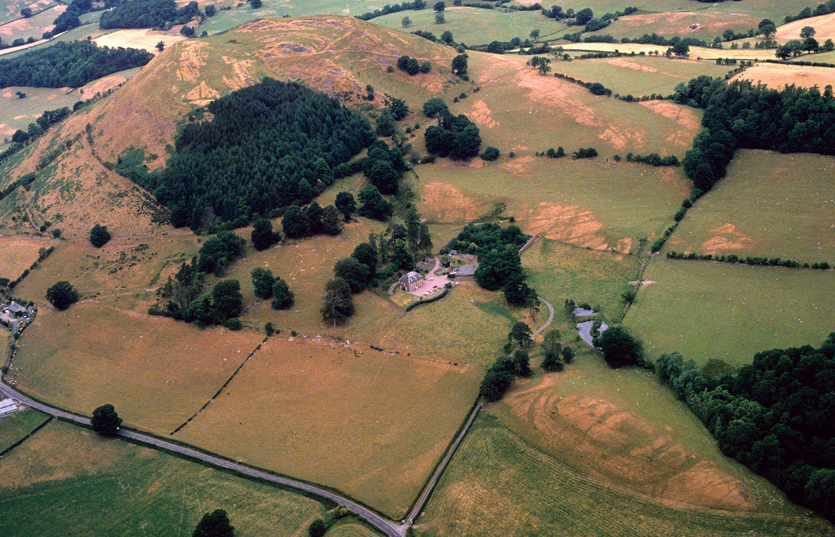
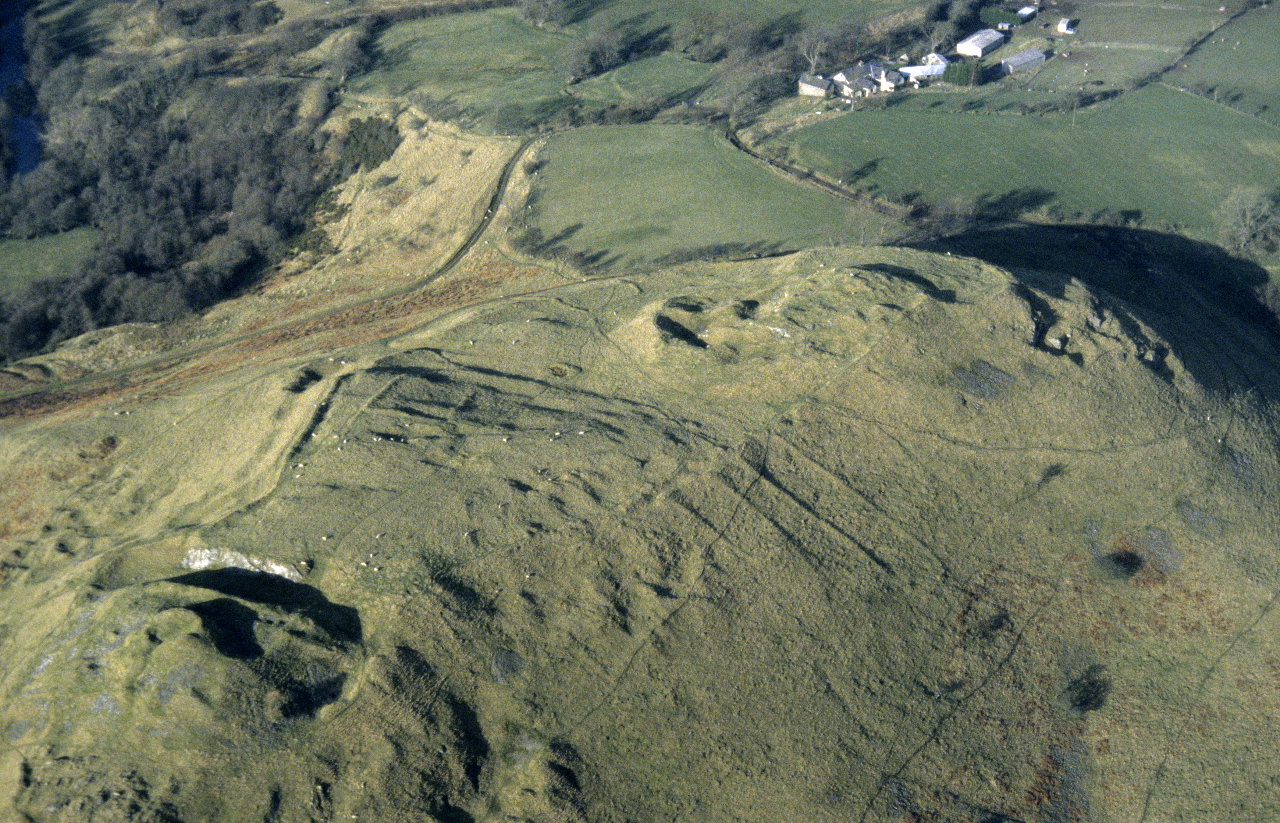
Figure 7: Juxtaposition of hillfort and smaller enclosure near Llangedwyn in the Tanat Valley. To the top left is the Llwyn Bryn-dinas hillfort and to the bottom right is the Plas Uchaf enclosure, showing up as parchmarks. Excavations at Llwyn Bryn-dinas have shown an sequence extending from the Later Bronze Age into the Iron Age. The Plas Uchaf enclosure is unexcavated but seems likely to have been contemporary with the Iron Age phases at Llwyn Bryn-dinas. Excavations in the Severn valley at the Breiddin and the Collfryn have shown larger hillforts and smaller enclosures were being occupied simultaneously. (© Clwyd-Powys Archaeological Trust 89-c-0190).
Figure 8: The enclosure at Caer Du, just to the south of Llandrindod Wells, is accompanied by a second, more polygonal, enclosure less than 100m to the north (Image: Clwyd-Powys Archaeological Trust 88-16-23)
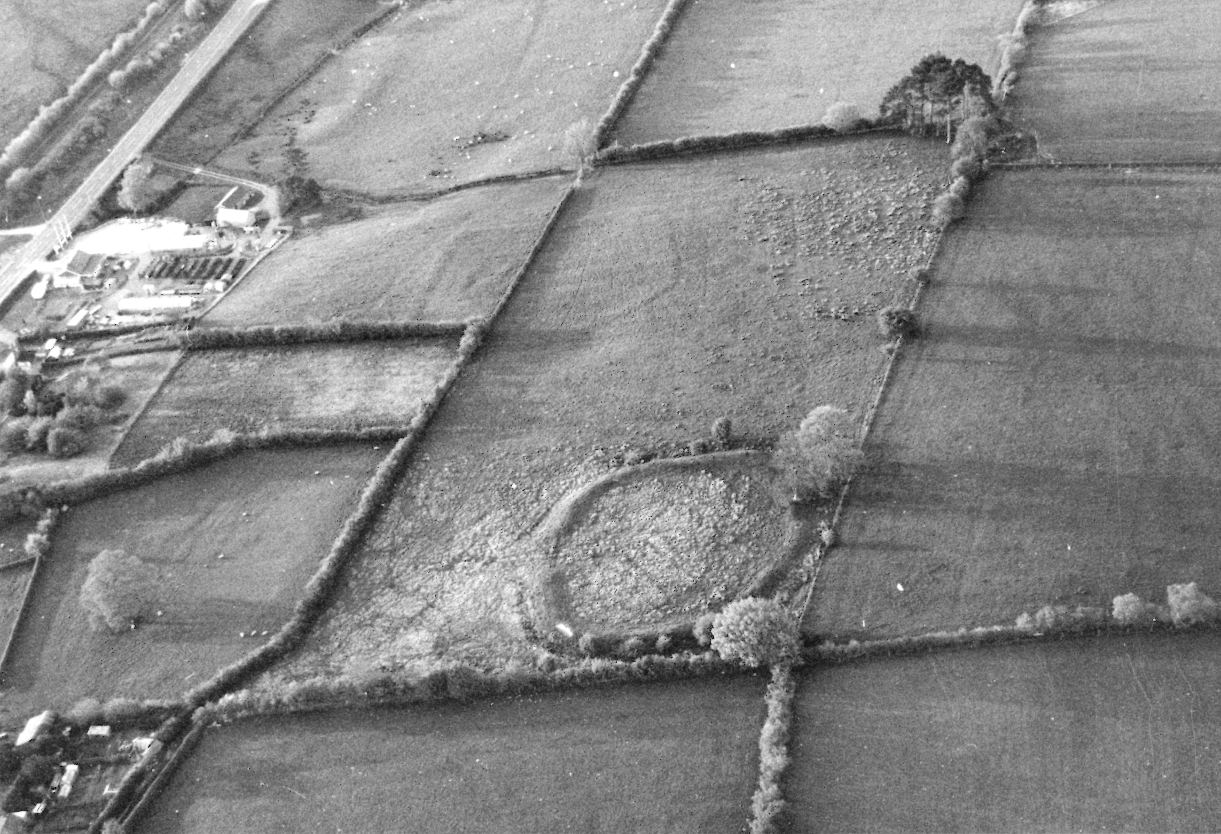
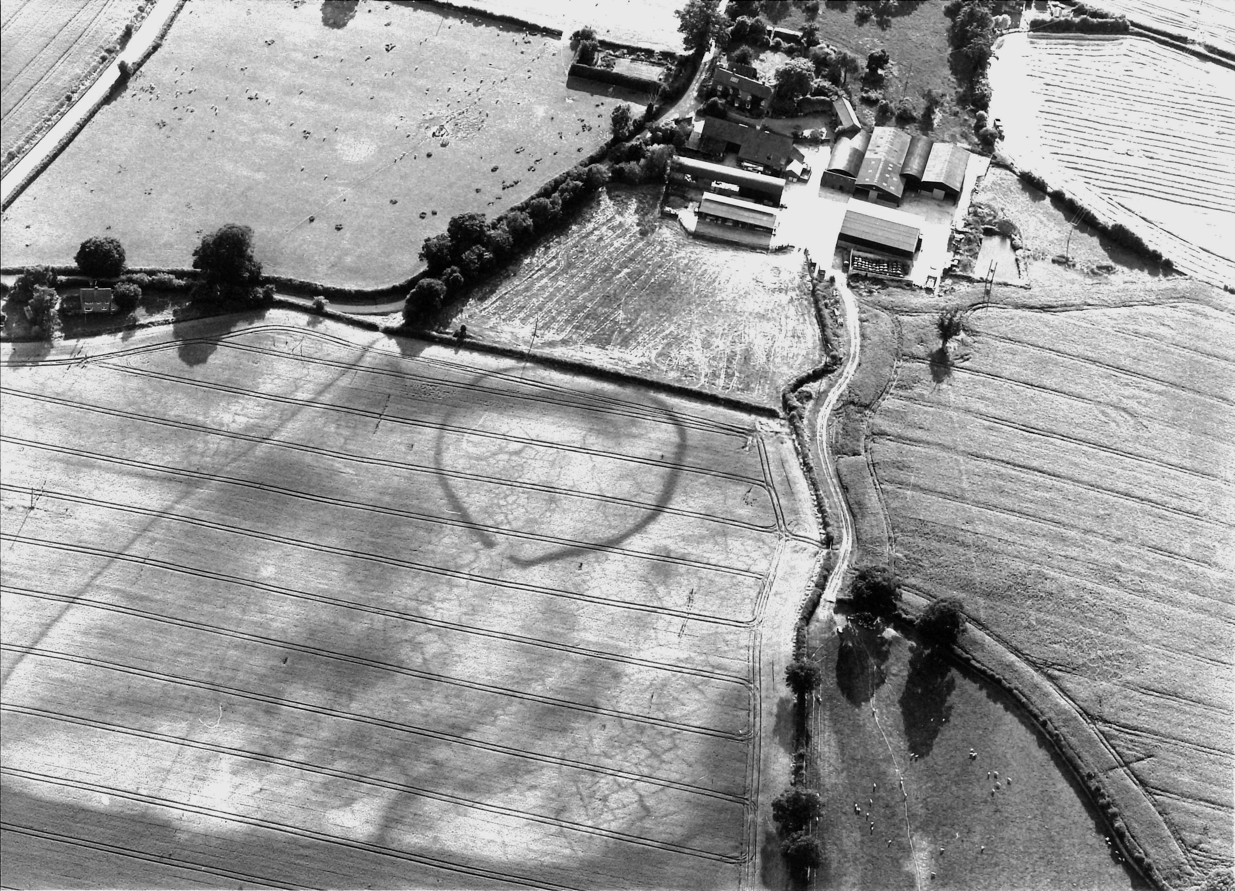
Figure 9: On one of the smaller commons in Radnorshire the Coed Swydd enclosure lies off the crest of the hill on a slightly lower terrace Image: Clwyd-Powys Archaeological Trust 92-c-510
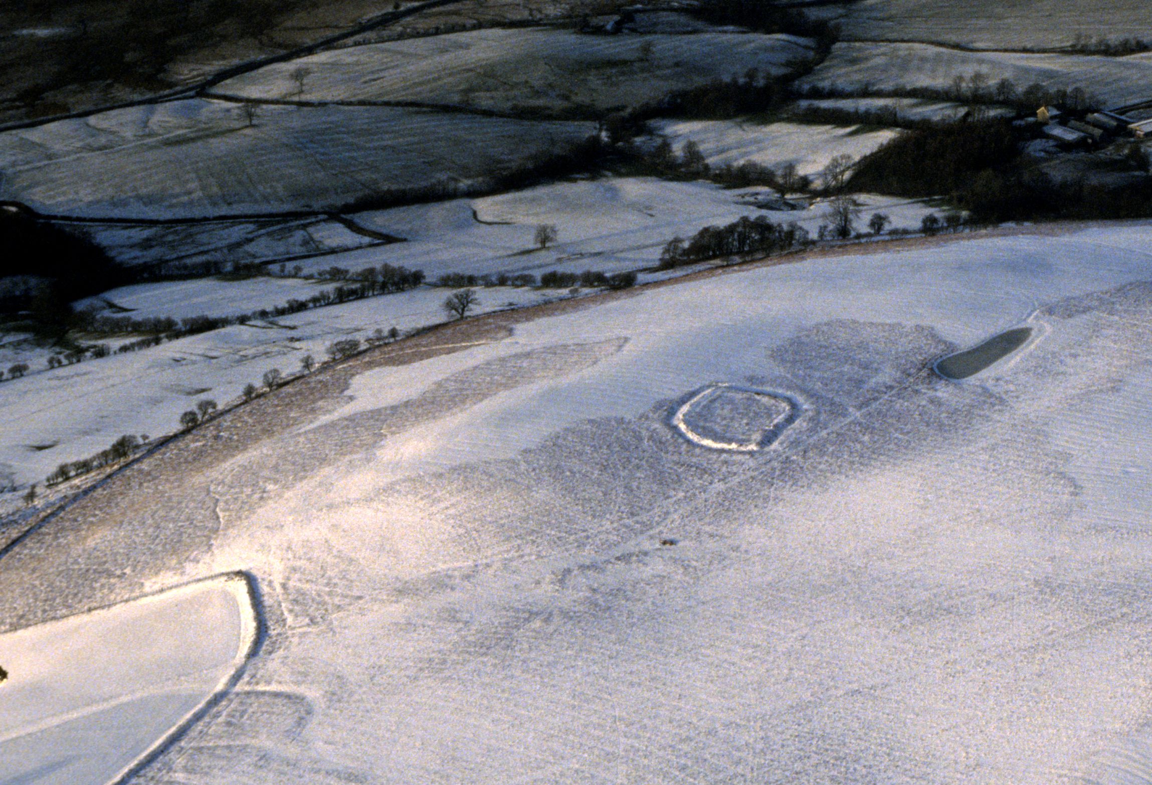
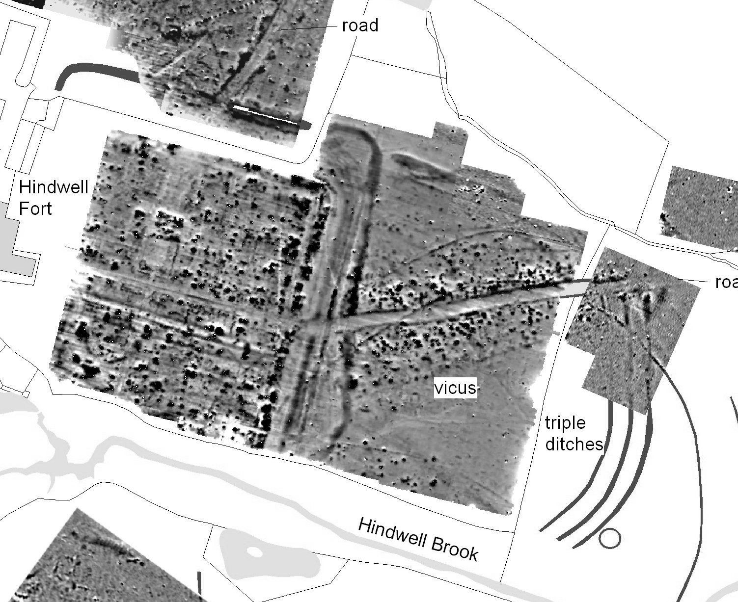
Figure 10: Hindwell, Radnorshire. North-west of the triple ditches, which have a Roman military origin, wide-spaced double ditches can be seen passing under the dense anomalies that make up the vicus. First thought to be Iron Age, these are now known to be part of a Neolithic palisaded enclosure (Image: Clwyd-Powys Archaeological Trust)
Figure 11a: Wapley hillfort, Herefordshire (S) 345 624). Photo by Chris Musson; © WNFC MASH 00.MB.007.
Figure 11b: A small curvilinear enclosure at Vowchurch, Herefordshire. Image: C. Musson, 96.MB. 0401.
Figure 12a: Penycloddiau, largest of the hillforts on the Clwydian hills. (Image: Clwyd-Powys Archaeological Trust, 86-c-0068)
Figure 12b: Castell Dinas Bran with its castle lying inside the ramparts of the earlier hillfort overlooks Llangollen (Denbighshire) in the Dee Valley. (Image: Clwyd-Powys Archaeological Trust, 88-mc2-0014)
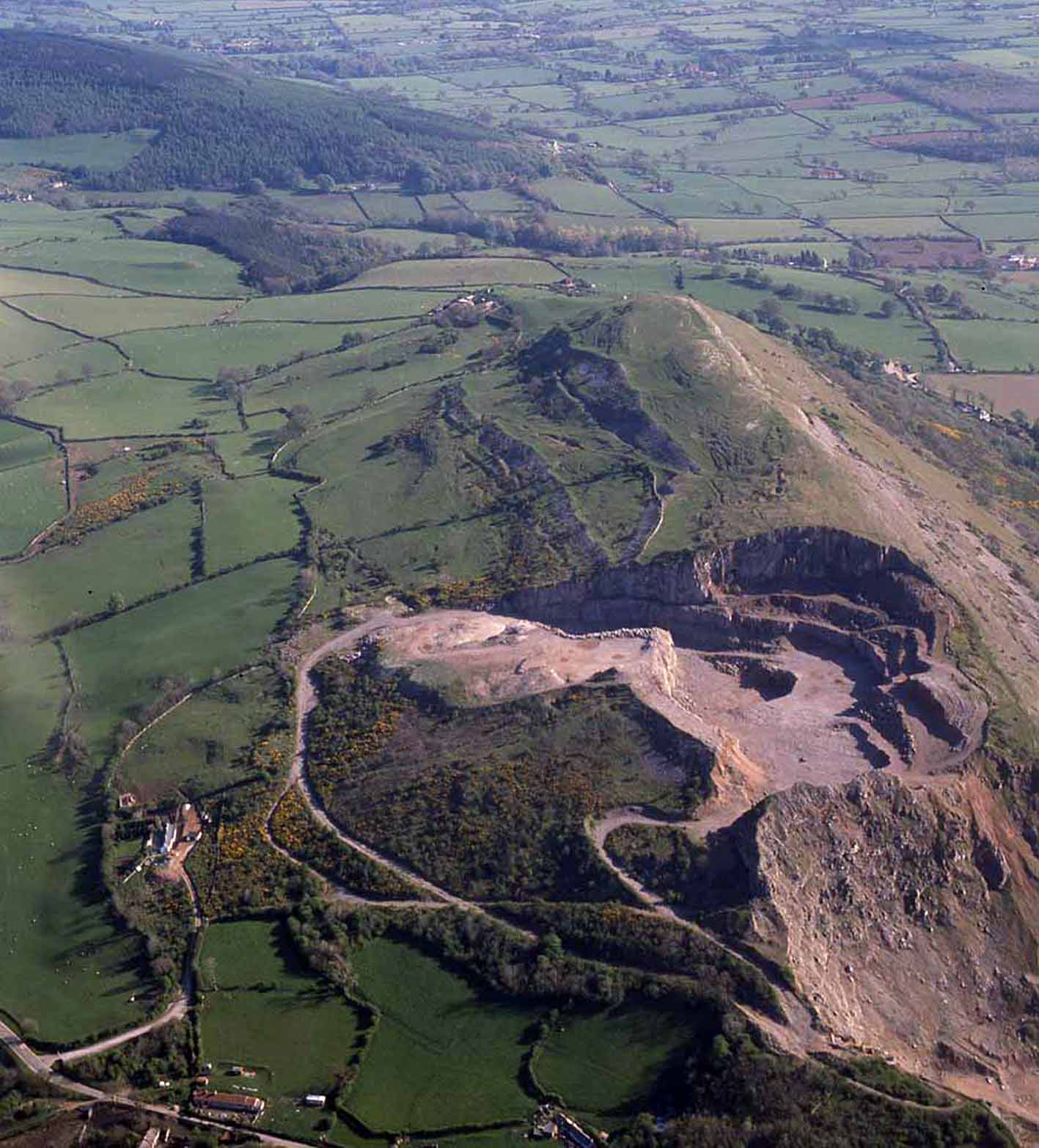
Figure 13: The partially quarried Moel Hiraddug hillfort, viewed from the north (Image: Clwyd-Powys Archaeological Trust, 88-mc4- 0010).
Figure 14: The stone-built fort of Caer Drewyn above the Dee Valley near Corwen, formerly in Merionethshire Image: Clwyd-Powys Archaeological Trust, 06-c-380
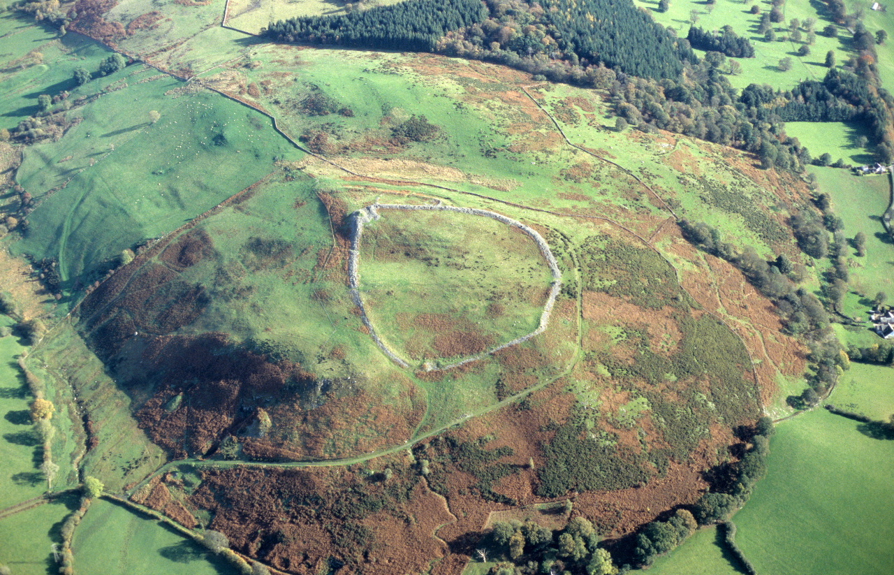
Figure 15: The small enclosure at Bryn Teg near Cerrigydrudion (formerly Denbighshire) with what may be the remnants of an associated field system Image: Clwyd-Powys Archaeological Trust, 87-c-0196
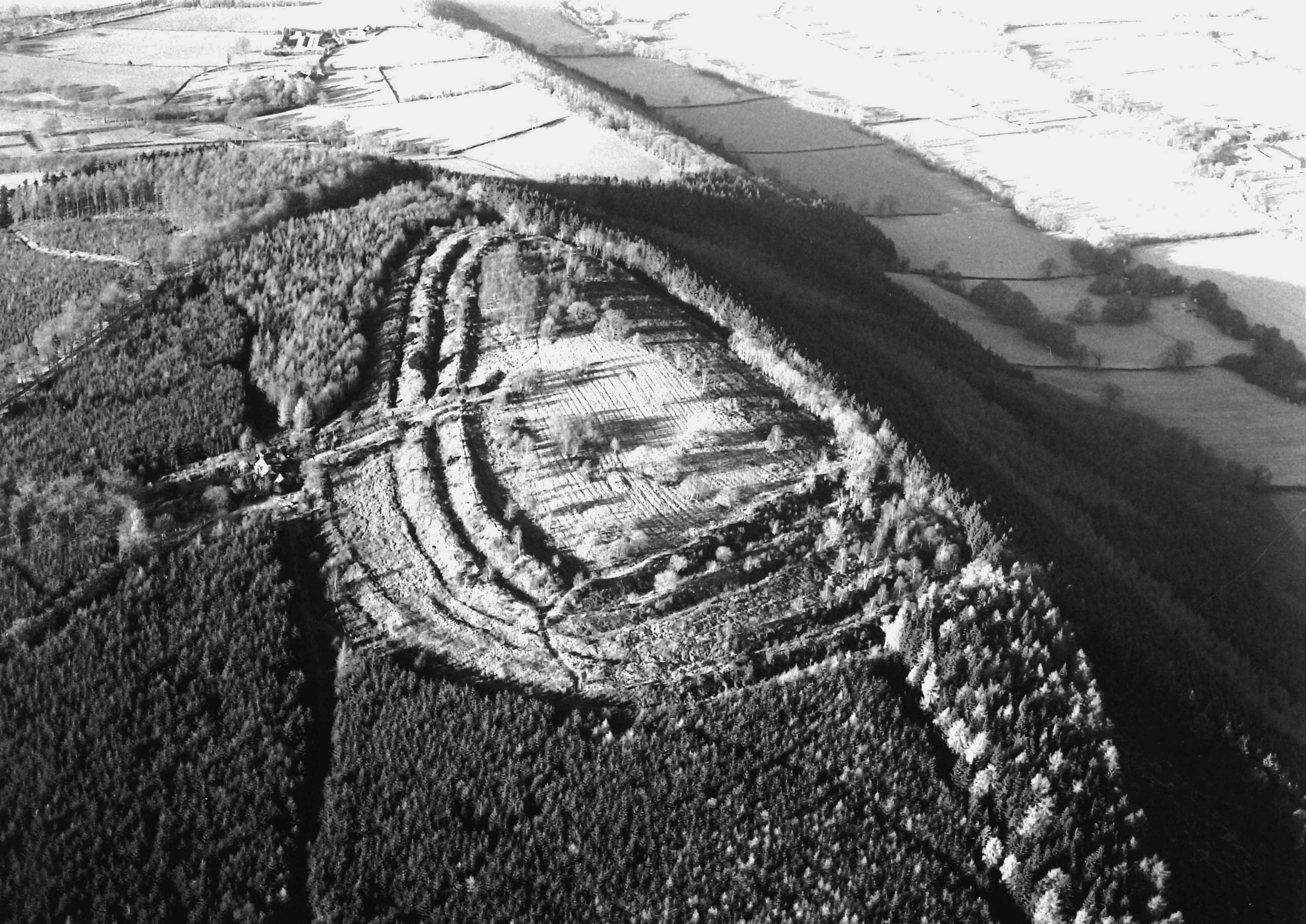
Figure 16: Cefnllys, Radnorshire. The hill, isolated by a loop in the River Ithon, has seen occupation at several times in the past. Medieval castles lie at either end of the hill, while the defences of the Iron Age hillfort are apparent just below the crest on the slope furthest from the camera Image: Clwyd-Powys Archaeological Trust, 94-c-0023
Internet Archaeology is an open access journal based in the Department of Archaeology, University of York. Except where otherwise noted, content from this work may be used under the terms of the Creative Commons Attribution 3.0 (CC BY) Unported licence, which permits unrestricted use, distribution, and reproduction in any medium, provided that attribution to the author(s), the title of the work, the Internet Archaeology journal and the relevant URL/DOI are given.
Terms and Conditions | Legal Statements | Privacy Policy | Cookies Policy | Citing Internet Archaeology
Internet Archaeology content is preserved for the long term with the Archaeology Data Service. Help sustain and support open access publication by donating to our Open Access Archaeology Fund.