Cite this as: Evans, E. 2018 Romano-British Settlement in South-East Wales, Internet Archaeology 48. https://doi.org/10.11141/ia.48.8
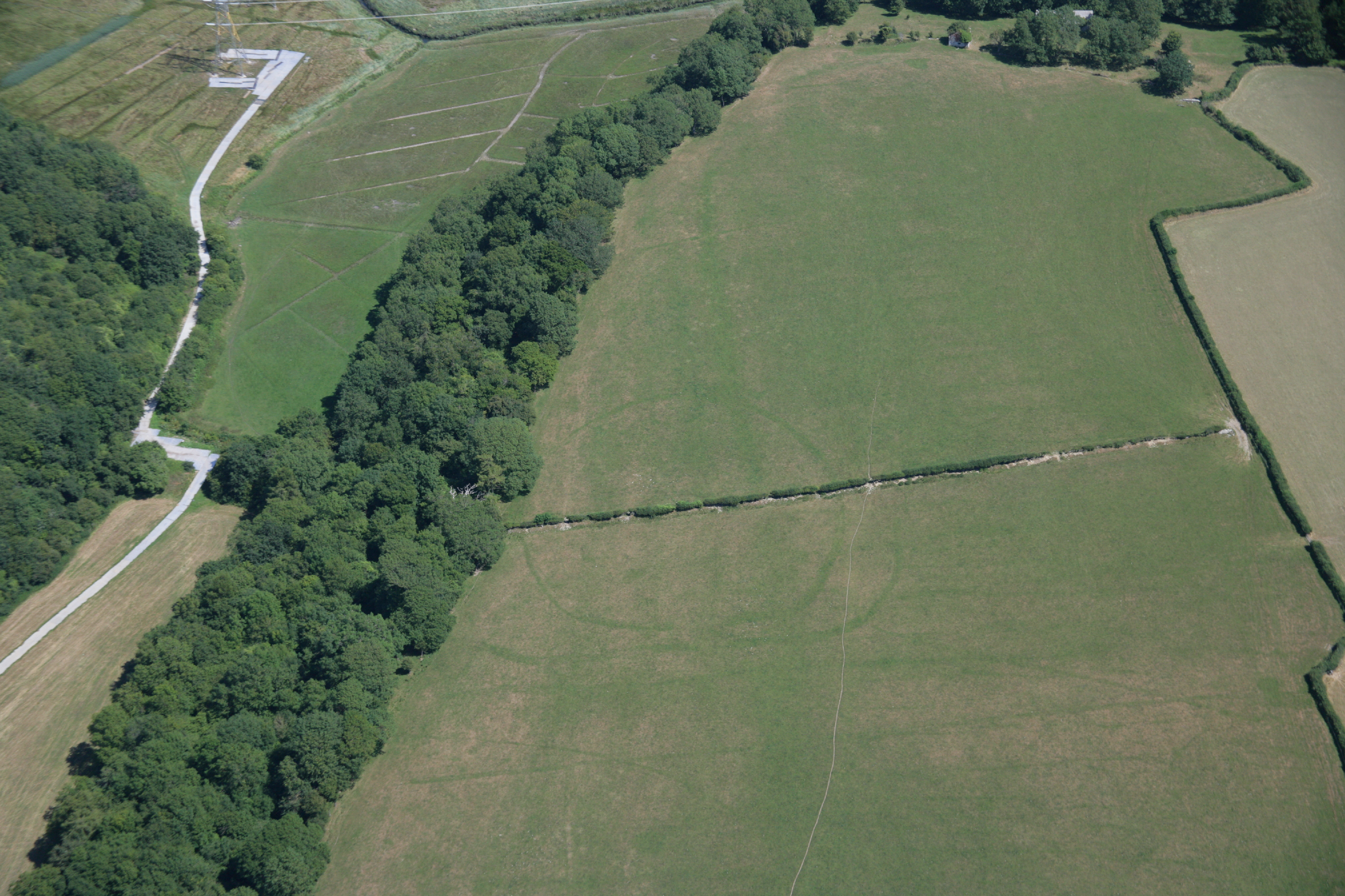
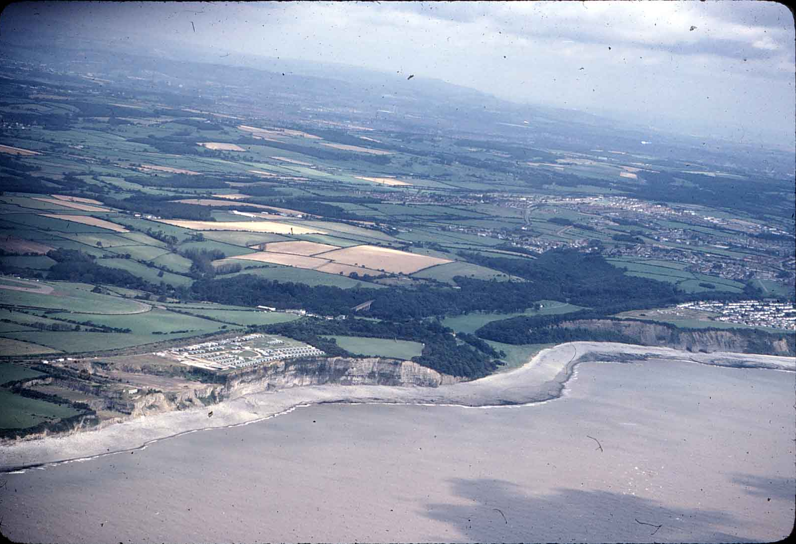
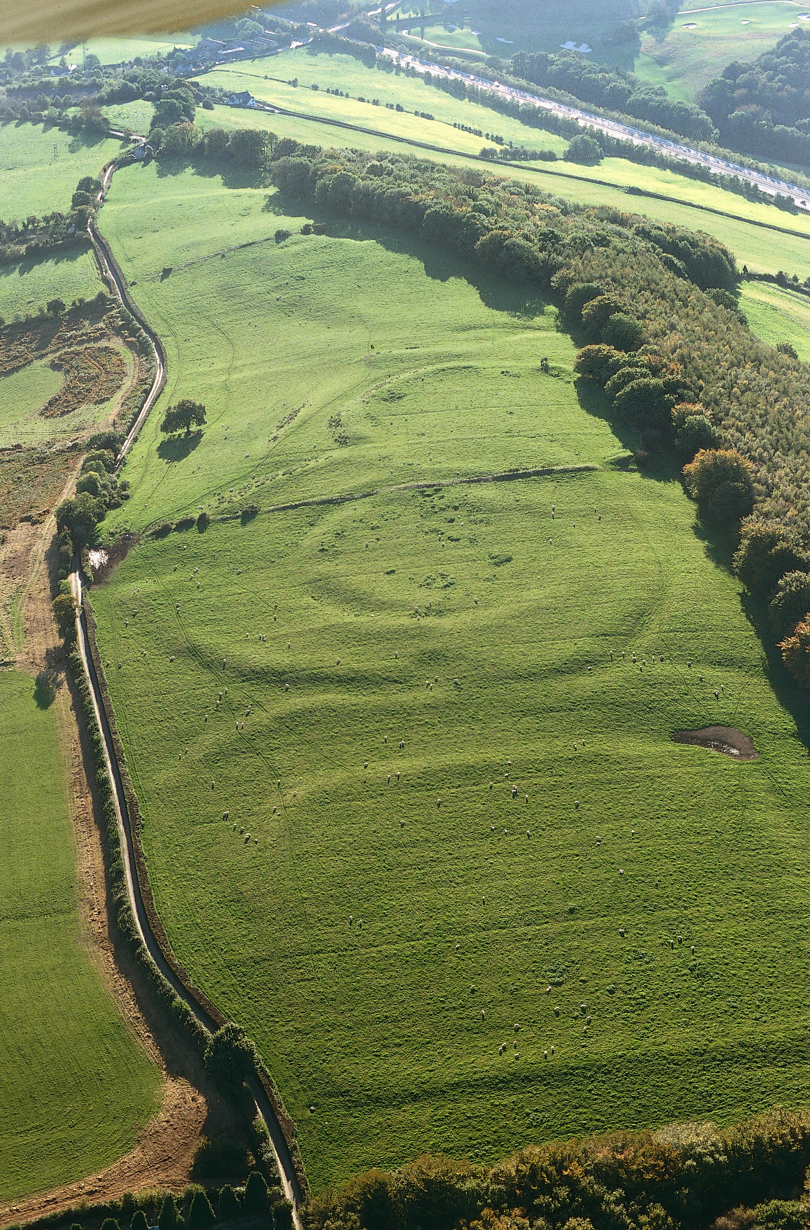
When the Romans invaded what is now the south-eastern corner of Wales, they encountered a people that they knew as the Silures. It is not clear whether this was a single tribe or a confederation, and archaeology does little to resolve the problem - some differences are visible between one part of the region and another, but it is not possible to isolate enough characteristics to demonstrate that there were distinguishable groups. Part of the problem is that patterns of Iron Age occupation in this region are not well understood. For the overall distribution of enclosures, we are mainly reliant on surviving earthworks because much of this area is permanent pasture, and the soils only rarely produce cropmarks. Although some remarkable discoveries have been made from the air in the Vale of Glamorgan when the conditions have been just right, they are in the minority. Photographs taken by the Ordnance Survey in the drought year of 1975 in the Vale of Glamorgan reveal a dense concentration of enclosures clustering especially on the lips of the steep-sided cwms (cirques) that dissect the Lias Limestone plateau of the Vale, particularly around St Athan, Penmark and Porthkerry (Figure 1; Evans and Driver 2000) . Most of these sites have been flattened by ploughing, leaving nothing visible on the ground. If the densities of sites revealed in these photographs were repeated in other parts of the area, we are likely to be ignorant of the vast majority of enclosures that once existed. The other bar to understanding is lack of excavation. Only a very small proportion of known enclosure sites have ever been examined archaeologically, and of these even fewer have been excavated on any scale. This hampers our understanding of when sites were first occupied, whether they were defended from the outset, how many were occupied at any one time (and therefore how they might have related to one another), and the extent to which they continued being occupied into the Roman period. Not all Iron Age settlements were defended: in the earliest phase of the settlement at Biglis, dated probably to the first half of the 1st century, a number of probable roundhouses, two corndryers and a couple of light fence-lines were part of an open settlement which probably did not receive a palisade until the second half of the 2nd century, or a boundary bank (without ditch) until the last quarter of the 4th century. Unenclosed settlements, however, are even more difficult to identify than enclosures, and we cannot tell what would have been the proportion of one to the other.
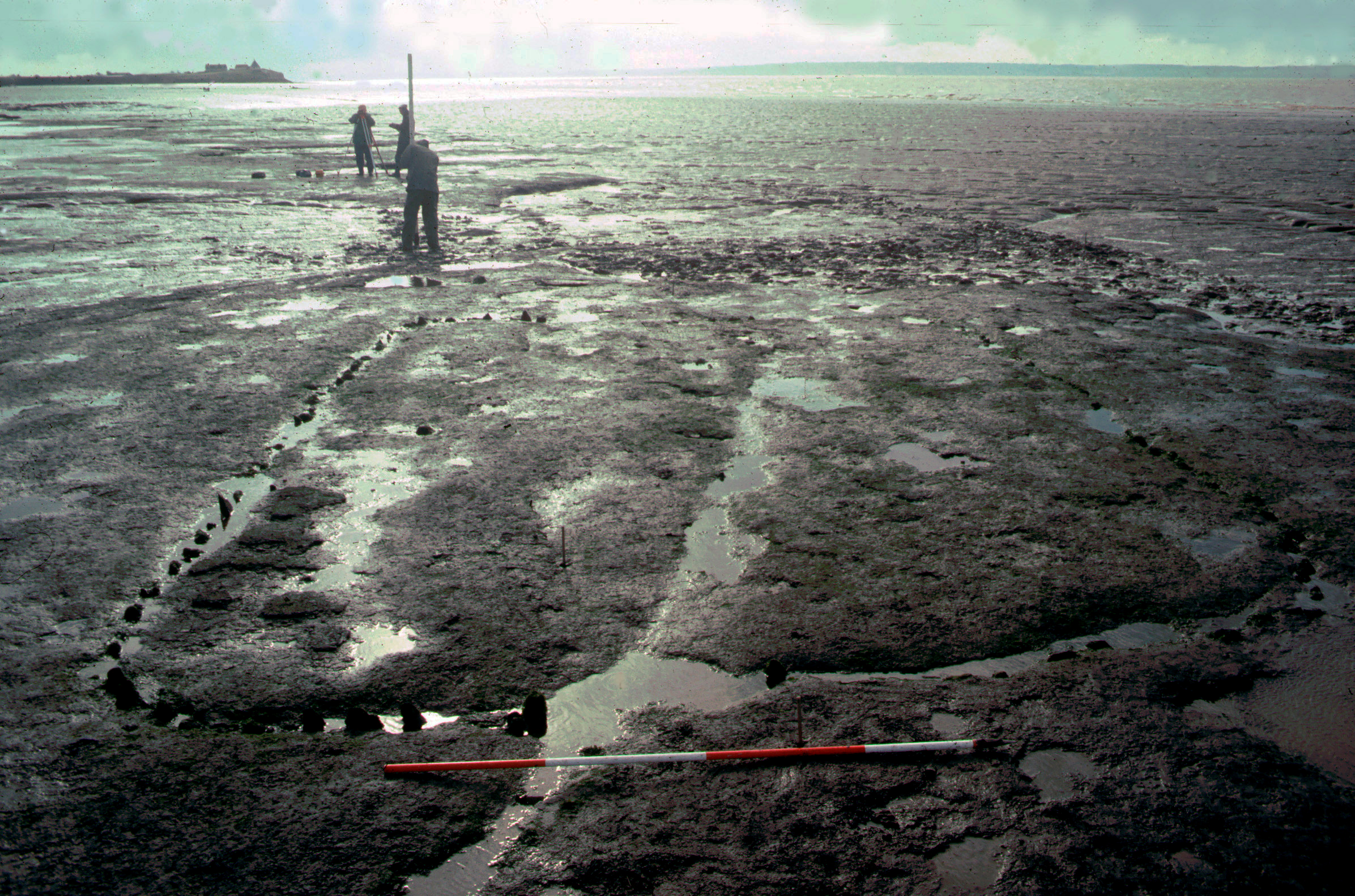
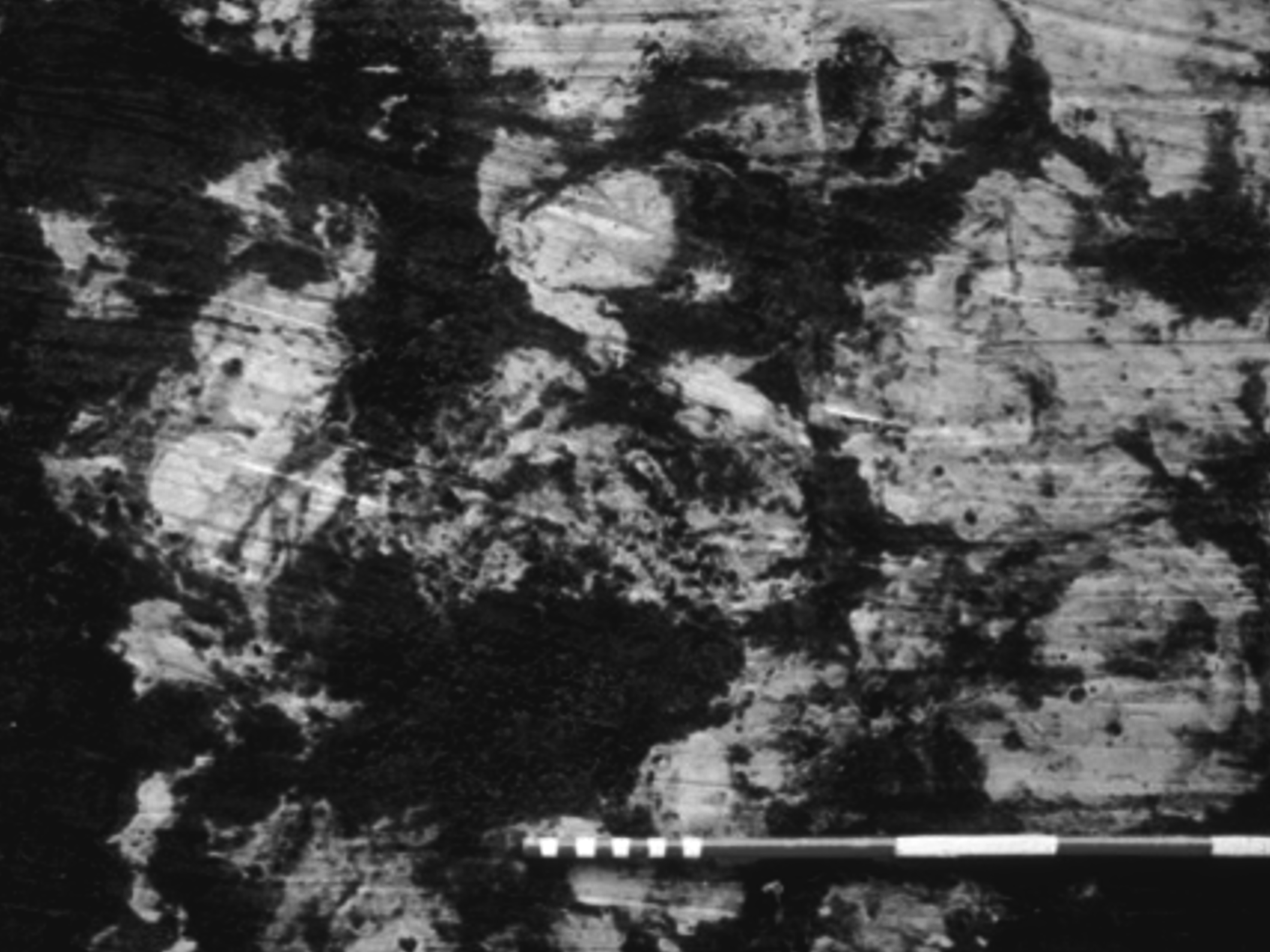
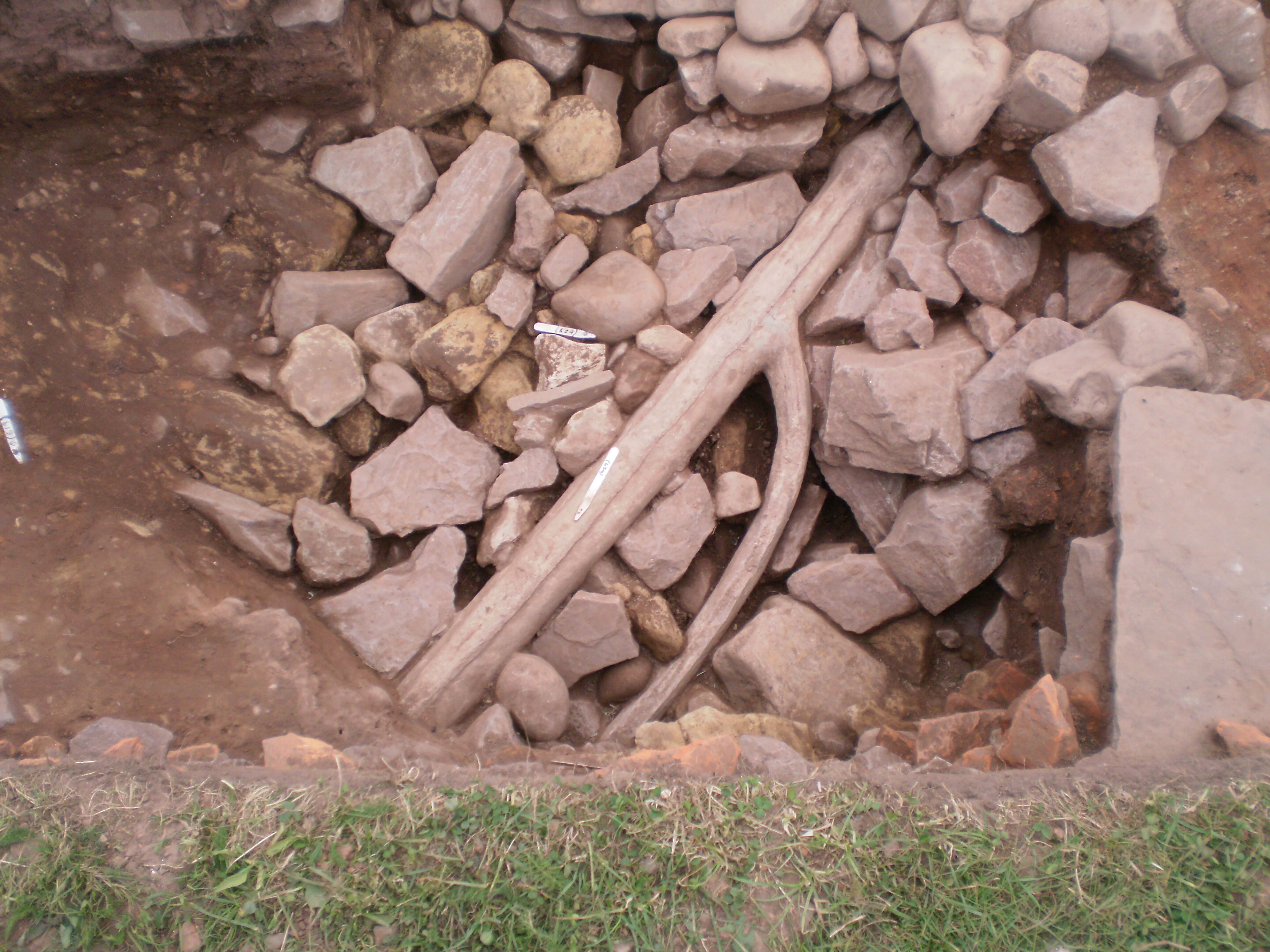
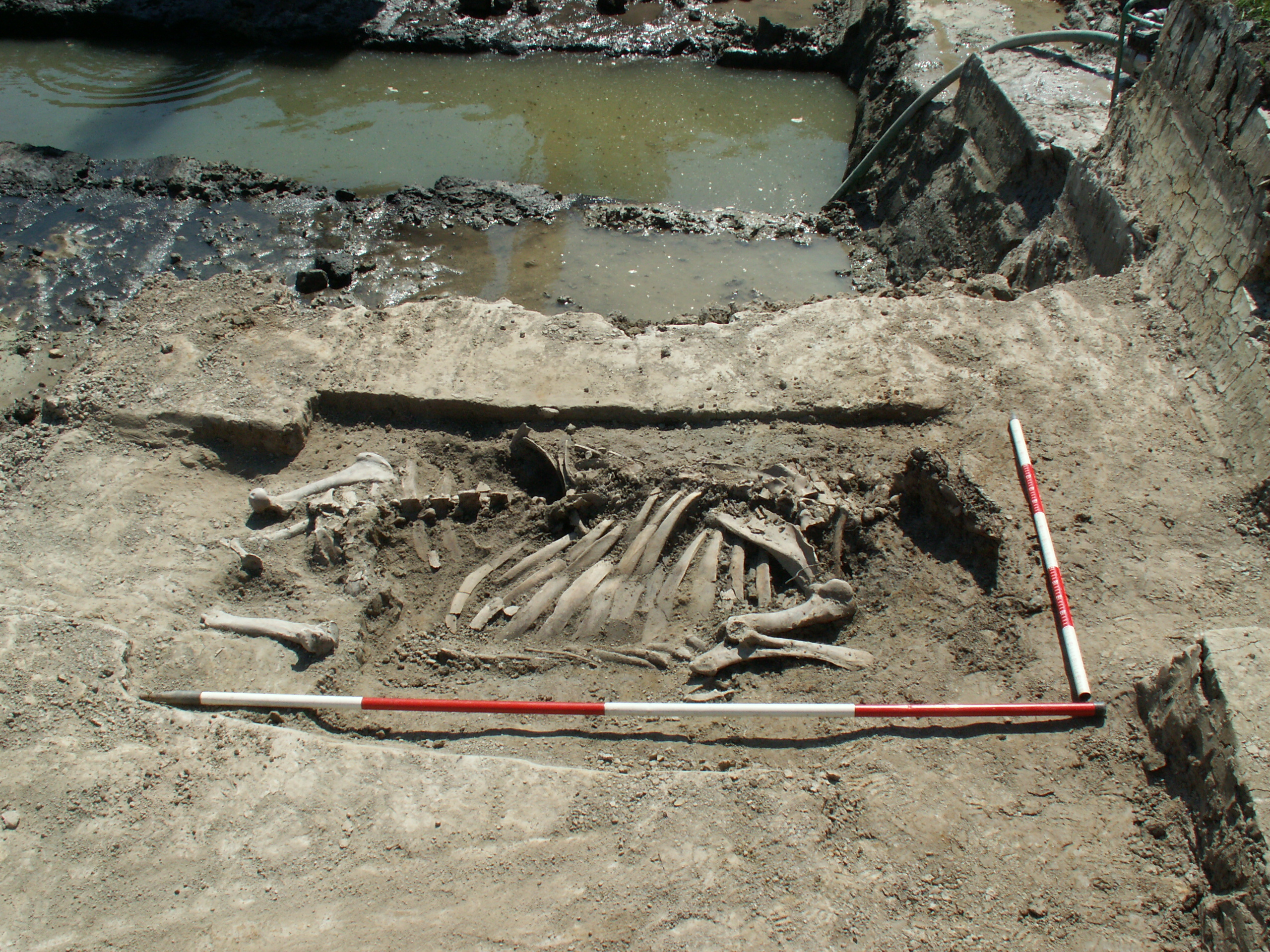
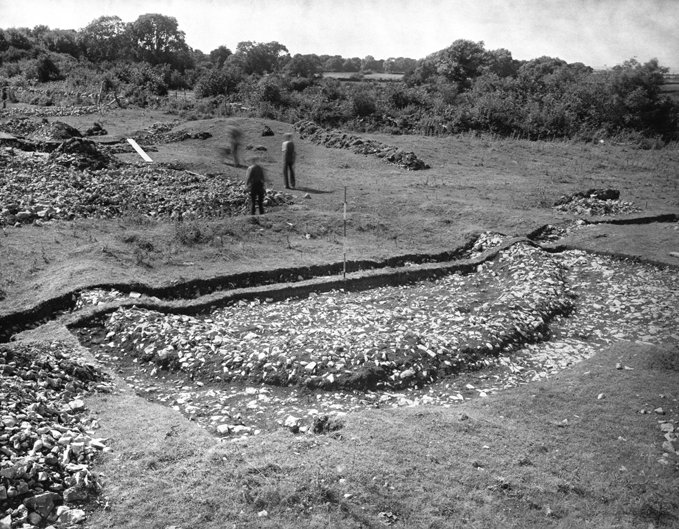
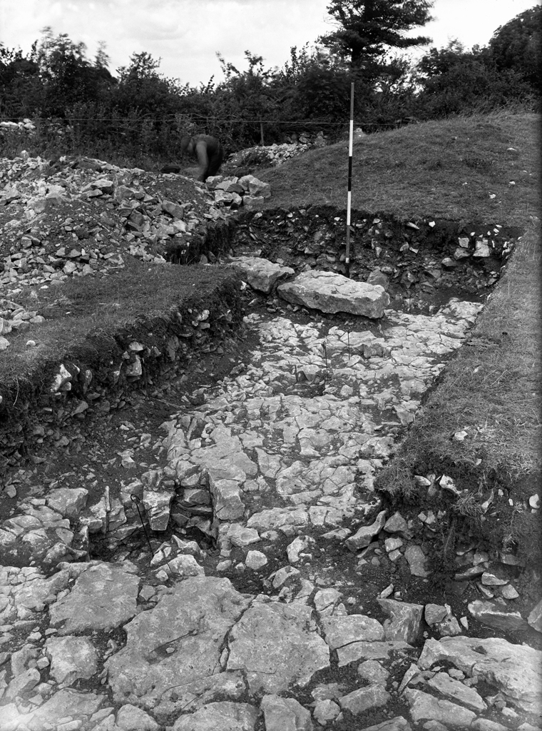
Although a significant proportion of the area consists of uplands, this higher ground contains very few defended enclosures, and those that are present are mainly on the lower fringes. The main distribution of sites is in the most fertile areas of the coastal plain and the lower hills outside the South Wales Coalfield (Gower, the Vale of Glamorgan and northern and eastern Monmouthshire). This would suggest a clear connection between these sites and agricultural production. There is very little evidence generally for Iron Age activity in the uplands, and one possibility is that the Silures practised transhumance, moving their stock up into the hills for summer grazing as was done in the Middle Ages and later, when upland occupation sites associated with this practice were less substantial than the lowland sites that were occupied all year round. No certain evidence has been found for seasonal settlement in the uplands, but it is known from the Gwent Levels, which would also only have been suitable for grazing in the summer. Examination here of sites eroding out of the foreshore below the modern high-water mark at Goldcliff (Bell et al. 2000) has produced evidence for rectangular buildings with rounded corners and the wall-lines marked by small wooden posts and pairs of posts on the long axes (Figure 2). The area around these buildings was marked by cattle hoofprints, and the remains of cattle lice came from the flooring material inside one of the buildings (Figure 3). As far as we can tell, the sites associated with these lowland seasonal pastures were undefended. They presumably depended on all-year farmsteads further inland, at least some of which may appear in the archaeological record as defended enclosures, but as yet we have no evidence to show how far cattle were being driven in order to take advantage of the summer grazing and are not able to match up the two.
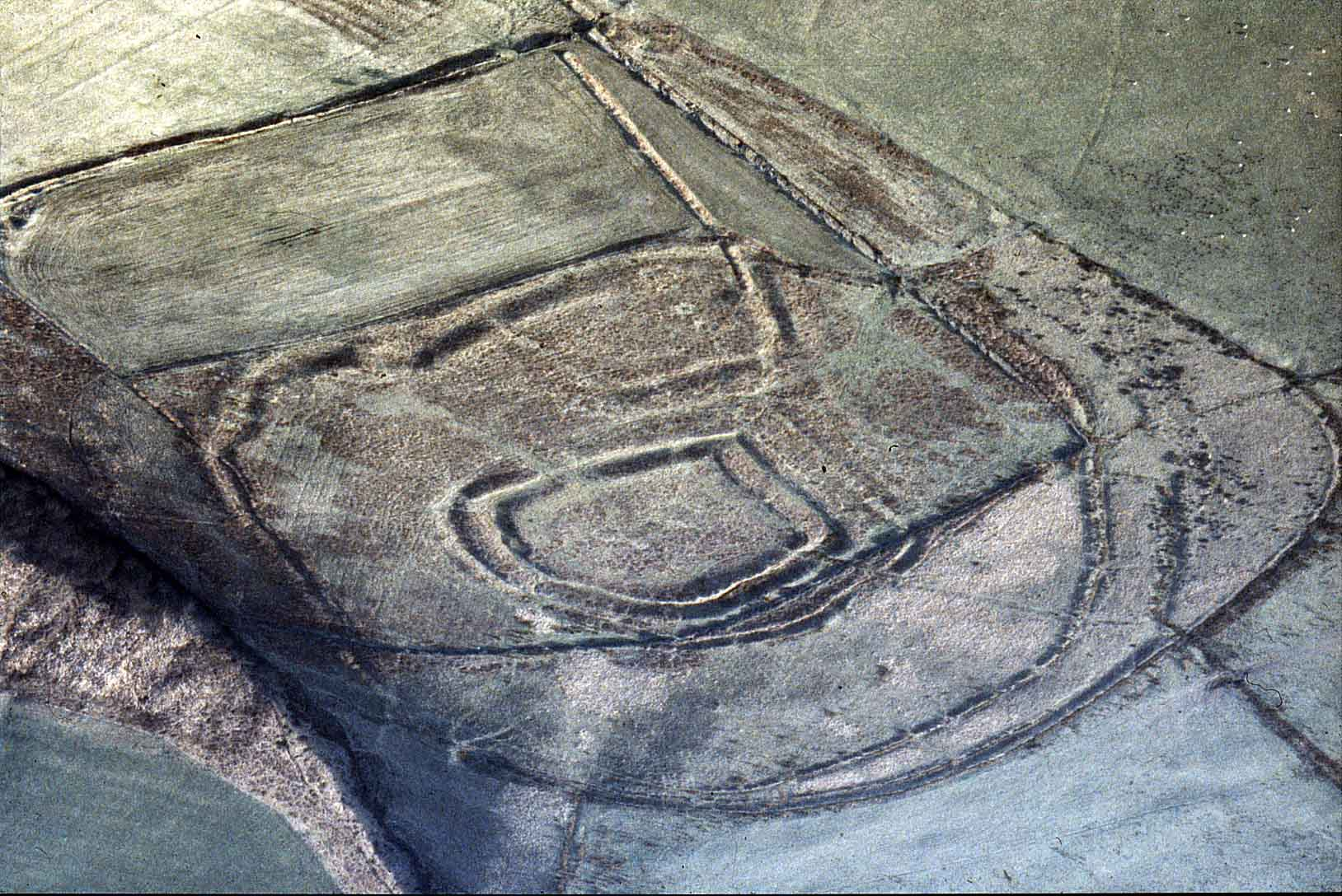
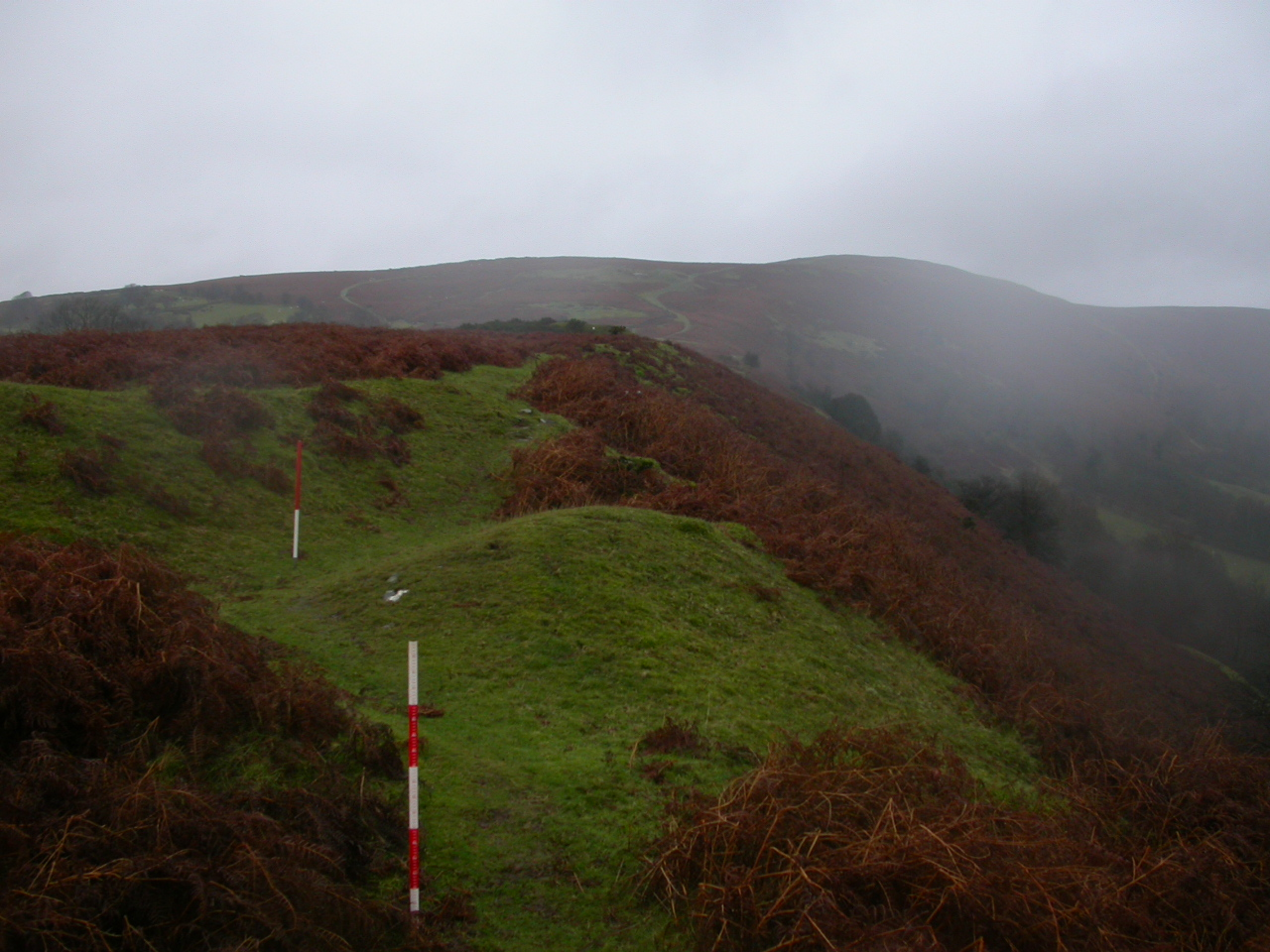
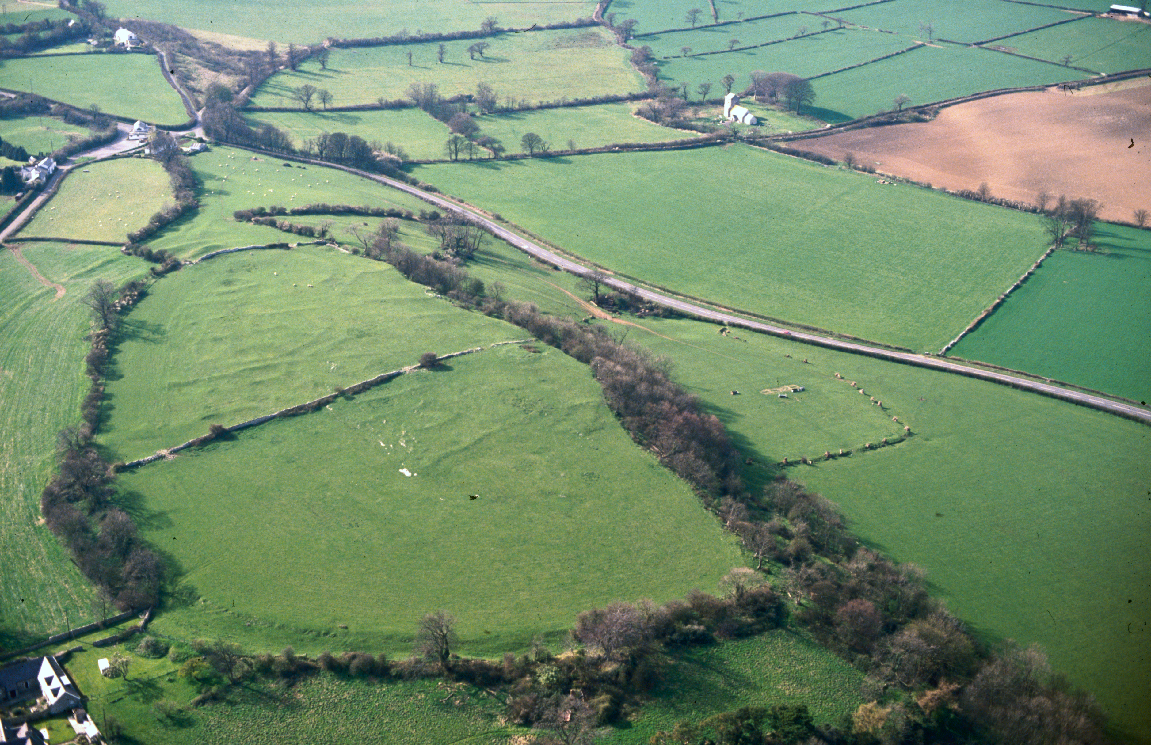
One of the forms taken by defended enclosures in this area is believed to be specifically related to stock management (Figure 4). This is where there is an inner enclosure with a single rampart, normally enclosing a relatively small area, lying within an outer enclosure surrounded by either another single rampart or multiple ramparts, which may not necessarily be continuous round the circuit. It is thought that the central enclosure was for the farmstead and the outer one was for stock when they needed to be gathered into a central place, for example during calving and lambing, collection for transhumance, or protection against raiding. Nearly a quarter of the enclosures in Glamorgan are of this type, of which the best preserved is probably Y Bwlwarcau on Mynydd Margam near Port Talbot (Figure 4). They are in a minority in Gwent (only about 10%), but it is possible that some sites that now survive as univallate enclosures originally had such an outer ring of defences now lost to ploughing, or because they were removed in antiquity.
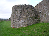
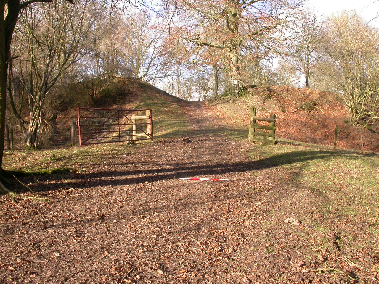
Although modern scholars have seen this type of enclosure as ideally suited to stock-raising, it cannot only have been these sites that reared animals. Cattle were being reared at Whitton, which only has a single bank and ditch (see Whitton: from Iron Age farmstead to Roman villa). Over half of known enclosures, and the type with the widest distribution, are of this type. The defences at Whitton would have been an effective deterrent against a casual raiding party, and could have been held against more determined attack provided the number of defenders holding the rampart matched the size of the attacking party. Other enclosures are more obviously designed for serious defence (Figure 5). These are the ones with two or more closely set ramparts: bivallate or multivallate enclosures account for about a quarter of the sites in Glamorgan and just over a third in Gwent. The bivallate Castle Ditches at Llancarfan in the Vale of Glamorgan occupies a position of considerable natural strength at the end of a steep-sided inland promontory surrounded by water on three sides, and replaced a smaller enclosure surrounded by a stone wall but no ditch. A similar promontory site, though without the water, is occupied by Gaer Fawr in the hills north of Wentwood in Monmouthshire, which has a triple rampart and ditch across the southern side where there are no natural defences, extending also along the west side; the double defences along the east side spread apart round the northern tip where the position is strongest to form an annexe. Buckholt Wood north of Monmouth also makes use of the topography although defended by steep slopes on only two sides: the latest examination of this site suggests that these natural defences were supplemented by a quadruple rampart and ditch with a total width of about 20m and the strongest defences on the outside. Good survival of earthworks on other, less well naturally defended sites such as the bivallate Twyn Bell near Usk, Monmouthshire, where part of one rampart still stands to 4m, shows that such forts could be made into serious defences even where the local topography was less favourable. Serious defence is particularly likely where the entrances are elaborated into something more formidable. A few sites have an entrance passage with guard chambers as at Caerau, Llantrisant in Glamorgan, or barbicans or hornworks like the larger of the two Piercefield Camps near Chepstow. It is not possible to tell what sort of relationship such sites had with the greater numbers of more lightly defended enclosures, whether they represented strong points for a group of homesteads or whether they were the bases of families higher in the social structure.
The evidence suggests, however, that such enclosures were probably not significant during the Roman conquest. Elsewhere in Britain, there is some evidence for siege and assault of hillforts, but no such evidence has been found in south-eastern Wales. Campaigning by the Roman army against the Silures started around AD 50, when the displaced Catauvellaunian leader Caratacus seems to have made his base among them. The sketchy account of the earlier campaigns by the Roman historian Tacitus in his Annals (12, 33,39) implies that they were heavily biased towards guerrilla warfare. Tacitus' historical account does not cover the later campaigns, but he did record in the biography of his father-in-law, Cn Julius Agricola, a later governor of Britain, that the Silures were finally brought under Roman control by Julius Frontinus between AD 74 and 78. What little Tacitus tells us about the fighting between them and the invading Romans suggests that they were waging war as it was done in the better-documented post-Roman period, when the defenders would follow and harass an invading army to limit the damage the invaders could do and wear them out, in preference to committing themselves to defensive positions or pitched battles (Davies 2004). One of the components of this strategy was to remove as much as possible of the community's wealth to a place of safety for the duration of the invasion. It is possible that hillforts may have performed this function, as it would provide one explanation why hillfort occupation in this area seems only to be sporadic (Figure 6).
Even if most of the fighting had taken the form of hit-and-run raids as reported by Tacitus, it is possible that more extensive excavation on a larger range of sites would produce evidence for attack, but it is notable that where excavation has taken place, such as at Llanmelin, Caer Dynnaf and the Bulwarks at Porthkerry (all discussed in more detail later) it tends to suggest that occupation in hillforts continued unbroken throughout the 1st century AD. This suggests that, at the time of the conquest, the type of warfare that the Silures were accustomed to waging did not involve the defence of fortifications.
If this is true of the larger and more elaborate hillforts, it would have been even more the case with the smaller enclosures, which were probably constructed with nothing more in mind than protection against cattle rustling. Here, the excavated examples have not only provided no evidence for attack, but also shown that life in at least some of them continued exactly as it had been until at least the middle of the 2nd century - approximately two generations. The only evidence for change in the political order is the introduction of Roman-style metalwork and ceramics, and the occasional coin, and even these finds seem to be in short supply at some sites. Some sites continued without much change right through the Roman period (like Cae Summerhouse or the DARA site at St Athans), but at others (like Whitton) timber roundhouses gave way to the rectangular masonry buildings typical of Romano-British villas. We cannot know the train of events that led to the development of one settlement in a Roman style and another settlement to stay as it had been for centuries, but we are able to suggest possible developments in society that led to differences in the way groups of people reacted to Roman rule.
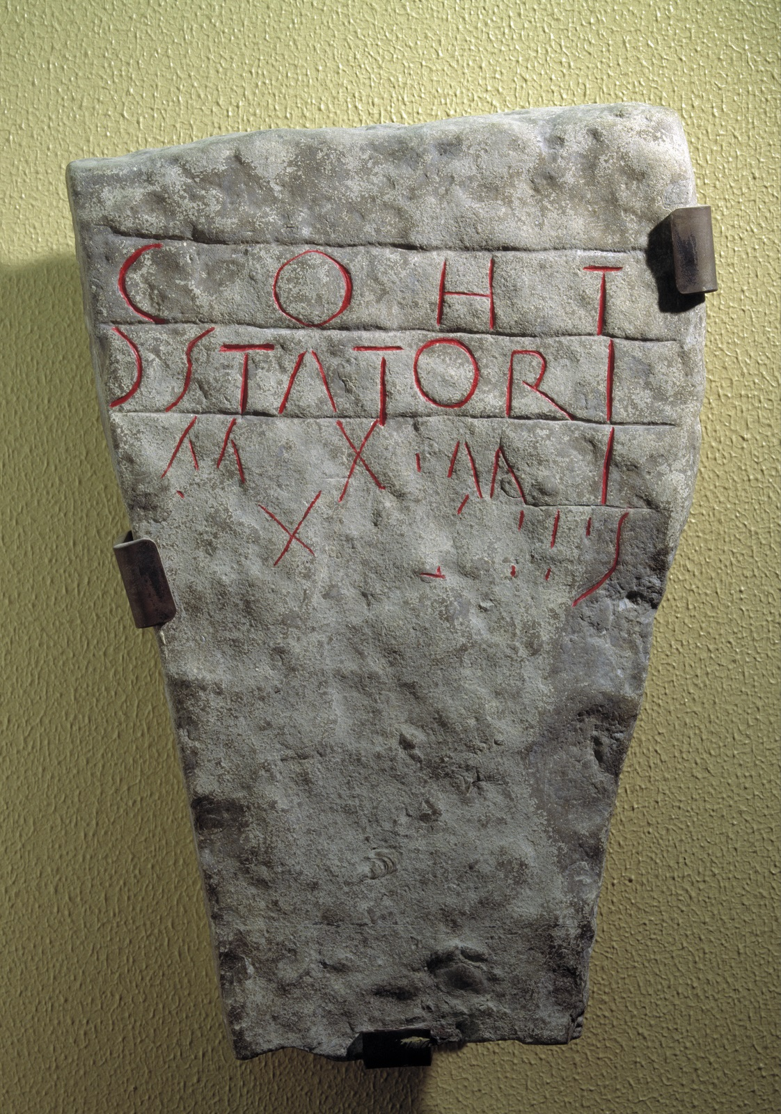
Immediately following their conquest, the Silures would have been under direct administration by the Roman state. In practice, for most things this would probably have meant initially administration of land as it was conquered by soldiers of the Twentieth Legion Valeria Victrix from their fortress in Usk, and from around the middle of the 70s AD from the new fortress that the replacement legion, the Second Augusta, was building at Caerleon. Both fortresses would have had a large territory in which to pasture their mounts and baggage animals, possibly also other livestock, and to supply other necessities such as firewood, and possibly minerals such as iron and lead ore and coal. It has been suggested that this territory was in the lower Usk Valley south of the fortress at Usk, and that one of the attractions of the site at Caerleon is that it could have utilised the same territory as its predecessor. Another possibility is that at least part of the territory lay on the Gwent levels - an inscribed stone from Goldcliff on the Caldicot Level 9km east of Caerleon records that a century of Legio II Augusta built 33½ paces of some linear work (Figure 7; RIB 395). It has also been claimed that the legion is likely to have been involved in reclamation works on the Wentlooge Level to the west. However, legionary surveyors and construction crews also undertook civil engineering projects, and the involvement of the legion is not proof that this area was intended as its territory - it could for example have been an imperial estate. Because of the nature of the land, which tends to waterlog in the winter, the Levels were probably still seasonal pasture. Excavations at the Waste Water Treatment Works site, Nash, have revealed that there was in the late 1st to 2nd century a landscape of saltmarsh pasture, changing to a more planned system, with a network of fields bounded by ditches, in which cattle-rearing was important.
In our current state of knowledge, we have few archaeological clues to enable us to recognise the territory on the ground. For legal and administrative reasons, we would expect the settlement at Bulmore on the opposite bank of the River Usk and the villas at Ford Farm (nearly 5km south-east of Caerleon) and Croes-carn-einion (nearly 10km to the north-west) to lie outside the land controlled by the legion, which gives some clue to its possible extent. At Bulmore, the road between Caerleon and Usk is lined by buildings of the type normally built in Roman towns, forming a satellite settlement. On the empire's Rhine-Danube frontier, where settlements of this type were first recognised, scholars believe that they were placed several kilometres from the fortress, outside its territory, so that they could be self governing. Occupation at Bulmore seems to have started about AD 90, but we have no foundation dates for the villas and cannot say whether there was any modification to the legion's territory during its lifetime. Air photography has shown that there was a series of small enclosures on the hills overlooking the River Usk, but we have no dates for these. We do not know whether any of them were occupied during the Roman period and, if so, whether they might have been utilised by the legion's graziers.
The army would have required large quantities of food for both the legion at Caerleon and the auxiliary troops with forts at Abergavenny, Caerphilly, Cardiff, Coelbren, Gelligaer, Loughor, Monmouth, Neath, Penydarren (Merthyr Tydfil) and Usk at least, and probably other sites as well. We know very little about the logistics involved. Study of a deposit of grain that had been accidentally turned into charcoal outside the fortress at Caerleon (Evans 2000) showed that it must have been imported from the Mediterranean, as it contained seeds of weed species found there but not in Britain. However, the weed seeds in a similar deposit from granaries at the fort at Loughor show that it could have been grown locally. No information about the sources of meat is available yet, as techniques that will show where animals were raised is a very recent development. However, it is likely that significant amounts of the food consumed by the army came from close at hand. There is a reference in Tacitus' Agricola (19) to the requisition of grain from British tribes and to reforms instituted by Agricola to ensure that such tribute was obtained as close as possible to its end-use. Even when the garrison of Wales had been run down in the 2nd century so that the army could concentrate troops in the north of Britain, supplies may still have been collected from this area and shipped north.
The necessity of ensuring a surplus of agricultural production great enough to supply the tribute demanded by the army may have had the effect of intensifying farming, but it is also possible that this surplus could have been met out of existing levels of production, if the result of the Roman occupation was to put a stop to a culture of raiding to drive off stock and lay waste to crops, such as is attested in the post-Roman period. It has been argued that the demands of Roman tribute on conquered peoples acted as spur to the market economy (Hopkins 1980), since peasants would have to sell their surplus in order to obtain money to pay their taxes. This, however, assumes that taxes were being paid in money whereas, according to Tacitus, at least some of the tribute levied by the Romans was paid in kind, and so would not have stimulated trade. Consumer goods arrived in quantity only at some sites in our area; others have surprisingly little in the way of pottery and metal objects and probably made much greater use of objects in materials like wood, horn and leather, which rarely survive. The inhabitants could have produced these themselves, since these materials require less technical expertise and expensive equipment to turn into household utensils.
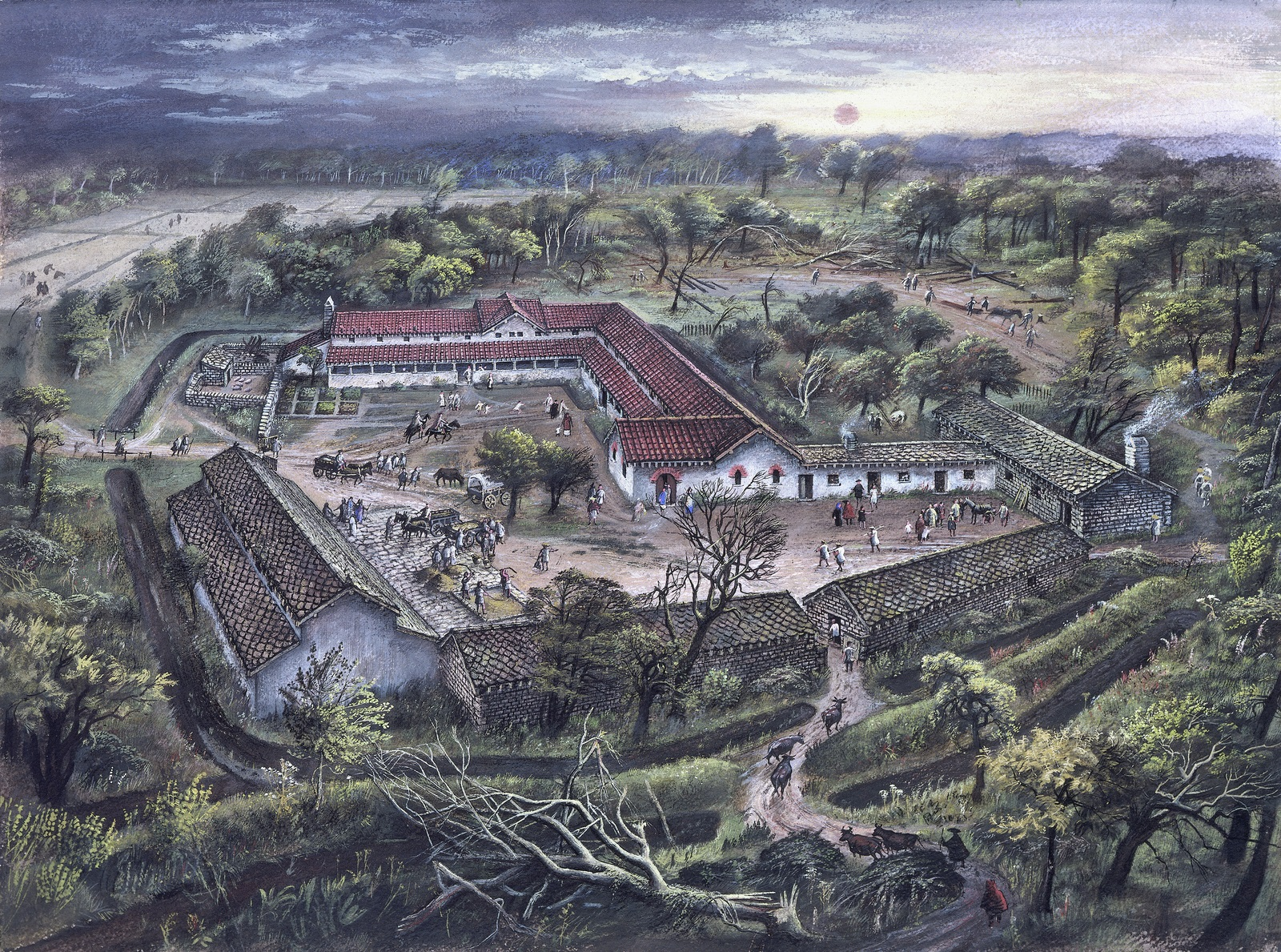
A further way in which the army would have caused changes to the economy and social structure is in the purchasing power of individual soldiers. Soldiers received wages, and could therefore pay for goods and services, encouraging traders to settle close to forts and developing the economic life of the areas in which these forts were situated. On retirement, veterans might choose to remain close to the fort where they had served and swell the settlement outside its gates. In our area, we do not have much information about the settlements outside most of the auxiliary forts (generally referred to as vici): the best understood is Neath, where there are buildings along the road leading to the fort from the east and at least one to the north, but not much structural evidence away from the road frontage. There is much more information about the settlement outside the fortress at Caerleon (Evans 2000), where a wide range of building types have been excavated (Figures 8-9), ranging from Mediterranean-style stone courtyard buildings to mud-brick cottages on cobble foundations, but including the so-called strip-buildings most typical of towns in Roman Britain. These were long rectangular buildings, at least partly in stone, and were arranged with their narrow end to the street. This settlement (the canabae) would have been on the legionary territory and under army control: a second settlement at Bulmore 2km away on the opposite bank of the River Usk, straggling along the road between Caerleon and Usk, probably enjoyed greater independence. This was also characterised by strip-buildings, and tombstones found there record that at least two veterans chose to settle here (RIB 359, 363). It is difficult to establish exactly who else might have been living in here, or their origins. The excavated parts of the settlement and its cemeteries do not indicate that any of the inhabitants were living in a way that reflected Iron Age traditions. Most of the tombstones from Bulmore record people with Latin names (though Latin names do not necessarily indicate that a person was of non-British origin as provincials frequently used them), but one of the names recorded on one tombstone was probably of Celtic origin.
In the 1st-2nd centuries AD, the two main officials in Britain were the governor, who as the representative of the emperor commanded the Roman military establishment in the province and was also head of the Roman legal system there, and the procurator who was responsible for seeing that taxes were collected. They were supported by staffs of clerks and administrators, some of whom would have been seconded from the army. Army officers could also be seconded to posts responsible for aspects of regional administration. However, once an area had been pacified, it was expected that local people would be largely responsible for local administration. The way this was done in Britain was to shape the basic unit of administration out of the tribe. Most of our information about the tribes of Britain comes in fact from the Roman period, although modern scholars suspect that the tribal system as it appears under the Romans is not necessarily the same as it was before the conquest - some tribes may have been sub-divided while smaller tribes may perhaps have been amalgamated, in order to form units that fitted into a scheme convenient to the empire. In the Roman way of thinking, the natural place to centre a tribal administration was in a town, so towns had to be provided even if there was no local tradition of large nucleated settlements. The governing body was the ordo, a council of men drawn from leading families from which would be appointed or elected officials (magistrati) to run the administration of the town and the tribal area, deal with the less serious crimes and with civil transactions carried out under customary law, and possibly also collect the tribe's taxes. The ordo res publicae ciuitatis Silurum (council of the polity of the Silures) is named in an inscription from Caerwent, the tribal capital whose Roman name was Venta Silurum (the market place of the Silures).
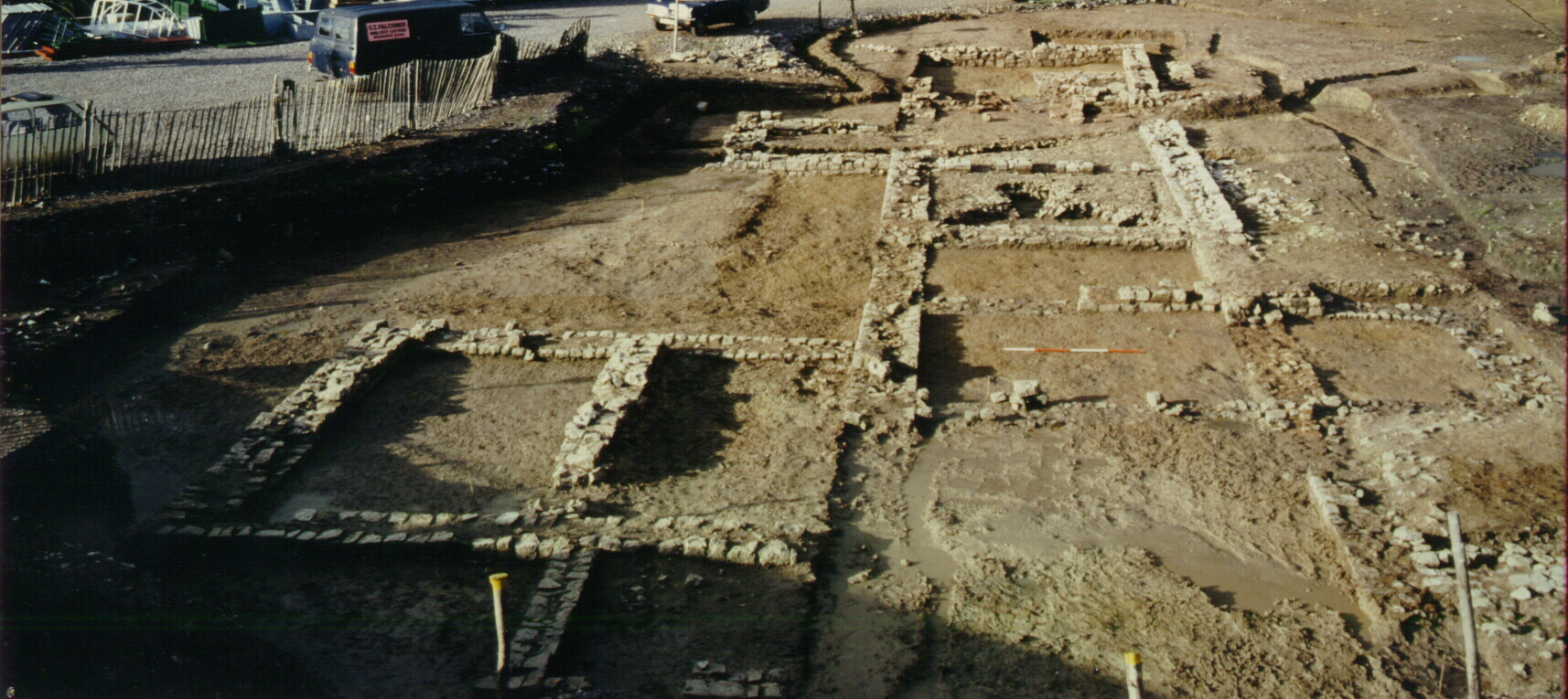
Much of the administrative centre at Caerwent has been excavated (Brewer 2006). As in similar centres all over the empire, the main components are the forum, a colonnaded square (Figure 10), and the basilica, a large aisled hall. We do not know exactly how they were used, but it is likely that a combination of civic, legal and commercial activities went on there. One of the rooms opening off the basilica was the council chamber (curia). Let into the floor of this is a series of slots to take the framework supporting the seating for the members, and on one short side four stone pads that would have taken the dais for the presiding magistrates. The forum-basilica, completed in the earlier part of the 2nd century, lies in the middle of Caerwent, and next to it is a temple built to the typical Romano-Celtic plan of the north-western provinces, with a central square cella, which would have risen above the surrounding ambulatory, a colonnade or corridor. The temple stood in its own walled precinct, which had a long shallow entrance hall with a mosaic floor and an apse at one side providing access from the main street. The cella would have housed the cult statue; we do not know which deity was worshipped here, but the central position of the temple suggests that it may have been one that was particularly important to the Silures. Interestingly, however, it was only constructed around AD 330, on what had previously been an open space. The general layout of the town is fairly well known from excavations carried out at the beginning of the 20th century. These show that it possessed a street-grid, other public buildings including baths, a possible mansio (inn for official travellers) and other temples, and a range of house-types - strip-houses acting as shops and workshops as well as number of well-appointed courtyard houses, some of which were provided with mosaic floors and hypocaust under-floor central heating. At least some of the tribal notables probably maintained houses in the town, possibly in addition to villas in the countryside.
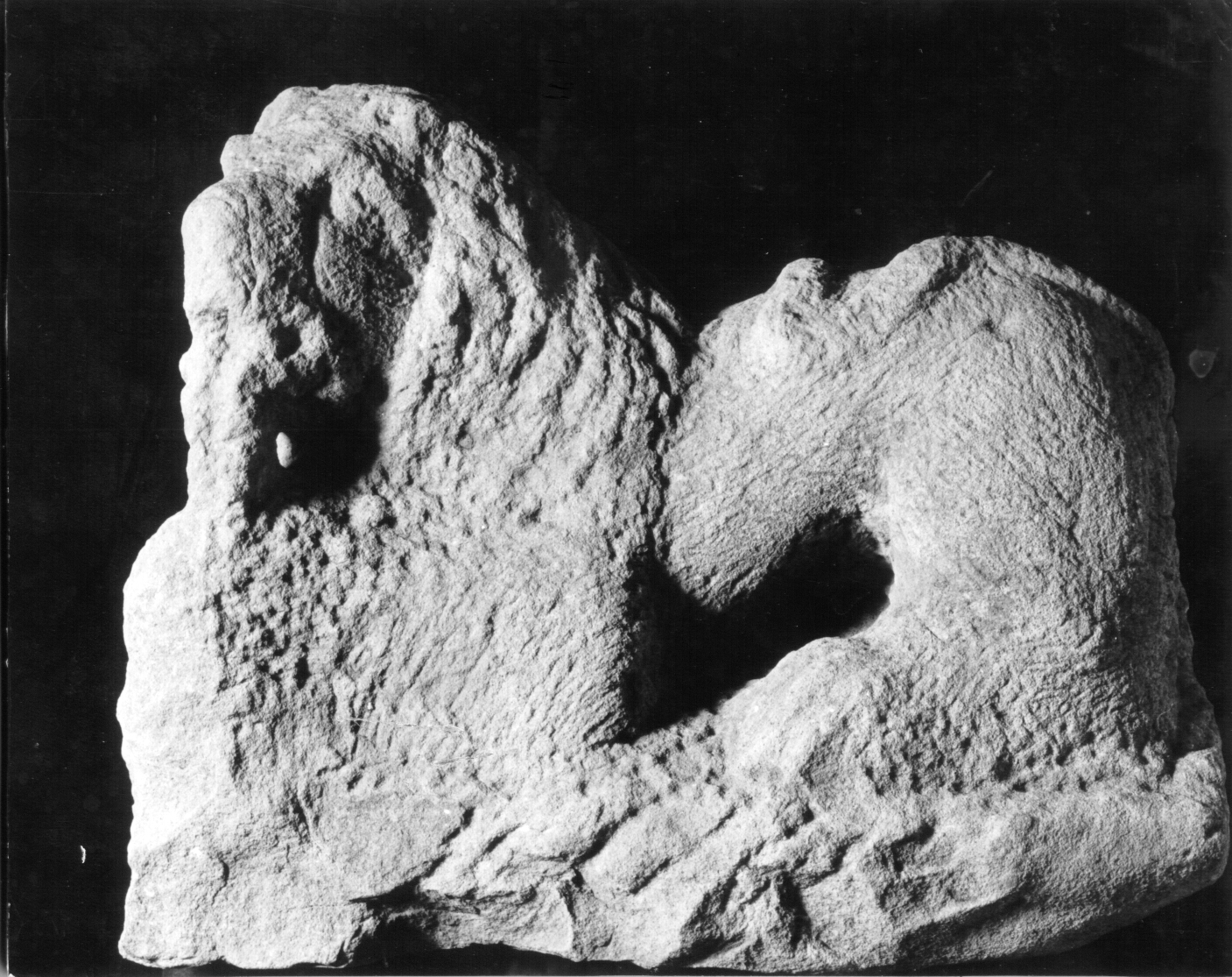
While we can readily identify Caerwent as an administrative centre, it is less easy to decide whether there were others. A possible candidate is Cowbridge (Parkhouse and Evans 1996), 40km south-west of Caerleon in the Vale of Glamorgan, where there was ribbon development including strip-houses and an iron-smelting furnace along the main road between the forts at Cardiff and Neath, and evidence of activity (probably industrial) at some distance behind this frontage. A bath-house was constructed here, incorporating tile stamped by the Second Augustan Legion, but it was only in use at the beginning of the 2nd century, possibly due to problems with flooding, and we are unable to say whether it was replaced by another elsewhere in the town (Figure 11). Cowbridge may be identifiable as the Bovium of the Antonine Itinerary, a 3rd-century route-planner, in which case it probably had a posting-house for travellers on official business and would have been a natural place for a local administrator. A sculptured lion was found here, which probably came from a fairly elaborate Roman-style tomb, indicating that a member of the establishment died and was buried here (Figure 12).
The towns at Caerleon, Caerwent and Cowbridge all had large hillforts on the hills overlooking the town and within 2km of it, at Lodge Hill, Llanmelin and Caer Dynnaf respectively. There has been too little excavation at Lodge Hill and Llanmelin to be able to establish whether there might have been any relationship with Caerleon and Caerwent. It has been speculated in the past that Llanmelin was a key pre-Roman centre that the Roman authorities deliberately replaced with a new town on the plain below, but the excavations on this hillfort did not produce any firm evidence either for or against this hypothesis. The suggestion is in any case based on a view of Iron Age societies as being very centralised, which does not fit well with what was happening in Wales. It has been suggested that the presence of Cowbridge was an important influence on the way in which Caer Dynnaf developed in the Roman period, but because so few hillforts have been excavated, we are not in a position to say whether there is anything unusual about it that needs to be explained by proximity to a town.
Although towns were an important new contribution to the landscape of south-east Wales, most of the inhabitants continued to live in the countryside. The range and distribution of rural sites is not particularly well understood, nor is the landscape in which they were situated, for the same reasons that affect our knowledge of the Iron Age. The two areas that have been best studied are the Gwent Levels and the Vale of Glamorgan. As noted above, the Levels form a specialised landscape, most of which required seasonal exploitation. Some areas of fields that have been excavated here, at the Nash Waste Water Treatment Centre (Meddens and Beasley 2001; and see section 2) and Goldcliff, have been shown to be connected with cattle husbandry in seasonal wetlands subjected to varying levels of influence by the sea (Figure 13). Nothing is known of the form of any associated settlement sites in the Levels.
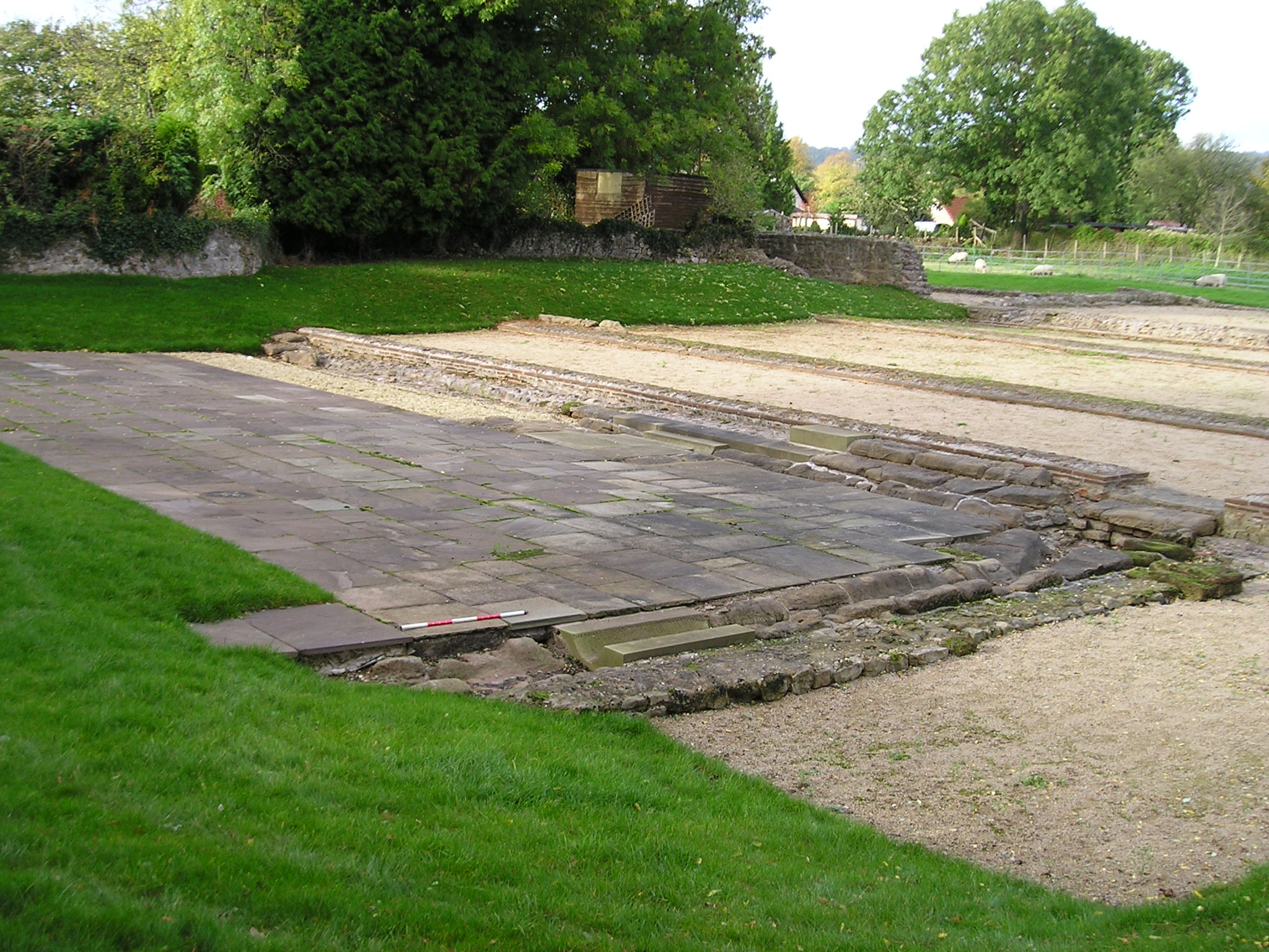
Year-round occupation is possible on the Vale, which is ideally suited to mixed farming. A survey was carried out in 1999-2000 over two adjacent parishes of fairly typical topography in the eastern Vale (Penmark and Porthkerry) to identify settlement patterns. This was one of the areas with the highest level of information already available, because of the work on air photographs (see above), and sporadic fieldwalking and monitoring of development since the 1950s had identified other sites from pottery scatters. The only site known with upstanding earthworks was the Bulwarks at Porthkerry, where limited excavation had revealed Roman-period buildings of no great sophistication (Figure 14). It also contained extensive areas of arable, the largest block of which was over 1km² and interrupted only by field boundaries. Systematic fieldwalking over this and adjacent areas of arable, combined with the air photographs and the previous fieldwork, found evidence for a probable network of sites spaced at intervals of about 0.5km but mostly represented only by one or two sherds of pottery and scatters of daub or iron slag. This is the sort of site density known from elsewhere in southern Britain, but the paucity of pottery suggests that most of them were at subsistence level.
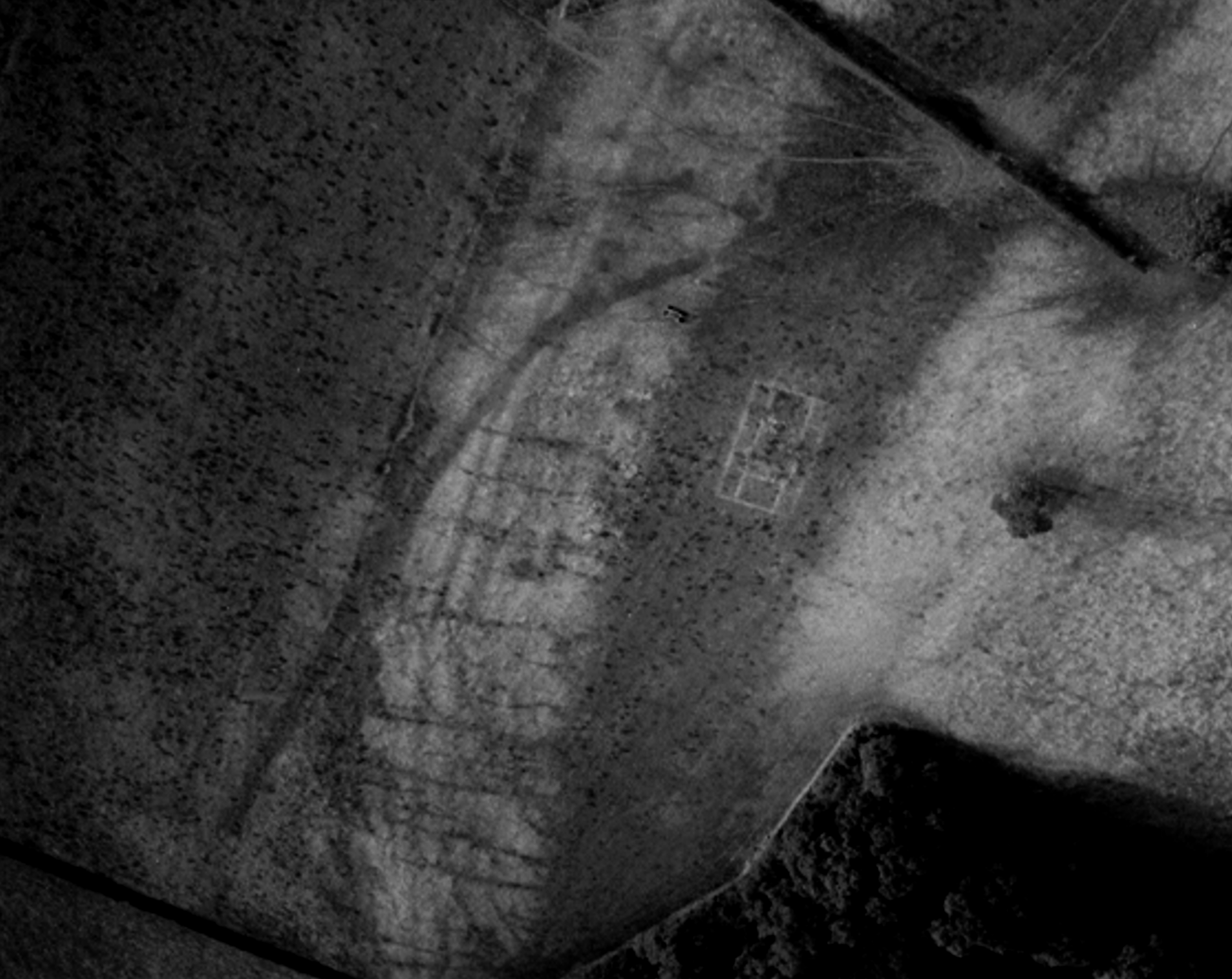
Although the sites known from air photographs were enclosed, and the siting of some at the top of the very steep escarpment above the Kenson and Waycock Rivers suggested that they were semi-defensive, it was not possible to tell whether sites identified from finds were enclosed or not. Two sites appeared from air photographs to be associated with very limited areas of fields or paddocks; one of these (Kenson South) was enclosed, but the form of the other (Nurston) is unknown. Kenson South also has a trackway leading from its general direction diagonally down the escarpment to the river which, if it is contemporary, would have provided a route to take stock to water. Another group of possibly early fields of paddock size appeared a little further east on a photograph of 1953, but with no recognisable occupation site. These complexes are similar to a site that survives as an earthwork on Dinas Powys Common, also in the Vale, where a square enclosure, dated by excavation to the 2nd-4th century AD, lies in the middle of a complex of small quadrangular and rectangular paddocks or small fields outlined by low stony banks and scarps (Figure 15). Other small fields or paddocks have been excavated within the hillfort of Caer Dynnaf, where they are believed to be connected with one or two farmsteads of the Roman period (Figure 16). Almost all traces of field systems that have been noted in the Vale are in the immediate vicinity of settlement sites, giving the general impression that over much of the area there may have been an infield-outfield system, with small fields or paddocks close to the settlements and the land further from the settlement used for ranching.
As for the Iron Age, relatively few sites of the Roman period have been excavated in south-eastern Wales. What evidence we have, however, suggests that there was a high level of continuity between the two. A total of 25 hillforts and other enclosures of late prehistoric type have been excavated in the area, and 20 of these have produced Roman pottery; on a further three sites Roman material has been picked up at the surface. At Sudbrook camp, this pottery is exceptionally early, similar to that found at the invasion-period fortress at Usk and probably dating between AD 55 and 70, and is associated with coins of Tiberius, Claudius and Vespasian (Nash-Williams 1939; Sell 2000). This has led to the suggestion that here we may be seeing Roman military occupation of a pre-Roman defensive site, designed to secure a good point for a ferry-crossing across the mouth of the River Severn. This material was associated with cobbled floors that overlay the quarry ditch behind the bank, but neither geophysical survey nor the very limited excavation that has been carried out so far have found any evidence of the sort of buildings typical of Roman forts. The reason for suggesting that this occupation was military is that there is little evidence for conquest-period Roman material on native sites in this area, suggesting there was no significant market. Otherwise, such material would have to arrive at Sudbrook as gifts, which does not seem very likely in view of Silurian hostility, or booty. However, booty is a possibility. Another hillfort site where a Roman military takeover has been suggested is Coed y Caerau, also known as Pen-toppen-ash, on the hills overlooking Caerleon from the other side of the River Usk (Figure 17). Here there is a sequence of forts culminating in a small enclosure with rounded corners. This was earlier identified as a Roman signal station on the basis of its shape and the fact that it has a clear view not only of Caerleon but also of the coast and the mouth of the Usk. However, enclosures of this shape are now known also to be typical of late prehistoric enclosures (see Whitton: from Iron Age farmstead to Roman villa and Defended enclosure at RAF St Athan), so the shape by itself cannot be used as an argument for a Roman military presence.
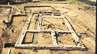
At most sites, the only way we can tell that area was now under Roman rule is because goods manufactured in the Roman tradition start to appear. Mynydd Bychan in the Vale of Glamorgan (Savory 1955) is a small enclosure with an impressively defended entrance, originally containing timber roundhouses (Figures 18-19). The defences seem to have gone out of use by the time these roundhouses were replaced by others with drystone footings, one of which encroached over the bank. The collection of pottery from this site has recently been re-examined, and modern opinion is that as a whole it suggests that occupation finished soon after the conquest. At the Bulwarks, Porthkerry, a coastal site on the cliffs of the Vale of Glamorgan, the excavation of a limited area against the tail of the innermost rampart on the north-west side of the fort discovered three successive buildings, the second of which was a timber building that had burned down before its site was tidied up, probably in the early 2nd century, to be replaced by a building with drystone footings. The pottery indicates that occupation of this building did not continue much beyond the middle of the 2nd century. At Whitton, on the other hand, occupation seems to have been continuous from before the Roman conquest up to the beginning of the 4th century (see Whitton: from Iron Age farmstead to Roman villa).
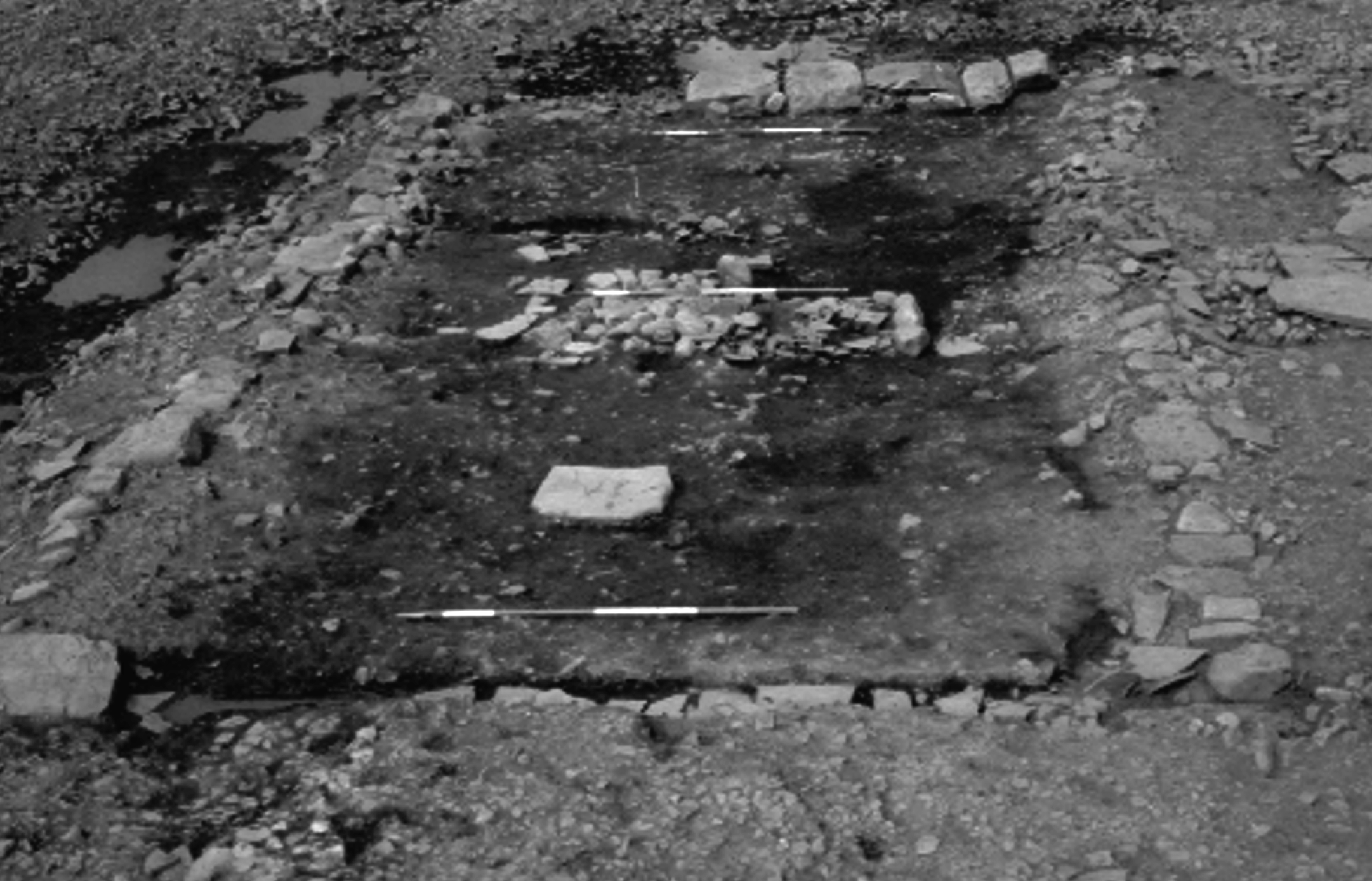
Also occupied throughout the Roman period were the defended enclosure at Cae Summerhouse near Porthcawl (Davies 1973b), and the hillfort known as Caer Dynnaf in the Vale of Glamorgan. Cae Summerhouse was an embanked and ditched rectangular enclosure similar to Whitton, with a causeway between the terminals of a rock-cut ditch leading to a funnel-shaped passage through the rampart and a gate represented by two large postholes at its inner end. There were at least five structural periods: Roman pottery makes its first appearance in the filling of the phase III ditch, and thereafter the finds indicate intensive occupation between the 1st and 4th centuries. A D-shaped enclosure demarcated by a ditch, possibly a stock pen, lay just within the defences on the south side of the enclosure, and was partly overlain by one drystone wall of a courtyard that seems to have had the same function. The interior was largely free of structures, but elsewhere there were timber buildings including four-post and six-post structures. A corndryer of Roman date had been dug into the top of the filled-in ditch, and there was another in the interior. Much of the western half of the interior of Caer Dynnaf hillfort was occupied in the Roman period by a system of small rectilinear terraced enclosures edged by low stony banks, associated with at least one rectangular stone building. The whole settlement complex produced large quantities of pottery, ranging in date from the late 1st to the 4th century.
It is possible that new enclosures continued to be built after the Roman conquest. A sherd of mid-2nd century samian was found stratified beneath one of the banks of an oval enclosure at Llwynheiernin, Swansea, during a field evaluation (Morris 1968). This is one of the excavations that have produced only very limited amounts of Roman material, which is sometimes abraded, showing that it must have been lying on the surface or in ploughsoil. This may, at least to some extent, result from the fact that only a very small proportion of any individual site has been excavated, but it could also reflect that generally low amounts of pottery were in use at some Roman-period sites. Even where pottery is present, it is not always securely related to structural features (e.g. Figure 20). This is the case at Lodge Hill overlooking Caerleon (Pollard et al. 2006), Llanmelin hillfort, Camp Hill at Tyr y mynach near Raglan, all in Gwent, and High Pennard and the Bishopston Valley promontory fort, Gower. At some sites the material came from the top fills of the defensive ditches, as at Lodge Hill, and Fonmon and Tredogan, both in the Vale of Glamorgan.
Various interpretations have been offered to account for such small collections of Roman pottery, most usually that they arrived on the site as a result of manuring. However, this is unlikely since extensive experience of field evaluations over the last twenty years shows that Roman pottery is rare as a ploughsoil find, and the results of the Penmark-Porthkerry survey show that it did not move far from settlements. It is possible that they represent a layer of Romano-British society that is all but invisible in the archaeological record because these people were not buying and using Roman pottery or other goods, and were presumably living in a similar way to their ancestors in the Iron Age. We know that this was the norm in most other parts of Wales, but until recently it has been assumed that all the inhabitants of this area were at least buying and using Roman pottery as part of their normal activity. The prospect that some people may only occasionally have come into contact with trading networks may need us to rethink south-east Wales as a place where there was a much greater degree of economic stratification.
If sites like Llwynheiernin represent the homes of subsistence farmers who were either unable or unwilling to buy into a Romanised way of life, villas are the direct opposite. By villas, we normally understand houses in the countryside that have been built to a certain standard involving Roman-introduced construction techniques of mortared stone walls and roofs of ceramic tile or stone slates, and the adoption of a plan with rectilinear walls and a layout of at least moderate sophistication with rooms of clearly differing function. It may also involve painted wallplaster (though this does not always survive, particularly in acid soil conditions), mosaic floors and central heating provided by a hypocaust or hypocausts. By these criteria, we can recognise fifteen villas in south-east Wales. There are also a further three sites that are recorded as having produced masonry structures or evidence for mosaics or wallplaster, although in the absence of plans it is possible that these could have had another function, such as temples. There are three other sites known only from cropmarks that look like Roman villas in plan, but where there are as yet no finds of structural material of Roman date to confirm that they are villas. In contrast, the whole of the rest of Wales has produced very few sites of this nature, and one of these, Pentre Farm in Flintshire, contains tiles stamped by the Chester-based Twentieth Legion and seems most likely to be an official building.
At nearly half of the definite sites with Roman stone buildings, there is evidence that the villa was preceded by an enclosure, including two sites in the Vale of Glamorgan where fairly extensive excavations have been carried out. Although no Iron Age finds are reported at Ely, what appears to be a defensive circuit was partially excavated and has been shown by geophysics to extend round at least three sides of the villa. A sherd of Iron Age pottery was found at Llantwit Major courtyard villa (Nash-Williams 1953), the largest and most elaborate villa in our area, though the outlying banks and ditches lying outside the masonry buildings here do not appear to be particularly defensive (Figure 21). Llandough near Penarth had evidence for Iron Age structures in the area on which the villa was later built (Robinson 1988), although there is no definite evidence for an enclosure. However, the salvage excavation here was limited in extent, and the possibility of one cannot be ruled out. All these villas had complex plans revealing a complicated structural history, and were provided with mosaics or painted wallplaster and bath-buildings. Geophysics also confirmed the existence of another enclosure of this type at Llanbethery, another site in the Vale, where trial excavation has shown the presence of masonry walls and flue tiles, and of a circular enclosure seen on air photographs at New Mill farm, Monknash, as well as the masonry buildings that are also known from geophysics.
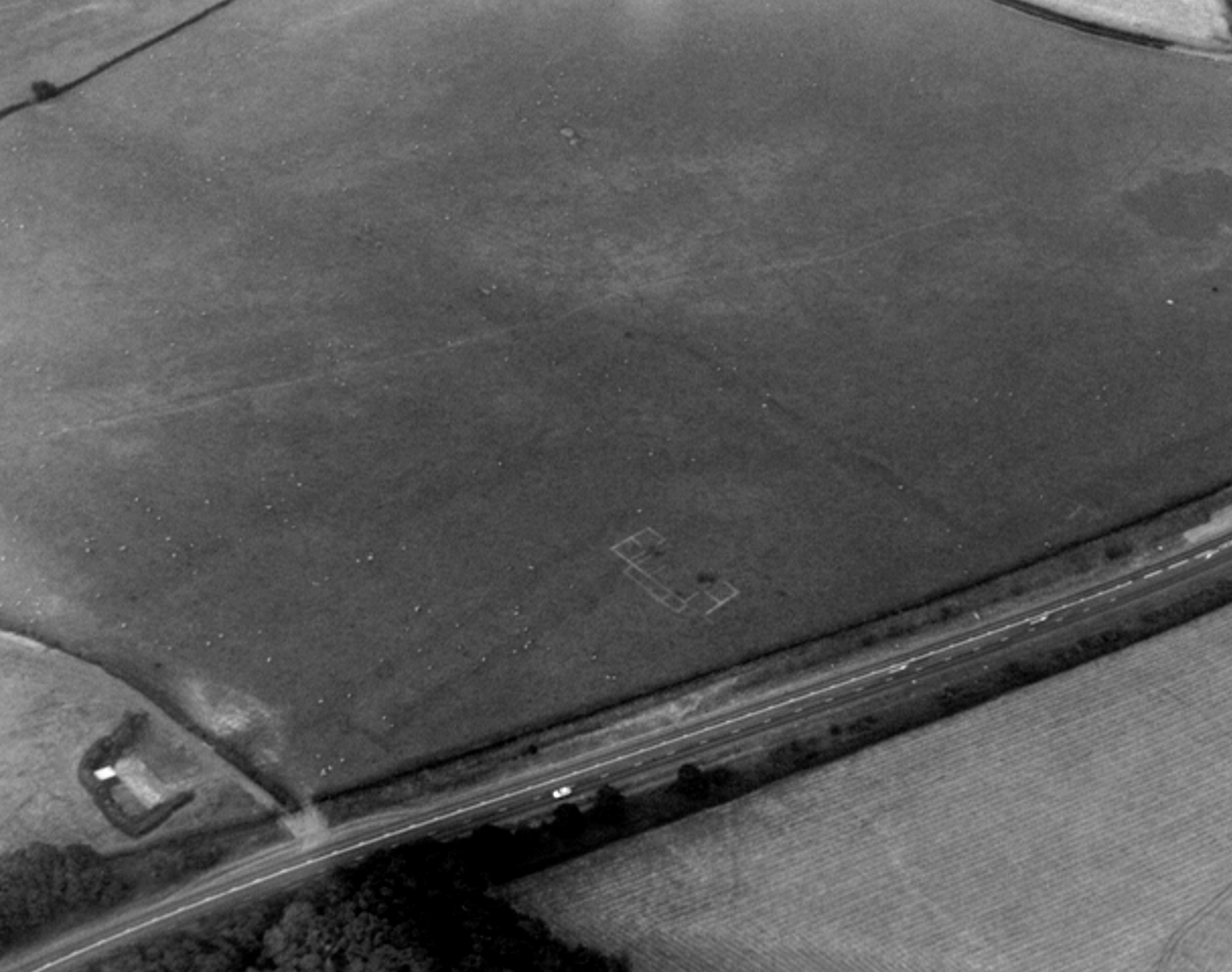
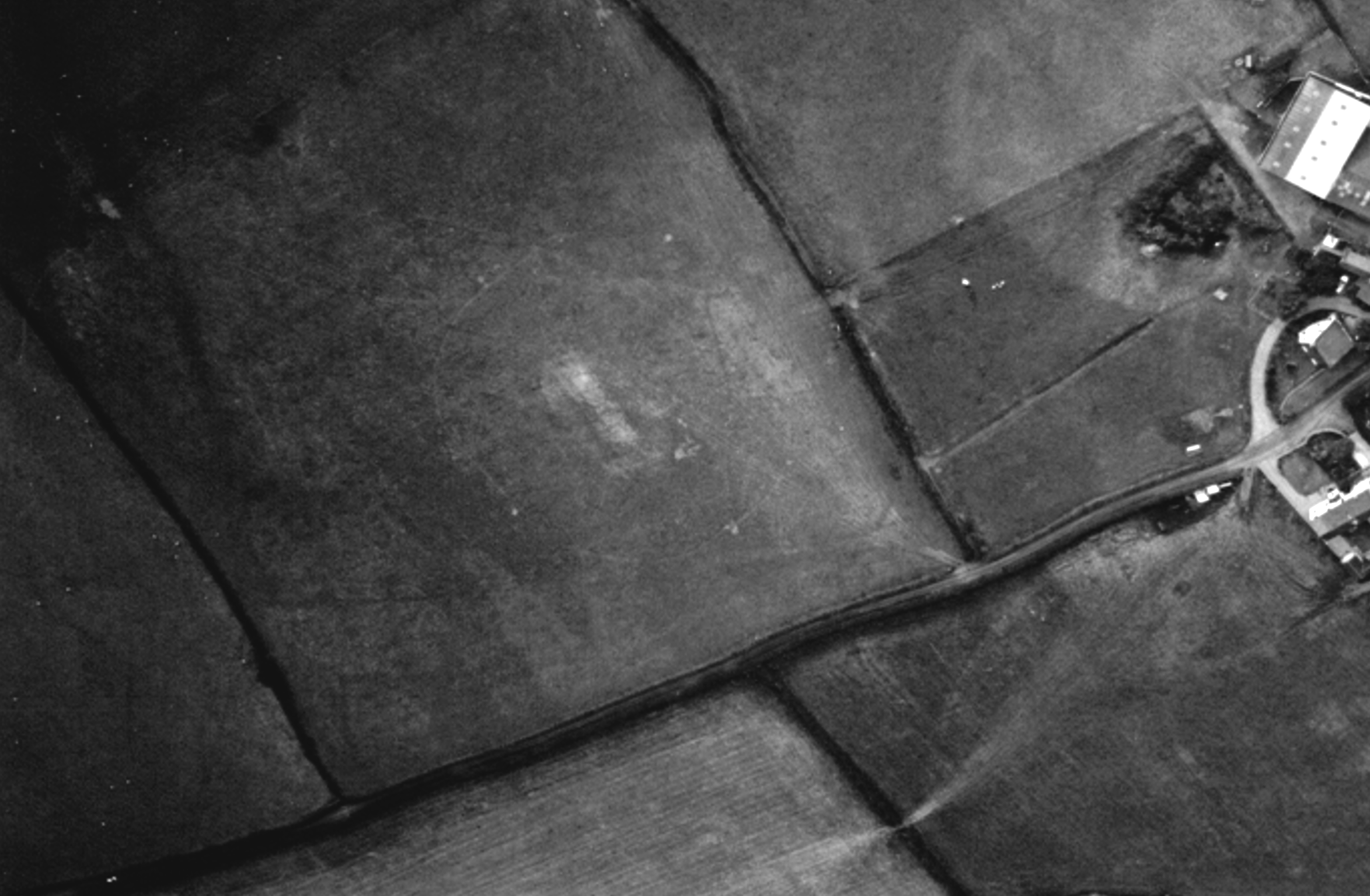
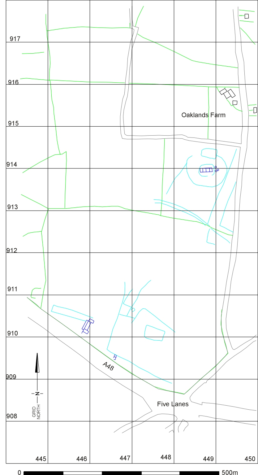
No modern excavation has been carried out on the Gwent sites, but a site at Wyndcliff near Chepstow, known originally from finds - a Trinovantian gold stater, a Roman stone roof-finial and the leg of a bronze statuette of Mars - has been shown by air photography to contain a rectangular building with multiple rooms and two corridors, lying within a univallate hillfort (Figure 22). At Croes Carn Einion in the Lower Rhymney Valley, there is a villa known from air photography that lay within the curve of a bank recorded in 1950, and this bank may have been the remains of circular enclosure. The photographs show that it had at least two buildings with plans typical for villas, one a winged corridor building and the other an aisled building. There was also at least one other building that does not show up on air photographs, one wall of which was cut through by a gas-pipe trench, when roof- and flue-tiles were also disturbed. Two villas with mosaics were noted by antiquaries near Caerwent. Our information about the Whitewall Brake (Castle Tump) courtyard villa is too slight to know whether it had Iron Age antecedents, but there are good air photographs of the Five Lanes villa complex, which is the only villa where some information about the surrounding landscape can be inferred (Figures 23–25). The part of the site from which the mosaic was recorded showed a field system as well as a winged-corridor building, possibly with two phases of construction, and a second, smaller, building. Another air photograph taken the following year revealed a continuation of the field system to the north, where there was also a simple rectangular building, consisting of a row of four rooms, some 400m to the north, and this additional building lay within a circular enclosure, with an inner oval enclosure not much longer than the building. Although no excavation has been carried out to confirm the sequence, the impression given from the air photographs is of a pre-Roman circular enclosure within which a stone building was subsequently erected, and which may have later been replaced by the winged-corridor building on a slightly different site. Alternatively, if these two sites represent a similar density of settlement as has been noted in the Vale, they could have been in use contemporaneously in the Roman period. The usual assumption has been that these villas represent the houses of indigenous families who had enough motivation (and enough wealth) to buy into the Roman way of life, although it has also been suggested that they may have belonged to retired legionaries from Caerleon. These need not be two mutually exclusive groups. Interaction with the Army explains the way recruitment of native peoples took place to the Roman army and how this may have provided a driver for some families to adopt at least some Roman ways. However, this does not explain everything: even between the pottery-using sites, there are still considerable differences in the range of artefacts that their inhabitants were using as well as the sophistication of the buildings. Differences in status within the tribal structure, differences in army rank, and differences in the histories of the families concerned are likely to be possible influences in producing the results that can be seen on the ground as a farmstead or a villa, but they will probably not be accessible through archaeological means of enquiry.
As we have seen, on at least some hillforts occupation continued well into the Roman period, as at Caer Dynnaf, and for around a century at Porthkerry on the small area excavated, with the possibility of later occupation elsewhere within the defences. At Wyndcliff, the residents were expressing their high status in a manner that was wholly Roman, although with no closely datable finds; the time at which they were doing this is unclear at present. There seems no reason to suppose that hillforts do not follow the same pattern as smaller enclosures such as Cae Summerhouse and Whitton, with pottery sequences from the 1st to the 4th century, or Llantrythid, Llanbethery and Monknash where finds dating from the 2nd to the 4th century have been recovered.
There are, however, a few hillforts and promontory forts where the evidence does suggest a return of some sort in the 4th century to defended enclosures that had been abandoned in the Roman period. Sudbrook is one possibility for reoccupation: the finds assemblage showed tentative indications of late Roman or early medieval activity, although the specialists were unable to catalogue anything diagnostic. This would depend on occupation of some part of the fort's area other than the restricted amount excavated. At Coed y Cymdda, however, where a good half of the interior was excavated, the 4th century is represented only by a few finds, with no identifiable structures, and pottery from the top of the ditch fill indicates that the fortifications were not functional. This does not suggest a high-status reoccupation, and there is no evidence for activity in the post-Roman period. Evidence from the only two sites that have been shown to have secular occupation in the early medieval period, Dinas Powys in the Vale of Glamorgan and Hen Gastell near Briton Ferry, does not support an earlier origin for either. Both are defended sites, in the case of Dinas Powys quite strongly so (Alcock 1963). At both there was a small quantity of Roman pottery with no associated structures. At Hen Gastell caution must be exercised in interpretation, since it is estimated that 70-80% of the site had been lost to quarrying before any excavation took place (Wilkinson 1995). At Dinas Powys, however, where approximately two-thirds of the interior was examined, the excavator noted that there was no structural evidence to match the Roman-period finds and believed that they had been brought to the site in the early medieval period: interpretation of the dating of the earliest defences has varied, but the most usual consensus is that the defences do not pre-date the early medieval period.
If Roman pottery was reaching early medieval sites from elsewhere, some of the hillforts noted above as containing a few sherds of Roman pottery might have been reoccupied in this period rather than continuing in occupation under Roman rule. This might explain a sherd of samian of the second half of the 2nd century at Mynydd Bychan being so much later than any of the other Roman pottery there. However, without more definite evidence, this cannot be considered as any more than a slight possibility.
Defended enclosures continued to play a part in the mix of settlement types that characterised the Roman period in south-east Wales. As can be seen from the development of Whitton, actual defensibility (even just for the establishment of secure points) was no longer a practical priority, thanks no doubt to the pax Romana imposed by the army, which would not have tolerated private wars in the countryside. However, enclosing banks and ditches still could have a part to play for the control of stock and as property boundaries, and there would be no particular reason to get rid of them where sites continued in use and did not grow beyond their original boundaries. They may also have been linked with ideas of prestige and status. Where traditional methods of construction were still in use, they may still have been an obvious choice for new work (as is the case with roundhouses on some Roman-period sites, not just in Wales but also in the English Midlands where more of the trappings of Roman material culture were in use). It would be nice to be able to provide a history of defended enclosures over the period of Roman rule, but there is too little evidence - too few sites have been excavated for us to know whether the sequence of events on individual sites translates to general trends. However, at least some sites seem to have continued in use throughout the period, and possibly also beyond.
Internet Archaeology is an open access journal based in the Department of Archaeology, University of York. Except where otherwise noted, content from this work may be used under the terms of the Creative Commons Attribution 3.0 (CC BY) Unported licence, which permits unrestricted use, distribution, and reproduction in any medium, provided that attribution to the author(s), the title of the work, the Internet Archaeology journal and the relevant URL/DOI are given.
Terms and Conditions | Legal Statements | Privacy Policy | Cookies Policy | Citing Internet Archaeology
Internet Archaeology content is preserved for the long term with the Archaeology Data Service. Help sustain and support open access publication by donating to our Open Access Archaeology Fund.