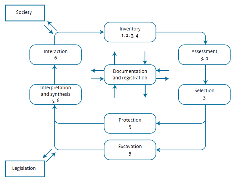
Figure 1: The archaeological heritage management cycle (after Willems 1997). The figures indicate how the projects (1-6) of the Archaeology Knowledge Kit programme relate to different parts of the cycle: 1. Predictions in Layers; 2. Mapping Disturbances; 3. Maps in Abundance; 4. Prospection Best Practice; 5. National Archaeological Research Agenda 2.0; 6. Valletta Harvest (Lauwerier 2017, 15)
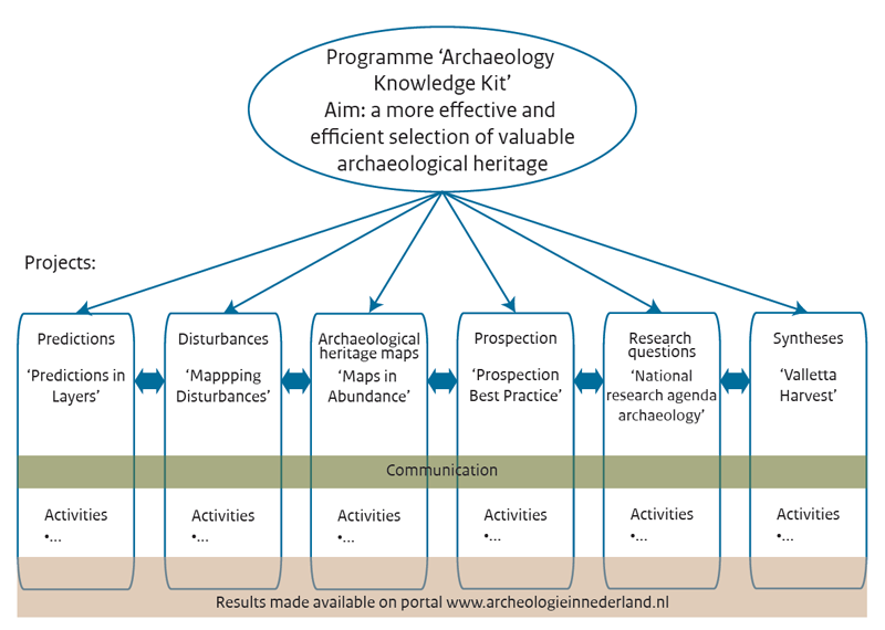
Figure 2: Organisational structure of the Archaeology Knowledge Kit programme (after Lauwerier 2017, 16)
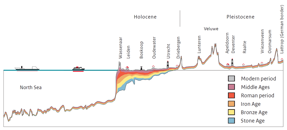
Figure 3: Schematic cross-section of the Netherlands, from the North Sea coast to the German border, indicating the depth at which remains from different periods are present
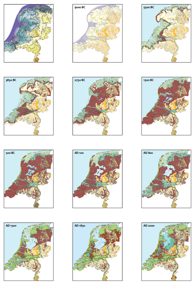
Figure 4: Overview of the palaeogeographical maps of the Netherlands (taken from Vos and De Vries 2017, 52)
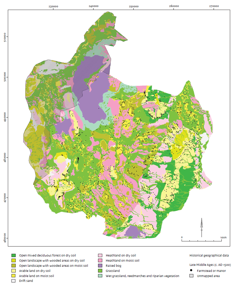
Figure 5: Reconstruction map of the vegetation in the Late Middle Ages, around AD 1500 in the region Twente, the Netherlands. Historical sources clearly demonstrate that the landscape, which had become very open due to intensive and prolonged human land-use, was dotted with numerous farmsteads (after Van Beek et al. 2017, 69)
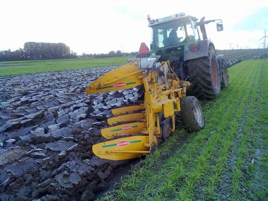
Figure 6: Soil disturbance by agricultural activity (Image from Van Reuler et al. 2014, 14. Used with permission)
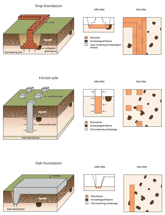
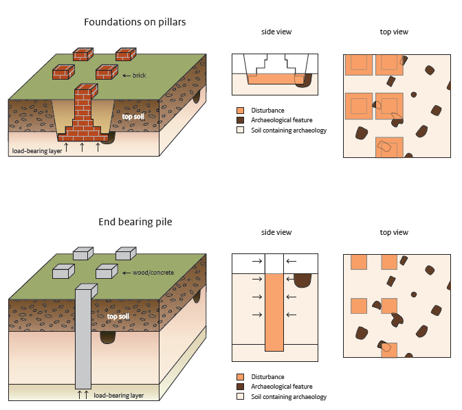
Figure 7a/Figure 7b: The most common types of foundations found beneath buildings in relation to archaeology (after Bouwmeester, Abrahamse and Blom 2017, 150)
Figure 8: Two well-developed archaeological layers at Zwaagdijk, the Netherlands. Both layers are divided by a thin, less dark coloured layer. The top layer dates to the Early Bronze Age and the lowermost to the Late Neolithic. Excavation by Archol (Image from Knippenberg 2014, 14. Used with permission)
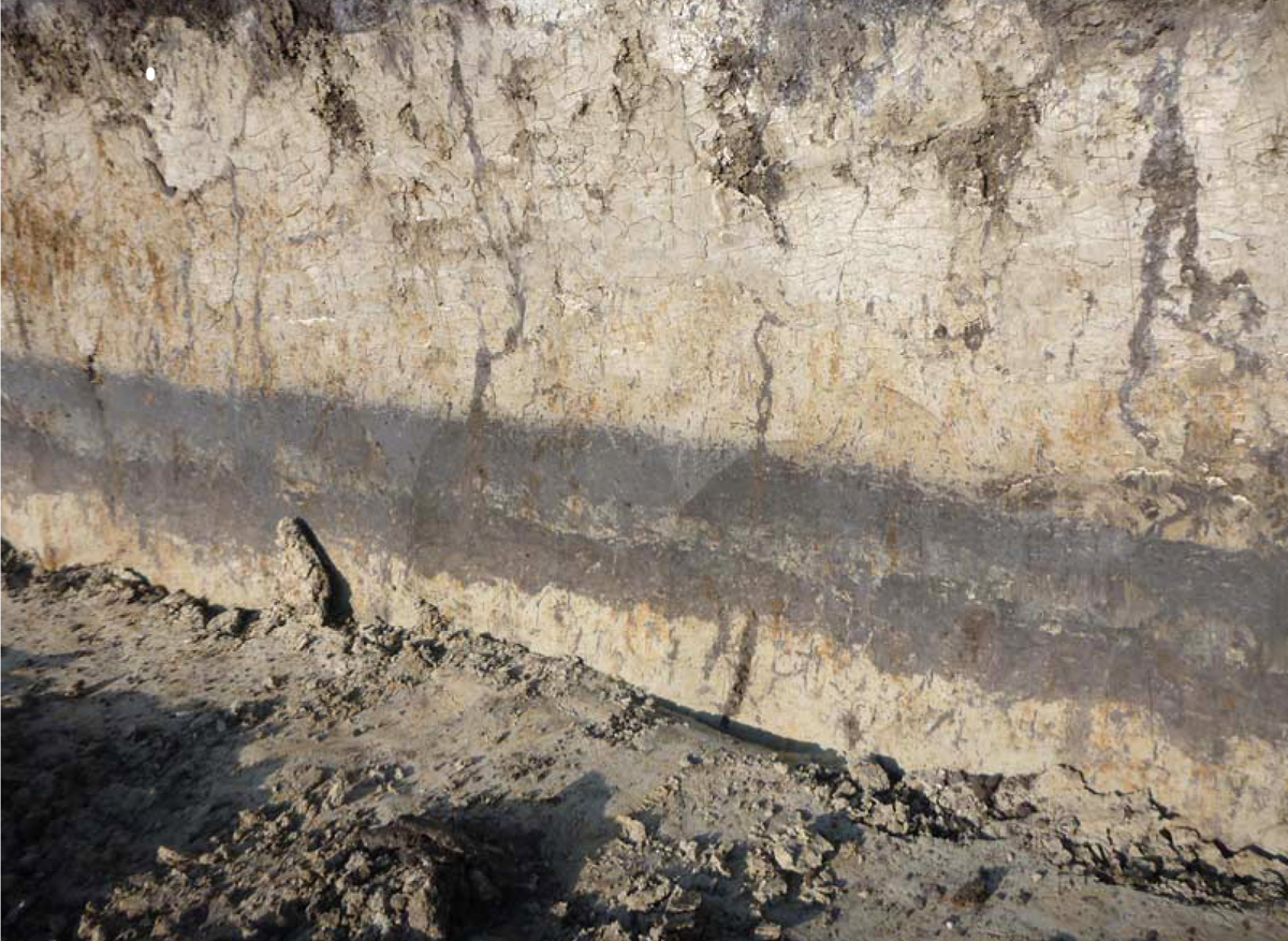
Figure 9: Example of incompatible local authority archaeological predictive maps (after Van Doesburg et al. 2017a, 161)
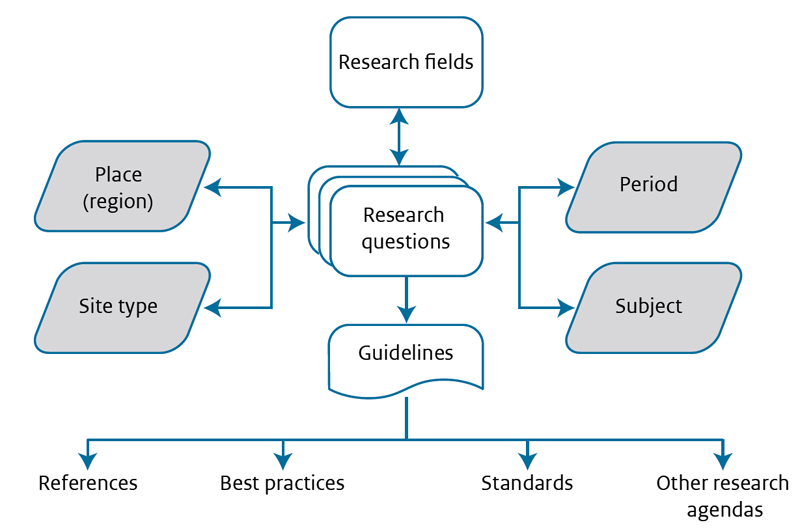
Figure 10: The structure of the new National Archaeological Research Agenda 2.0 (after Groenewoudt et al. 2017, 189)
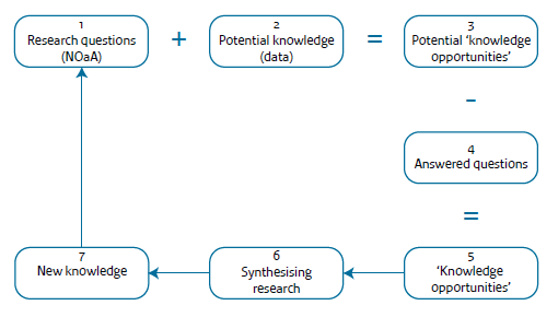
Figure 11: Bottom-up method of identifying knowledge opportunities and creating new knowledge and questions (after Eerden et al. 2017, 200)
Internet Archaeology is an open access journal based in the Department of Archaeology, University of York. Except where otherwise noted, content from this work may be used under the terms of the Creative Commons Attribution 3.0 (CC BY) Unported licence, which permits unrestricted use, distribution, and reproduction in any medium, provided that attribution to the author(s), the title of the work, the Internet Archaeology journal and the relevant URL/DOI are given.
Terms and Conditions | Legal Statements | Privacy Policy | Cookies Policy | Citing Internet Archaeology
Internet Archaeology content is preserved for the long term with the Archaeology Data Service. Help sustain and support open access publication by donating to our Open Access Archaeology Fund.