Plans:
During the late 13th century, a stone church was constructed on this site. Large foundations suggest that the ground was of poor quality, possibly associated with the estuarine nature of the area due to the confluence of the Dee and Denburn just to the south (excavated at 2-12 Rennies Wynd and 67-71 Green; Murray 1982, 91-5, 108).
Construction
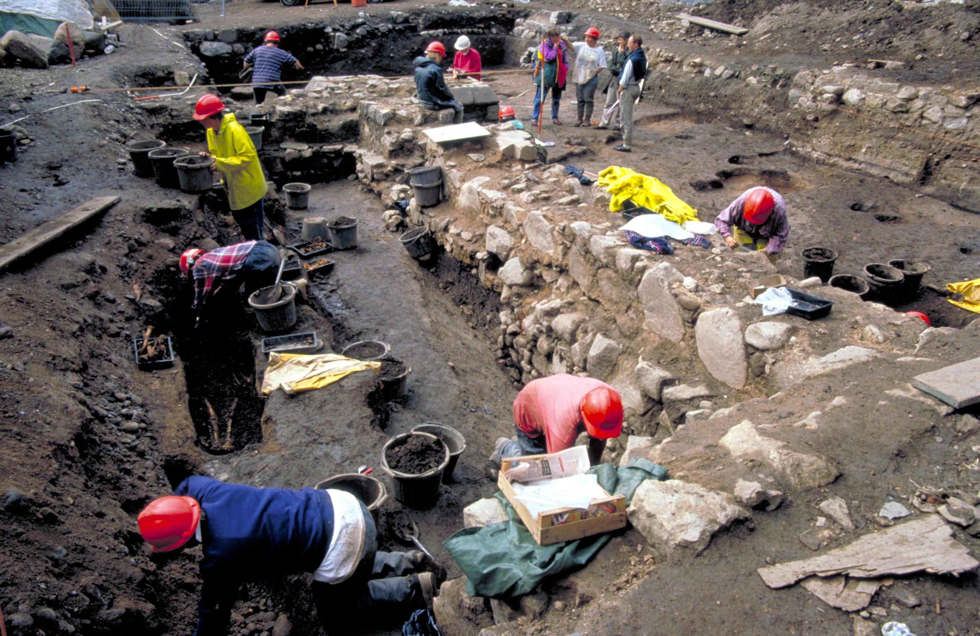
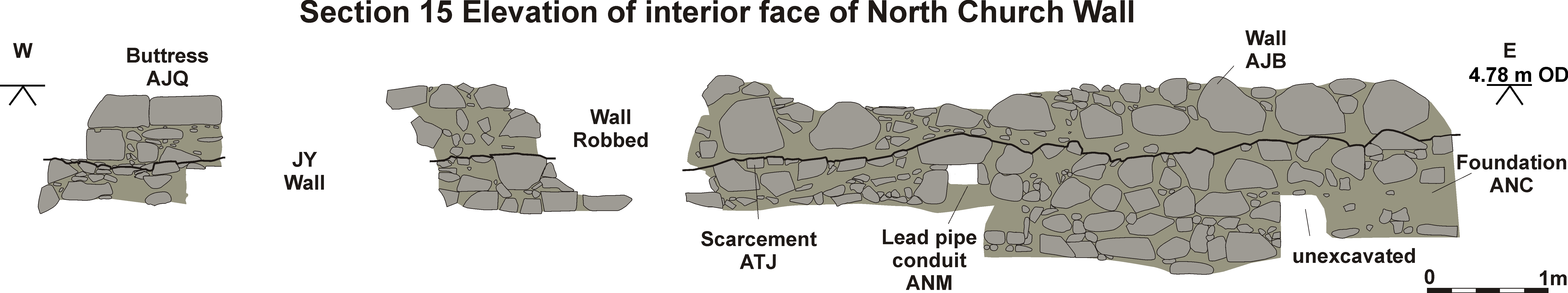
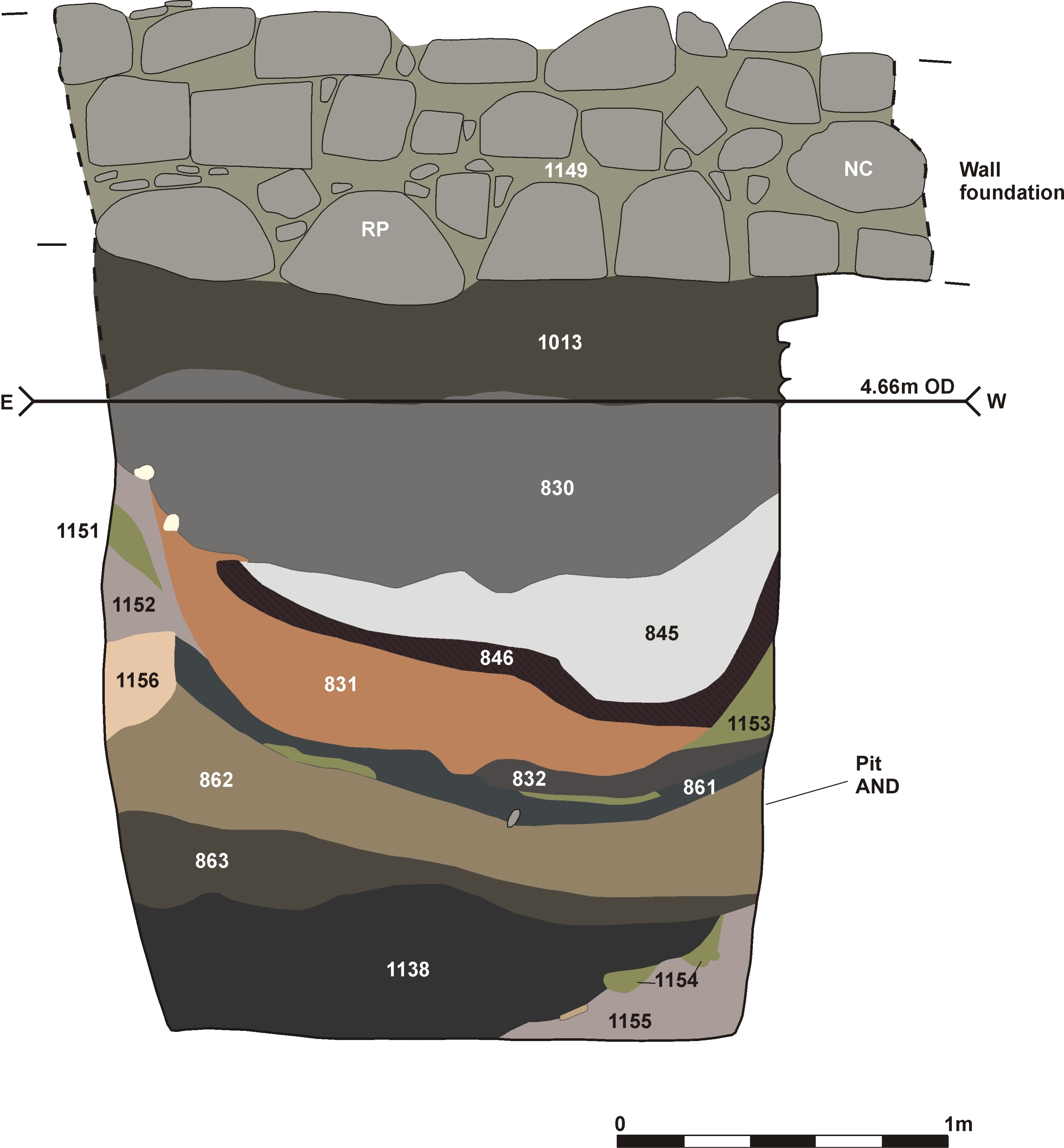
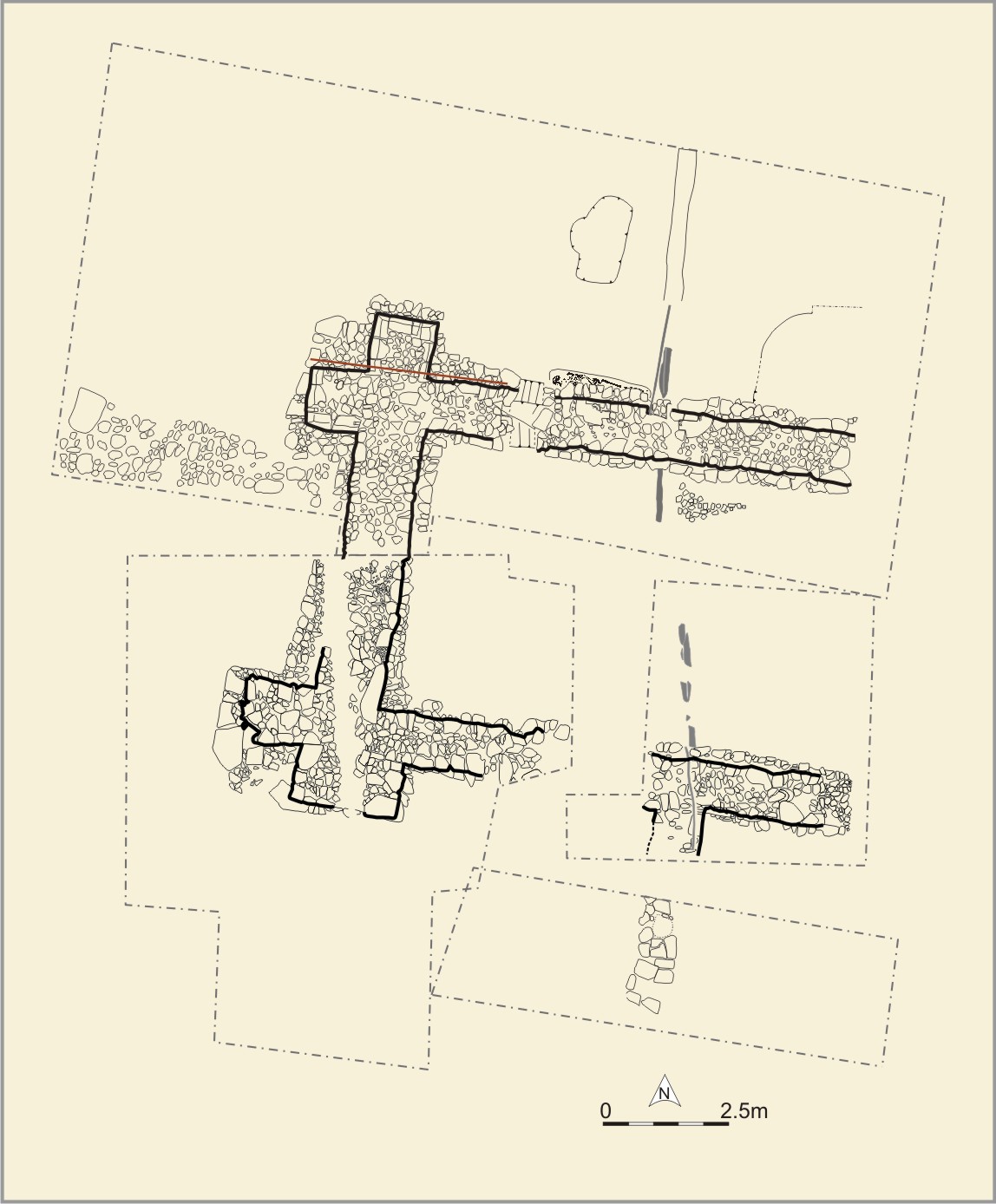
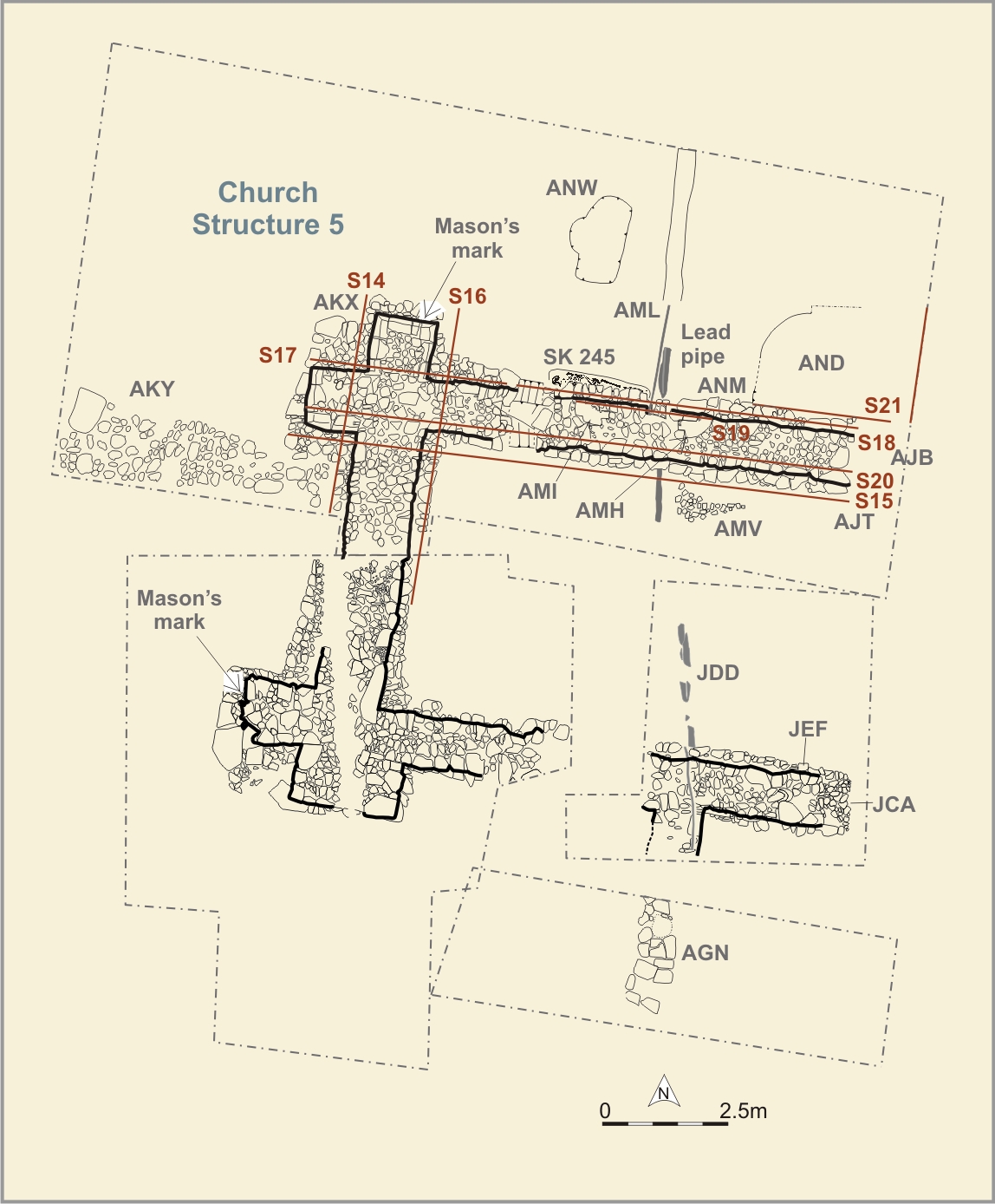
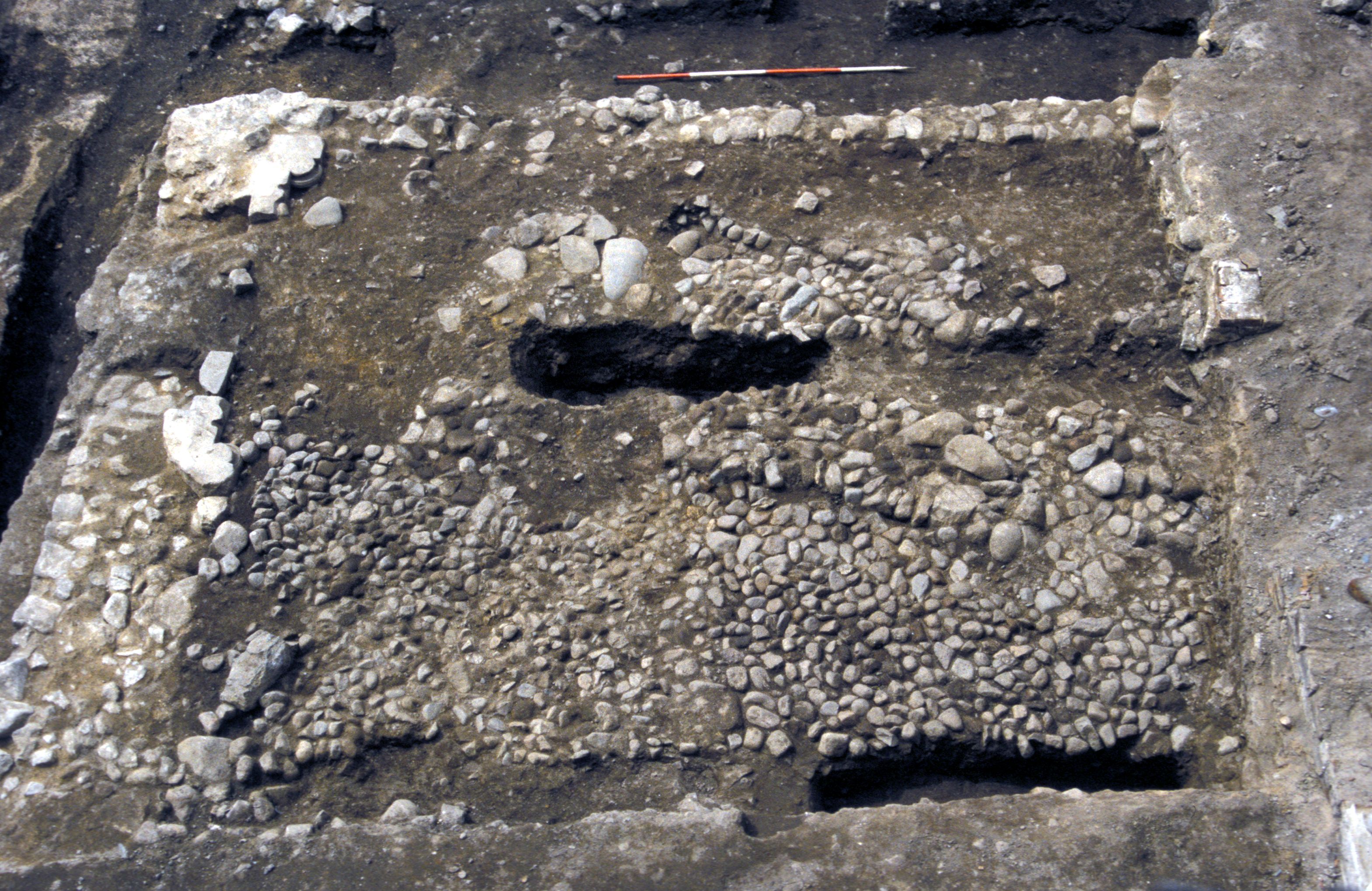
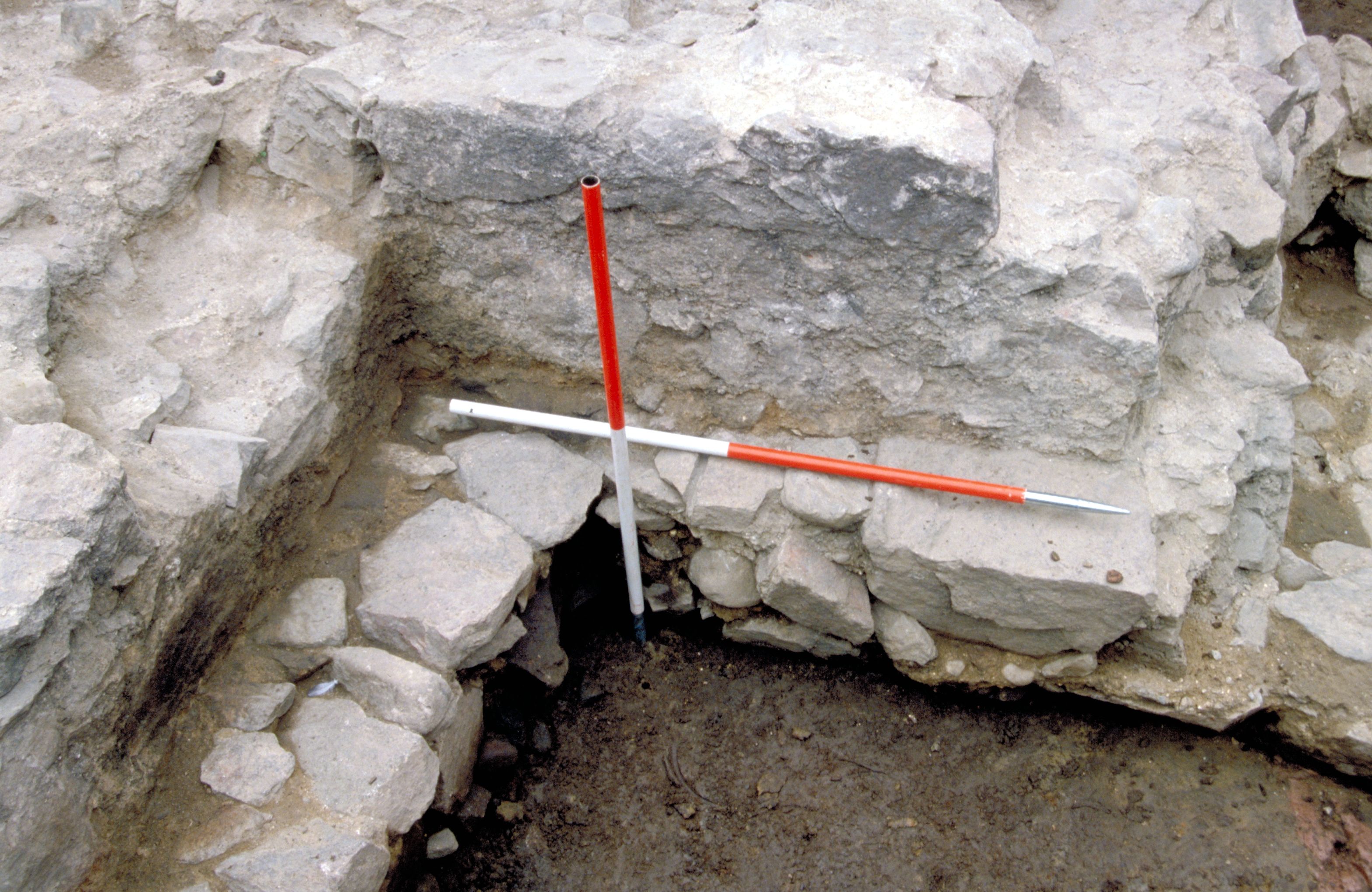
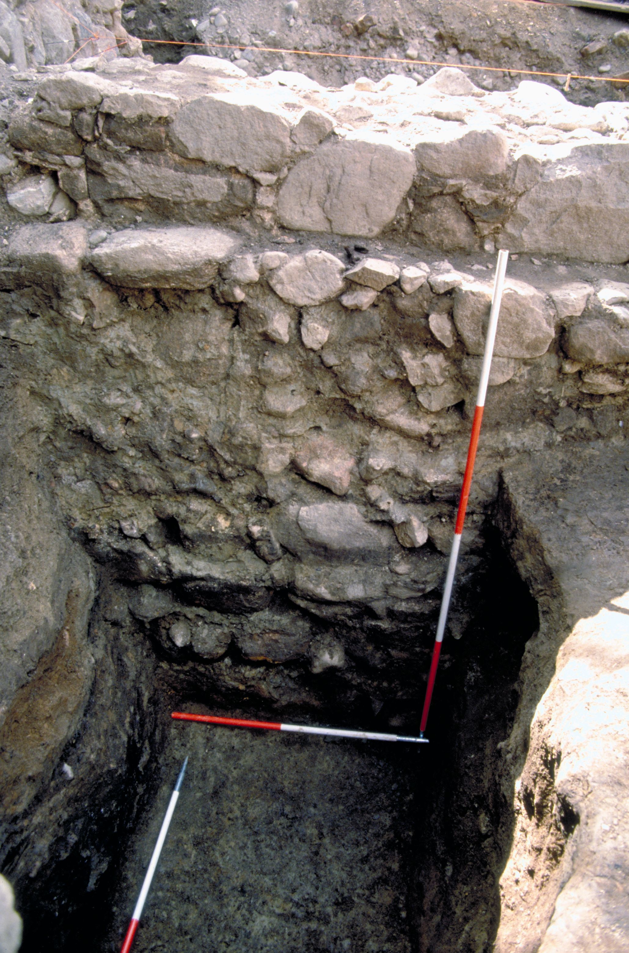
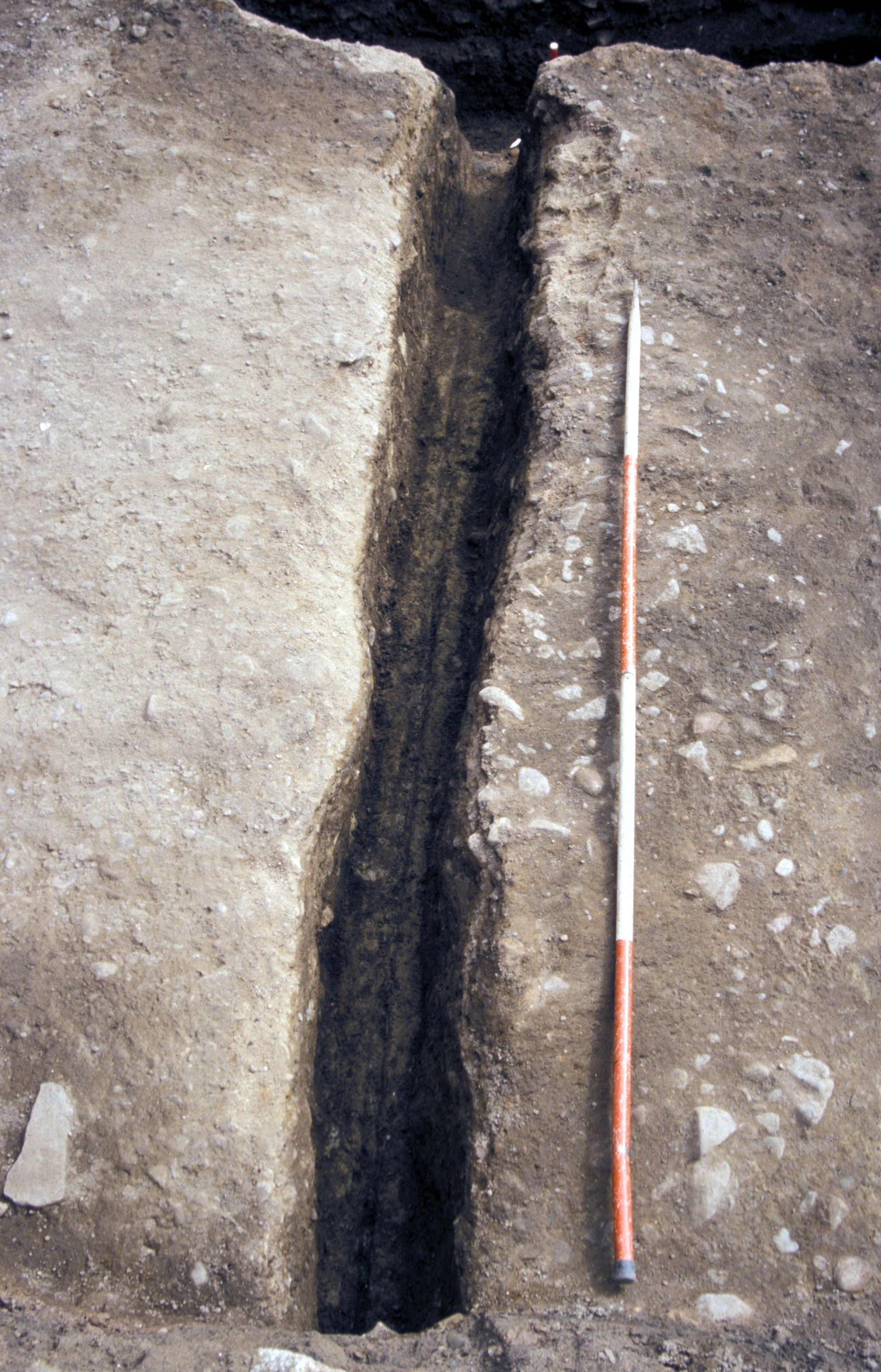
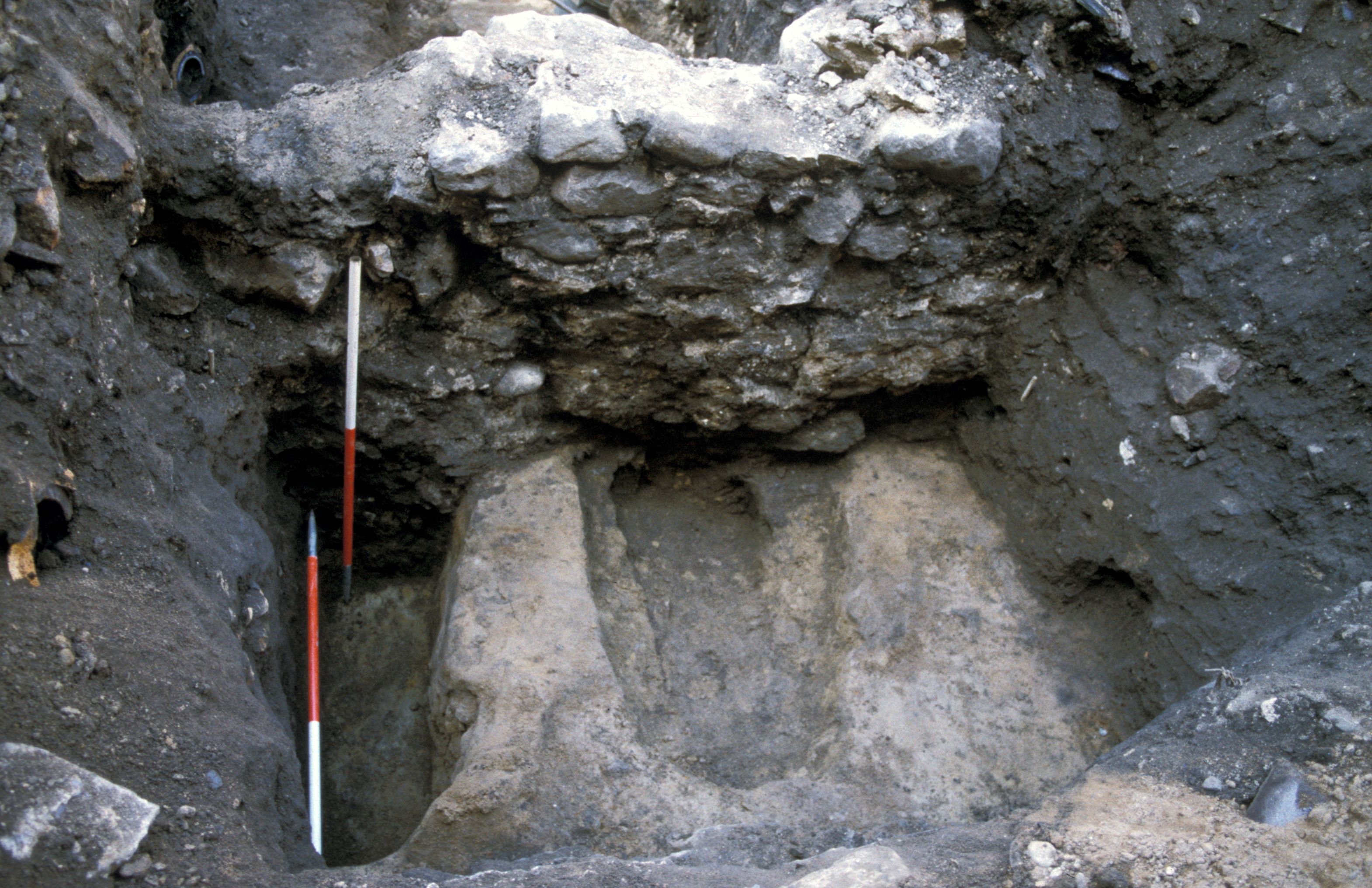
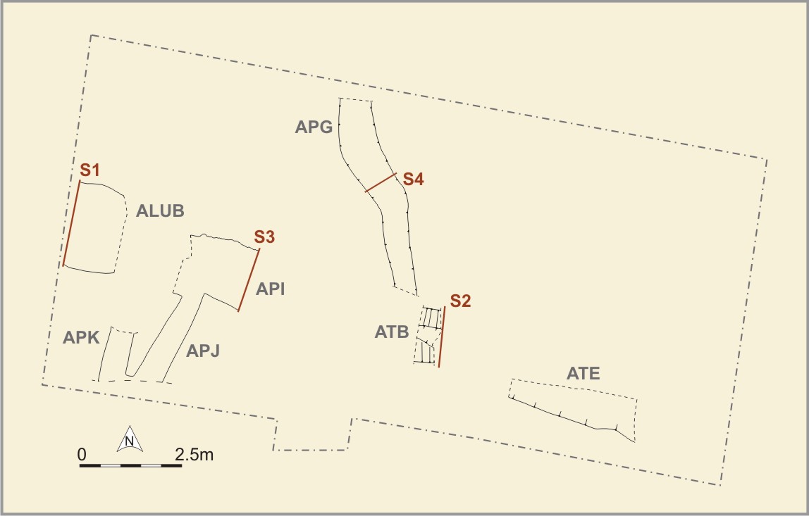
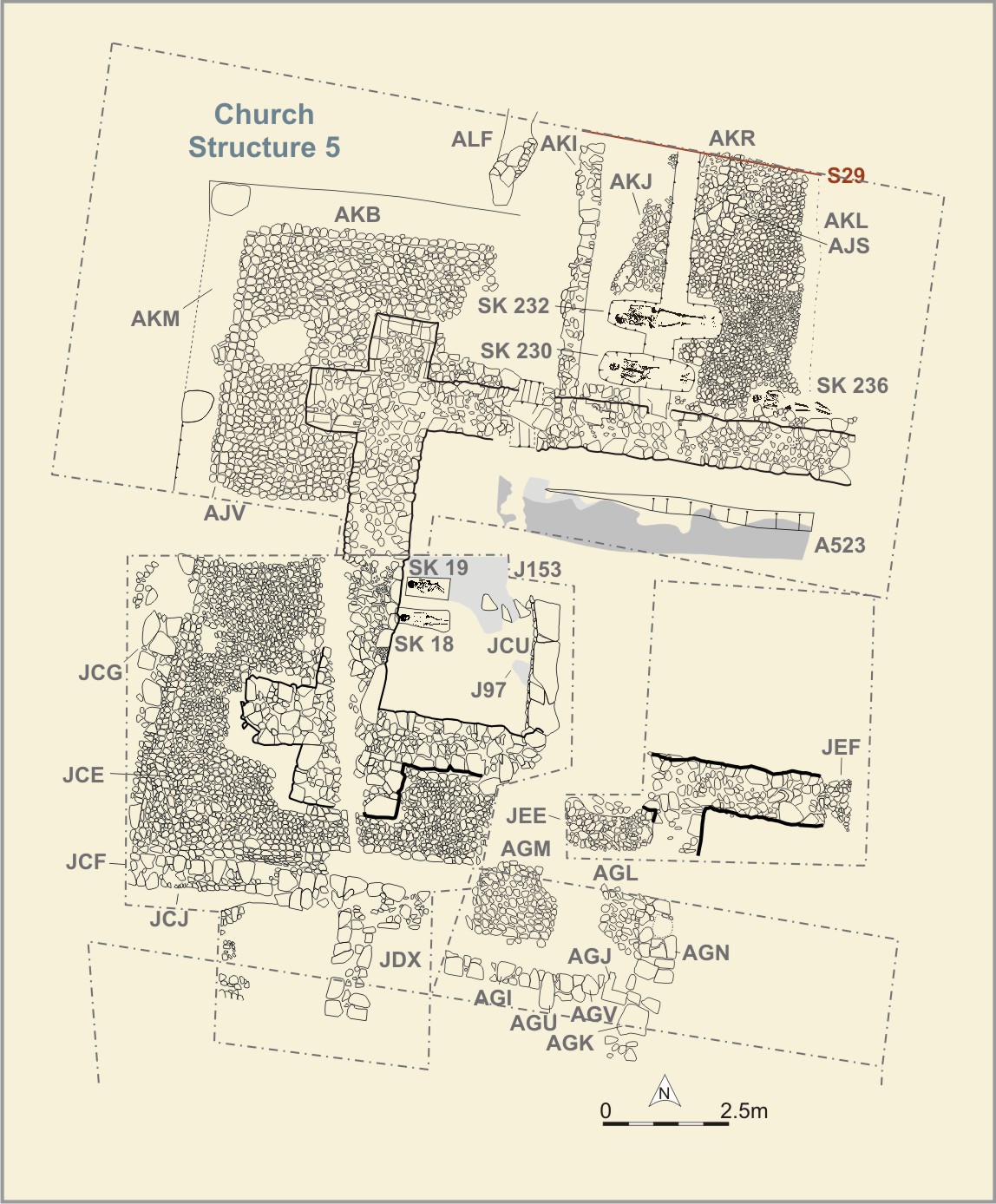
A large stone building [Photo 0081] (Structure 5) has been identified as the west end of the friary church. The building's foundation consisted of a large 'raft' [Photo 0184] of stones in loamy clay ANC onto which a substantial granite and sandstone wall (AJB/JCA) had been constructed. The raft was 1.75m wide and 0.60m deep and had, in part, been laid on top of Phase 1 ditch ATB [Photo 0544]
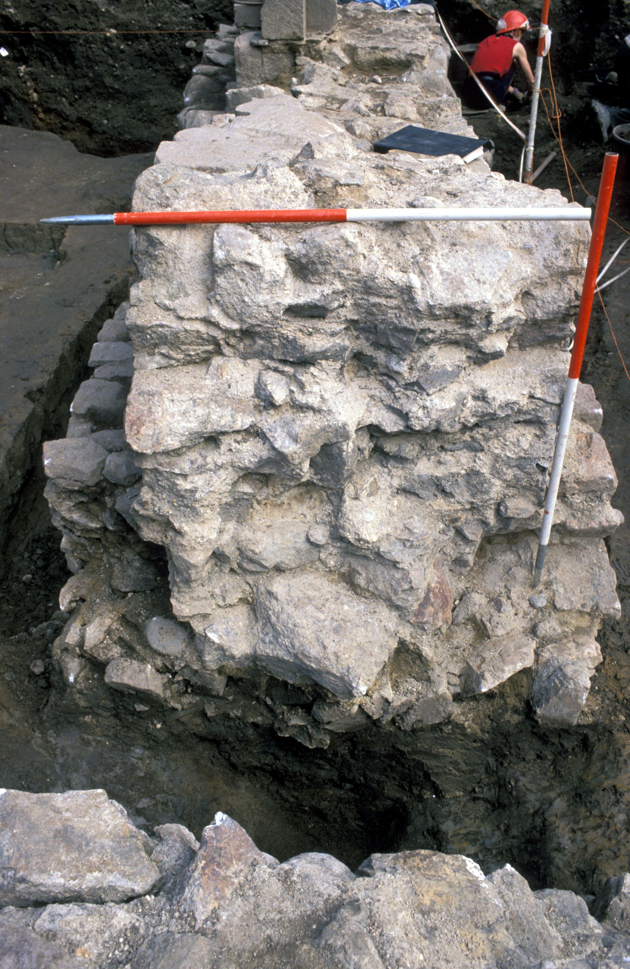
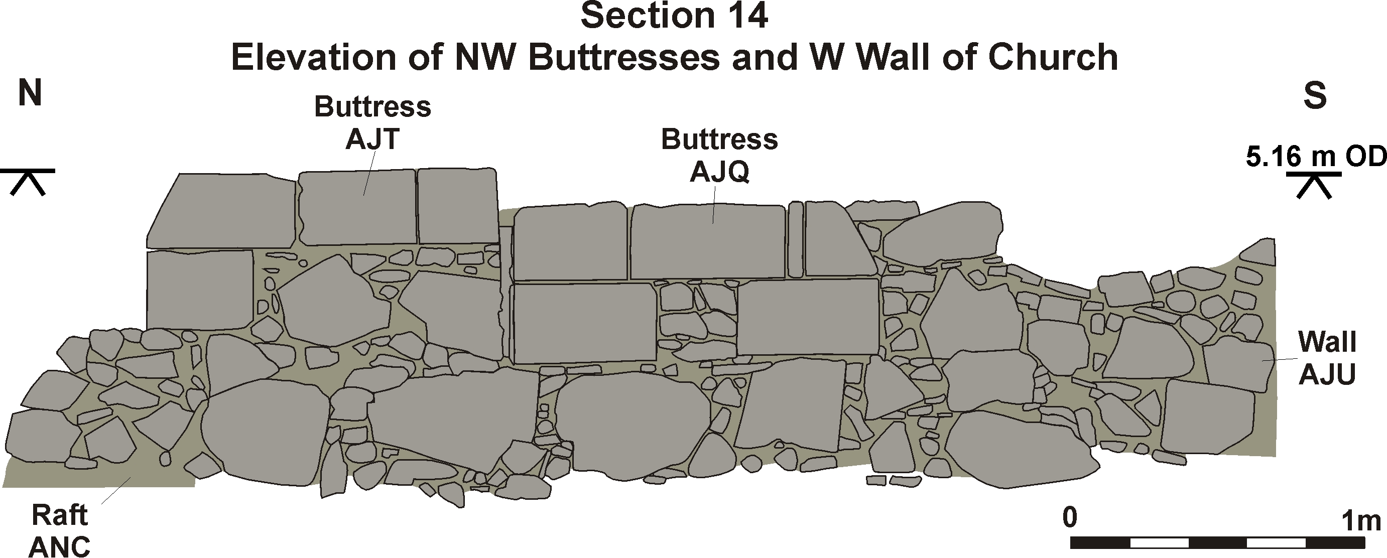
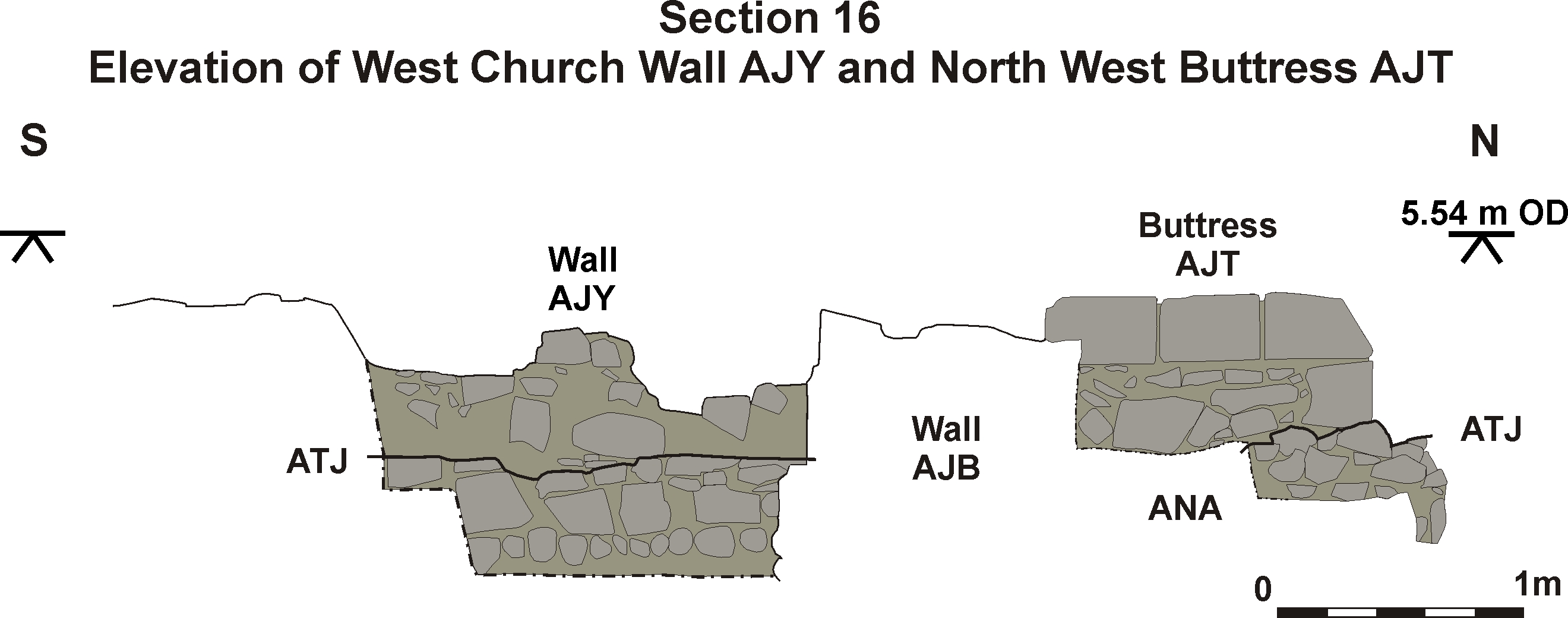
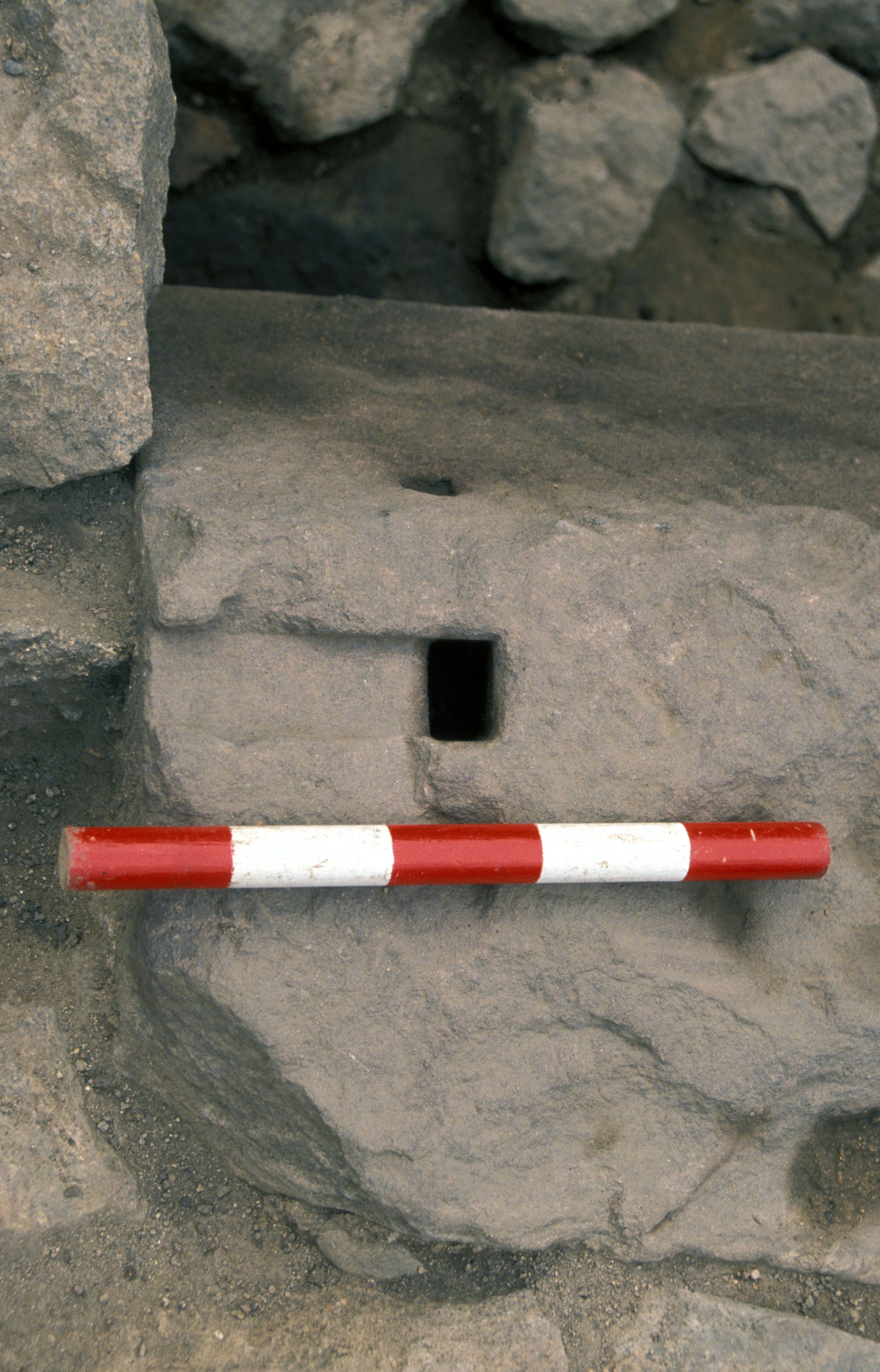
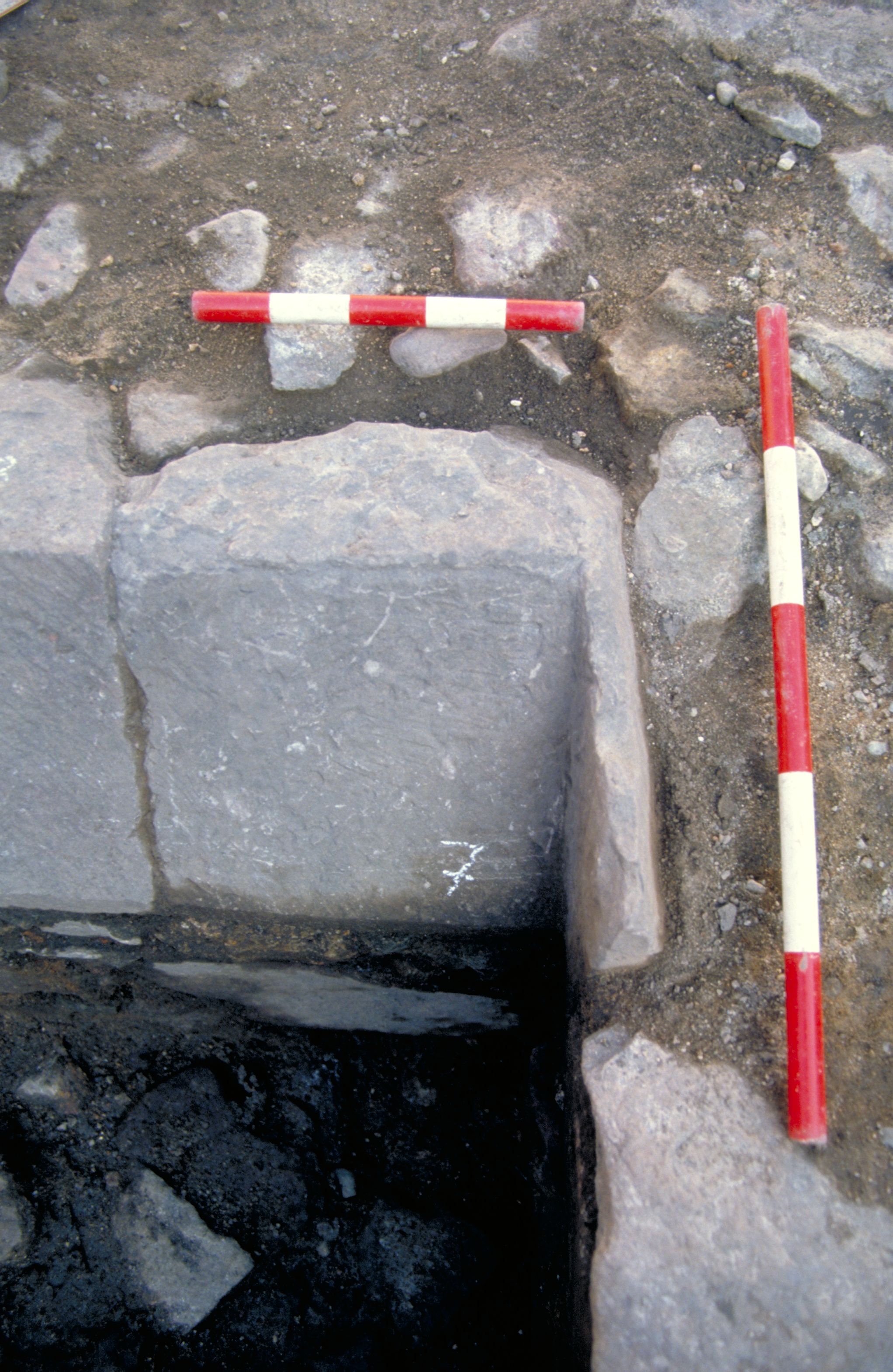
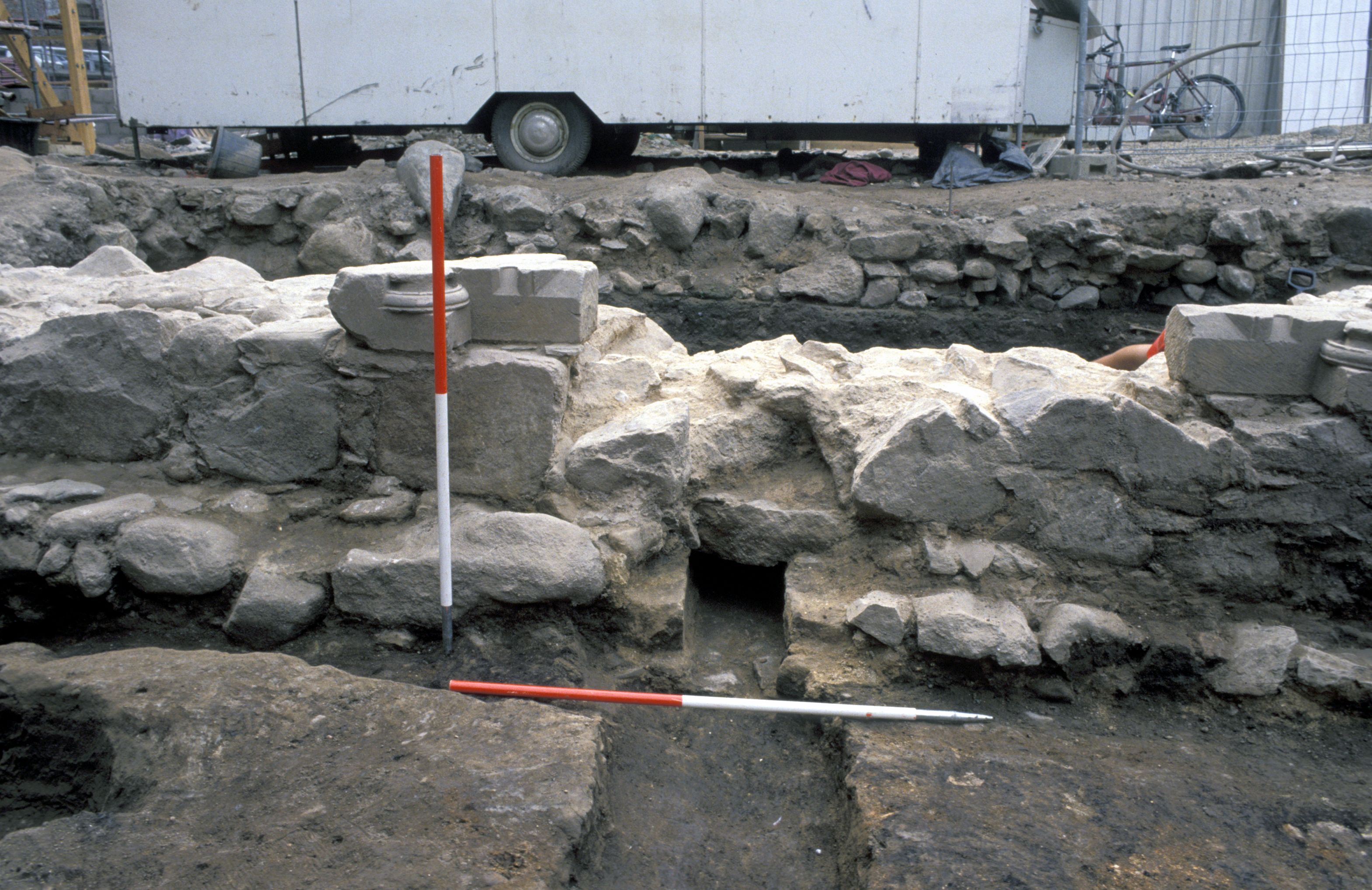
The wall of the church was 1-1.10m wide and survived to a maximum height of 0.75m [Photo 0384]. Large granite field stones faced the outside surfaces of the wall and the centre was filled with granite and sandstone rubble. The lower courses of the foundations were bonded with pink clay whereas the upstanding wall was bonded with off-white mortar. Holes [Photo 0311] (ANP, ARJ, AKU, AKX) for attachment of metal straps or supports, to strengthen the bond between the stones, can be seen on some of the stones of the buttresses.
A few dressed and moulded stones had been re-used in the construction, but as some of these have been stylistically dated to the 15th-17th century, their presence may suggest that parts of the foundations were repaired or rebuilt during the later use of the building. At the extreme east end of the excavated area, at JEF, it was apparent that JCA had begun to collapse because of the presence of Pit JDH, and had been repaired, using smaller boulders [Photo 0536] and a more crumbly mortar than in the original structure. This repair, however, may have taken place at any point between Phases 5 and 6. The width of JCA was c.1.30m, but towards the base of the foundations it was stepped out to a width of c.2m. This stepping occurred both internally and externally, although it was at its widest on the outside of the N-S portion of JCA.
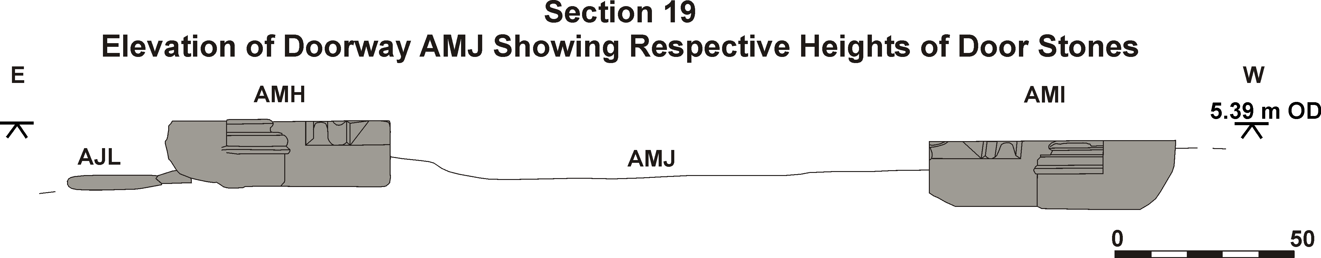
Door
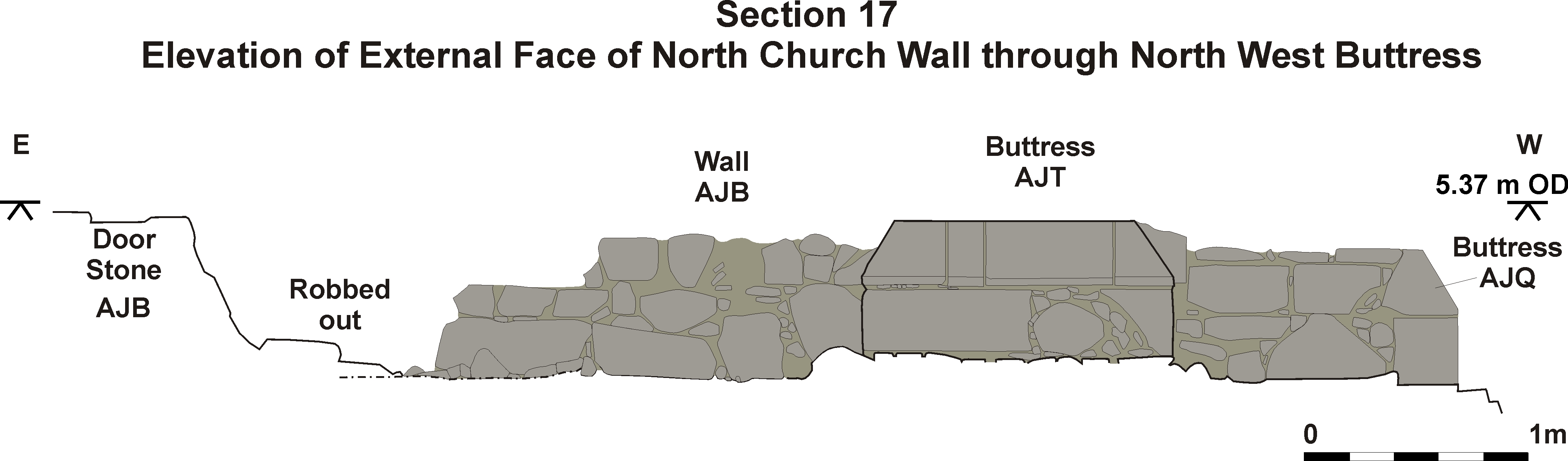
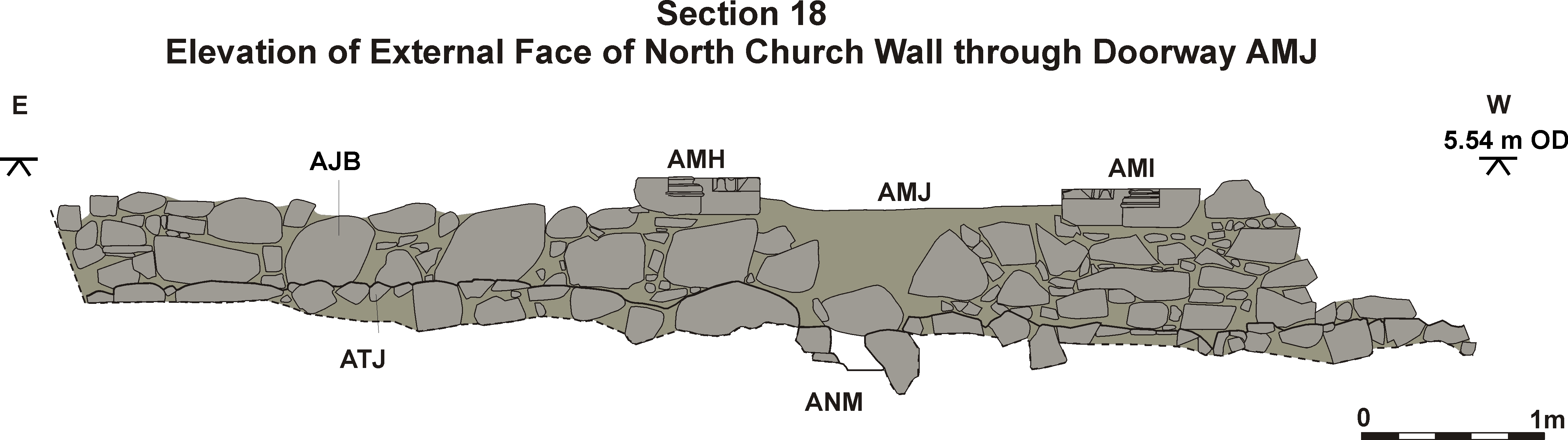
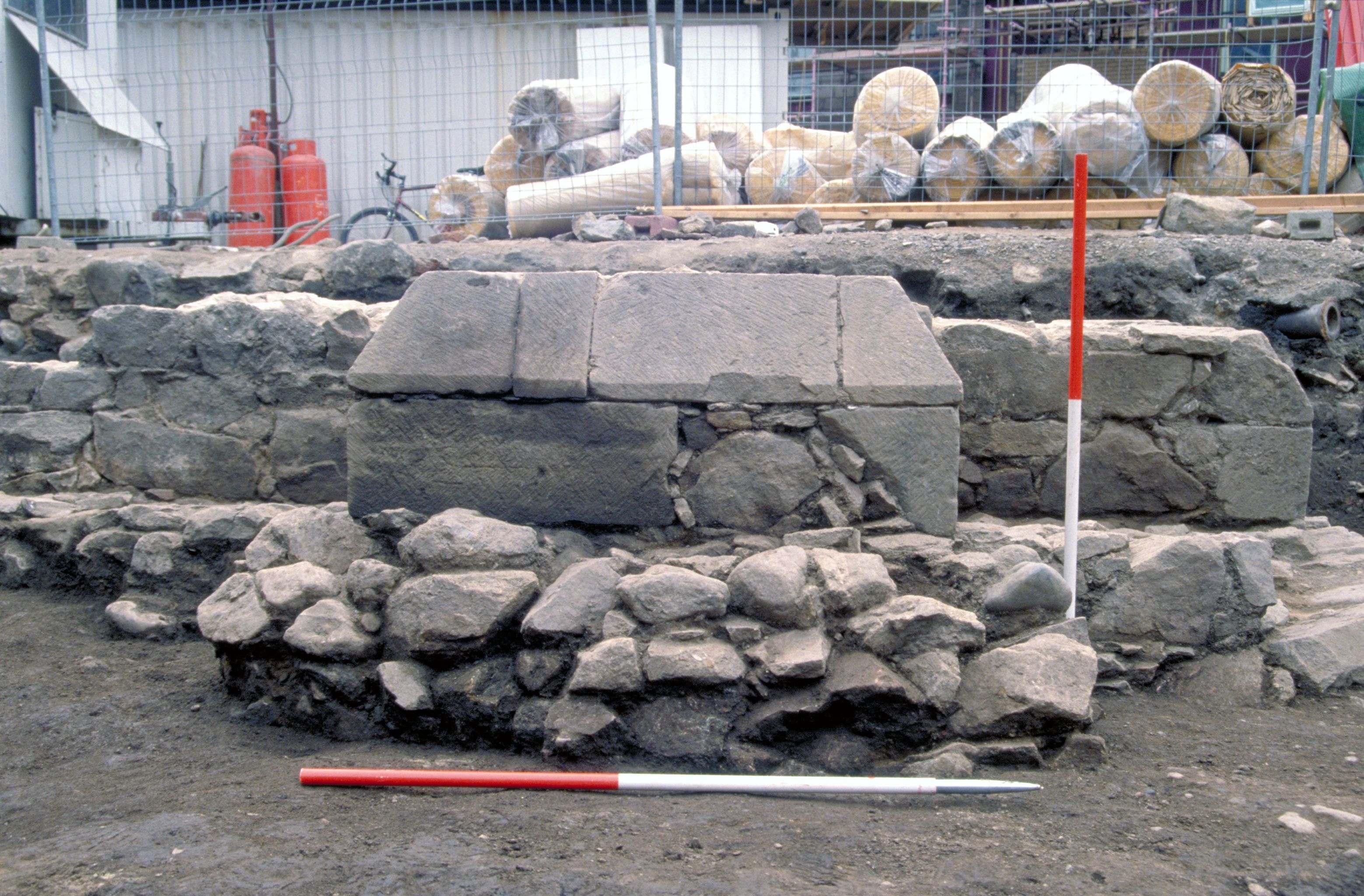
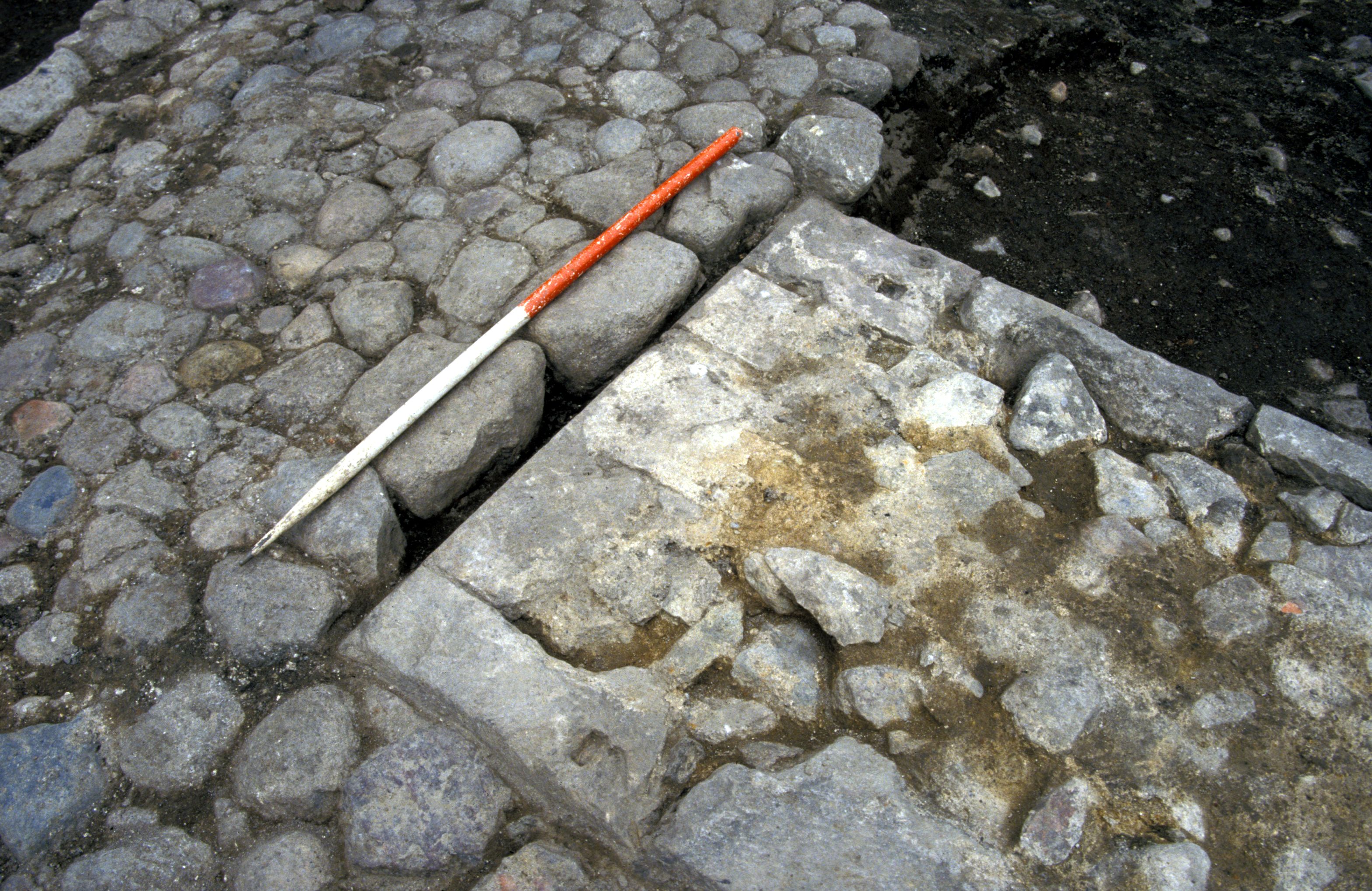
The remains of a door, surviving as a threshold and the lower course of decorated sandstone blocks, AMI [5] and AMH [4] [Photo 0381] survived in the north wall of the church. The Phase 6 external cobbled surfaces [Photo 0460] had covered the stones of the doorway and buttresses [Photo 0451] and they would therefore have been below ground at the Reformation when most of the dressed stone was removed for re-use in other buildings. The stones have been dated stylistically to the late 13th century (Richard Fawcett pers. comm.).
Buttresses
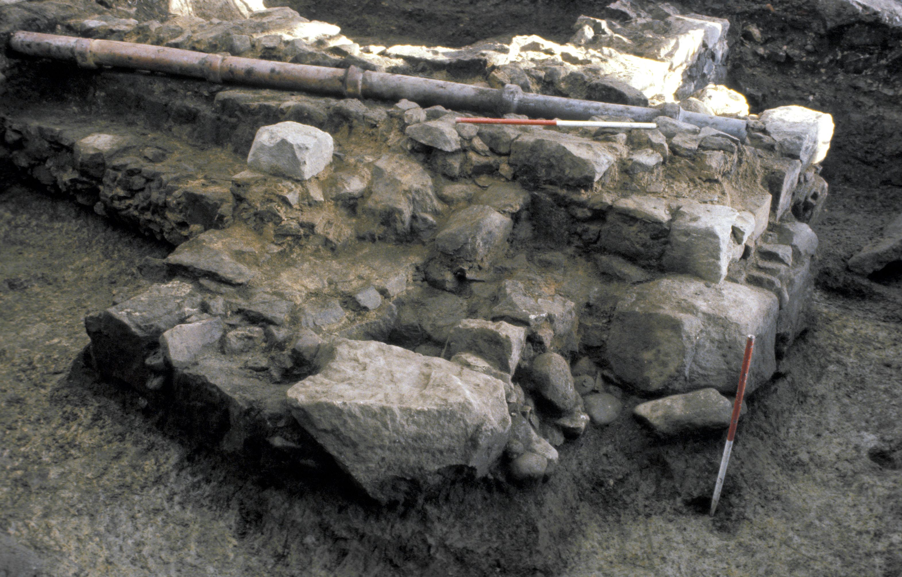
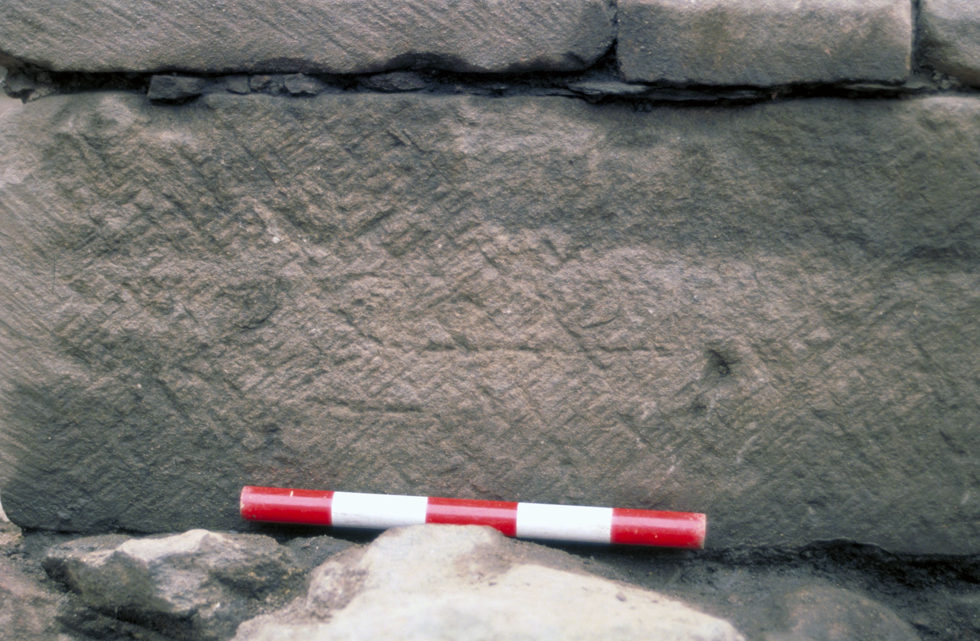
Two pairs of buttresses at the south-west [Photo 0540] and north-west corners [Photo 0385] of the church were faced with worked sandstone from the Cowie Harbour, Stonehaven area (see Section 8.4.2). The sandstone had been intricately worked, sometimes cutting a stone into an L-shape to create a corner stone [Photo 0177]. Two identical masons' marks were found on the north-facing vertical face of the northern arm of the north-west buttress [Photo 0155] and on the west face of the south-west buttress [Photo 0116].
Size of the church
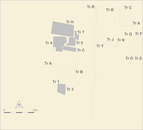
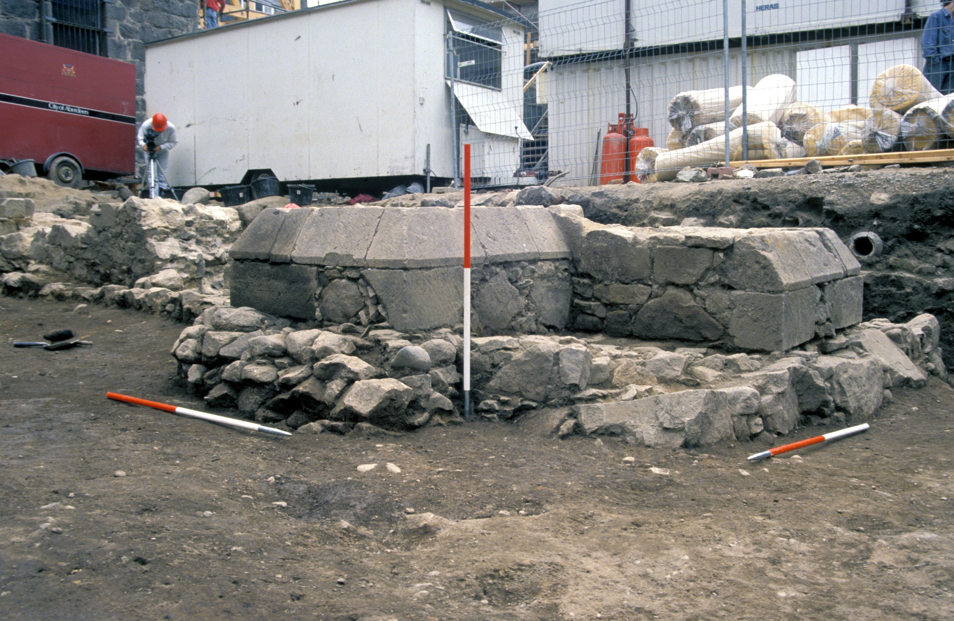
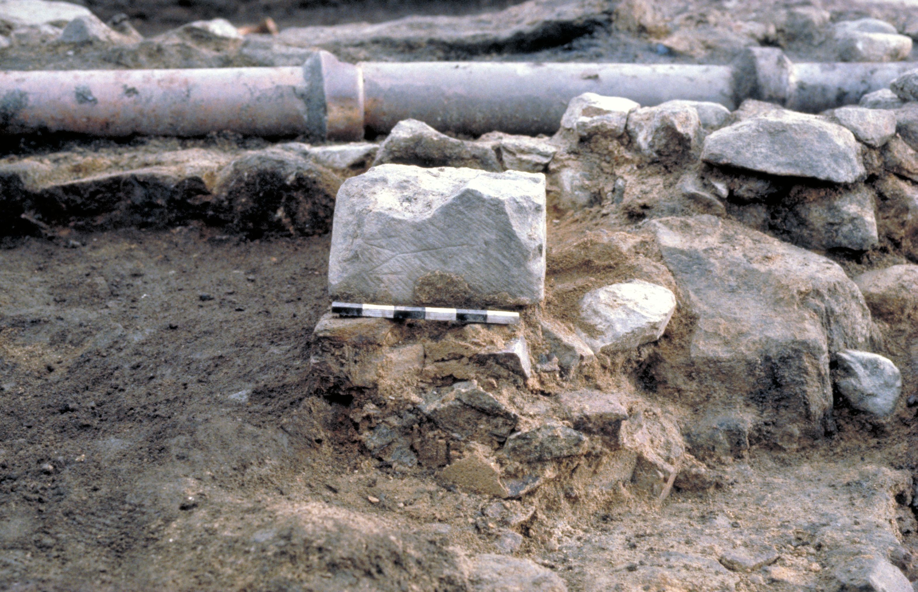
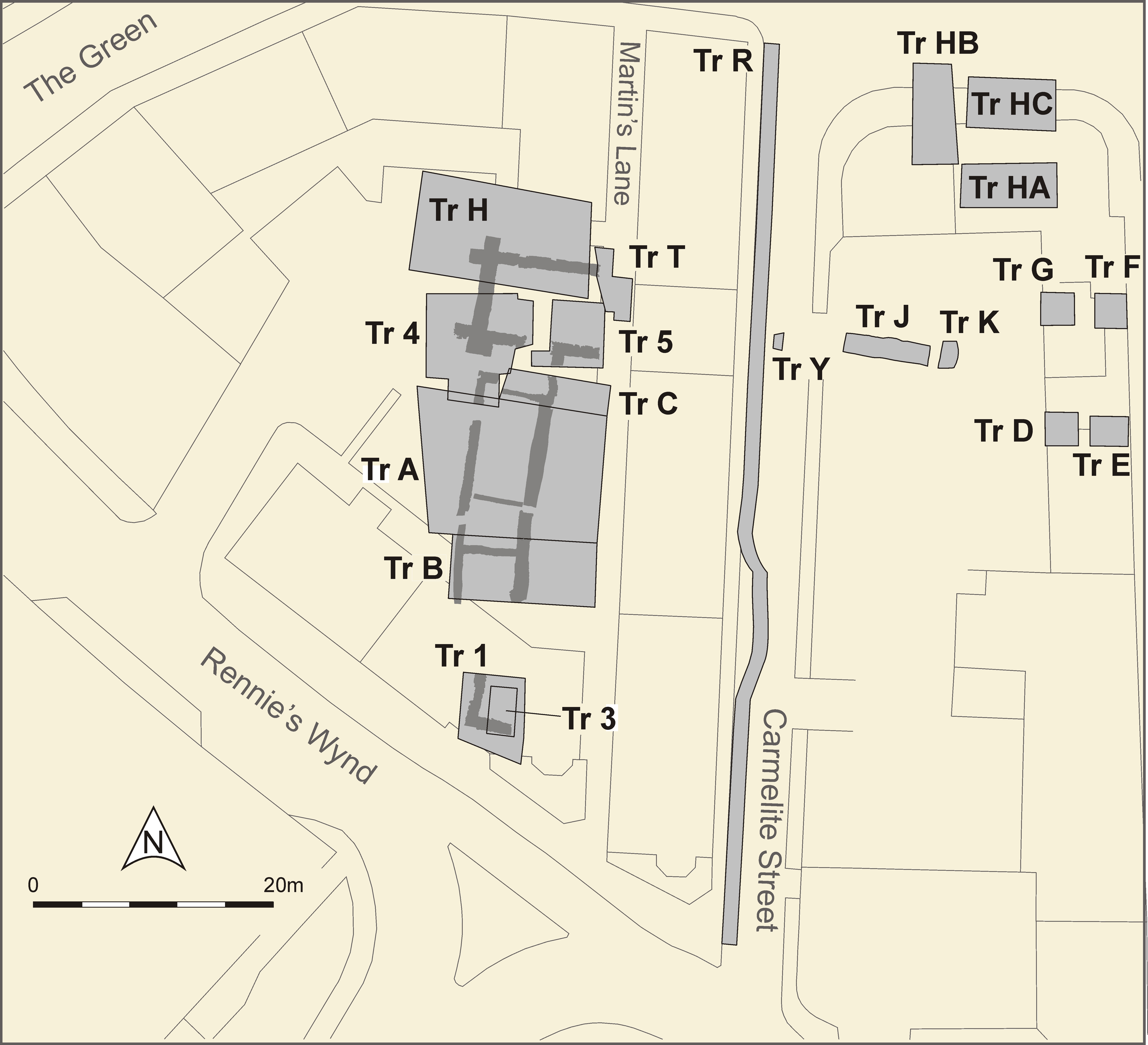
During observation of trenches in Carmelite Street to the east of the excavated site, a substantial stone and mortar wall (AWP [Photo 0134]) was excavated in Trench Y (see Trench location plan). It is possible that this was the east wall of the church, making its internal dimensions 24m in length and 7m wide.
Floors and scarcement
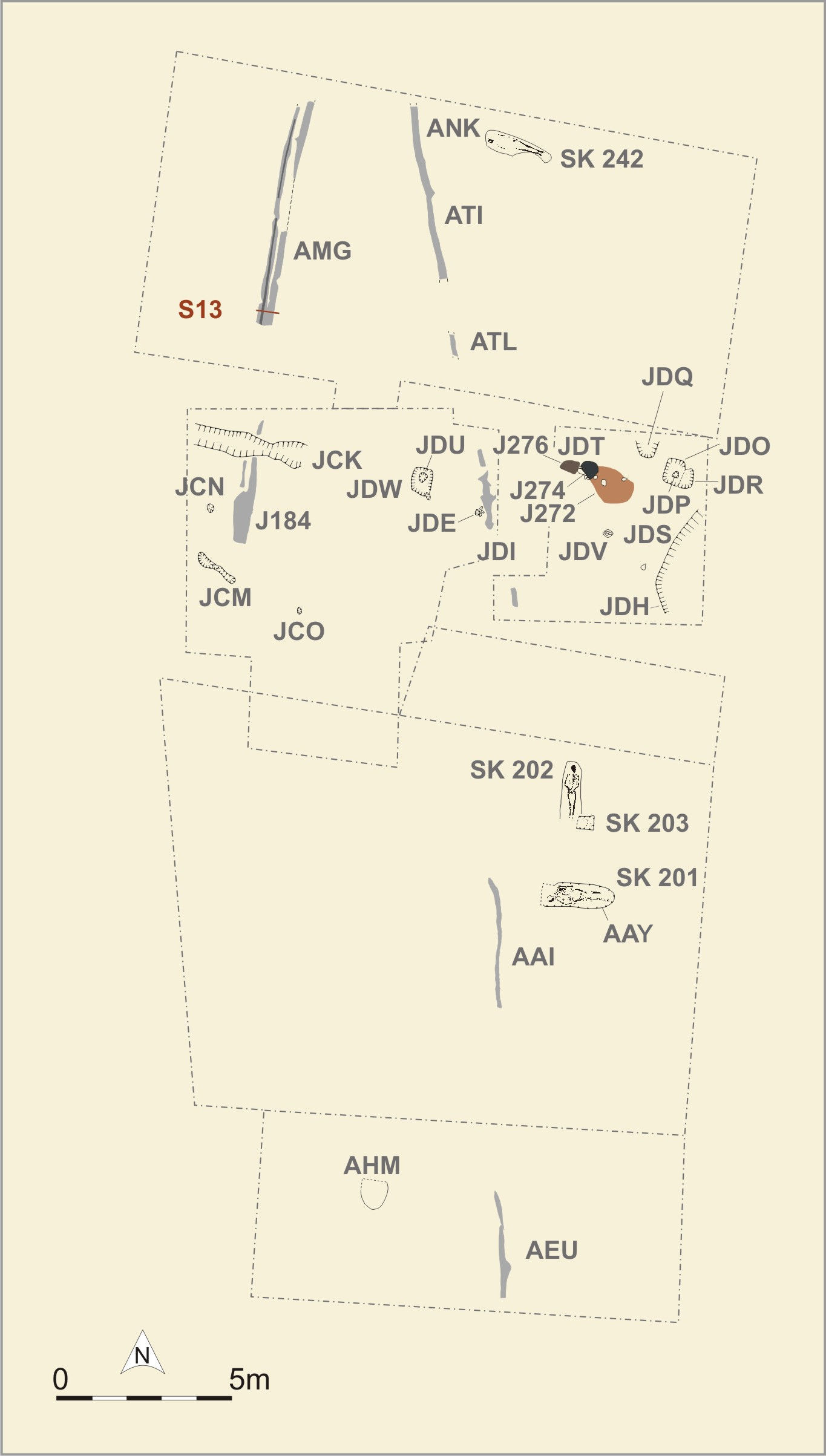
Feature JEO/ATJ [Photo 0178], the internal stepping within the stone church had something of the appearance of a scarcement for supporting a wooden floor, but it is difficult to reconcile that with some other aspects of the building, for example its use as a place of burial. Some of the burials were placed partially or completely over this scarcement, so clearly if it did represent a floor level, then the floor had gone out of use before those burials were made. The floor level rose by c.1.2m during the lifetime of the church.
A cobbled floor, AMV was also laid during this period, but only a very small triangular portion survived as it was disturbed by a large number of grave cuts.
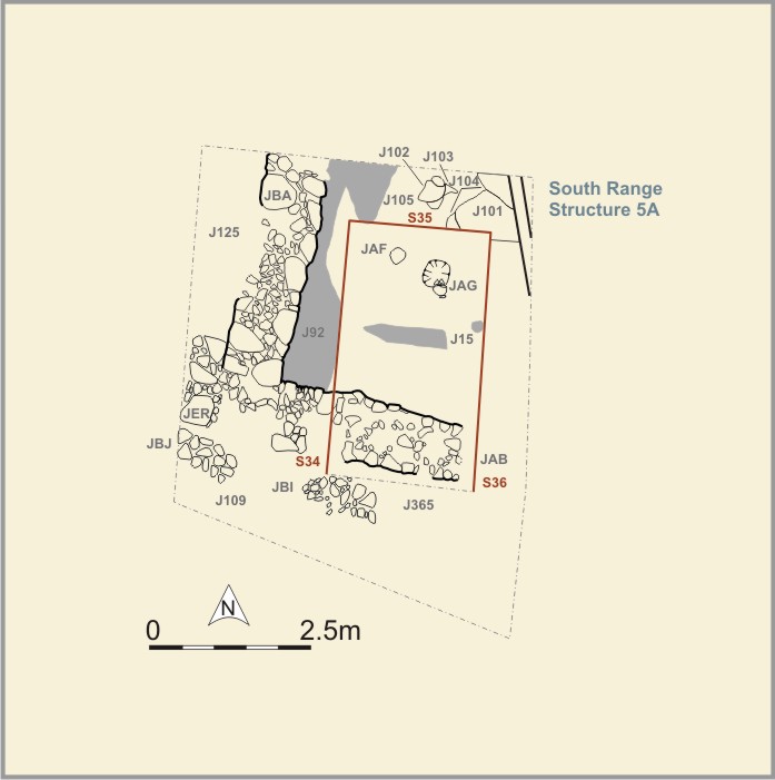
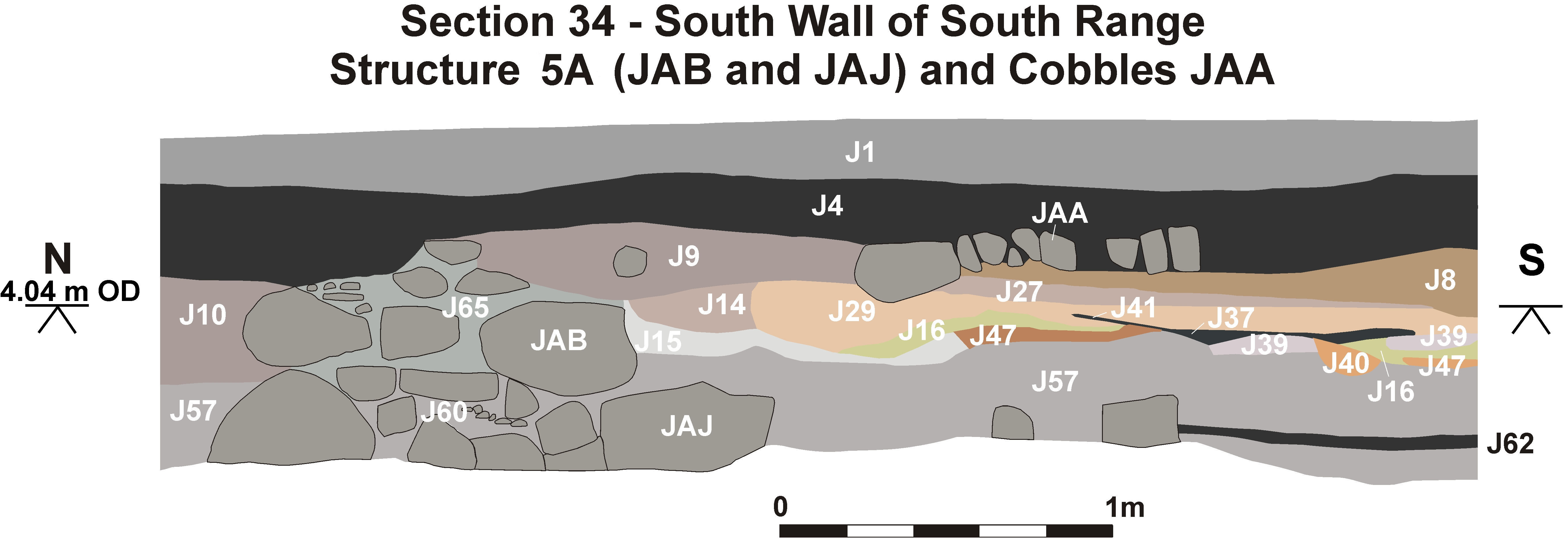
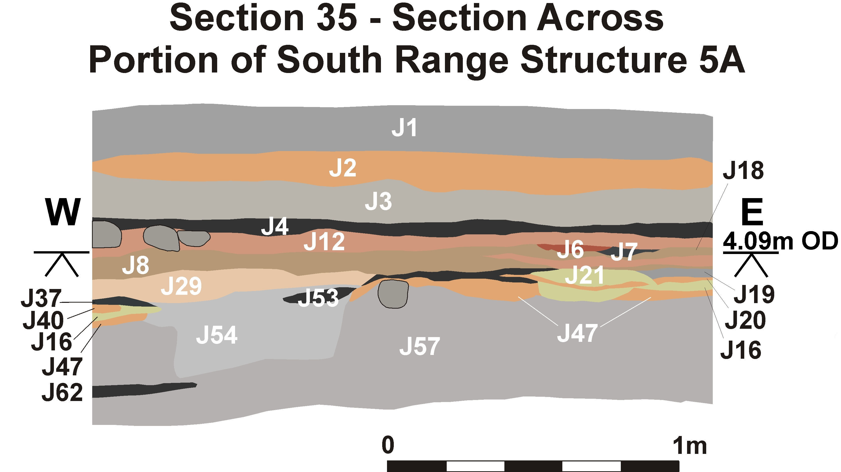
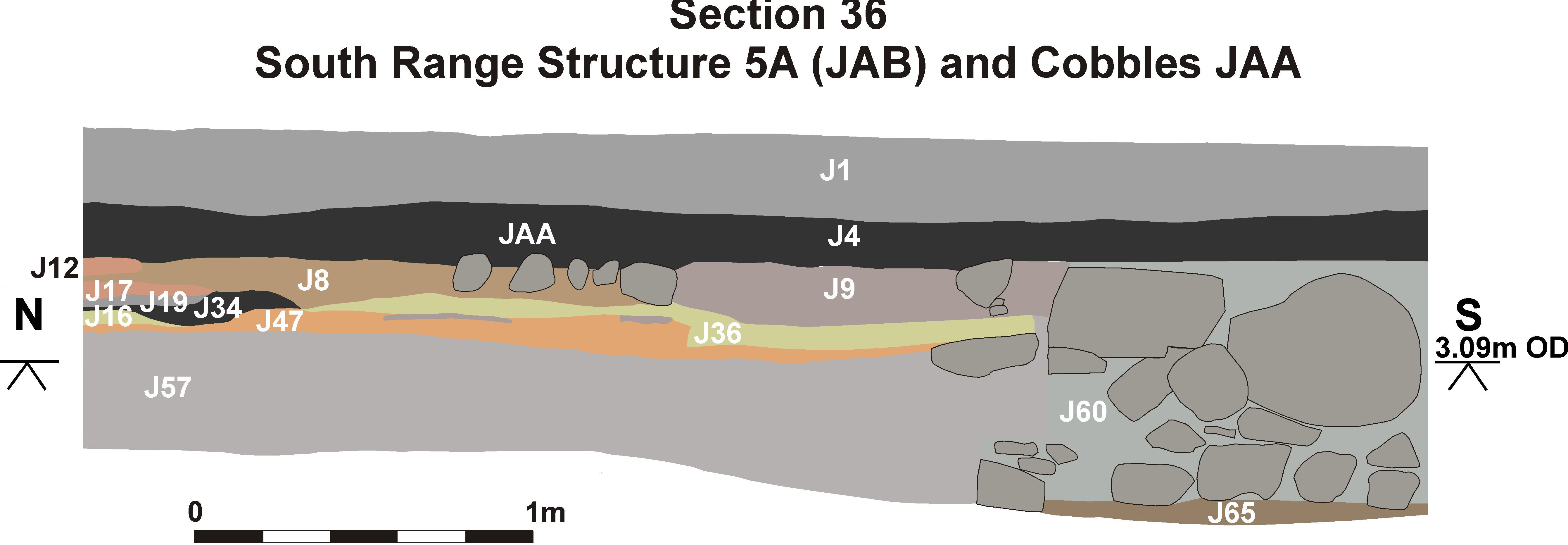
Walls JAB and JBA formed the south-west corner of a building, possibly part of a South Range (Section 35). The walls were similar in size and form to the West Range walls and the church walls, being c.1m thick and bonded with lime mortar (Section 34, Section 36). The foundation trench of JAB contained a cut halfpenny from silver long cross penny of Henry III [1672], 1248-50 but probably lost in the 1250s or 1260s. Layers J15 and J92, both spreads of mortar, appeared to represent remains of floor surfaces within the building, as may J101, a clayey mortar. The presence of the coin might in fact suggest that construction of this building occurred or started in Phase 4, but the similarity of its foundations to the church structure suggests otherwise.
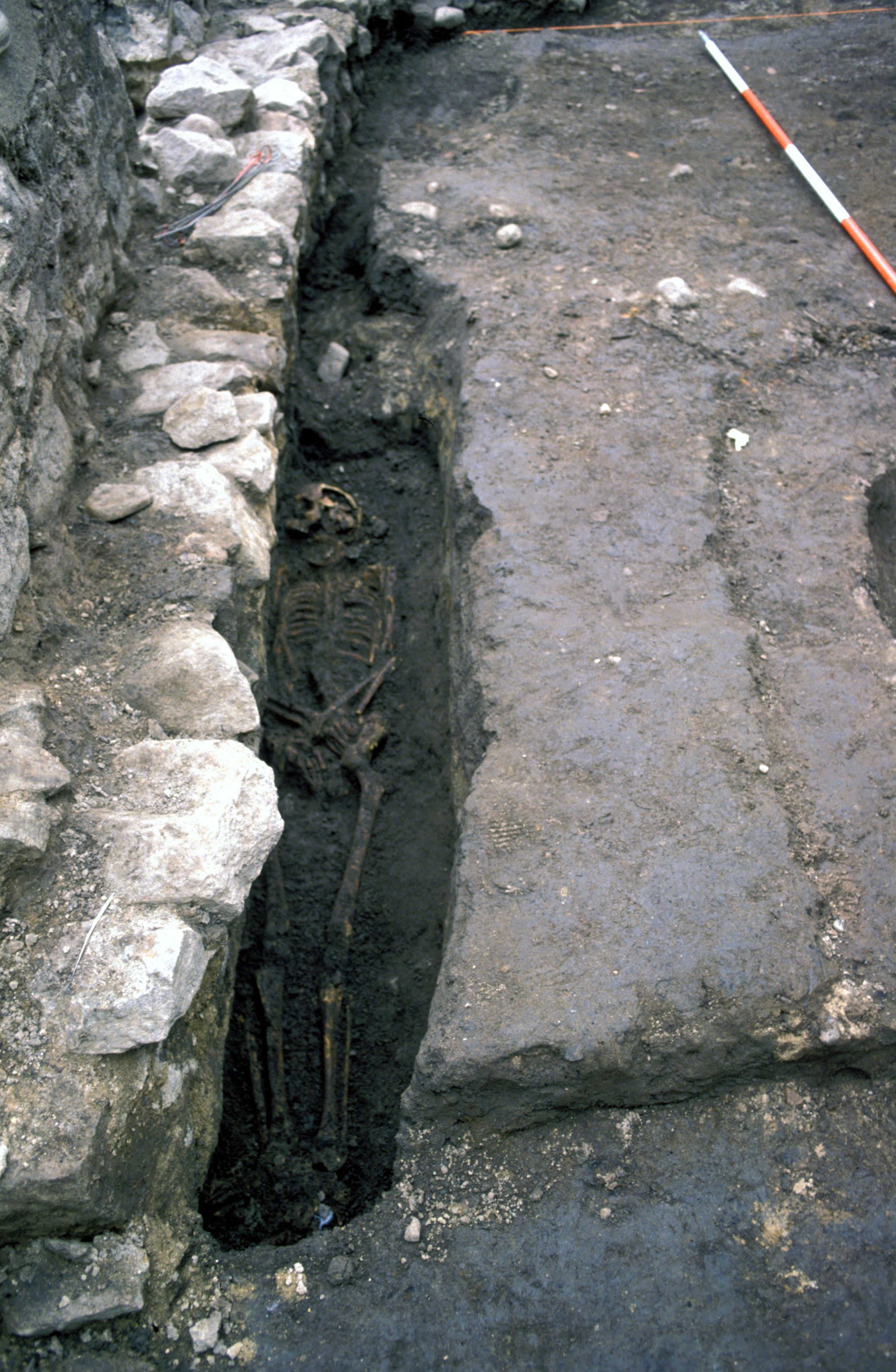
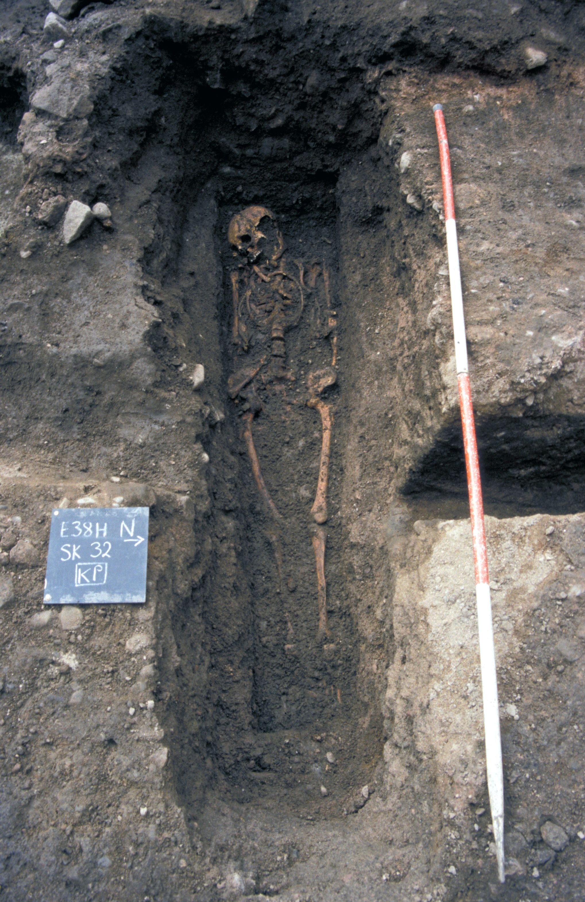
The burial, SK 245 [Photo 0509], of an early middle-aged adult male just north of the church, may have taken place at the same time as the raft for the foundation of the church [Photo 0545] was laid. The grave cut appeared to be contemporary with the foundation of the church (ANU), and the body had slumped underneath the raft. Three nails were found in the fill but there is no evidence that this burial was in a coffin.
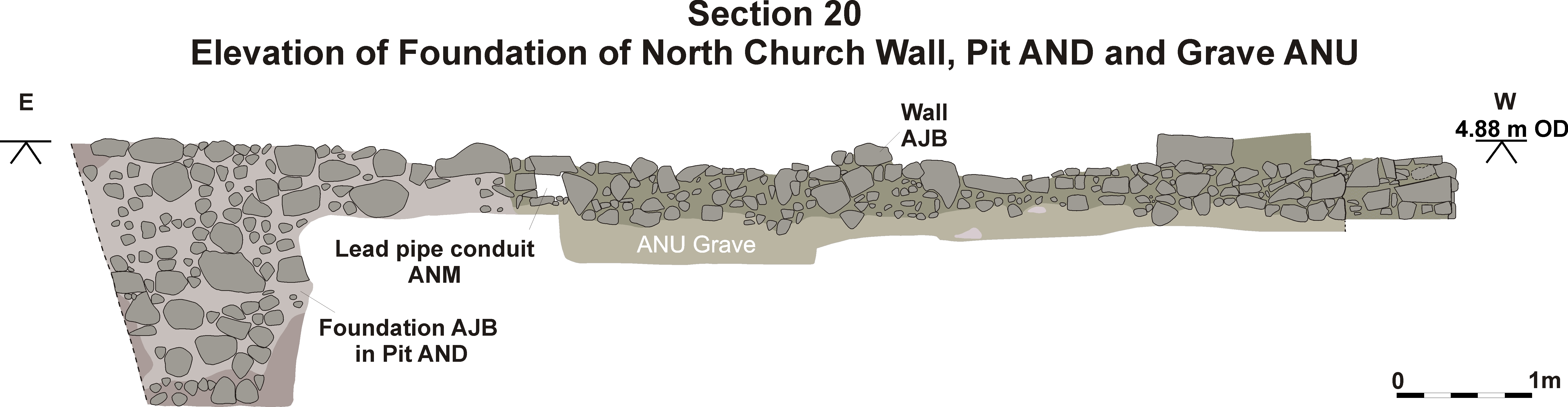
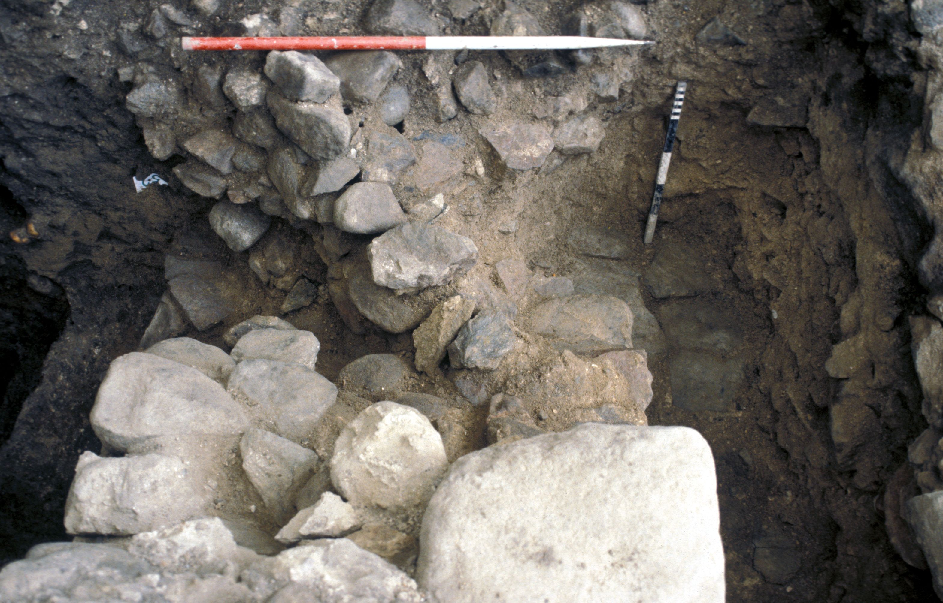
Pit AND was probably dug as part of the construction of the friary church. It was 2.23m deep and was filled with clays and loams. Fragments of wood, very decayed oak planks [Photo 0169] and bark (Section 9.3) survived in the bottom fill (A1138) in a layer which had the appearance of very decayed organic matter such as peat or midden with charred roots and twigs which may have originated in burnt peat or turves (Section 9.3) and uncharred heather shoots and extremely decayed Sphagnum shoots. Mammal and fish bone, the latter in some quantity, sphagnum moss and some faecal concretions were found in layers A863 and A864 suggesting that there was an element of cess incorporated in the pit fill. The layer also contained fragments of wood, bark, peat, beetles and fly puparia suggesting that the pit was also used for more general rubbish.
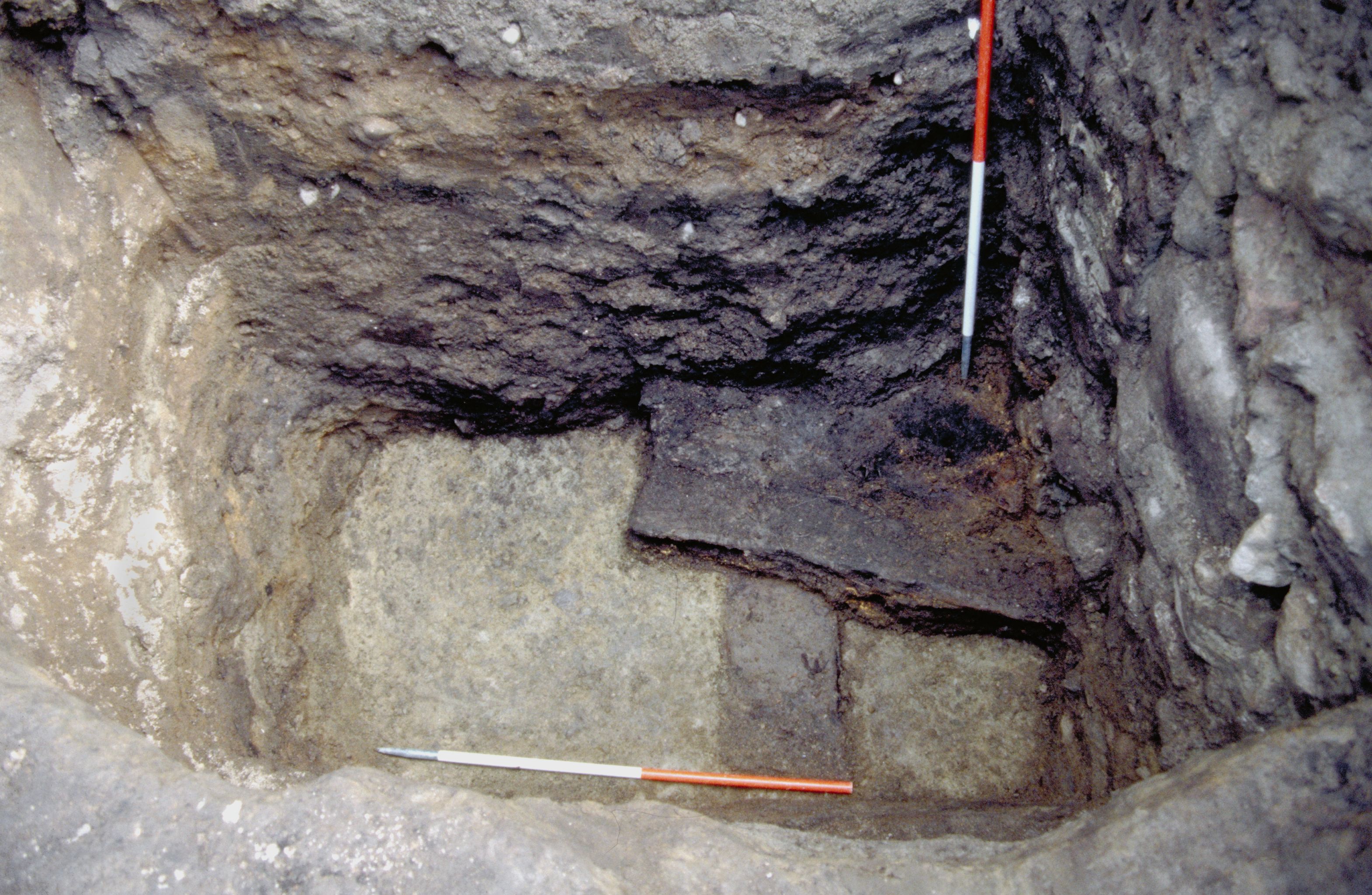
The foundation of wall AJB at this point was over 2m deep [Photo 0172]. If this pit is, indeed, contemporary with the construction of the stone church, several possible interpretations are possible. It has been considered that the church may have had a tower in this position which would have needed substantial foundations. Towers were often cause for concern in medieval friaries: at Fountains Abbey, an attempt to construct a tower over the crossing resulted in its collapse (Greene 1992, 104). Even though the foundations of the Aberdeen church were 2m deep at this point, it would still seem unlikely that they were substantial enough to support a tower.
The fish recovered from this pit included grey gurnard, a tasty offshore fish common on sandy bottoms all around northern Europe (Wheeler 1978) and thornback rays, a valuable food fish often marketed today as skate (Section 9.2.2). The pit also contained the skull of a cat with three parallel knife cuts (Section 9.1.7) just behind the orbit of the eye, indicating that the cat had been carefully skinned for its fur. Other finds from this pit included a buckle plate riveted around leather [868].
ANW was a shallow pit filled with burnt clays and sands. There was no burning in situ and it is not known for what purpose it was dug, but it was ultimately used to dispose of burnt material.
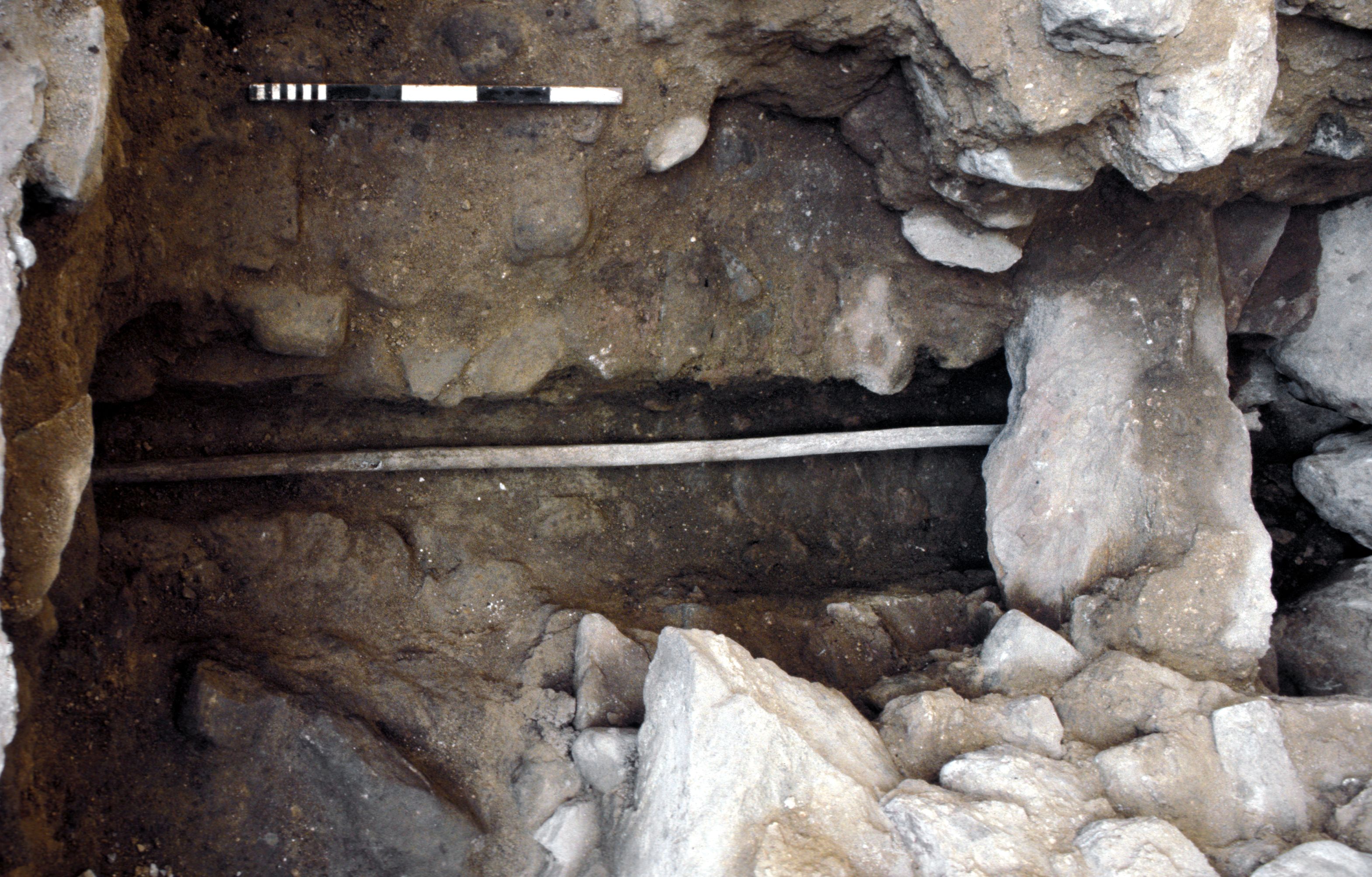
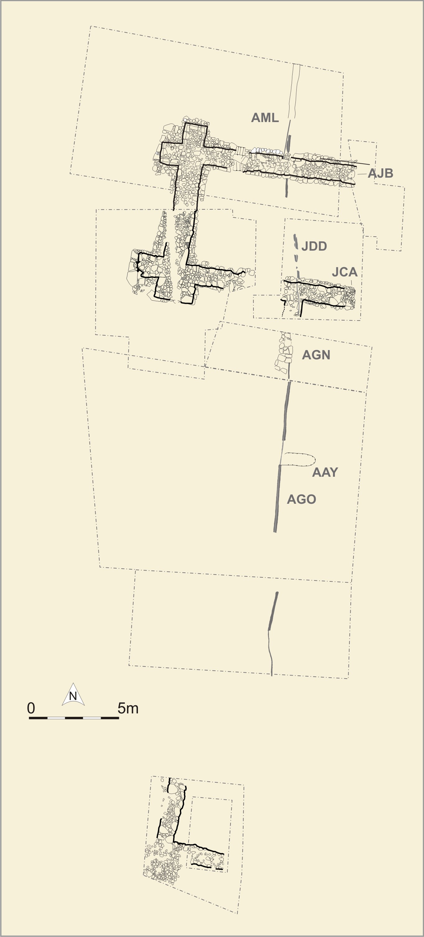
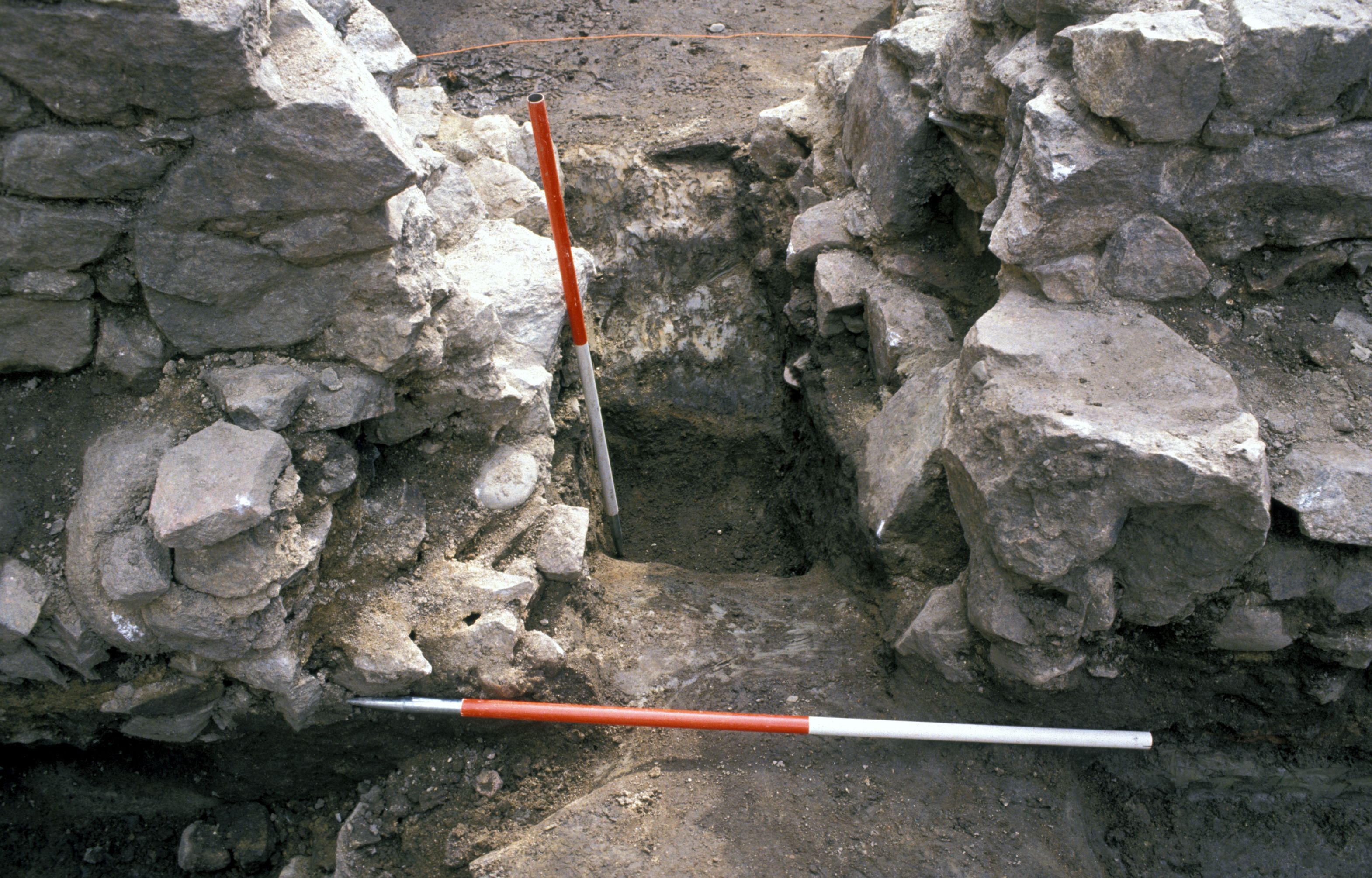
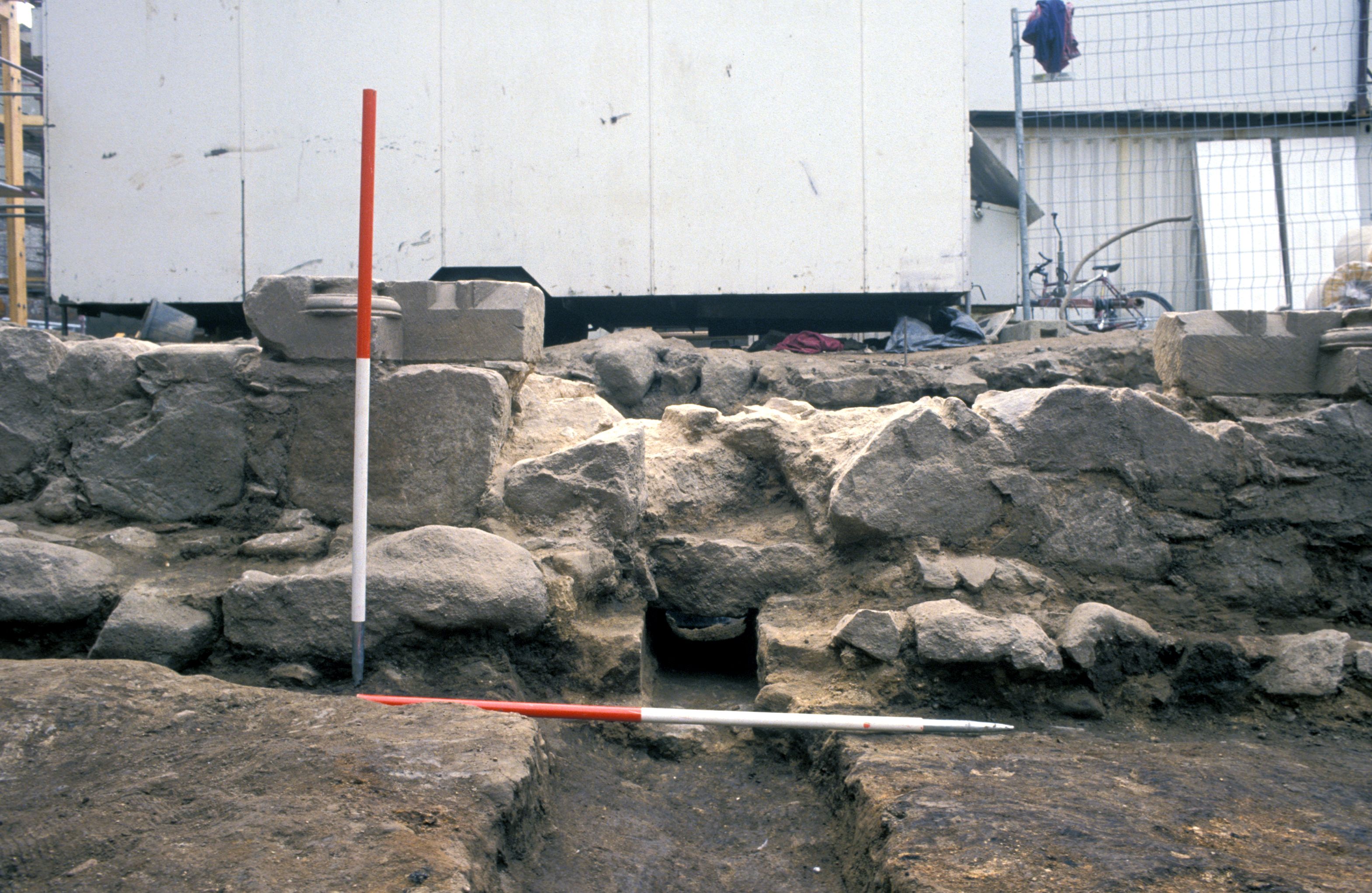
A water supply was installed in the early stages of this phase. It consisted of a lead pipe set in clay (AML and JDD and was excavated over nearly all of the north-south length of the excavated trenches. The lead pipe survived in situ for much of its length, particularly where it was set in garden soil along the east side of the West Range buildings. The pipe had sunk into Phase 4 grave cut AAY where it had become flattened and broken. Where it passed through walls AGN, AJB [Photo 0246] and JCA [Photo 0539], the pipe had been set into well-constructed culverts [Photo 0090] to protect the soft lead and allow the water to flow freely. North of the church it lay in a shallow trench [Photo 0247] with no clay packing evident.
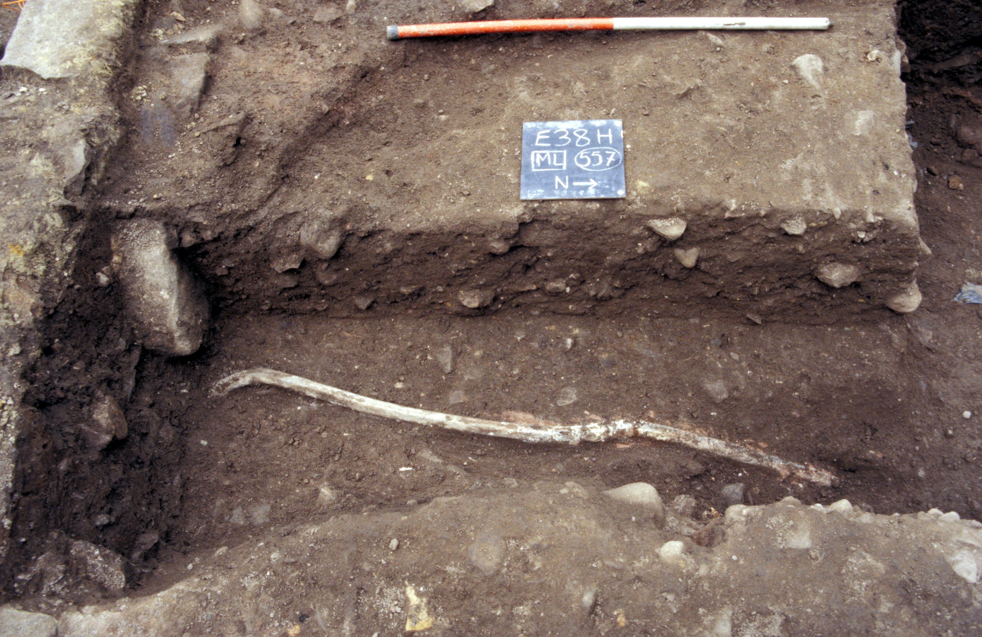
Much of this pipe had been removed, however, prior to a number of the burials taking place within the church and it is difficult to reconcile the elaborate construction of the conduits for the pipe through the walls of the church, with its early removal. The most northerly portions of the pipe, which at that point was set into a trench (AML) had also been removed [Photo 0258] in Phase 6 during the burials SK 232 (AKP) [Photo 0234] and SK 230 (AMP) and a robber trench was identified (AKR) for this removal.
Linear stone feature AKY was an area of roughly laid stones which was constructed at the same time as the stone raft for the church. It was not filling a hollow in the ground and did not appear flat enough for a path.
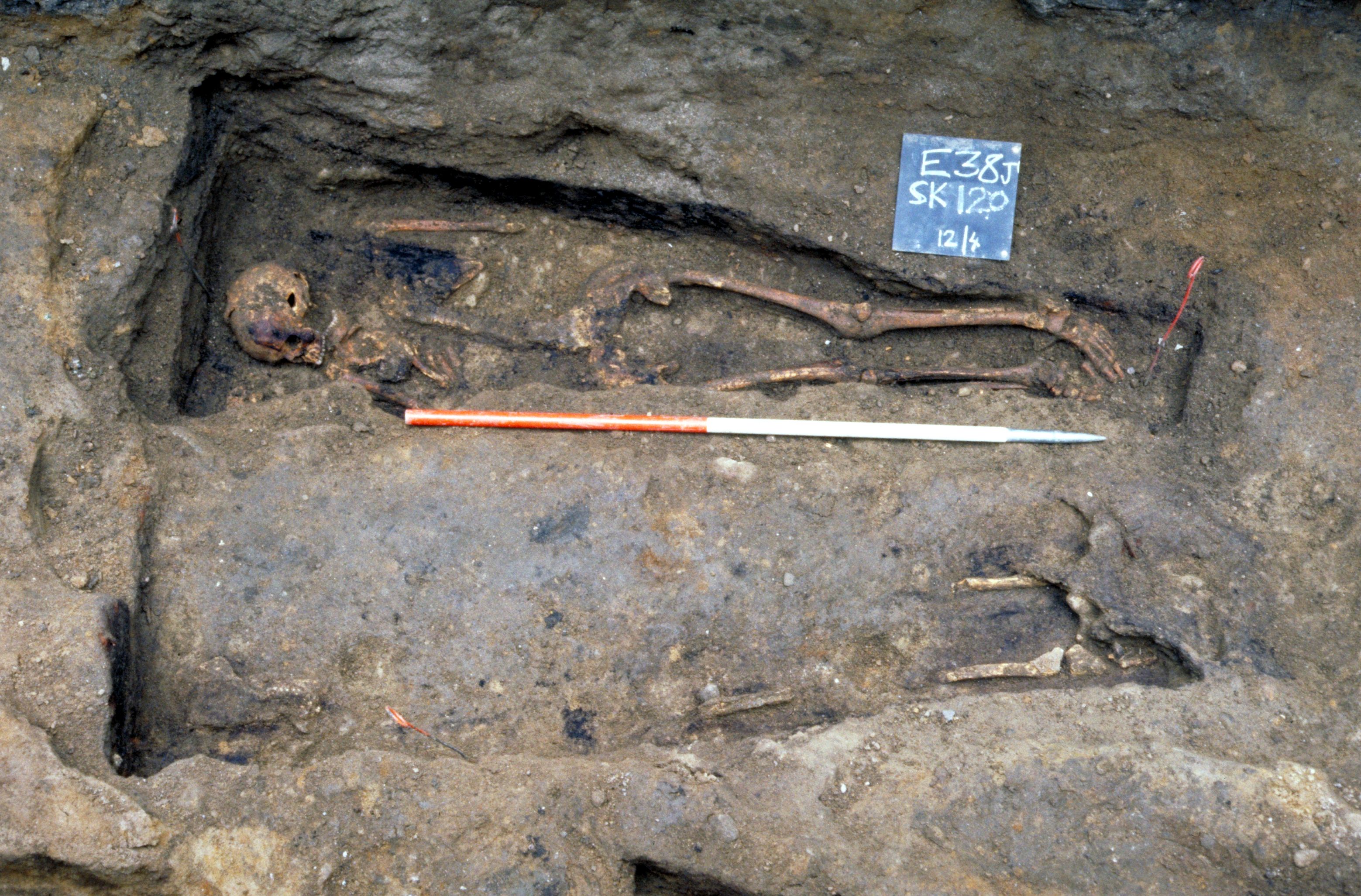
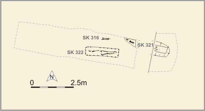
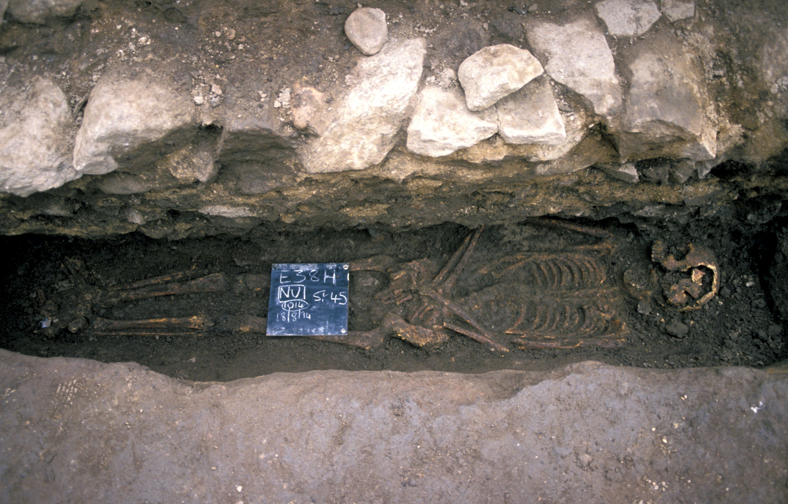
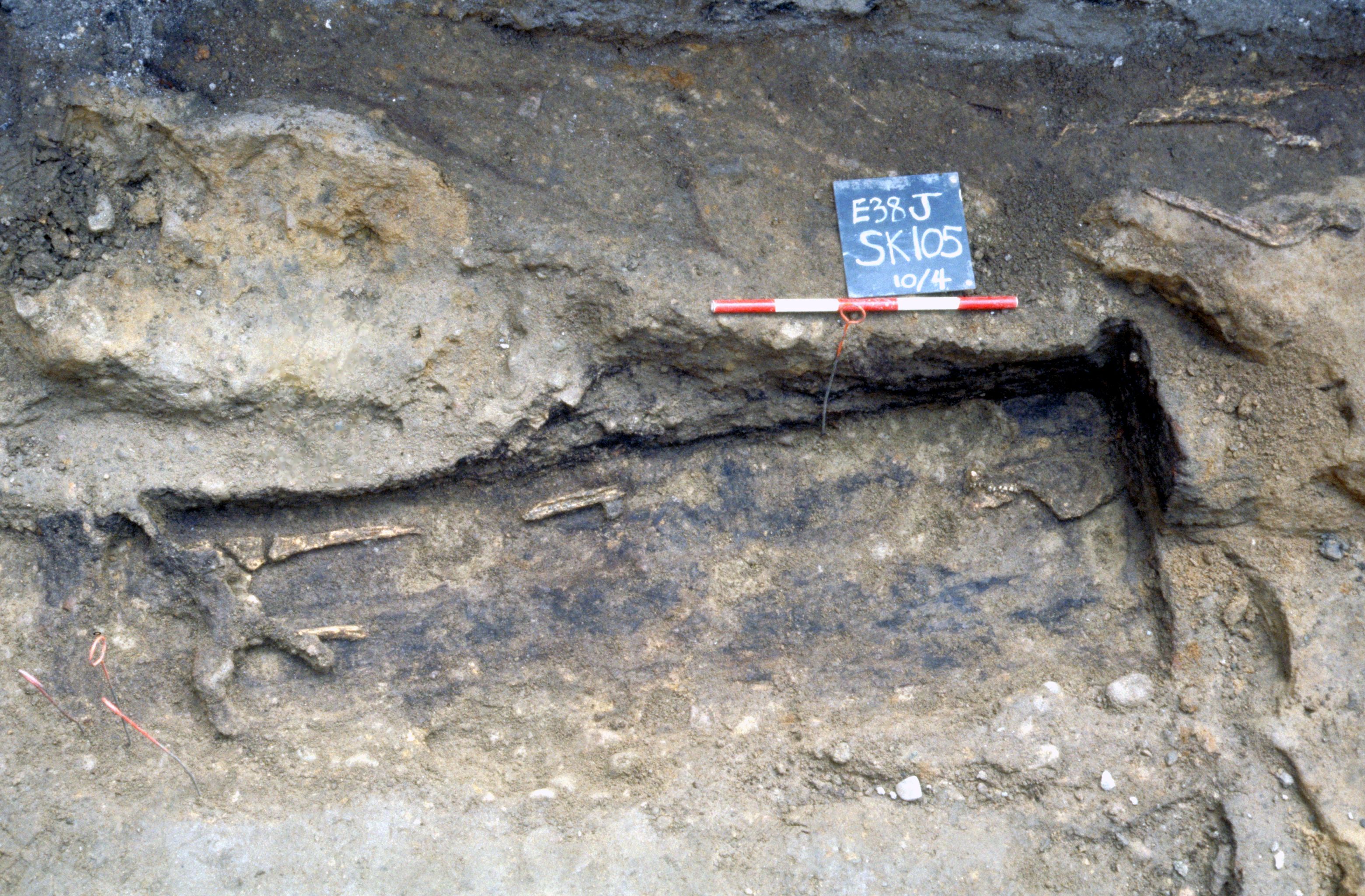
A service trench (J/K) (see Trench location plan) to the east of Carmelite Street revealed a number of graves. Due to the discovery of wall AWP , it is thought that this area was the graveyard. Wooden coffins (e.g. SK 322 AUY]) [Photo 0143] were better preserved in this area than anywhere else on the site, although it was not possible to lift any of the 'wood', which remained only as staining in the ground [Photo 0142]. The outline of coffins could be seen in several graves, for example SK 312=321 AUQ [Photo 0394].
Ground radar survey
This survey was carried out in the area surrounding the trench excavated in the 'graveyard' area. The survey did not reveal any features of medieval date and it would appear that this area had not supported a friary building. It was not possible to determine whether other graves were present in the survey area, but small anomalies in the survey results may suggest minor soil disturbance of the type associated with grave-digging.
Garden soil accumulated in this area during this phase and it was probably a garden or cultivated area until Phase 6 when a courtyard was laid over much of it. A fragment of vessel glass [1514] was found in this garden soil.
Internet Archaeology is an open access journal based in the Department of Archaeology, University of York. Except where otherwise noted, content from this work may be used under the terms of the Creative Commons Attribution 3.0 (CC BY) Unported licence, which permits unrestricted use, distribution, and reproduction in any medium, provided that attribution to the author(s), the title of the work, the Internet Archaeology journal and the relevant URL/DOI are given.
Terms and Conditions | Legal Statements | Privacy Policy | Cookies Policy | Citing Internet Archaeology
Internet Archaeology content is preserved for the long term with the Archaeology Data Service. Help sustain and support open access publication by donating to our Open Access Archaeology Fund.