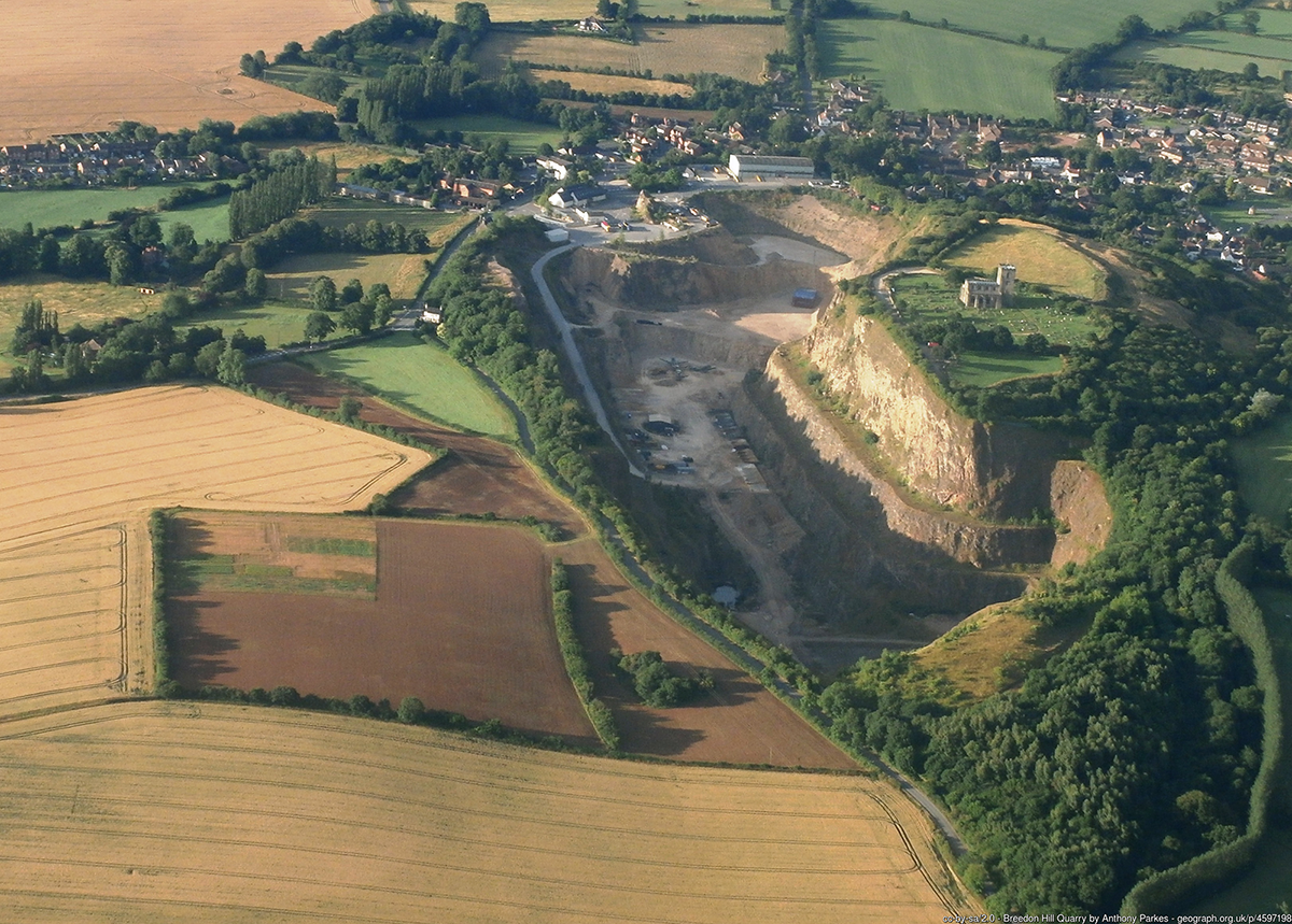
Figure 1: Breedon Hill from the air looking southward. (Taken from http://www.geograph.org.uk/p/4597198 ©Anthony Parkes (2015) and licensed for reuse under CC BY-SA 2.0)
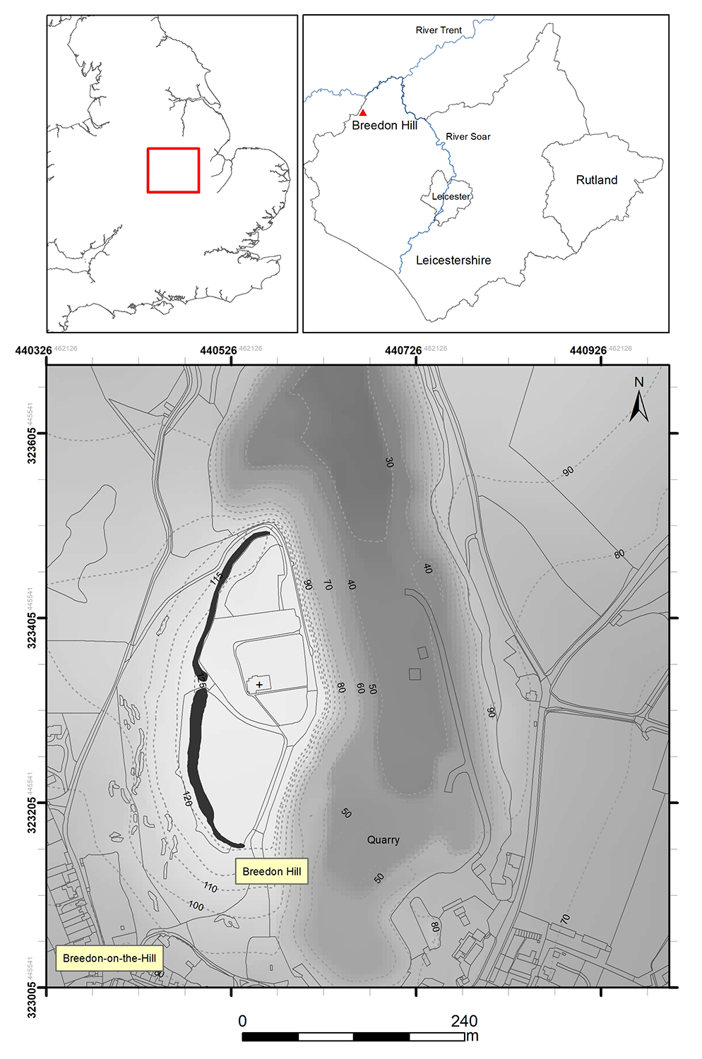
Figure 2: Breedon Hill in its local and regional context
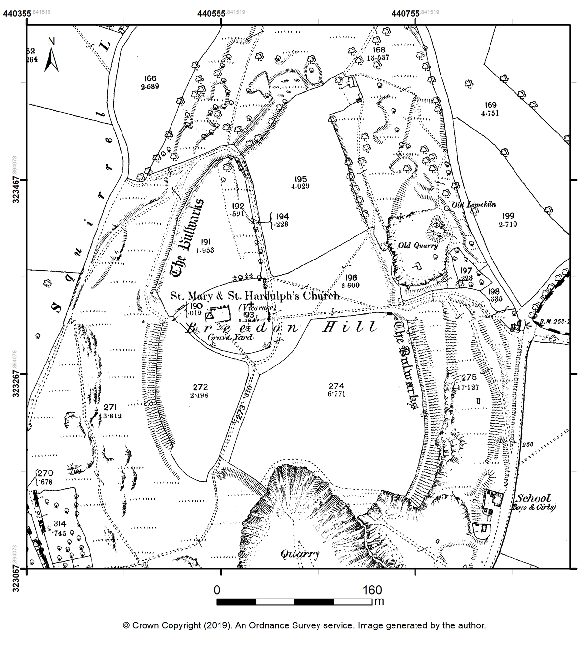
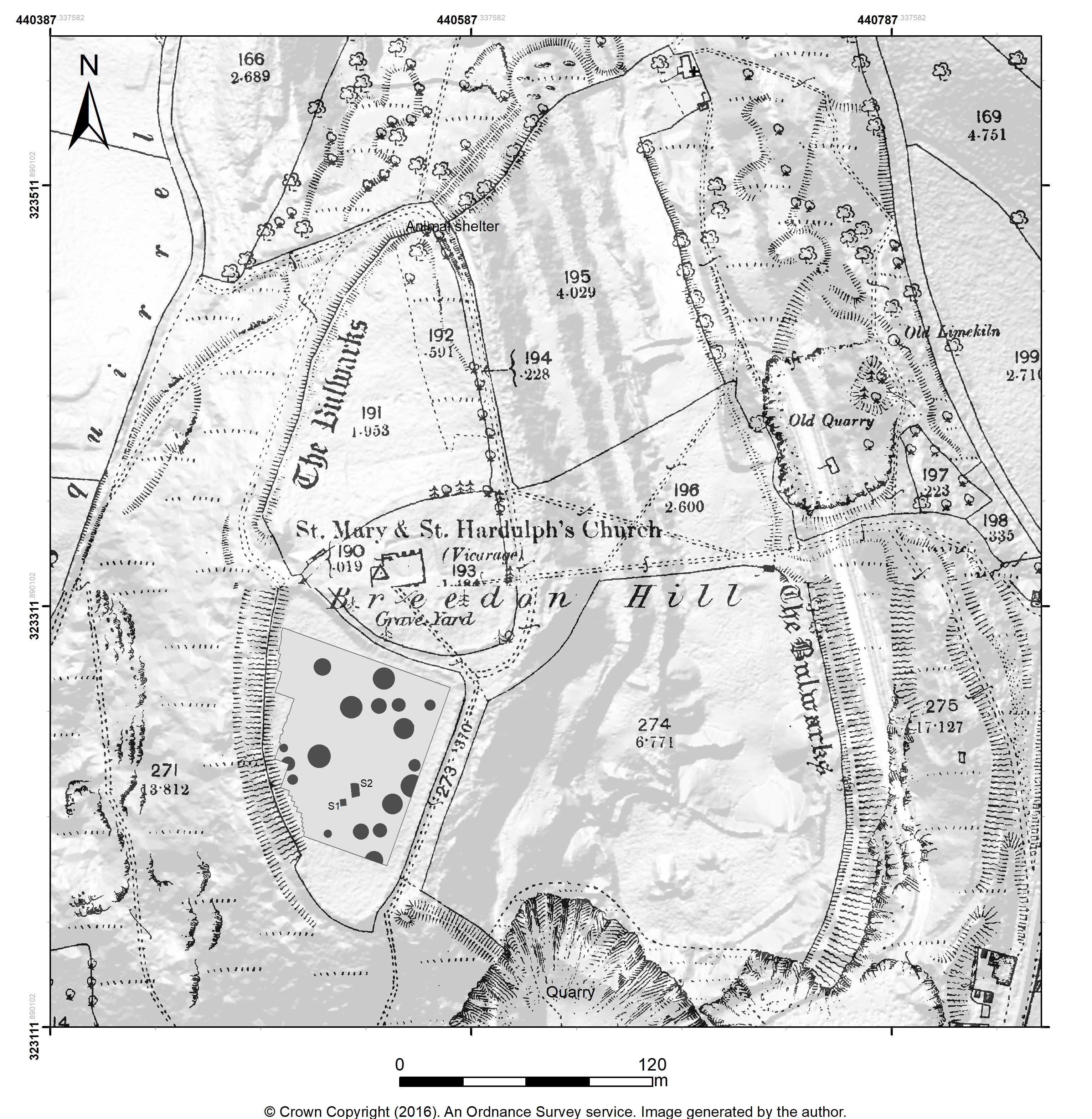
Figure 3:Ordnance Survey 1:2500 plan of the hilltop published in 1882 (surveyed 1881) showing something of the character of the eastern earthworks and the extent of quarrying in the late 19th century
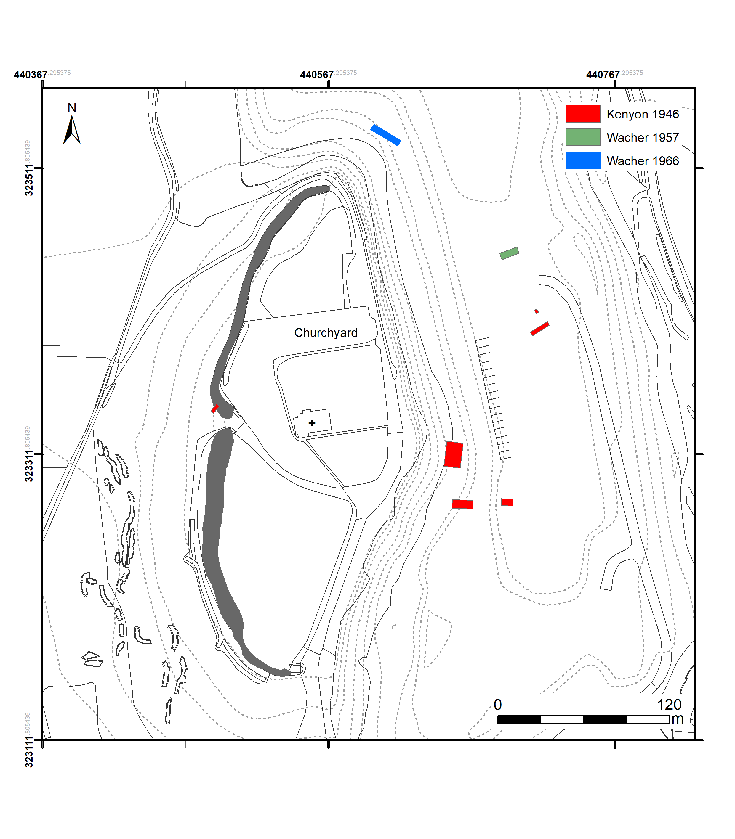
Figure 4: Locations of the previous mapped excavations in relation to the rampart bank
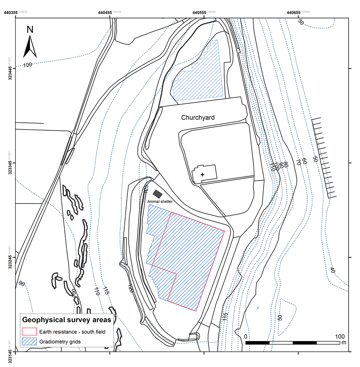
Figure 5: Locations of the geophysical survey areas at the hilltop
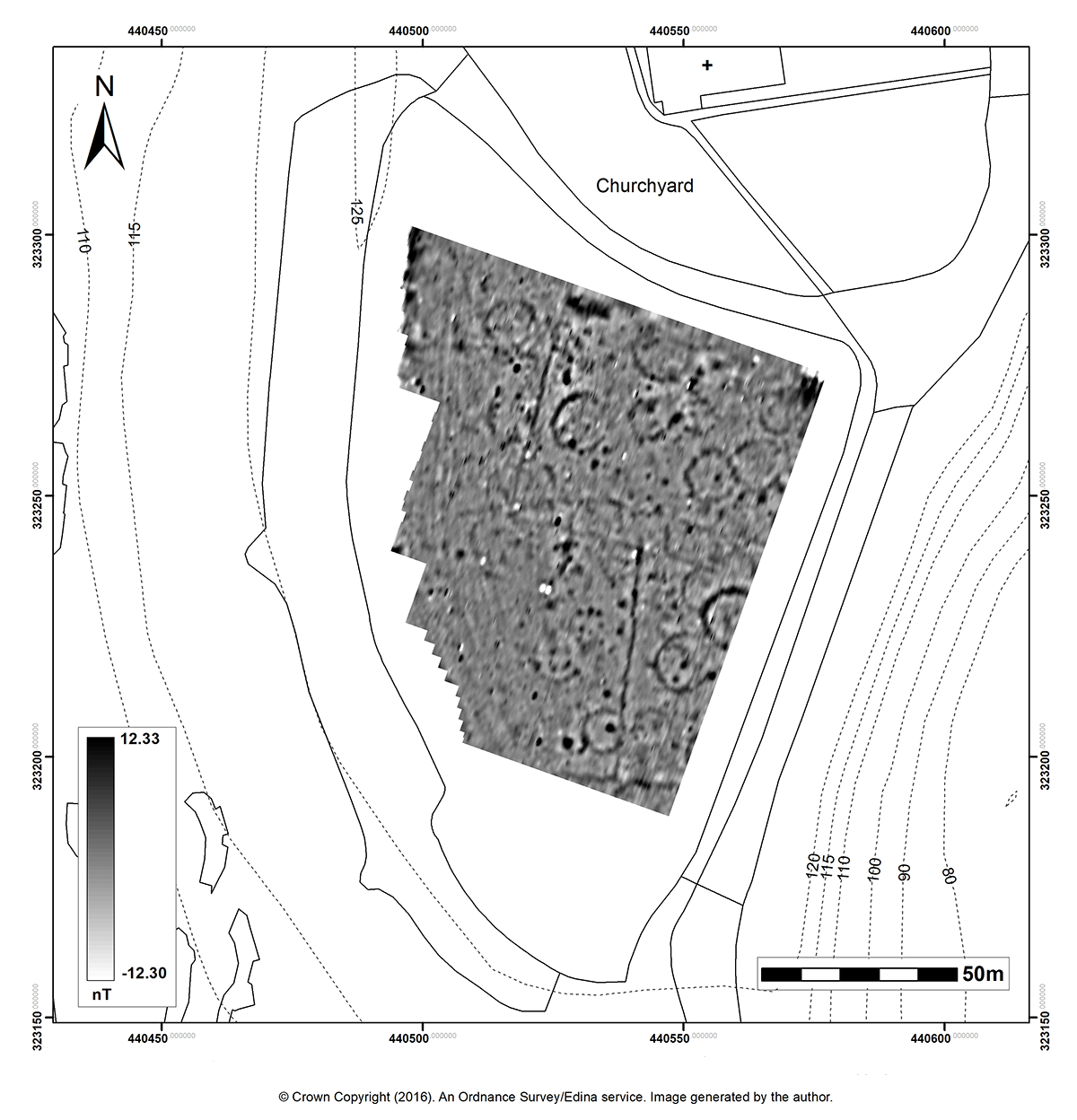
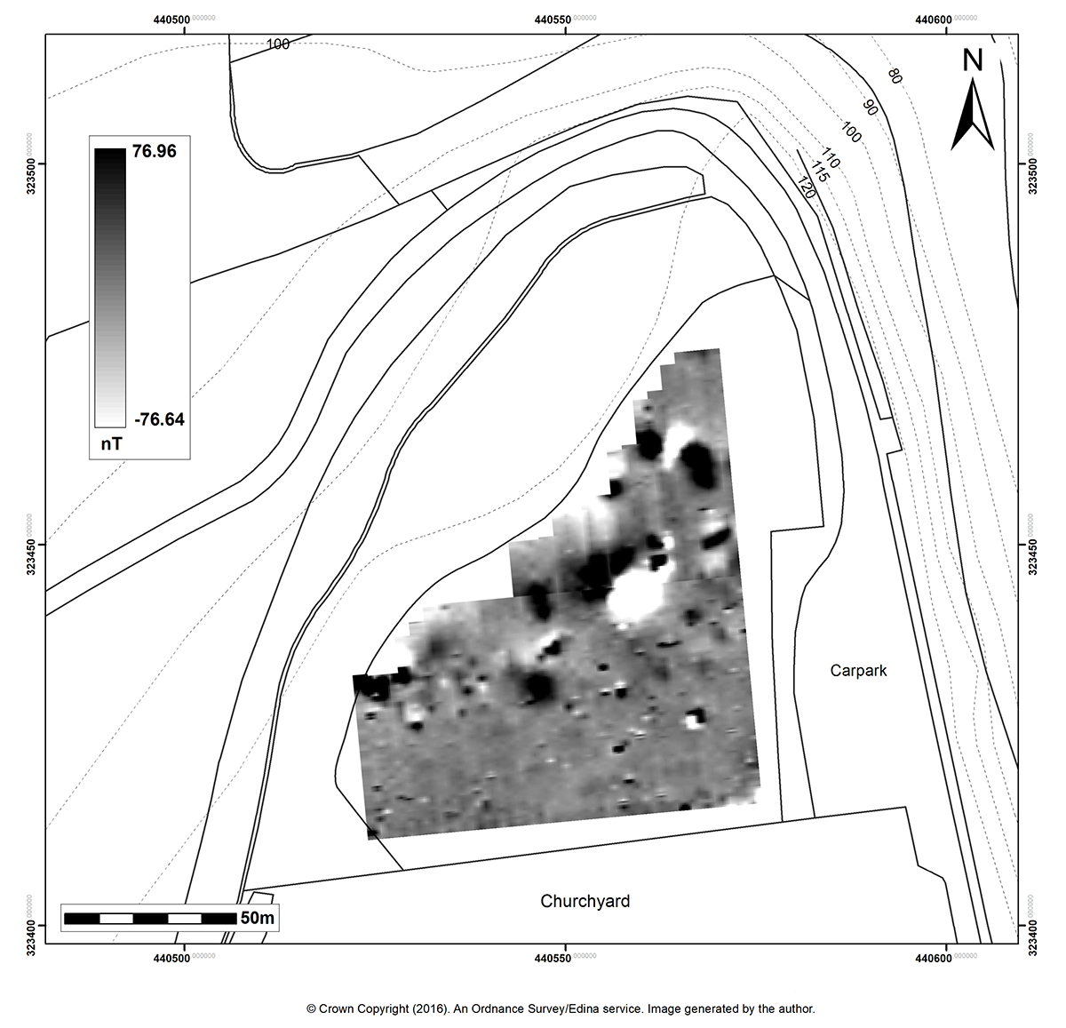
Figure 6: Results of Fluxgate gradiometer survey in the south field
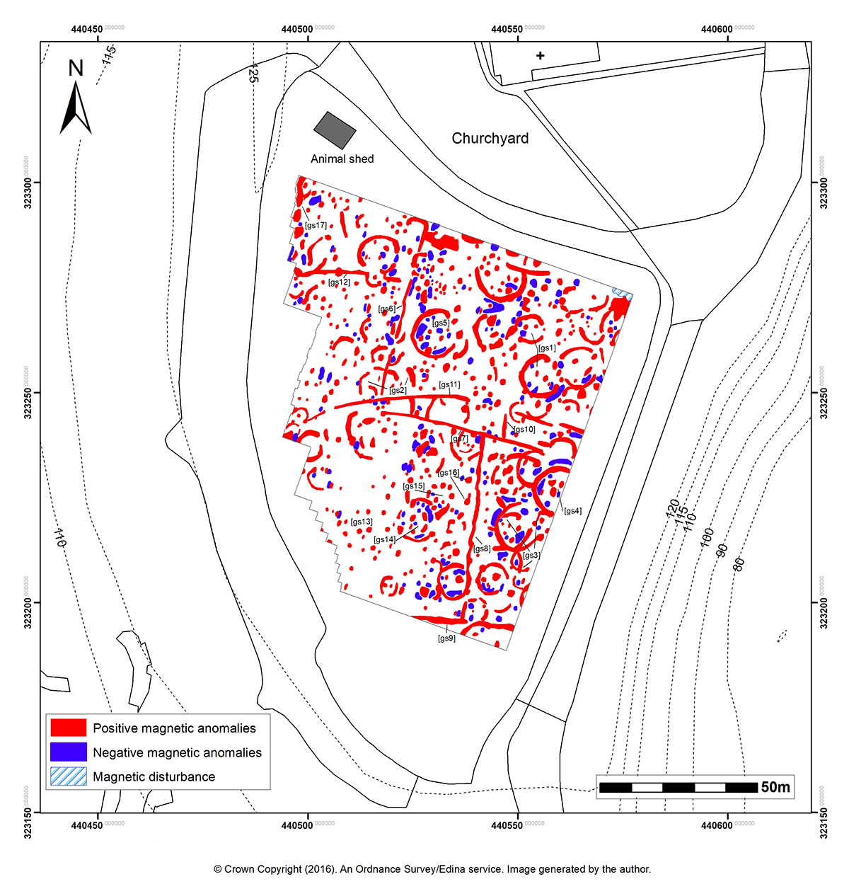
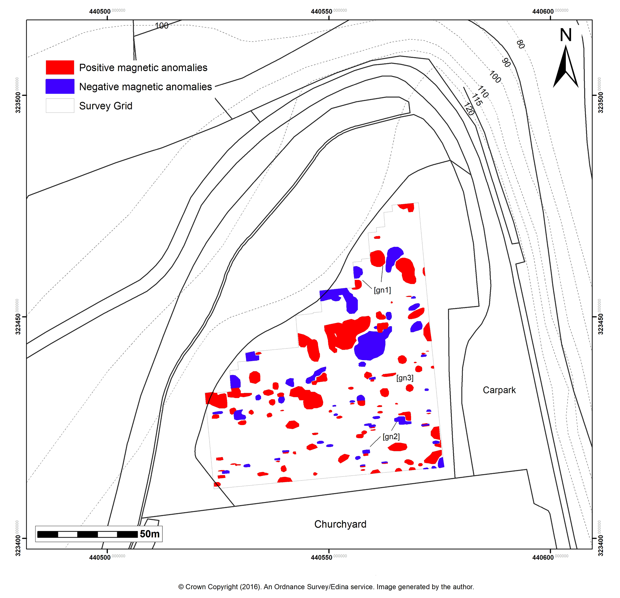
Figure 7: Graphical summary of Fluxgate gradiometer survey in the south field
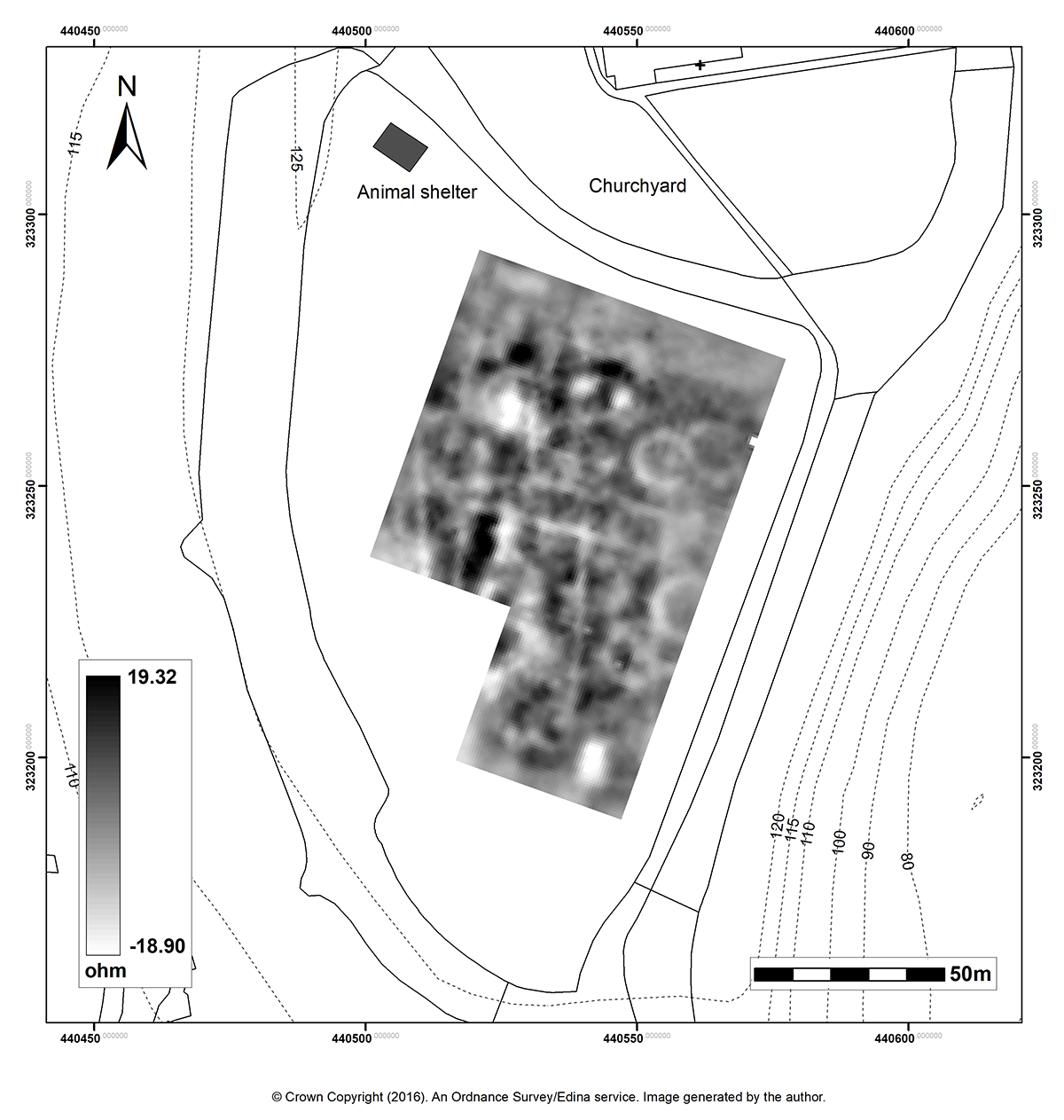
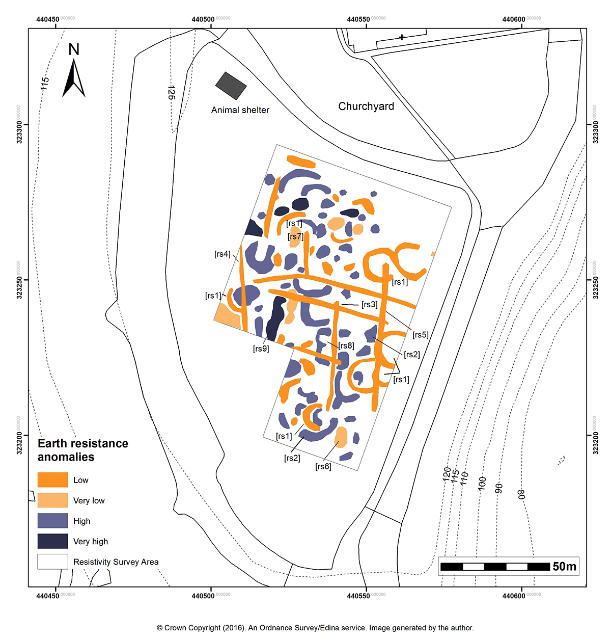
Figure 8: Results of the earth resistance survey in the south field
Figure 9: Graphical summary of the earth resistance survey in the south field
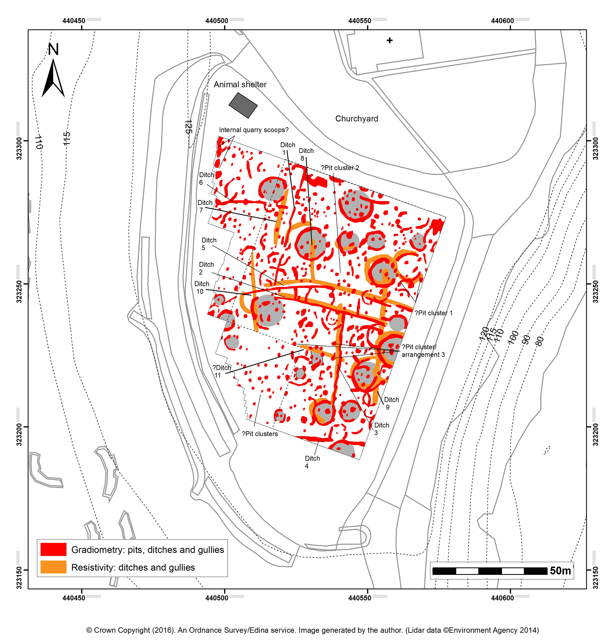
Figure 10: Interpretation of the possible structures based on the gradiometer (limit represented by full line) and resistivity (dotted line) surveys in the south field
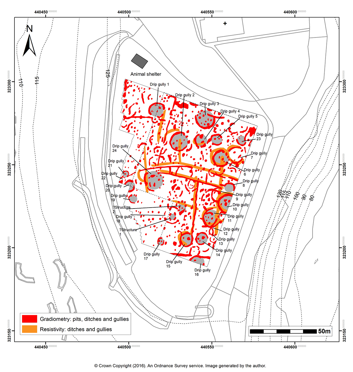
Figure 11: Interpretation of possible archaeological features based on the gradiometer (limit represented by full line) and resistivity (dotted line) surveys in the south field
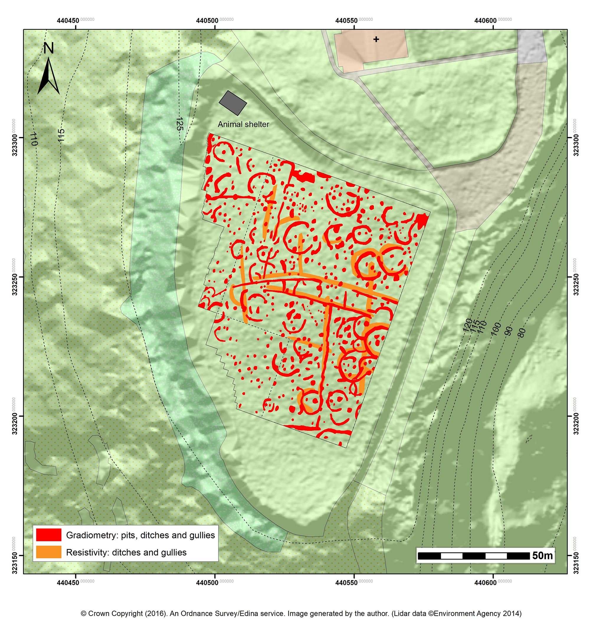
Figure 12: Graphical summary of the proposed archaeological features recorded in the south field in its topographic context
Figure 13: Results of the Fluxgate gradiometer survey in the north field
Figure 14: Graphical summary of the Fluxgate gradiometer survey in the north field
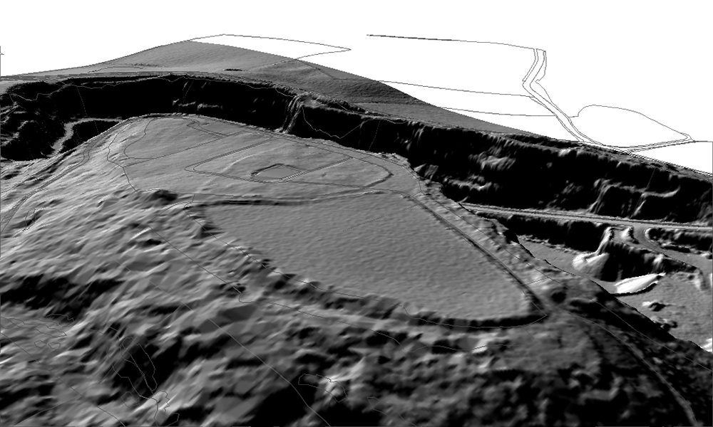
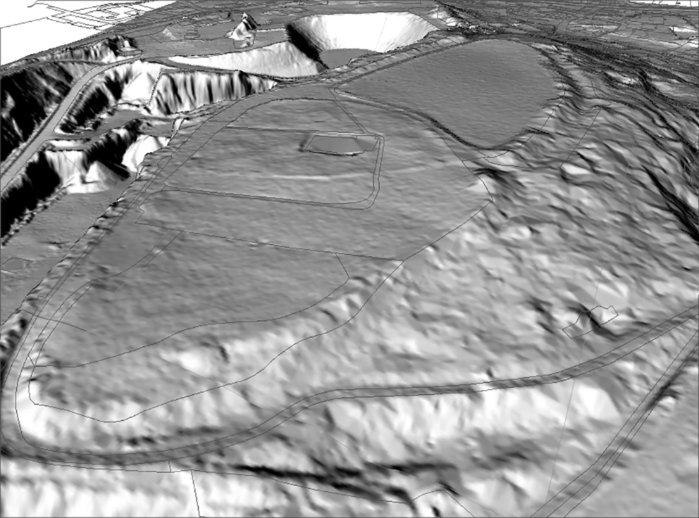
Figure 15a/Figure 15b: A DTM-derived 'Hillshade' model of the surviving hillfort earthworks as viewed from (a) the south-west (b) and the north-west. (© Crown Copyright (2016). An Ordnance Survey service. Lidar data ©Environment Agency 2014)
Figure 16: A possible phase of roundhouse and rectangular structures in the south field in the context of the first hachured plan of the hillfort earthworks dating to 1882, draped over a 'Hillshade' model depicting the current state of the site. (© Crown Copyright (2016). An Ordnance Survey service. Lidar data ©Environment Agency 2014)
Cite this as: Whittaker, C. 2019 Breedon Hill, Leicestershire: new surveys and their implications, Internet Archaeology 52. https://doi.org/10.11141/ia.52.6
Internet Archaeology is an open access journal based in the Department of Archaeology, University of York. Except where otherwise noted, content from this work may be used under the terms of the Creative Commons Attribution 3.0 (CC BY) Unported licence, which permits unrestricted use, distribution, and reproduction in any medium, provided that attribution to the author(s), the title of the work, the Internet Archaeology journal and the relevant URL/DOI are given.
Terms and Conditions | Legal Statements | Privacy Policy | Cookies Policy | Citing Internet Archaeology
Internet Archaeology content is preserved for the long term with the Archaeology Data Service. Help sustain and support open access publication by donating to our Open Access Archaeology Fund.