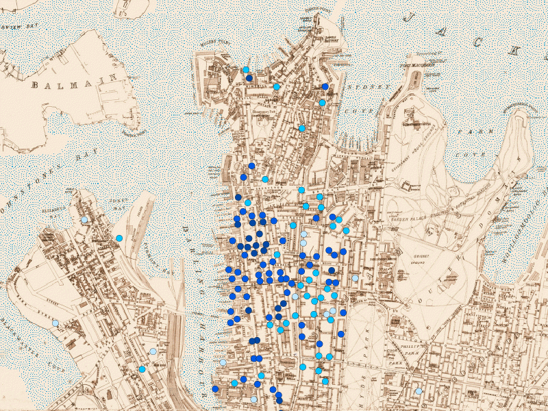
Figure 14: Place of infection - plague cases in Sydney 1900 (darker colour = earlier)
A map of infection locations reported for the plague in Sydney in the early 20th century (Figure 14) soon shows up the fallacy of the widely touted view that the plague was an inevitable result of the poor housing and sanitary conditions in the poverty-stricken slums of 'The Rocks' area, west of Circular Quay (the north end of the central promontory in Figure 14).
In fact the map shows that the infections are directly related, both spatially and in sequence, to proximity to the docks on the eastern size of Darling Harbour, suggesting an exogenous origin, and that few, and mostly late, cases occurred in the residential areas of the Rocks.
Figure 14: Place of infection - plague cases in Sydney 1900 (darker colour = earlier)
Figure 15: Socio-economic status in The Rocks 1865 (after Mullen 1993)
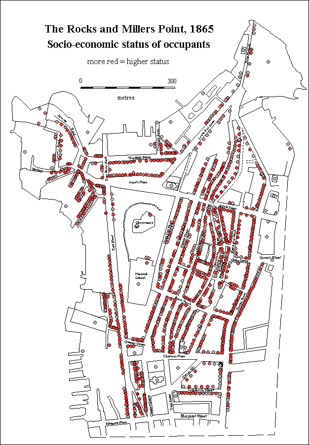
Another study (Mullen 1993) shows that there is no clear pattern of low socio-economic status clustering in The Rocks, with ships' captains and traders rubbing shoulders with seamen and labourers (Figure 15).
Last updated: Wed Sep 11 2002
© Author(s). Content published prior to 2013 is not covered by CC-BY licence and requests for reproduction should usually go to the copyright holder (in most cases, the author(s)). For citation / fair-dealing purposes, please attribute the author(s), the title of the work, the Internet Archaeology journal and the relevant URL/DOI.