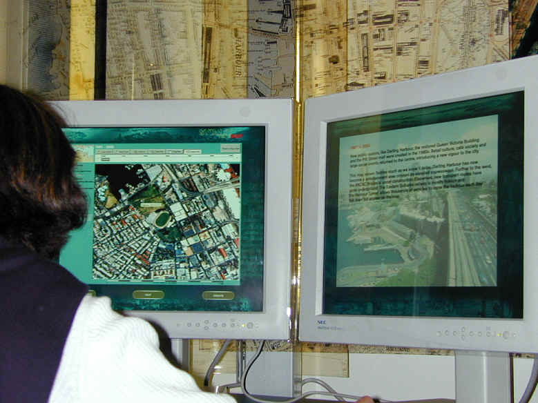
Figure 5: Kiosk application at the Museum of Sydney
I will discuss three examples of the use of TimeMap in an educational context. In each of these examples, a wide range of resources are delivered through a time-enabled map interface which accesses live database data rather than pre-structured curated presentations of data. This flexibility brings its own challenges in providing intuitive pathways and appropriate levels of detail in response to free-ranging user enquiries. I will outline some of the approaches we have adopted to resolve these issues. However, it should be noted that only the first of these applications has any history of use: the second is about to go online and the third has been introduced to only a small number of beta testers.
Sydney TimeMap (Figure 5) is a kiosk application [2] which was installed at the Museum of Sydney in November 2000. The kiosk is aimed at visitors who, it was assumed, would spend only a few minutes exploring the resource (based on comparative information from other museums with interactive exhibits, notably the Power House Museum in Sydney and the National Museum in Melbourne). Consequently the interface was designed to be simple and intuitive, with all information accessible within three levels of the introductory screen. Functions are limited to selecting a map for a particular theme, switching map layers on and off, zooming the map, selecting a time range and viewing historical images in context by clicking markers on the map. Visitor reaction to this straightforward map-based interface has been generally positive, even from those with some knowledge of GIS who might have been expected to demand more options.
Figure 5: Kiosk application at the Museum of Sydney
The second application, soon to go online, is a web-based map interface to MacquarieNet (Figure 6), a rich online encyclopaedia whose primary audience is the secondary schools market. In this case the emphasis is on providing a spatial search into a large database, with filtering according to theme and spatial extent. The web-based maps use the TimeMap TMJava application to provide thematic filtering, zooming, incremental loading of data and spatial contextualisation of searches[3]. In this case the emphasis is on free exploration of the resource, driven by user interest or school curricula - there are no specific interpretations or pre-defined pathways through the data.
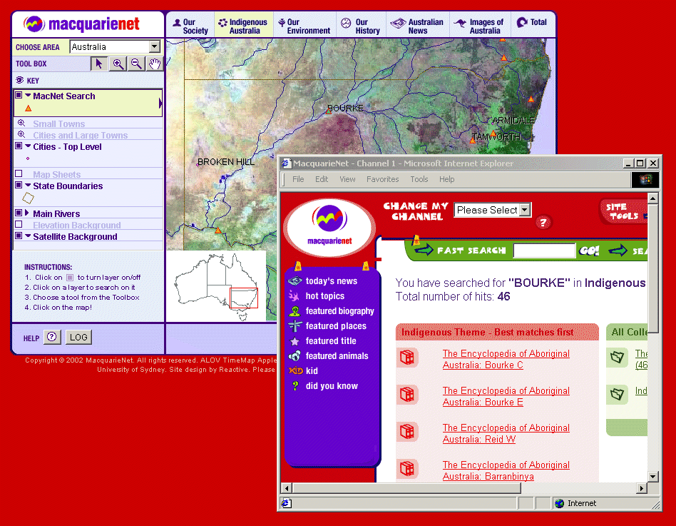
Figure 6: MacquarieNet map interface - 'Indigenous Australia' theme
The third application is the Electronic Cultural Atlas Initiative (ECAI) Metadata Clearinghouse, which allows the creation of interactive maps from distributed data resources contributed by ECAI associates. In this model, individual associates or associated institutions are responsible for registering their data with the clearinghouse and maintaining and serving data. Figure 10 illustrates ECAI's first digital map publication, created as part of the ECAI ePublication series, showing archaeological sites attributed to the Sasanian Empire.
Datasets registered in the ECAI clearinghouse can be mapped through either the TMView (Figure 7) or TMJava map viewers, and maps created with these programs can themselves be stored in the clearinghouse as 'MapSpaces' for download by others (maps are rebuilt each time from current data rather than being stored as an image, and are fully interactive). The clearinghouse offers an opportunity for educational institutions to build interactive map resources, share data and draw on a range of shared resources, without investing in costly software.

Figure 7: A TimeMap MapSpace downloaded from the ECAI clearinghouse
[2] The kiosk is implemented using the TimeMap Windows viewer program (TMView) and Internet Explorer, embedded in a controlling program written in MacroMedia Director. TMView was programmed by Artem Osmakov, Leonid Vasilenko, Astrid Noake, Reba Kearnes and the author using Borland Delphi and ESRI MapObjects.
[3] With the exception of daily AAP news feed data, the database is not coded by time, so this aspect of TimeMap functionality is little used in this application.
Last updated: Wed Sep 11 2002
© Author(s). Content published prior to 2013 is not covered by CC-BY licence and requests for reproduction should usually go to the copyright holder (in most cases, the author(s)). For citation / fair-dealing purposes, please attribute the author(s), the title of the work, the Internet Archaeology journal and the relevant URL/DOI.