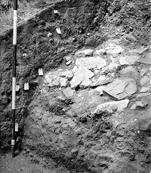
Image: BB-72/3761 (National Monuments Record)
Location: Pit B, Wareham West Walls
Aspect: View looking NE (ranging rod in feet)
View of the excavations of the western defences, showing the large blocks in the 'spill' from the destruction of the stone wall at the crest of the bank, tipping down the front slope of the bank. The remains of the former wall, not yet excavated, is under the baulk to the top right.
The 'spill', together with the underlying layers, is cut by the rescarping, associated in the report of the excavation with the cutting of the 12th century ditch (to the left). However, the cut for this can be traced to just below the topsoil, about 9 inches to the right of the ranging pole. The fact that this cuts a thick deposit overlying the 'spill', which could represent the heightening of the bank in the 12th century (phase 4), shows that the 'rescarping' - at least at this point - is a relatively recent feature.