To illustrate briefly how taskscapes can come alive from the stage set created through diachronic simulations, I chose the Neolithic site of Penitenzeria. The geomorphology of the area in which this settlement is located is characterised by a range of terraces on a broad plateau (called Umbro). In the vicinity, one finds steep cliffs (edges of the plateau – east, south) and gentler slopes lower down (west). This gives way to higher mountains (north) and dramatic reliefs towards the sea (south) (cf. Van Hove 2003, 53). This geographical picture and environmental situation would have allowed a wide range of land-use activities (see Fig. 8).
Figure 7: Foraging space around Penitenzeria over an accumulated history of 150 iterations (years), using an economy with 15% farming, 15% herding and 70% foraging. Annotated are the potential ways the off-site territory could have been perceived, representing a hypothetical interpretation based on the simulation outcomes
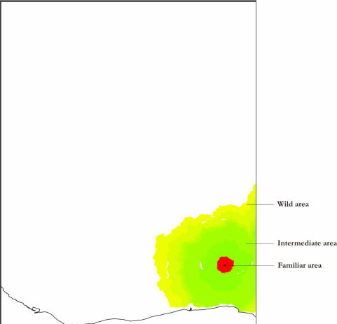
The area close to the site (i.e. the familiar area, cf. Fig. 7) would have consisted of gardens, foraging patches and herding space. Farmland would have been scattered in the close neighbourhood of a site. In between these pockets, gathering and herding territory could have been dotted around (Fig. 8). Beyond this familiar zone, areas could have been used for broader gathering and hunting activities or would have belonged to other groups. Beyond the familiar area, the closest other villages to Penitenzeria are visible in the far distance (Fig. 9). Because of the distance, they could be mentally perceived as different. The hidden world (the areas between the first crest at c. 800-1000 metres and the highest point at c. 2000 metres are blocked from view) could have included particular mountainous landmarks such as M. Grappida to the east and Pentidattilo to the west (cf. Van Hove 2003, 223-24).
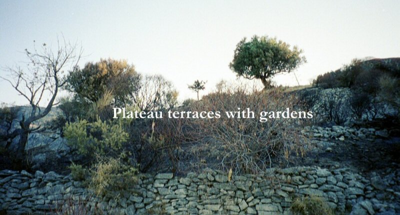
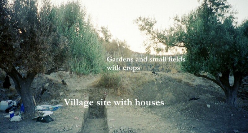
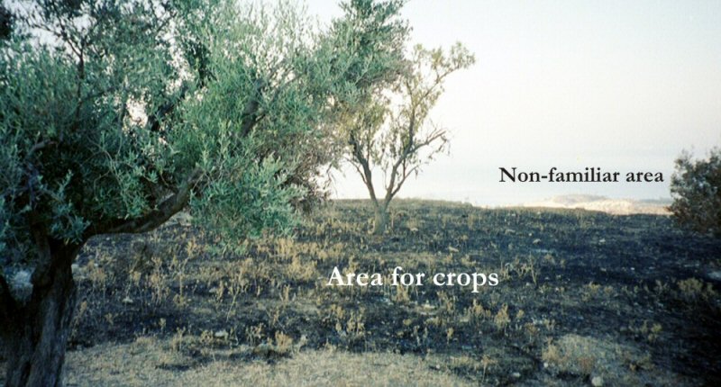

Figure 8: Panorama with annotations taken from on top of the backfill of the Neolithic site of Penitenzeria. Directions N-E-S-W (l-r)
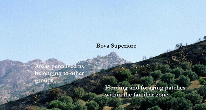
Figure 9: View to Bova Superiore from the top of the Umbro plateau, with annotations
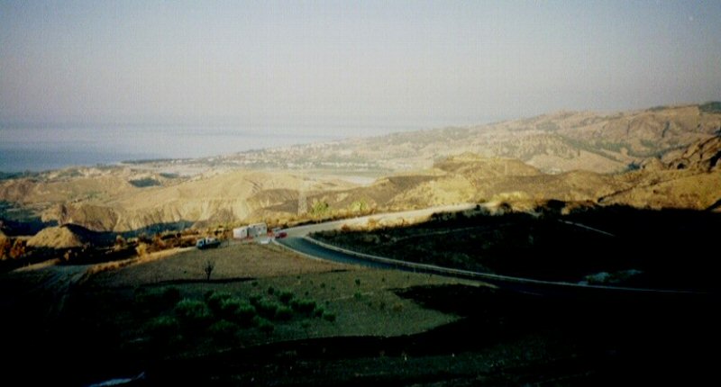
Based on the diachronic simulation results, and discussed in a preliminary, explorative and mostly indicative fashion, one could imagine the following social map of surroundings for the people living at Penitenzeria. What is visible (the plateau and its terraces) and what is immediately beyond it would have functioned as their home. It would have been an area of important resource patches and associated activities (see Fig. 8). Areas further away and visited rarely (Fig. 10; Fig. 11) could have possessed a practical or exotic meaning, depending on why they were visited and the groups active within them. The areas in between could be viewed as necessary buffers between 'home' and 'away' areas or as 'home away from home' places for hunting contingents.
Through the outcomes of the diachronic simulation and illustrated by the site of Penitenzeria, it is very easy to imagine a Neolithic landscape filled with activity. This includes intense daily uses of familiar worlds, e.g. what potentially happened on the Umbro plateau and its terraces, visible, known and safe, but also rare and specifically chosen involvement in areas beyond the detailed human view, e.g. trips to the coast for raw material (exotic) or voyages into the unknown for hunting (risky) (see Fig. 10; Fig. 11 ). All these activities involve movement in many ways: smaller movements closer by the site, larger movements farther away. What this suggests is that, even though the simulation assumed sedentism (people living permanently at one site), Neolithic land use was far from static.
Figure 10: Southwest view to mountainous areas from the Penitenzeria terrace, with annotations
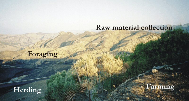
Figure 11: View to the sea from the Penitenzeria terrace
© Internet Archaeology
URL: http://intarch.ac.uk/journal/issue16/5/3.7.html
Last updated: Thur Nov 11 2004