Figure 1: Distribution of monuments in southern Morbihan
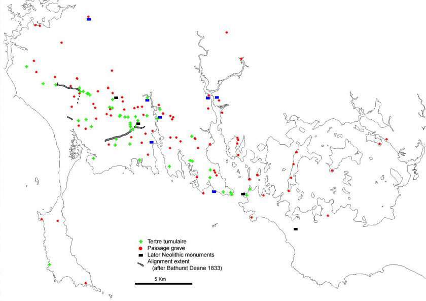
The Neolithic monuments of the Carnac area of southern Morbihan, Brittany, are impressive and numerous (Fig. 1). These internationally significant monuments have been a focus for archaeological research for nearly two hundred years (Bailloud et al. 1995). Archaeologists have predominantly studied the individual monuments; most of the Neolithic sites have been excavated, often in the 19th century, and without systematic recording. Although recent excavations (L'Helgouach and Cassen 1990; Lecornec 1994; 1996; Cassen 2000) have provided important dating material, the chronological relationships of the monuments remain controversial (e.g. Boujot and Cassen 1993; Le Roux 1999a; Scarre 2002). Although the subject of 19th-century accounts, the landscape contexts in which these monuments were situated have been comparatively ignored over the last 100 years (Roughley et al. 2002).
There are a variety of Neolithic monuments in the Carnac area. Although most famous for the alignments, there are many other monuments in the area which, it is assumed, were used for burials (the acidic soil does not preserve bones). This article discusses two types of monuments: earthen long mounds, which are potentially the earliest Neolithic burial monuments in the area (Boujot and Cassen 1993), and angled passage graves, which are a type of later Neolithic site only found in southern Morbihan (L'Helgouach 1965). These examples have been chosen to demonstrate the range of techniques used during this research (Roughley 2002a), and the potential of the various approaches to contribute to the study of archaeological landscapes. Further discussion of the landscape contexts of all types of monuments can be found in Roughley (forthcoming).
Earthen long mounds have received less attention than other, better preserved, sites. However, recent work by Boujot and Cassen (1993) has highlighted the importance of these sites for understanding the Neolithic archaeology of the region. They have shown that some of the earthen long mounds are probably the earliest Neolithic monuments in the area (Cassen 2000), and may pre-date the construction of many of the passage graves. The sites have a variety of forms, but usually consist of a long earthen mound (Fig. 2) covering a number of stone cists. There may also be a kerb of small stones. Boujot and Cassen (1993) have argued that the earthen long mounds of this area were derived from broadly similar sites in the Paris basin, but this interpretation is not universally accepted (see Scarre 2002).
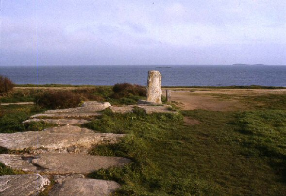
These are later Neolithic monuments, probably dating to between 3500 and 2500 BC. The sites consist of a long passage with a bend to the left in the middle (Fig. 3), leading to a chamber which is often poorly differentiated. This type of monument is only found in the Carnac area; there are also a small number of later Neolithic monuments of different forms in the area (gallery graves and lateral entrance graves).
Figure 3: Angled passage grave of Les Pierres Plates (Locmariaquer). View from above chamber towards entrance
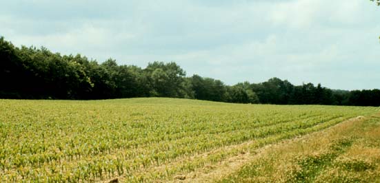
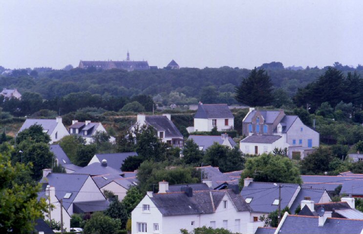
The landscape now has many buildings and modern plantations. Many of the sites are difficult to see in the field (Fig. 4). The relationships between even the largest and best-preserved monuments are often obscured (Fig. 5).
Figure 4: View of the earthen long mound of Mané Net (visible in the road section in front of the car)
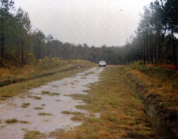
Figure 5: The Carnac alignments from the top of Mont St Michel (visible between the trees behind the houses)
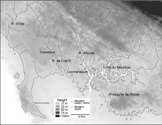
The Carnac area is topographically subtle. It is a landscape of small hills, many of only a few metres high with small river valleys (Fig. 6). Slight ridges (up to 50m high) run around the basin of the Coëtatouz. To the northeast, the land rises to an inland area of larger valleys and ridges. There have been important changes in the landscape in the last 6500 years. The sea-level has risen approximately 5m since the Neolithic (Lambeck 1997). Although it is possible to estimate where the coastline was in the Neolithic, erosion and sedimentation will have also affected the shoreline.
It is likely that the landscape was relatively open during the Neolithic – pollen and soil micromorphology evidence suggests that the areas immediately around the monuments were cleared, often considerably prior to the construction of the monument (Marguerie 1992; Gebhardt and Marguerie 1993). Although the available palaeoenvironmental evidence provides a useful indicator of the likely vegetation, it is not sufficiently detailed to enable a vegetation model to be constructed for the landscape (e.g. Allen 1997).
© Internet Archaeology
Last updated: Thur Nov 11 2004