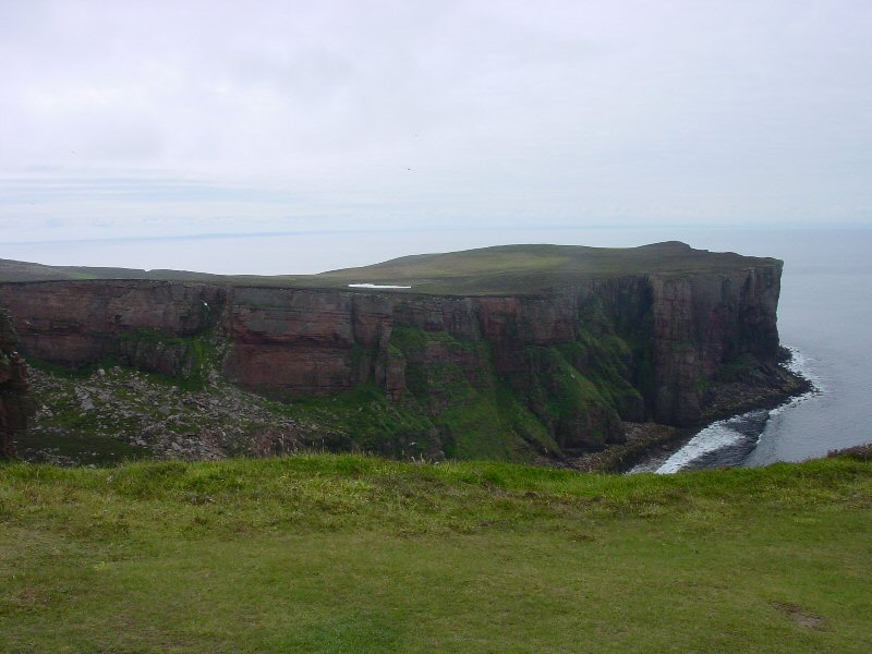
Figure 1: High cliffs near Rackwick, Hoy, Orkney
Lying just off the north coast of mainland Scotland, Orkney comprises a group of 70-90 islands, depending on the tides, straddling the 59th parallel. The island group is dominated by Mainland, which accounts for more than half of the land area, and currently is home to three-quarters of the population (Berry 2000). The land surface is broadly tilted upwards to the north and west, producing high cliffs mainly along the west coasts of Westray, Hoy and Mainland (Fig. 1); however, low cliffs and rocky shores are present almost everywhere, with sandy or shingle beaches (Fig. 2) making up only 10-11 per cent of the coastline (Davidson and Jones 1985, 13). Elevations are generally low, with only Hoy having proper mountains (up to 477m ASL), and only Rousay and western Mainland having proper hills (ranging up to 275m ASL).
Figure 1: High cliffs near Rackwick, Hoy, Orkney
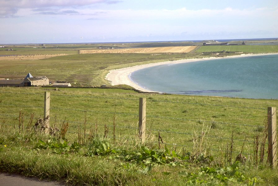
Figure 2: Sandy beaches on Sanday, Orkney
Orkney's shoreline can be divided into three broad classes: cliffs ranging from 10 to over 30m in height, lower wave-cut banks of 3-10m in height leading to rocky shores, and gently sloping sandy beaches. Historically, these sandy beaches have been the preferred launching and landing points for boats in the absence of artificial harbour facilities. The rocky shores can be used for landing a boat in some situations, especially at high tide, but the presence of a wave-cut bank makes getting the boat up onto land difficult (Fig. 3), and the height of the cliffs, while occasionally climbable, would generally preclude their use for access to the sea. The rocky shores have also been used traditionally for inshore cod fishing using a long line (Fenton 1997, 527-40). The cliffs can be scaled at some discrete points, but only with difficulty. As these cliffs are frequently home to bird colonies, they have in the past provided an alternative food supply in the form of seabirds and their eggs (Fenton 1997, 510-23).
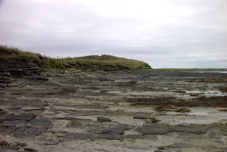
Figure 3: Rocky foreshore and wave-cut bank on Westray, Orkney
The overall visual appearance of Orkney is of gently rolling peat-covered hills, with extensive agricultural fields and pasture on lower ground and a conspicuous absence of trees. Orkney's biotic environment, from plants down to soils, is in no small part a product of millennia of human activity. The islands have been continuously occupied since at least the Neolithic, with occasional spot finds of Mesolithic flints hinting at even earlier occupation (Wickham-Jones 1994). The extent to which agriculture dominates the landscape can be seen in recent characterisations of Orkney's flora, where the only 'natural' plant communities listed are located at the margins of the sea, marshes and bogs, and the tops of hills (Berry 2000, 57-77). Neolithic colonists, while perhaps not entirely responsible for the denudation of the environment, may have accelerated the removal of forest cover by removing sufficient trees to promote bog growth, creating a positive feedback cycle detrimental to tree growth (Berry 2000, 53).
The Iron Age environment of Orkney was broadly one of worsening climate, with peat making inroads on grazing and agricultural land that was previously available during the Neolithic and Bronze Ages. At the same time as peat was encroaching, farmers were likely involved to at least some degree in reclaiming land for agriculture where possible and practical, through the generation of plaggen soils (artificially deepened agricultural soils) through the spreading of domestic waste on the fields to improve their yields (Dockrill 2002). The Iron Age landscape of Orkney, therefore, was likely a combination of these major factors of encroaching peat and land reclamation.
© Internet Archaeology/Author(s)
University of York legal statements | Terms and Conditions
| File last updated: Tue Dec 20 2005