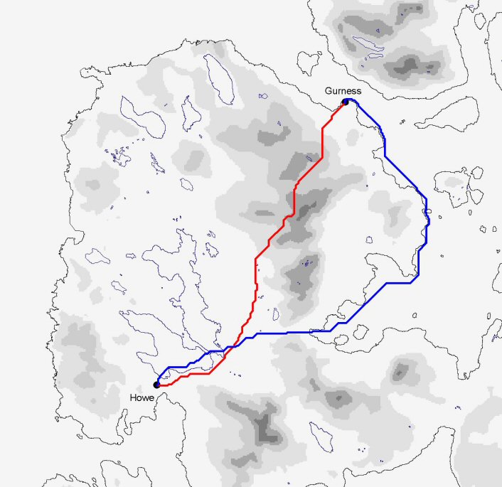
Figure 7: Comparison of lowest-energy cost paths between Gurness and Howe, under low (blue) and high (red) water-friction regimes
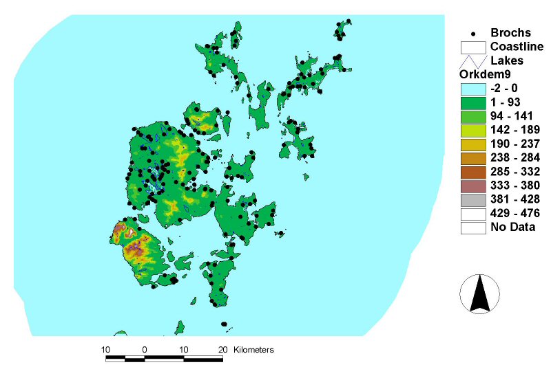
Figure 5: Map of Orkney, showing known or potential Iron Age broch sites [View static image]
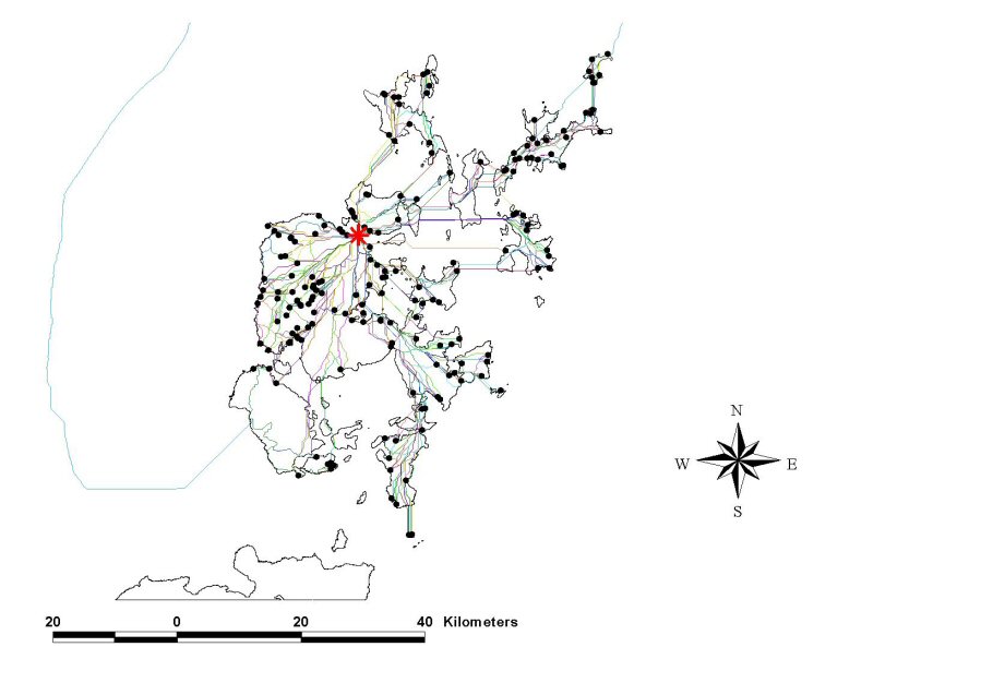
My research has identified a total of 190 known or potential broch sites in Orkney (Fig. 5), so the total number of potential paths under any particular friction scheme is just in excess of 36,000. This volume of data is both difficult to summarise and hard to make sense of visually (Fig. 6). At the same time, some regularities have begun to emerge. These are illustrated by means of a case study of two well-known broch sites.
Figure 6: Map of Orkney, showing all calculated pathways from the Broch of Gurness to all other known or potential broch sites [View static image]
Due to the very large expense, both in money and time involved, very few broch sites have been excavated to anything approaching modern standards. Two that have are the sites of Gurness (HY32NE5.00, see Hedges 1987) and Howe (HY21SE41, see Smith 1994). Comparing the lowest-energy cost paths between two sites (Fig. 7), unsurprisingly there is a substantial difference in the lowest-energy pathway between the two friction regimes. The high-friction path runs straight across land, while the low-friction path goes straight to the nearest body of water and remains on water as much as possible until it reaches its destination. Interestingly, the land component of this low-friction path also closely matches a modern roadway running from the present-day towns of Stromness and Finstown.
Figure 7: Comparison of lowest-energy cost paths between Gurness and Howe, under low (blue) and high (red) water-friction regimes
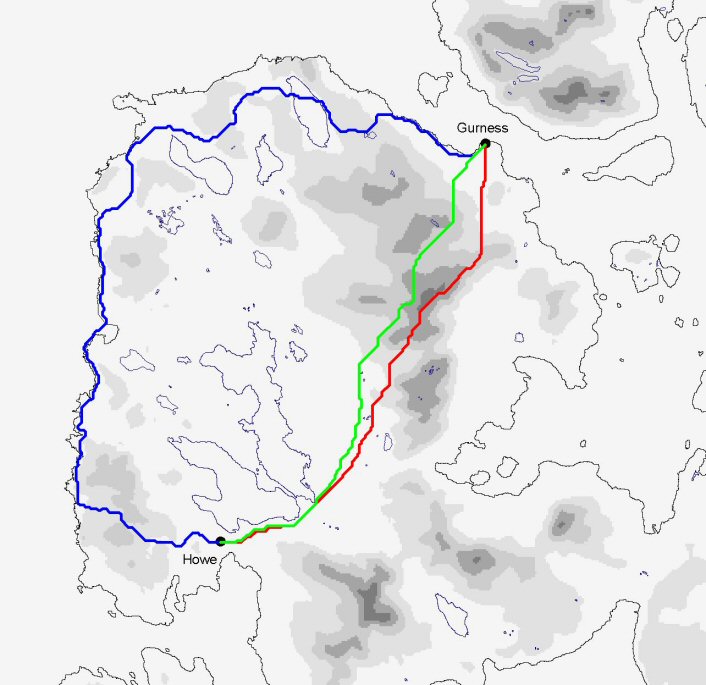
Figure 8: Comparison of high water-friction pathways under conditions of least-energy cost (green), highest visibility (red) and lowest visibility (blue)
If we compare the paths determined by observability, another pattern emerges. The most visible path (red) coincides closely with the lowest-energy path (green) in both the high water-friction (Fig. 8) and low water-friction (Fig. 9) regimes. The main difference in the high-friction case is that the most observable path goes over the tops of hills, while the lowest-energy path skirts them. The least observable path seems to differ little between the two water-friction regimes, but a closer inspection reveals that the low-friction path (pink) is travelling along the base of the cliff, in the sea, while the high-friction path (purple) is following the top of the cliff edge (Fig. 10).
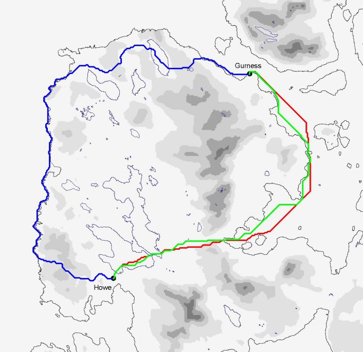
Figure 9: Comparison of low water-friction pathways under conditions of least energy cost (green), highest visibility (red) and lowest visibility (blue)
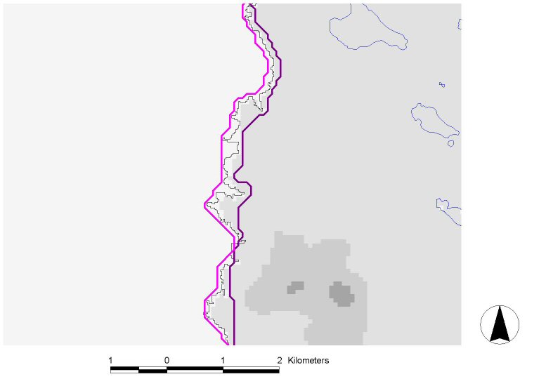
Figure 10: Detail of lowest-visibility pathways showing difference in route between low (pink) and high (purple) water-friction regimes
This pattern of paths is repeated throughout the entire dataset of 190 sites: the most visible and least-energy paths tend to coincide far more closely with each other than they do with the least-visible path. While it would be premature to infer an explicitly causal link between the results of this case study and the location of all brochs, it does suggest a few immediate possibilities that could be investigated further using other lines of evidence. Since the least-energy and most visible paths coincide, this could suggest that sites were chosen either to make travel between sites as visible as possible, or to make the easiest, most obvious route to the site also be the most exposed to outside observation. One interpretation of the former could imply that this coincidence of routes represents some sort of formalised processional way, so that visitors or travellers passing between sites can be seen as widely as possible by observers on the surrounding landscape, irrespective of where those observers are situated on it (recall that the 'friction' of visibility is derived from a set of random points on the land surface). The latter could reveal a defensive consideration, through making the easiest direction to approach the site also the most exposed, in other words, forcing an attacker to expend more energy in order to approach from an unseen or less visible direction. One potential way to resolve this could be to examine the viewed areas of each site and compare these to the pathways' direction of approach, to see if views from the sites themselves are constrained to see mainly along these directions of approach or not.
© Internet Archaeology/Author(s)
University of York legal statements | Terms and Conditions
| File last updated: Tue Dec 20 2005