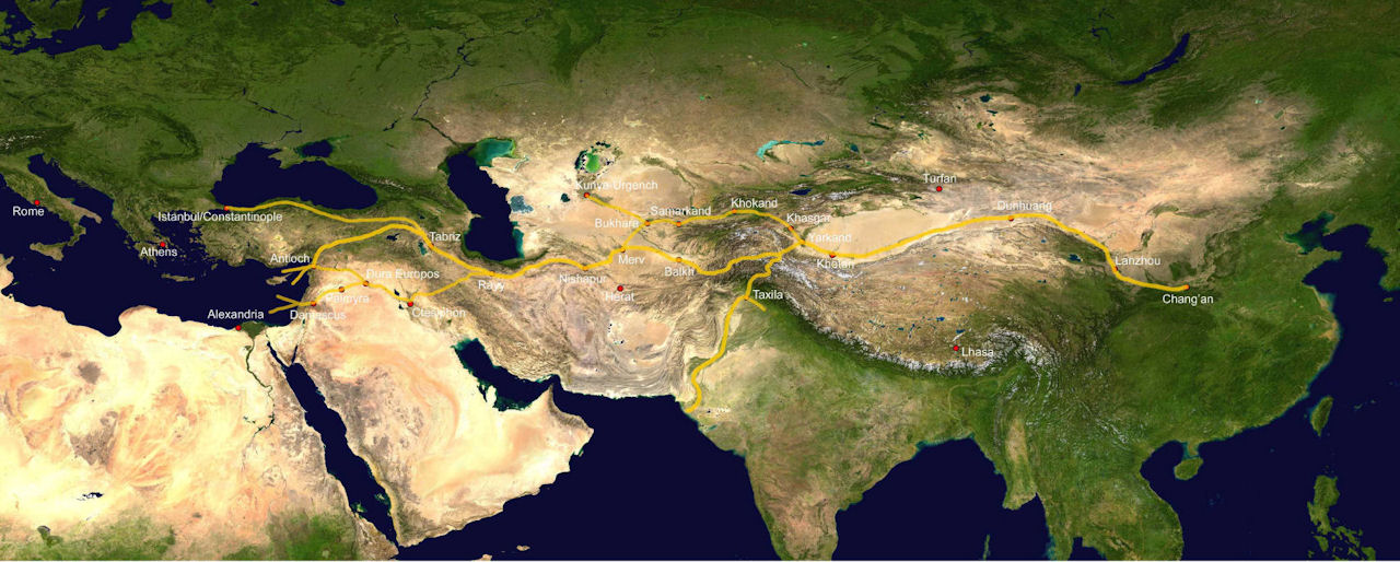
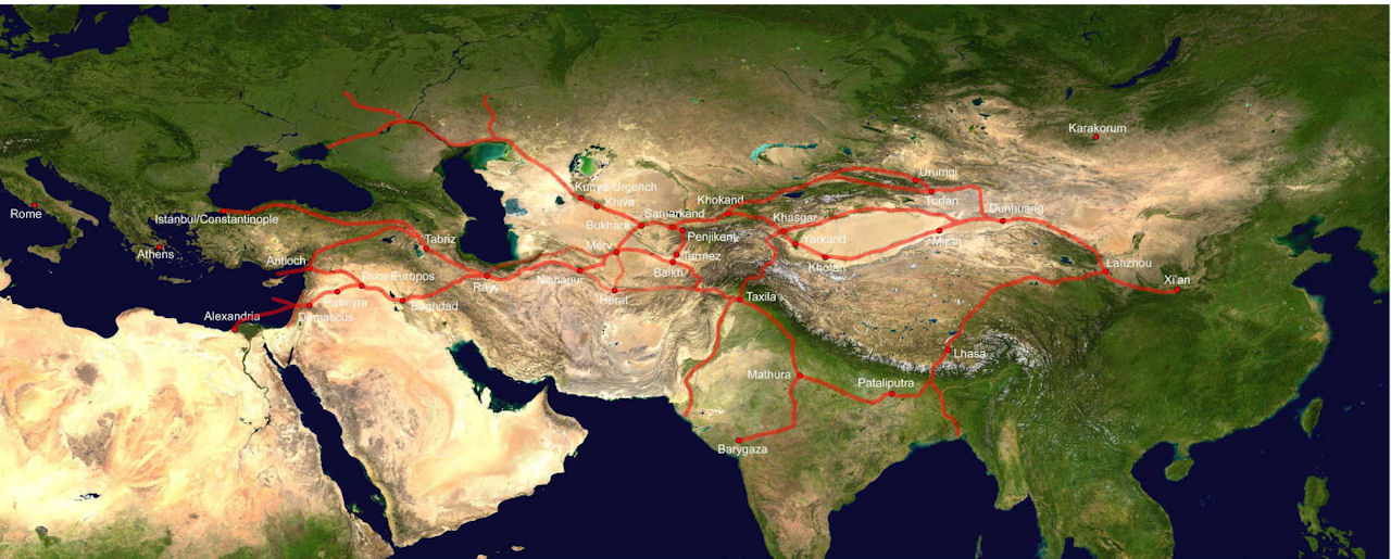
Figure 1: These maps are not intended to provide precise locations, although every effort has been made to locate sites as accurately as possible.
Map 1a: c. 2nd century BC to 3rd century AD. Chinese texts suggest that the main route passed along the southern edge of the Taklamakan to the Pamirs, where it passed though the "hanging passages" in the region of Gilgit and on to the Indus. It is likely that there was some traffic along the north side of the Taklamakan Desert fairly early on (but not shown here). There was also traffic from the West into Central Asia, through Merv, Balkh. Some probably travelled on the northern route via Afrisab (modern day Samarkand), while others passed through the Alay Valley and then eastward.
Map 1b: c. 5th to 8th century AD. The main emphasis by this time has shifted to the north. The axis through Merv, Bukhara, Samarkand, etc. has become dominant, as had the northern route around the Taklamakan Desert. While the main road to the Byzantine world ran through Merv and Iran, there was also an important route up the Amu Darya and north of the Caspian.
Map 1c: c. 13th/14th century AD. The Mongol conquests reunified large stretches of the Silk Roads, which had been more segmented between the 9th and 13th centuries, and there was a revival of traffic. The shift went further north, with the steppe route perhaps being at least as important as the road through Samarkand and Merv. Many of the older routes to the south were still in existence, but less important than they had been.
