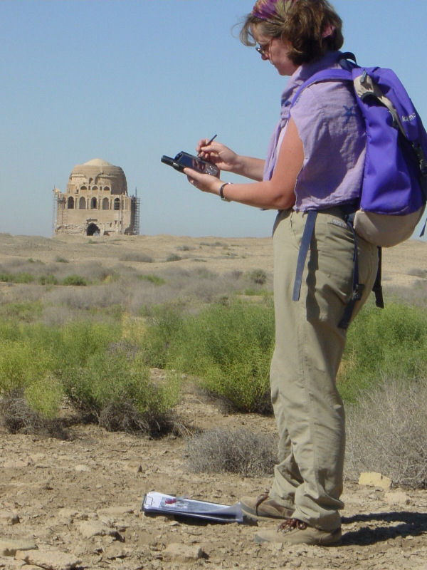
Figure 28: Checking the aerial imagery on the ground using a handheld PDA with GPS. The PDA was running ESRI ArcPad 6.0.2, enabling the GIS, including satellite images and aerial photographs, to be viewed in the field, with a Navman GPS sleeve providing the location of the surveyor to within 2-3m on the image. Sometimes it was easier, due to the strong light, to confirm details of the image on a printout, but the electronic system was invaluable in a landscape of numerous similar ridges and depressions.