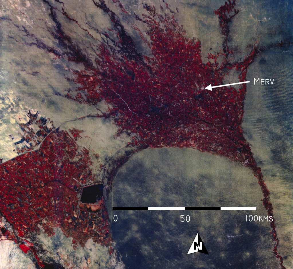
Figure 3: Landsat 7 satellite image of the Murghab Delta, showing the position of Merv. Note the relatively narrow and deep cut channel of the Murghab River flowing from the south (present day Afghanistan) and then spreading out in a fan shaped delta to the north. (Image thanks to the Tokai University Research and Information Centre).