Back | Forward | Close Window
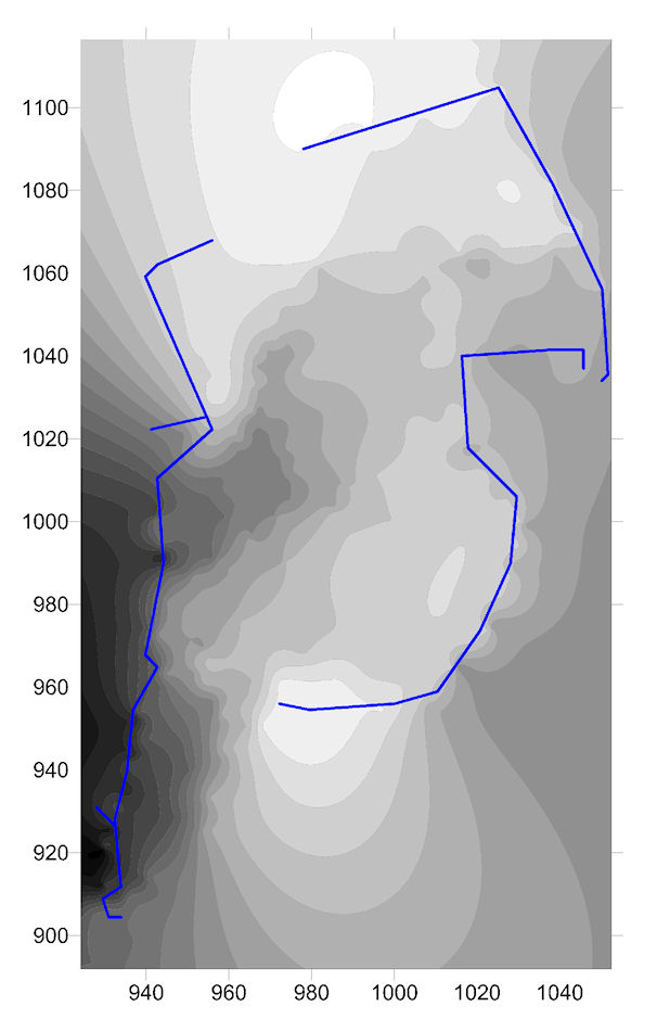
Figure 11: Two dimensional contour map showing the terraces and fortification walls at SVP Site 006. North is up, scale in metres, white is highest elevation (Galaty and Lee).