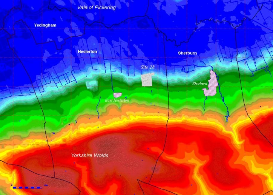
Figure 1: Map showing the location of HPP Site 28, between the modern villages of East Heslerton and Sherburn, the parish boundaries and a colourised surface model showing the extent of the ancient wetland area in blue, the shallow slope from the foot of the Wolds in green, the Wolds scarp in orange/yellow and the Wolds in red (Compiled using elevation data from NextMap).