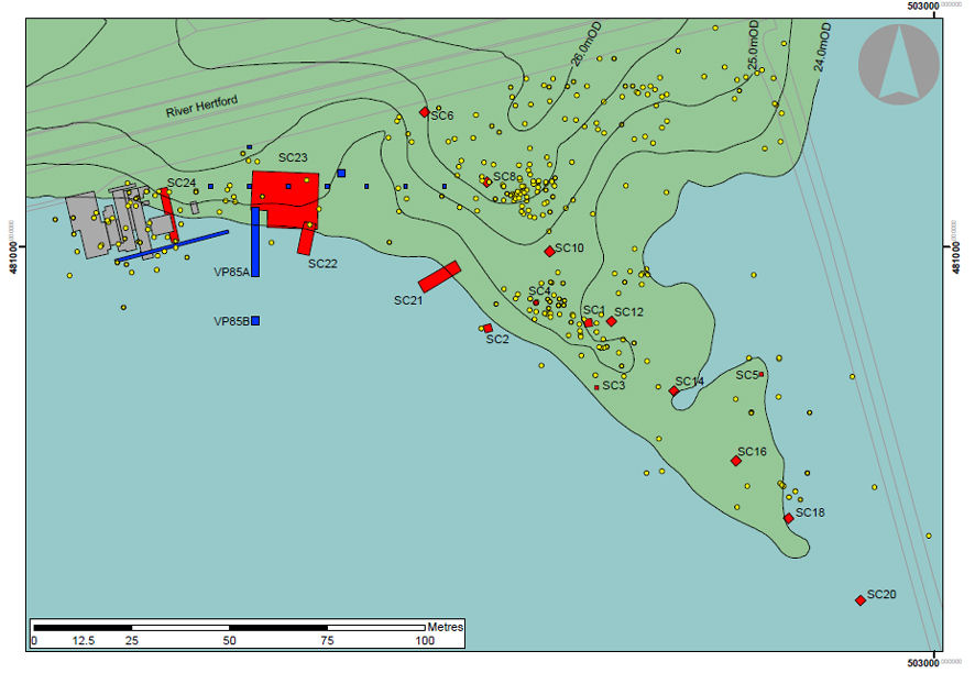
Figure 1: Map of the Star Carr Site. Blue represents where the lake was and the green area represents dry land. Plan of trenches: the grey trenches were excavated by Clark (1949-1951); the blue trenches in the 1980s by the VPRT; the yellow dots are fieldwalking finds and the red trenches have been excavated during the recent work at Star Carr by the authors: all these trenches contained flint debris indicating activity over much of the peninsula.