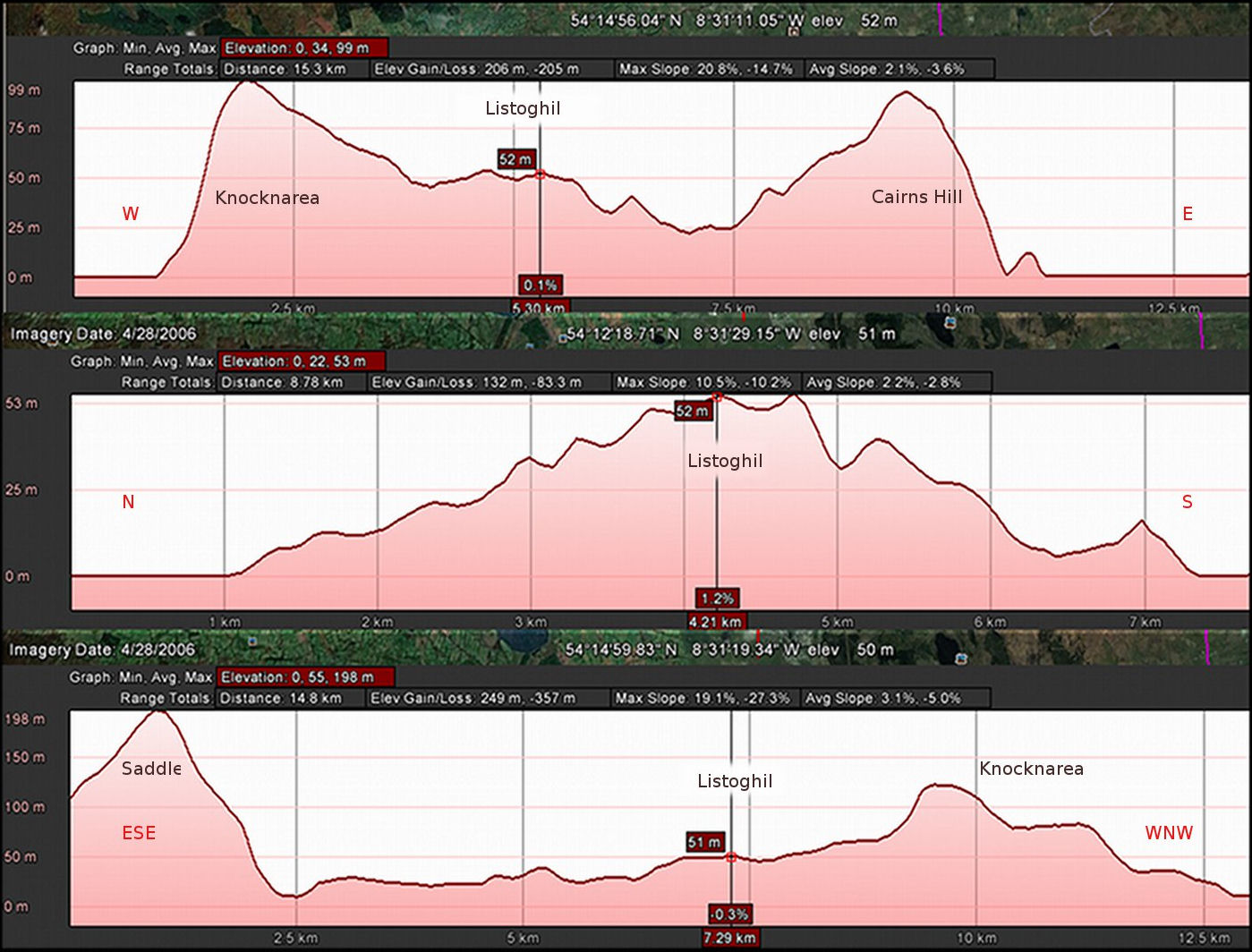
Figure 17: Elevation profiles, Cúil Irra Peninsula (after Google Earth). Elevation exaggerated by a factor of three. Top: Profile W-E. The Atlantic Ocean to the West, Lough Gill to the East. Centre: Profile N-S. The Carrowmore complexoccupies the most elevated position here, straddling twin ridges running E-W.Bottom: Profile along ESE-WNW Axis.