[Contents] [Journal Homepage]

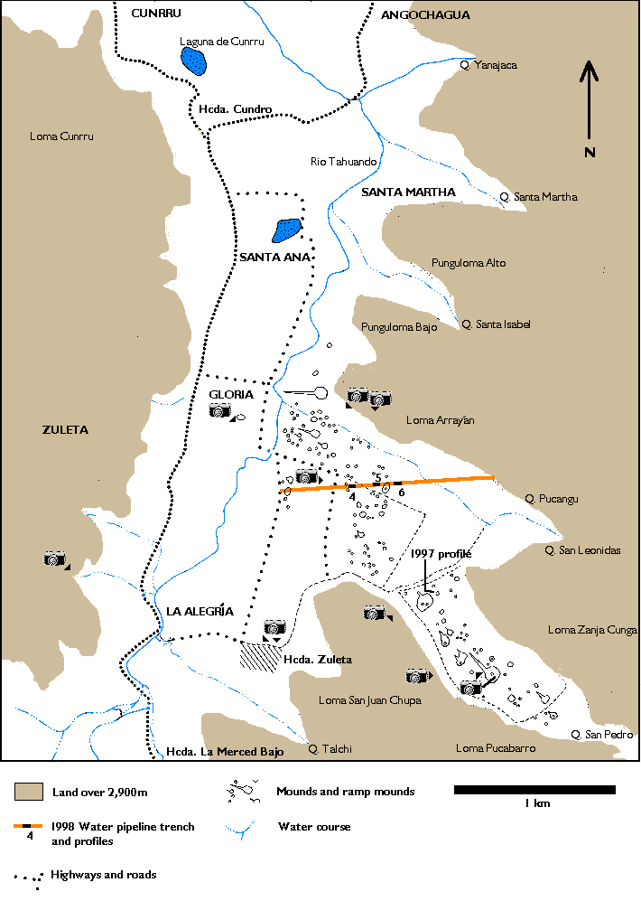
Figure 2. Hacienda Zuleta and environs.
Click on the camera icons to see various views of the study area (will open new window)
Figure 2 Pipeline sector 4 Pipeline sector 5 Pipeline sector 6 1997 profile Looking east towards 
 Quebrada Pucangu along pipeline View south-west across 
 tolas in the valley of the Río Tahuando Large quadrilateral 
 ramp-mound together with smaller mounds in the Quebrada San Pedro View north-west to Loma El Cunrru with 
 quadrilateral ramp mounds in the Quebrada San Pedro Looking south-east towards Cerro Cayambe across 
 indigenous chacras Hacienda Zuleta - 17th century buildings Hacienda Zuleta - 17th century buildings Tolas in the Quebrada San Pedro, with hemispherical tola excavated in 1997 to right looking South East towards Zanja Cunga, Pucabarro and San Juan Chupa Location of sectors 5 and 6 of the E-W water pipeline trench (now in-filled) and large hemispherical tola in centre  CONTENTS   HOME 

© Internet Archaeology URL: http://intarch.ac.uk/journal/issue10/currie/fig2cam.html
Last updated: Mon Feb 12 2001