Click on unmodified sinkholes for further analytical detail (where available)
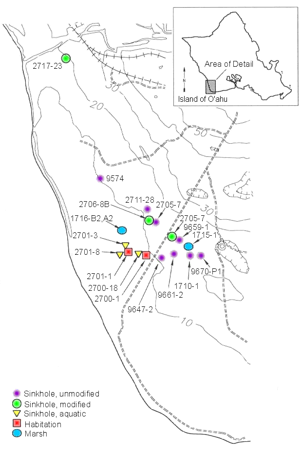
Figure 1b: Detailed map showing locations of sites mentioned in the text. Topographic information from 1928 USGS quadrangle.
Click on unmodified sinkholes for further analytical detail (where available)
© Internet Archaeology
URL: http://intarch.ac.uk/journal/issue10/dye/images/fig1b.html
Last updated: Tue May 29 2001