![]()
![]()
![]()
![]()
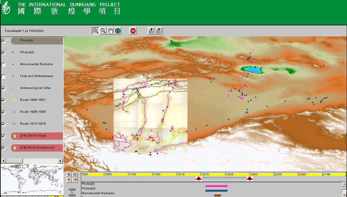
An example embedded TMJava map is shown in Figure 11a which draws on map and photographic resources from Aurel Stein's archaeological expeditions, held by the British Library, and superimposes these on background data prepared by the Sydney University Archaeological Computing Laboratory.
Access the interactive version
Figure 11a: Interactive TMJava map of Aurel Stein's archaeological expeditions
in western China, superimposed on worldwide 1km DEM image
A further example is a project by the Centre for the Analysis of Sacred Space (CASS), U.C. Santa Barbara, which is building teaching resources about religious sites in Asia. These resources allow students to explore major religious sites, read commentary and view photographs and video in context, using datasets supplied by other ECAI members as background to data collected in the field by CASS staff (Figure 11b). This project is still in prototype.
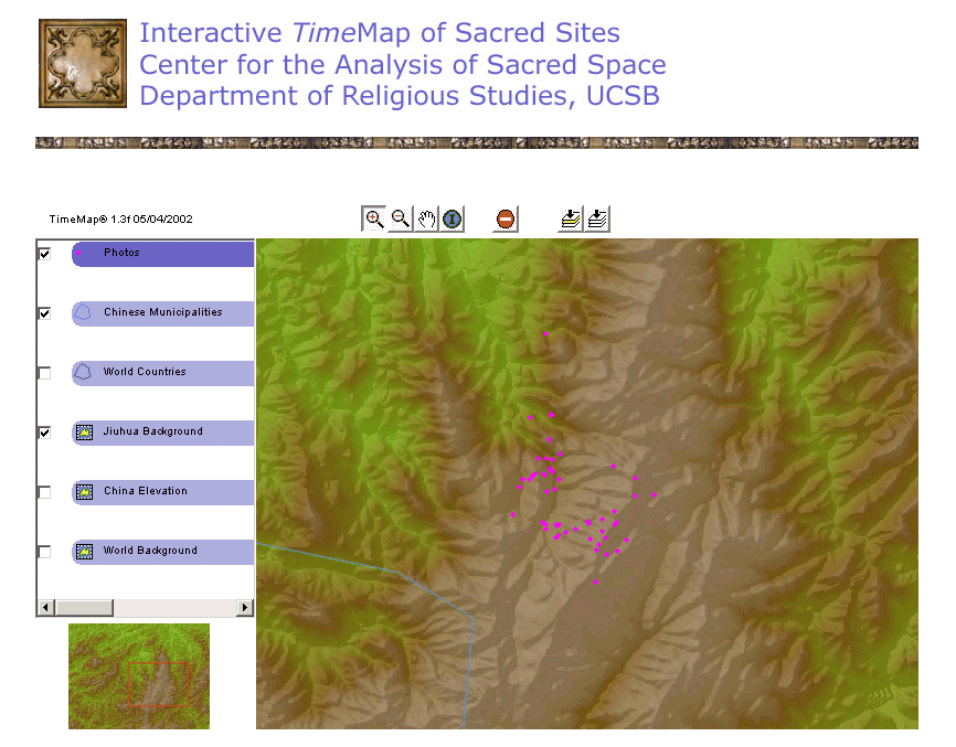
Figure 11b: TMJava map of photographs at a religious site in China (Jiuhua
Mountain), superimposed on a DEM image with hillshading
![]()
![]()
![]()
![]()
© Internet Archaeology
URL: http://intarch.ac.uk/journal/issue12/9/images/ij_fig14_interactive_map_examples.htm
Last updated: Wed Sep 11 2002