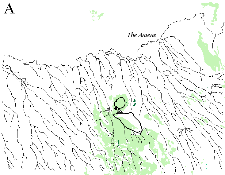
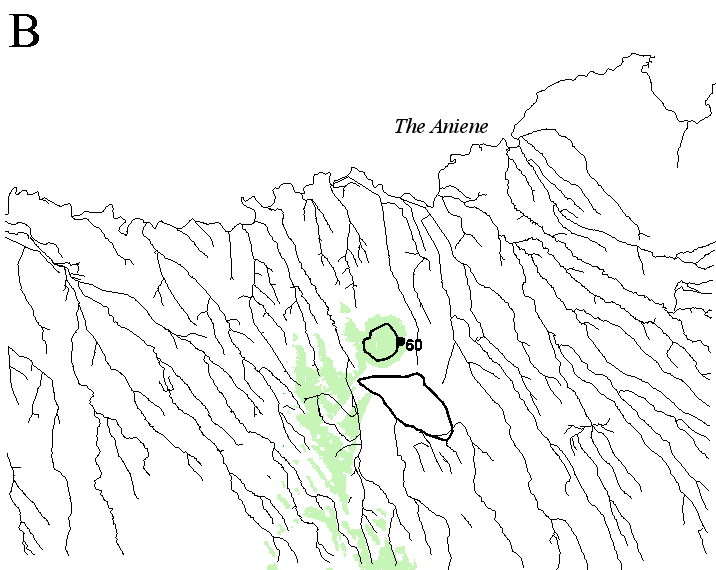
Much of the interpretation of the various visibility coverages discussed here (Fig. 3) depends on the current archaeological and environmental knowledge of central Italy. One has to know that, in the past, a lake was situated in the Castiglione crater and another lake or an area of marshland was located within the low-lying area in the south (cf. Segre 1992). Therefore, when the situation during the Neolithic is interpreted, one has to conclude that both lake and marshland areas may have been seen from the settlement, together with a considerably large area of dry land in the south-west. This suggests that guarding wetlands was important and the analysis suggests that the lake became even more important. During the Middle and Recent Bronze Age, the change in the location of the settlement site resulted in a diminished area of potential perception; the lake of Castiglione became the central feature. The significance of aquatic resources and the cultural importance of the lake are also suggested by bone material (Bietti Sestieri and De Santis 2000). Unfortunately, the Neolithic settlement is only known on the basis of surface survey. Thus we cannot compare the communities to see if the change in the use of resources affected how they viewed different parts of the landscape.
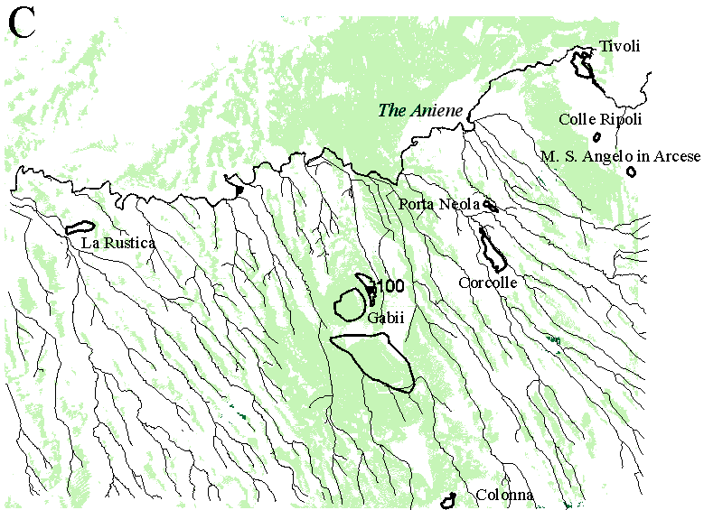
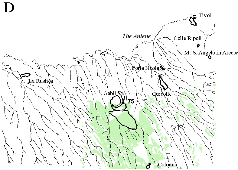
Figure 3: Visibility coverages. A. Neolithic: Casale del Pescatore. B. Middle and Recent Bronze Age: Lago di Castiglione. C. Final Bronze Age: Torre del Castiglione. D. Iron Age settlement and Archaic lower town
The interpretation that control was the defining character in the choice of location during the Final Bronze Age is based on the analogy between the typical locations of geographically defined Final Bronze Age sites (di Gennaro 1988) and the potential location at the highest point on the volcanic crater. It is generally assumed that the society was becoming more complex and this resulted with different levels of tension at the regional scale (cf. di Gennaro 1986; Bietti Sestieri 1992). This could have led to a state of affairs where the members of certain communities would have preferred places with wide visibility across the surroundings to more low-lying locations. In a situation where the relationships between different communities may have been to the less dominant area in the south from the Iron Age onwards can be seen as an act of occupying secondary locations by an expanding community.
© Internet Archaeology
URL: http://intarch.ac.uk/journal/issue16/2/6.3.html
Last updated: Thur Nov 11 2004