1
Heslerton Parish Project,
Old Bridge Barn,
Yedingham,
N. Yorkshire,
UK
2
Department of Geography,
University of Durham,
Durham,
UK
Cite this as: Powlesland, D., Lyall, J. and Donohoe, D. 1997 Enhancing the record through remote sensing: the application and integration of multi-sensor, non-invasive remote sensing techniques for the enhancement of the Sites and Monuments Record. Heslerton Parish Project, N. Yorkshire, England, Internet Archaeology 2. https://doi.org/10.11141/ia.2.4
The archaeological landscape is a fragile, disappearing and frequently little understood resource; conventional methods of field research tend to be both time-consuming and labour-intensive and produce a patchy and inconsistent record which reflects varying site visibility rather than poor research. If we are to preserve, or at least mitigate against damage to, this resource successfully, or even to undertake realistic assessment of landscapes as part of nationally established research agendas we need to re-assess our methods of site identification and discovery radically, lest the conservation movement lead to an entirely non-research based process of preservation or examination based on random discovery rather than academic selectivity.
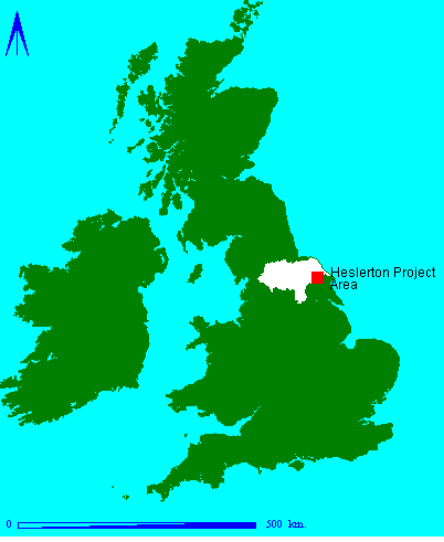
The Heslerton Parish Project was established in 1980 to provide a research framework for the rescue excavations then in progress at Cook's Quarry, West Heslerton (Powlesland 1981; Powlesland et al. 1986). The project research area covers a 10km square, centered upon West Heslerton, and spans a number of distinctive geomorphological zones which extend both to the east and west of the area and form a representative sample of the landscape at the interface of the Yorkshire Wolds and the Vale of Pickering
In parallel with rescue excavations, a ten-year program of intensive oblique aerial photography (1978-1988) was undertaken with the assistance of a local farmer and pilot, Carl Wilkinson. By 1988 this survey had generated new evidence which radically changed our understanding of the landscape, particularly in the low-lying plain of the Vale of Pickering. By 1990 it was felt that the returns from additional oblique air-photography had reached saturation level, such that only changes in agricultural methods on a field-by-field basis were likely to generate a significant increase in returns. The present project has been made possible by the award of an Natural Environment Research Council (NERC) Data Award, a grant from English Heritage to cover data processing and interpretation and the support and assistance provided by the University of Durham and the North Yorkshire County Sites and Monuments Record (SMR).
Go to article Table of Contents
© Internet Archaeology
URL: http://intarch.ac.uk/journal/issue2/pld_index.html
Last updated: Fri April 18 1997