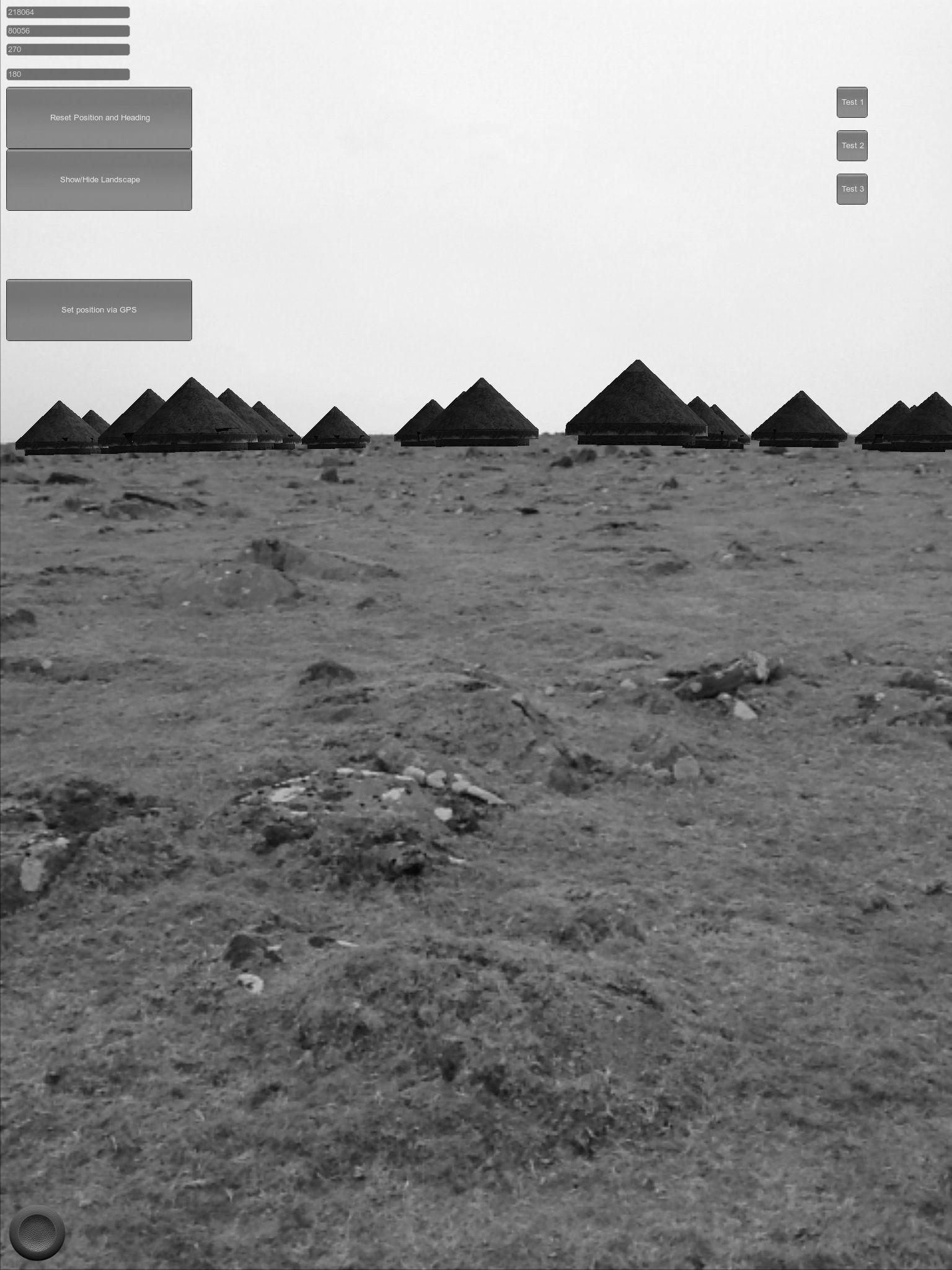
The creation and deployment of the embodied GIS involves a number of steps. The technical details of the process have been documented in detail elsewhere (Eve 2012; Eve 2014); in short, a 3D model of the landscape is created within an iPad application which can then be loaded with data fed directly from a desktop GIS. This initial model can then be used for augmenting different senses – for example, the nature of the software allows these data to be overlaid on the landscape as 3D objects that appear with the correct perspective and scale on the video feed of the iPad (Figure 3). In the following sections I will discuss augmenting visual, aural and olfactory elements into modern archaeological landscapes.
Internet Archaeology is an open access journal based in the Department of Archaeology, University of York. Except where otherwise noted, content from this work may be used under the terms of the Creative Commons Attribution 3.0 (CC BY) Unported licence, which permits unrestricted use, distribution, and reproduction in any medium, provided that attribution to the author(s), the title of the work, the Internet Archaeology journal and the relevant URL/DOI are given.
Terms and Conditions | Legal Statements | Privacy Policy | Cookies Policy | Citing Internet Archaeology
Internet Archaeology content is preserved for the long term with the Archaeology Data Service. Help sustain and support open access publication by donating to our Open Access Archaeology Fund.