Related to the ideals of digital archaeological documentation, whether we are talking about single context planning or schnitt, we are in fact dealing with a common basic assumption; that GIS or CAD delivers what we need in terms of vector-representation and raster management of observations and interpretations in archaeological recording. What is perhaps not immediately recognised is that the tools and software in question were developed alongside the archaeological methodologies during the 1980s and 1990, and that the tools in fact helped shape our methodology. This is, however, also what to expect, working with the available tools.
Today GIS can be considered the standard for archaeological spatial recording (Wheatley and Gillings 2002; Conolly and Lake 2006), but in fact it is hardly ever questioned and it is actually debateable whether GIS or CAD was the right choice for archaeology all along, and if it really deserves the wide acceptance we see today. GIS and CAD of course demonstrate some unique capabilities. For example the ability to make our spatial data 'globally aware' and to fit it into a broader, geographic and landscape-analytical perspective, combined with the collective representation of layers, which fits very well into the framework of stratigraphical or single context archaeology. But it comes at a cost. Fundamental to archaeological field methods is an ongoing struggle with the abstraction of transforming the interpretation of a three-dimensional world onto a two-dimensional surface, be it paper or computer screen. GIS has until very recently had problems representing true 3D in a way that actually corresponds to how our field methods operate. Everything is represented as a topside projection onto a geographic model. Since archaeology is not only about getting an overview map, but actually often a matter of extracting information from a three-dimensional representation, GIS never quite seems to solve that. From the perspective of an open-area site with perhaps thousands of postholes, especially one in Denmark, where the focus is on box-cut, one cannot ignore how much work is going into describing and correlating vertical sections or profiles, but how little it actually integrates into the standard GIS representation. Traditionally plane and section, horizontal and vertical documentation are managed separately, and only brought together through post-processing and setup of combined illustrations. The fact is, our traditional excavation methodology is based on two-dimensional units, documented in a vertical or horizontal plane. In that regard, the norm of documentation - regardless of methodological traditions - is the abstraction of a 3D spatial representation comprised of 2D fragments. We would see georeferenced plan drawings with vertical section drawings (raster or vector) detached and in an arbitrary two-dimensional coordinate system.
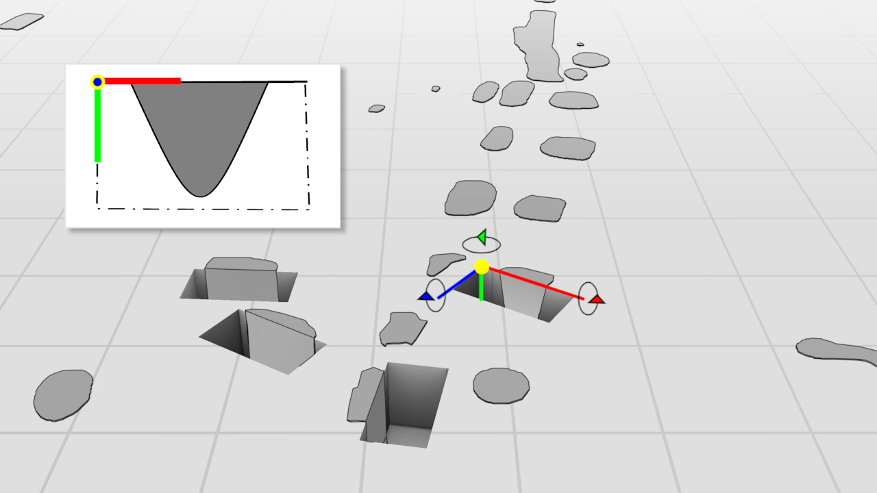
In this scenario, what GIS does not deliver is the ability to essentially georeference rasters and vectors in 3D. Currently, different workarounds are employed to convey the appearance of vertical sections in, for example, ArcScene, but it is not straightforward (Katsianis et al. 2006; 2008; Forte et al. 2015; Berggren et al. 2015; Landeschi et al. 2016). Usually, a raster image is georeferenced by defining the world coordinate of the top-left corner of the image, along with pixel size and rotation in relation to a world coordinate system. In fact, although not in use, the GeoTIFF specifications include x, y and z coordinates 'in anticipation of future support for 3D digital elevation models and vertical coordinate system' (Ritter and Ruth 2000). An archaeological information system that would allow for defining translation and rotation (origin, scale and three rotational axes) would effectively allow us to raise our two-dimensional sections (raster or vector) and integrate horizontal and vertical plans in a flexible visual representation that supports our current and historical excavation methodology (Figure 10)
As mentioned, the hand drawn excavation plan translates extremely well to a digital vector equivalent, which is fundamental to GIS and CAD. This direct conceptual correlation has undoubtedly helped accelerate the migration to GIS and CAD, and in combination with the possibilities of assigning attributes and performing analyses on vector representations, it has proven to be a very powerful tool. But is it possible that adhering to the concept of line drawing using vectorisation, and focusing on the use of GIS and CAD, is actually what has impeded the full integration of spatial data in the archaeological documentation, especially in the context of 3D documentation?
To most archaeologists, the line drawing is what separates mere descriptive observation from actual, interpretative or reflexive documentation, and removing it would undermine the value of documentation (Berggren et al. 2015; De Reuet al. 2013; 2014; Forte et al. 2015; Hodder 1997; 2000). But is it a necessary element of digital documentation, or a product of misconceptualised digital migration? It is worth considering if vector representation is actually how we want to use 3D models, or if it is just what current GIS solutions allow us to do.
The biggest challenge in using 3D documentation is how to do so on its own merits and not by reference to traditional 2D line drawing. This cannot be understated. We also need to learn how to effectively work with 3D polygons, if that is the goal, and deal with the way GIS uses projection and interpolation to conform vectors to 3D mesh surfaces.
Internet Archaeology is an open access journal based in the Department of Archaeology, University of York. Except where otherwise noted, content from this work may be used under the terms of the Creative Commons Attribution 3.0 (CC BY) Unported licence, which permits unrestricted use, distribution, and reproduction in any medium, provided that attribution to the author(s), the title of the work, the Internet Archaeology journal and the relevant URL/DOI are given.
Terms and Conditions | Legal Statements | Privacy Policy | Cookies Policy | Citing Internet Archaeology
Internet Archaeology content is preserved for the long term with the Archaeology Data Service. Help sustain and support open access publication by donating to our Open Access Archaeology Fund.