1 / 3
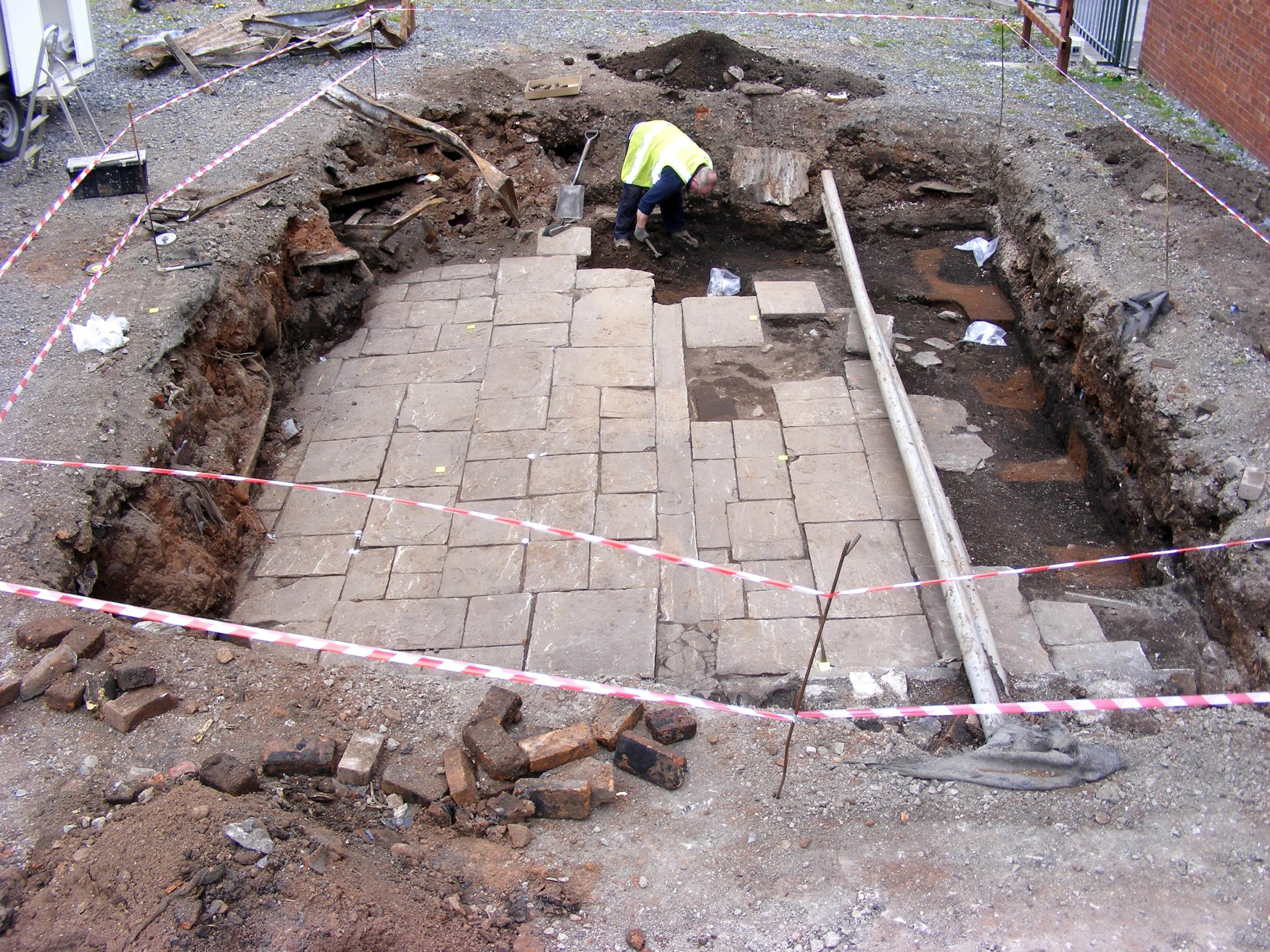
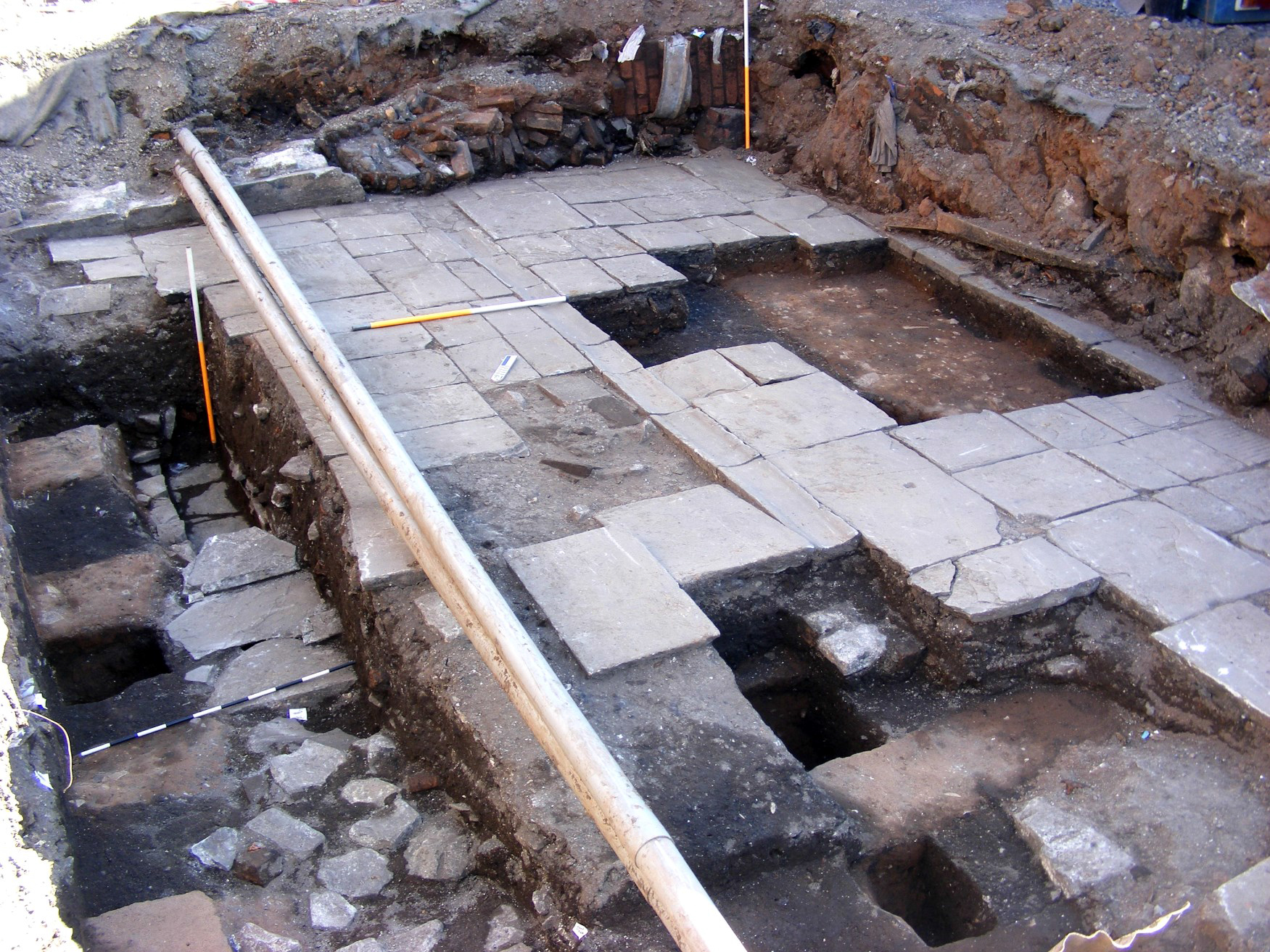
Figure 35: General view of Area C, partially excavated, showing flagstone surface (1184), overlain by modern dump and levelling deposits. View to north-west
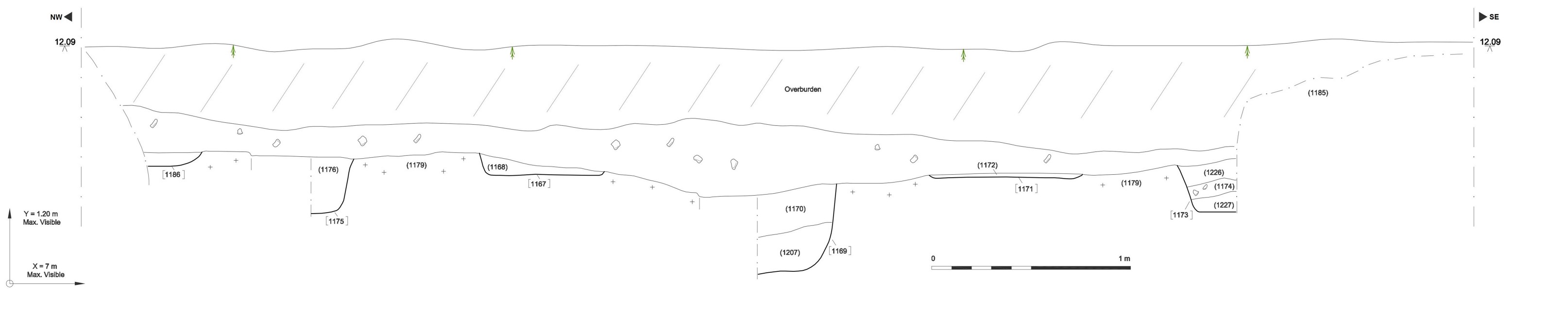
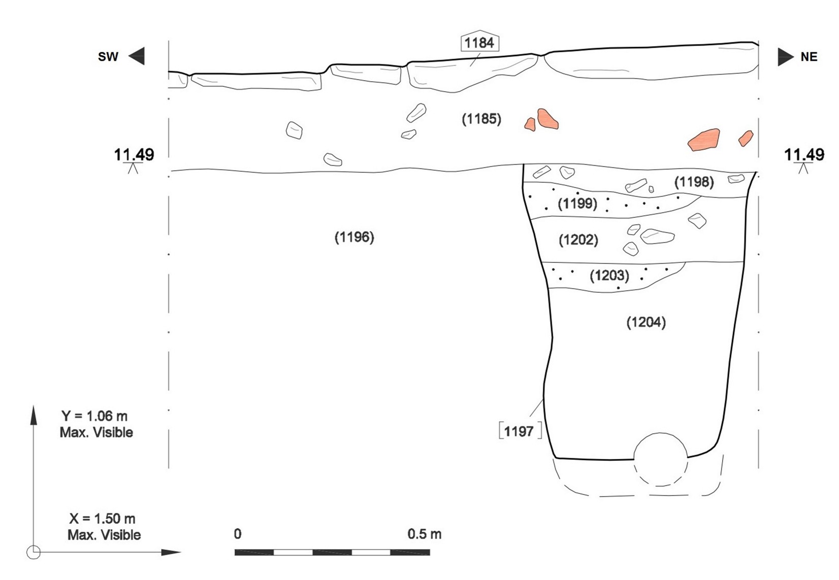
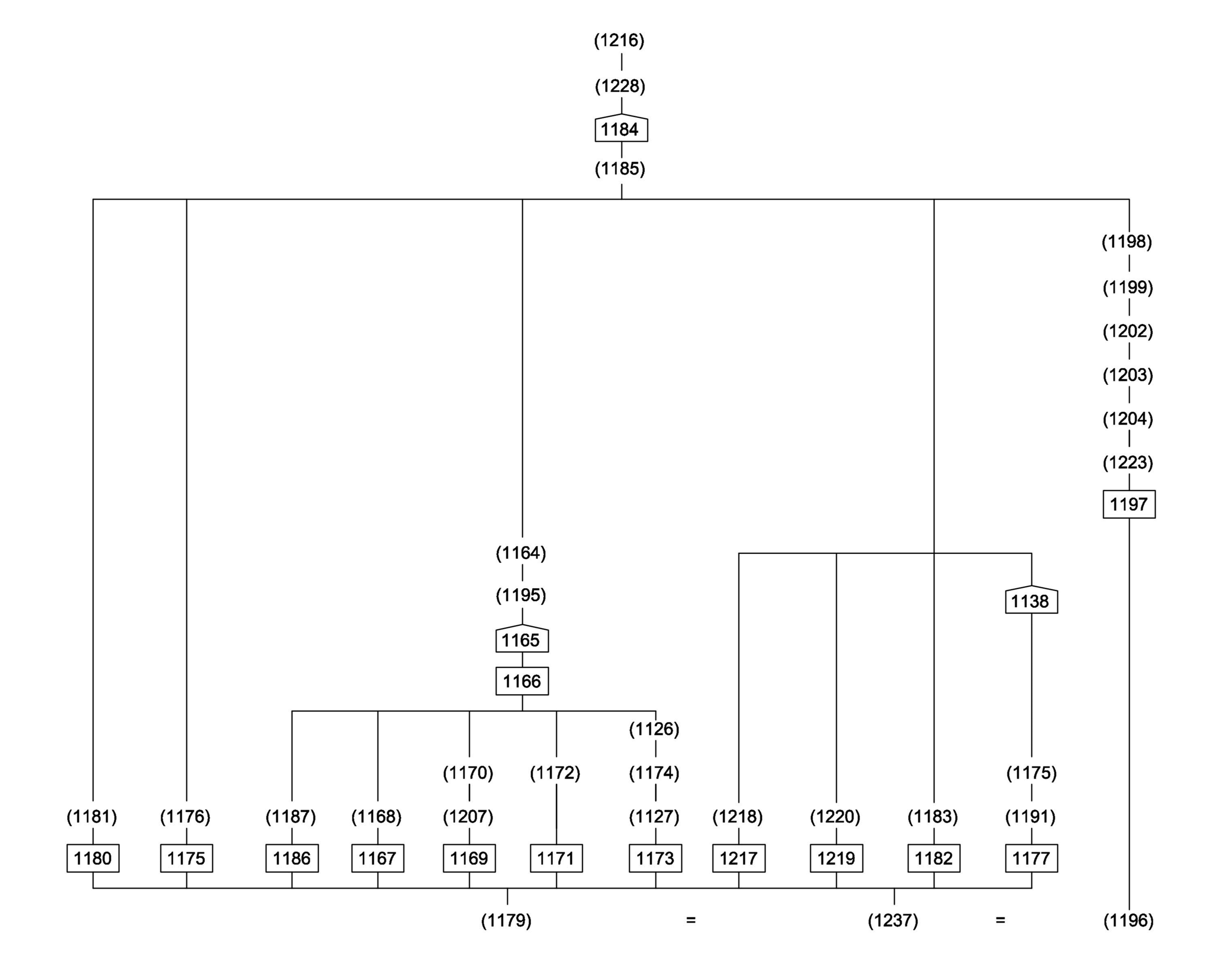
The primary deposit in this area is represented by (1179), and its analogues (1237) and (1196), (and see Figure 31, also see Figure 32: South-west facing section, Figure 33: South-east facing section, and Figure 34: Site matrix), which is taken as being a disturbed and/or partially redeposited natural layer, perhaps relating to the depositional regime of the River Frome, in the former floodplain of which the site lies. This deposit equates to others of a very similar nature which had already been identified in the basal deposits in the other two excavation areas.
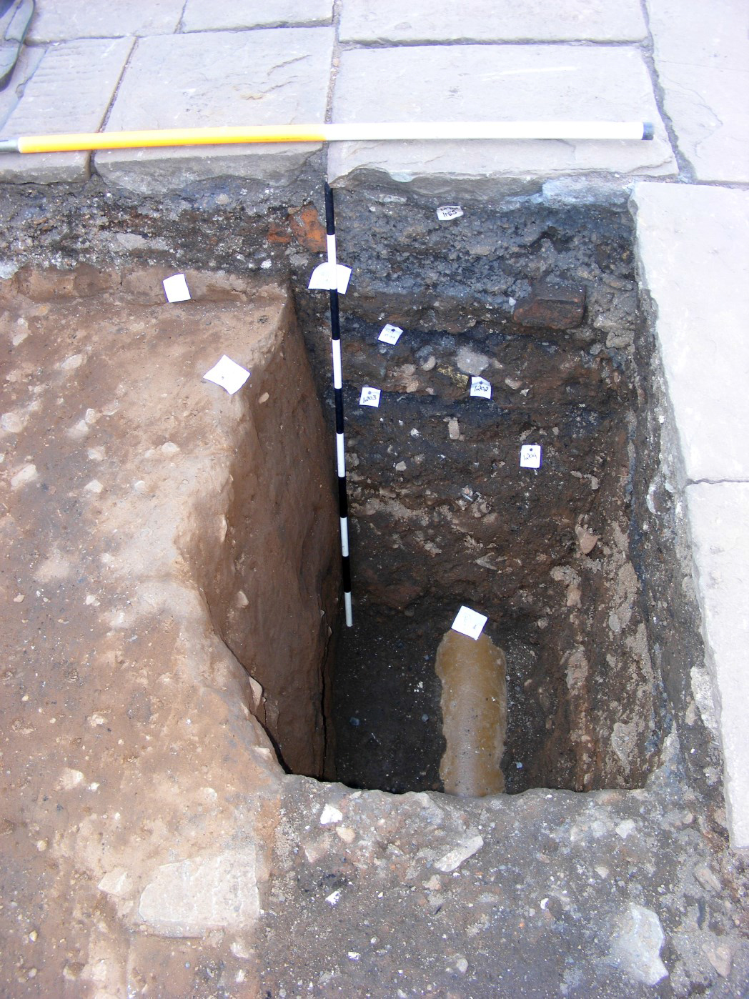
Phase 1. The earliest features in this area appear to be a series of largely undated linear gullies running south-west/north-east (cuts 1173, 1121, 1186, 1167, 1169, 1171, 1182 and 1177). It is likely that cuts (1217) and (1219) are also part of this group. Some of these features displayed clear termini (e.g. 1182, 1175, 1217, 1219 and possibly 1177). Their bases centred at around 11.20m aOD, which was among the lowest values on the site. Only one of these cuts, (1180), with its fill (1181), produced finds that could be dated even approximately: a base of a glass vessel, probably from a jelly or bonnet glass, and dating to the mid- to late 18th century, and a fragment of bone comb, also of probable 18th century date.
The purpose of these features is unknown, but it seems possible that they are some kind of cultivation ditches, possibly cut from higher up, so that the remains recovered may represent only the surviving bases of the original cuts. None of the fills of these features produced ceramic material that could be dated to any earlier than the late 17th/18th century, but the overwhelming majority was firmly 18th century.
Phase 2 was represented in this trench at its north-eastern side, where the various fills of the Phase 1 features were truncated by a cut (1166) for a stone-built culvert (1165) running north-west/south-east, and complete with cap-stones. This culvert is likely to be of 18th century date, and may represent part of the earliest phase of built development on the site, perhaps contemporary with the main spine wall (1043) in Area B.
Phase 3 in this area seemed to consist solely of a cut (1197) into the natural, also running north-west/south-east, and into which was inserted a modern-looking ceramic drain (1223) (technically a Vitrified Clay Pipe) and a series of backfill deposits.
Phase 4 involved the laying of a levelling and bedding layer (1185), which sealed the pipe cut and its various fills, and which extended across the whole of the excavated area, also sealing the culvert (1165). This was then immediately followed by the laying of flagstone surface (1184). By definition then, it is very unlikely that the flags, at least as they were revealed, were laid before about 1900. It is perfectly possible that Phases 3 and 4 represent closely related events that took place within a relatively very short space of time.
Phase 5. At the south-eastern corner of the excavated area, a wall (1228) was built on top of flag surface (1184). This was the last 'archaeological' phase before the dumping of modern overburden (1216) directly onto the flags. Again, this wall is undated, and all that can be said is that it must post-date the flagstone surface. It is most likely, however, to be late 19th or 20th century in date.
Browse via image gallery (Figures 35-37)
Internet Archaeology is an open access journal based in the Department of Archaeology, University of York. Except where otherwise noted, content from this work may be used under the terms of the Creative Commons Attribution 3.0 (CC BY) Unported licence, which permits unrestricted use, distribution, and reproduction in any medium, provided that attribution to the author(s), the title of the work, the Internet Archaeology journal and the relevant URL/DOI are given.
Terms and Conditions | Legal Statements | Privacy Policy | Cookies Policy | Citing Internet Archaeology
Internet Archaeology content is preserved for the long term with the Archaeology Data Service. Help sustain and support open access publication by donating to our Open Access Archaeology Fund.