In the 2015 field season, the project entered its 'paperless' phase wherein essentially all of our recording was completed in the field, using the tablets. At Çatalhöyuk, this entails a rather large operation. The whole excavation team, in 2015 consisting of 42 persons, was involved in the digital recording. This included, as mentioned above, doing real-time recording directly into the project's Access database. Unit sketches (of the kind usually found on the reverse of the unit sheets) were done on tablets, utilizing Wacom Bamboo Paper. Daily sketches (end of day progress sketches of the excavation – as discussed in Berggren et al. 2015, 435–8), were completed using the camera of the tablets themselves, digitally appended, and uploaded to the central server. But perhaps more importantly, stratigraphic units were recorded in the field, on the tablets. Here we expand on how we implemented this methodology, as our GIS database has become a fundamental tool in our exploration and interpretation of the archaeological record at Çatalhöyük.
From 2013 onwards, different teams have been using tablet technology to digitise stratigraphic units in the field, with parallel workflows incorporating ESRI's ArcGIS and the open source QGIS. Their primary function was seen to be as a tool for recording. However, from the outset a number of fundamental goals were established for the preparation of any digital workflows and equipment choices. The most important of these included:
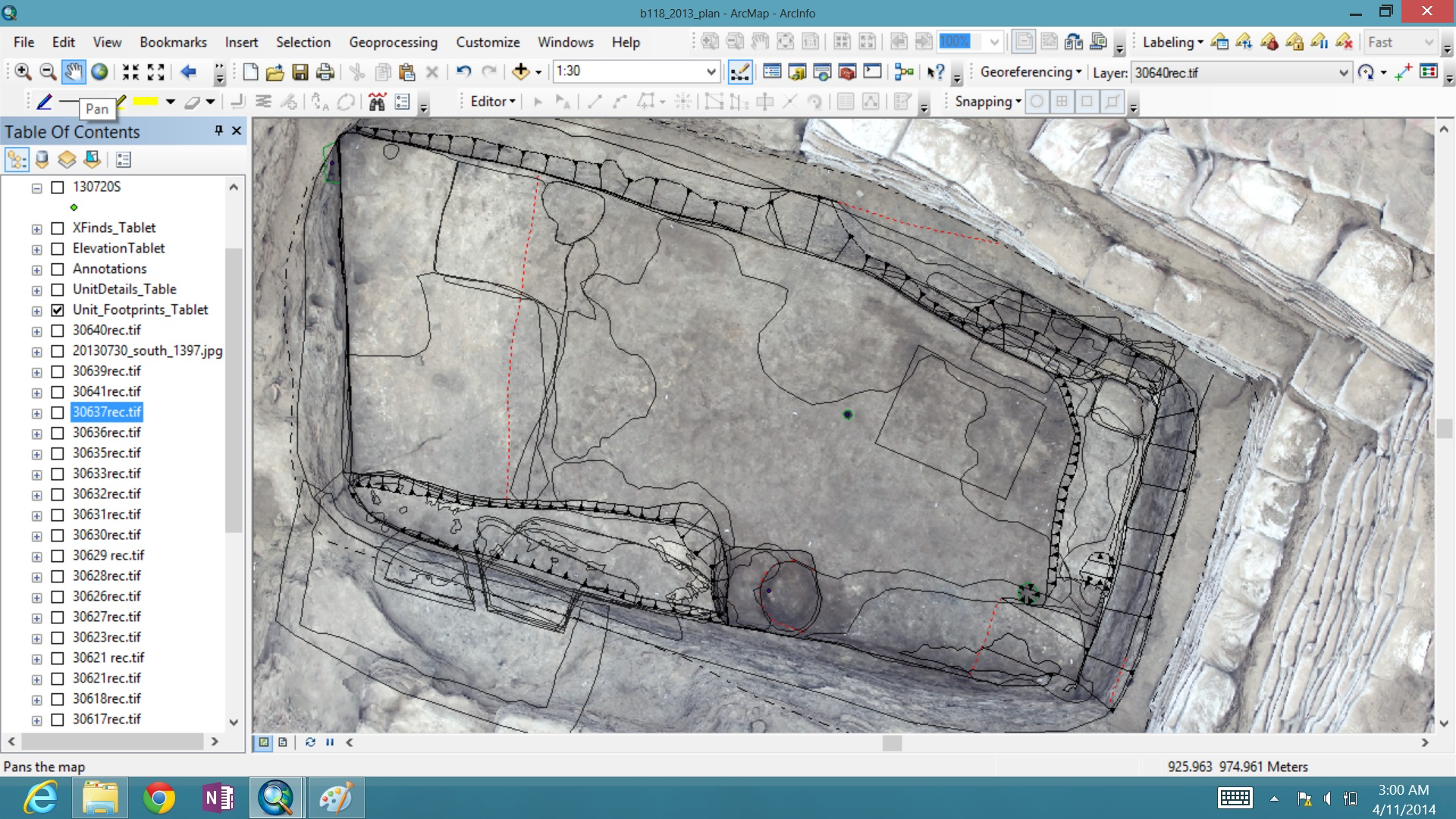
Following two seasons of experimentation, the workflow that was rolled-out across the project centred upon the use of ArcGIS, and although the workflow itself is flexible and dynamic, it is composed of the following broad steps:
One of the key issues with this approach is that the accuracy of the graphics produced can vary depending upon the quality of the source data (photographs) and the rectification process, which is essentially a 'rubber-sheeting' 'best-fit' approach. This problem is easily compounded by the relative level of care, skill or experience of the operator. The rectification process was especially problematic in the early stages of workflow implementation. Our initial solution for photo rectification consisted of proprietary software, often used in architecture (Perspective Rectifier). The software did not work well with Neolithic remains, nor the tablet, and caused significant delays and sometimes heavily skewed rectifications. Using the geo-referencing tool in ESRI's ArcMap to process photographs was an alternative solution which yielded better than expected results in terms of accuracy and efficiency.
Furthermore, data validation, although not as big an issue as initially anticipated, remains a problem, and a degree of rigour needs to be set up from the outset, with regular checks by those co-ordinating the process. Similarly, backup routines need to be rigorously enforced to avoid obvious problems. In terms of manipulating the graphics for analysis, checking stratigraphic relationships is harder than with paper archives; relationships are easily missed because plans are not physically overlain. However, this is not insurmountable and simply requires a slightly different approach to the problem and some understanding of how to query and filter the data in the GIS. In general, most of the problems stem from the less-experienced GIS operators. On the positive side, dealing with metadata was notably more straightforward in tabular form.
In terms of the hardware, the Windows Surface Tablets selected for this task have proved robust as long as some care is taken in looking after them (it is important to note that ÇRP's excavations take place in a dry but hot environment). However, it proved advisable to keep spare styli since the loss or damage of this weaker component could cause serious delays or problems. Throughout this process we sought to tune our methodology as we went along, in response to problems we encountered in the field, a process that did not always go smoothly and involved some tactical improvisation and negotiation both on and off site.
Internet Archaeology is an open access journal based in the Department of Archaeology, University of York. Except where otherwise noted, content from this work may be used under the terms of the Creative Commons Attribution 3.0 (CC BY) Unported licence, which permits unrestricted use, distribution, and reproduction in any medium, provided that attribution to the author(s), the title of the work, the Internet Archaeology journal and the relevant URL/DOI are given.
Terms and Conditions | Legal Statements | Privacy Policy | Cookies Policy | Citing Internet Archaeology
Internet Archaeology content is preserved for the long term with the Archaeology Data Service. Help sustain and support open access publication by donating to our Open Access Archaeology Fund.