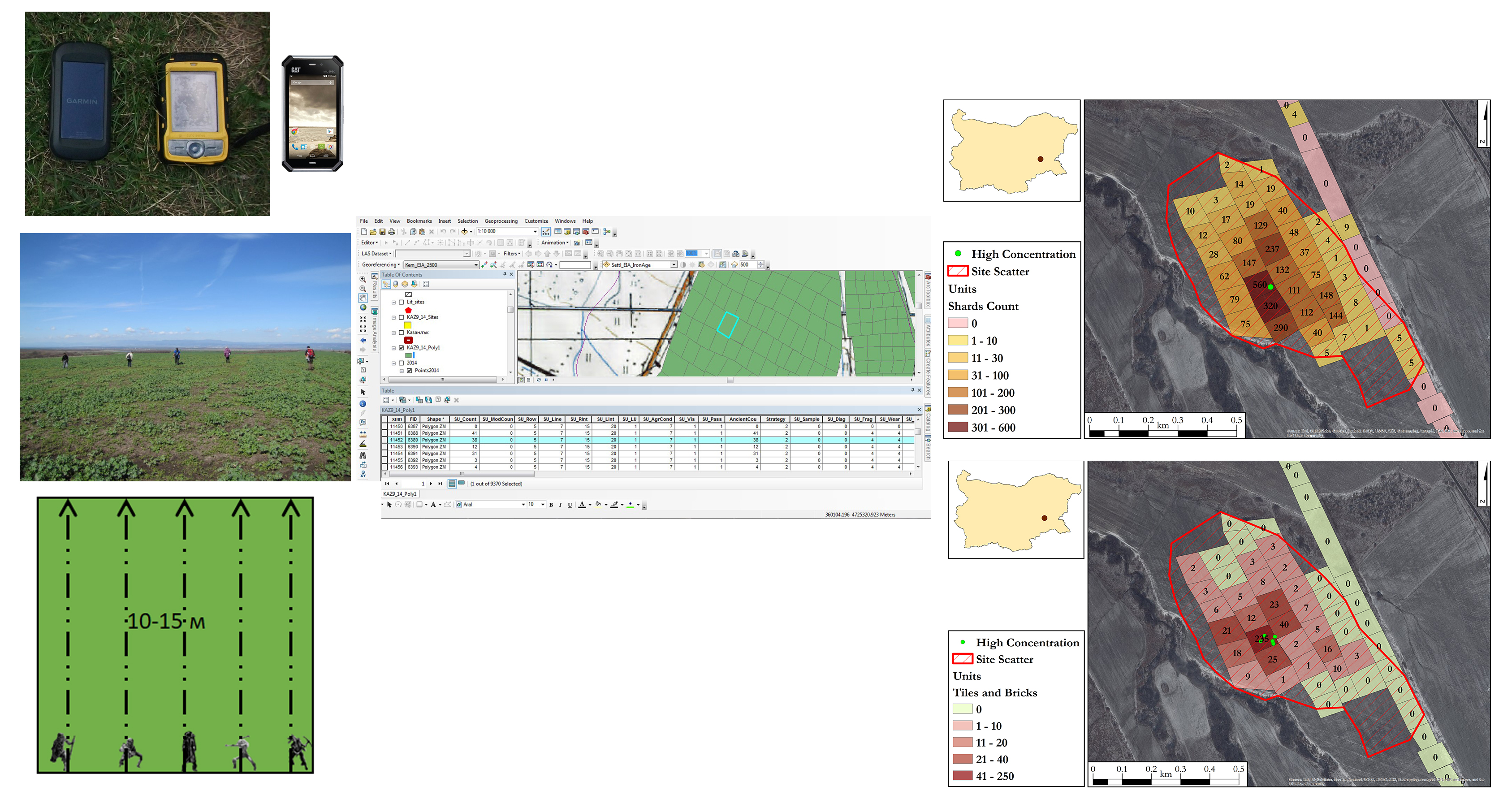
Figure 1: Field surveys in Bulgaria. Fieldwork, data input, and data analysis in GIS. Image: N. Kecheva
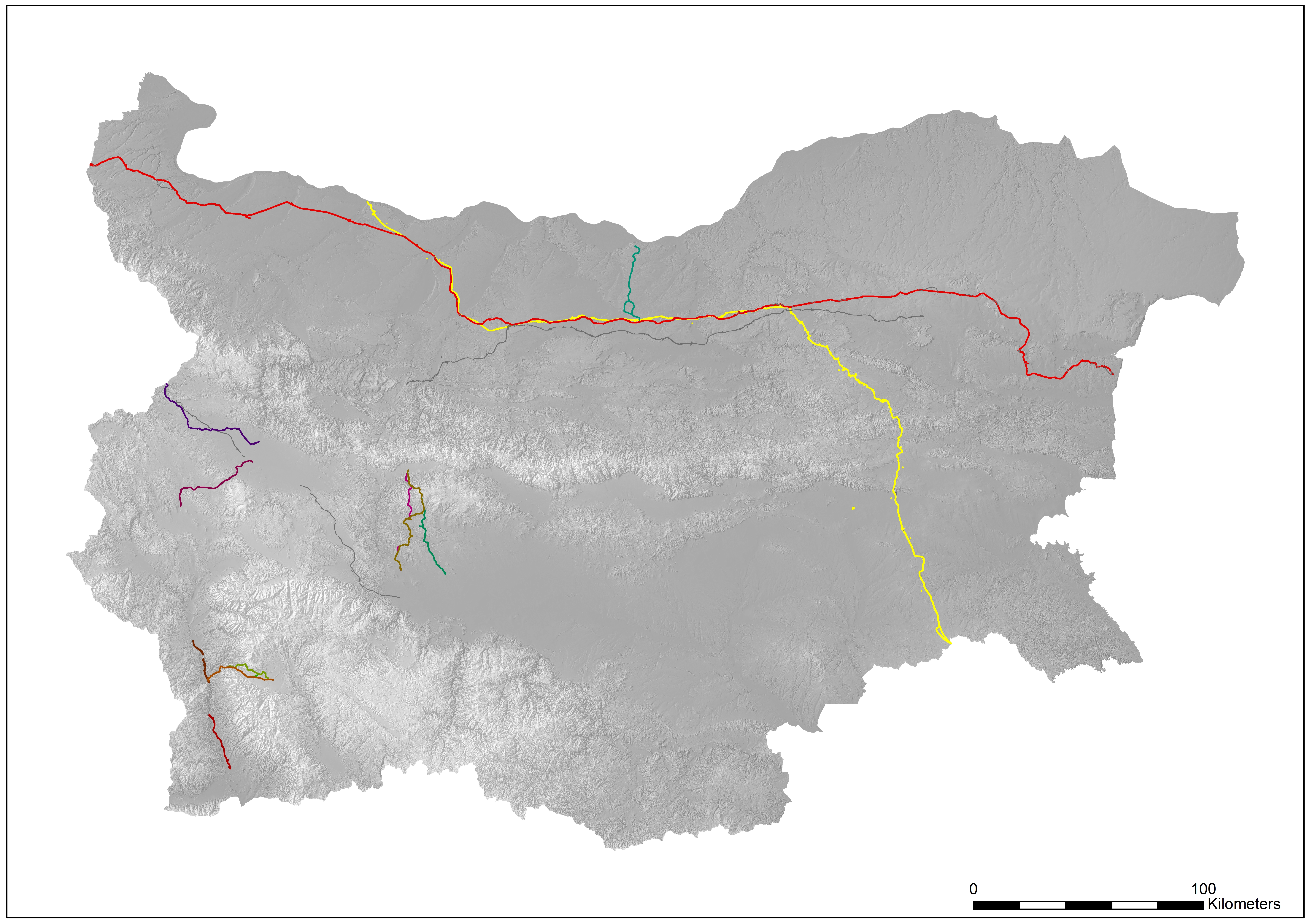
Figure 2: Transport and pipeline infrastructure projects executed in the period 2011-2017. Different colours represent different projects. Image: N. Kecheva
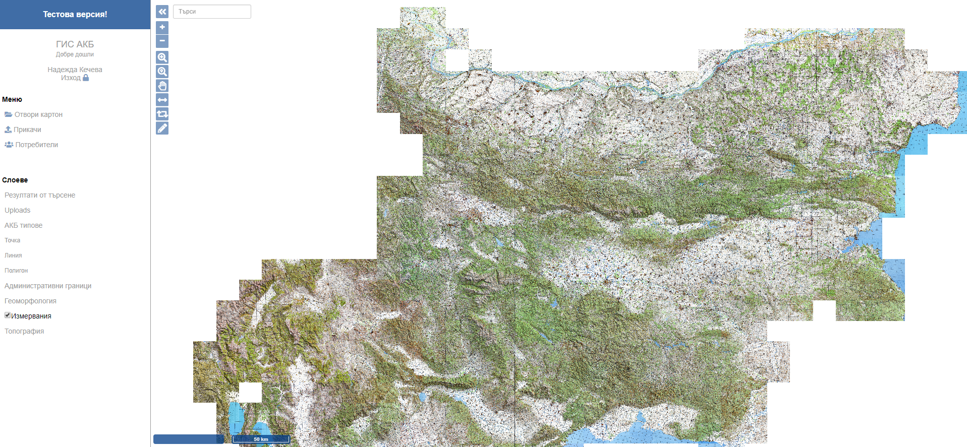
Figure 3: Archaeological geographic information system 'Archaeological Map of Bulgaria'. Image: N. Kecheva
Internet Archaeology is an open access journal based in the Department of Archaeology, University of York. Except where otherwise noted, content from this work may be used under the terms of the Creative Commons Attribution 3.0 (CC BY) Unported licence, which permits unrestricted use, distribution, and reproduction in any medium, provided that attribution to the author(s), the title of the work, the Internet Archaeology journal and the relevant URL/DOI are given.
Terms and Conditions | Legal Statements | Privacy Policy | Cookies Policy | Citing Internet Archaeology
Internet Archaeology content is preserved for the long term with the Archaeology Data Service. Help sustain and support open access publication by donating to our Open Access Archaeology Fund.