Bastles, along with a type of structure known as a 'Shieling', are structural types characteristic of the early modern upland societies of Northumbria and Cumbria. Shielings are found in the upland pastures and comprise the cottage dwellings used by transhumant herders during the summer months. Bastles, by contrast, take the form of defensible two-storey farmhouses, and represent the more permanent farmstead base of this largely pastoralist upland community. For a detailed account of the form and location of these unique structural types see Ramm et al. (1970).
Unlike the Peel Gap case study, the purpose here is not to identify and explore a clear, functional problem. Instead the aim is to illustrate how VRML can be used to explore and negotiate the landscape context of a monument more experientally, and to enable the participatory dynamics of a landscape encounter to be communicated, overcoming the static, abstracted modes of display and dissemination offered by traditional archaeological-GIS.
An interesting concept that is highly applicable here is the Heideggerian notion of 'gathering' (Thomas 1996; 49) where things, be they social actors, places or structures, are understood to gather the world around themselves in their own unique way. Although discussed primarily in relation to the notion of the human subject as positioned in space and time, the concept offers an insight to enhance more grounded ideas of context, and the specific qualities of significant places.
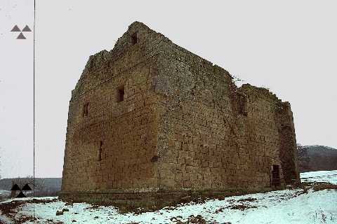
A graphics utility was then used to rectify the photographs to enable them to be mapped directly onto the walls of the bastle model, though it should be noted that this procedure is now possible entirely within the latest version of the Photomodeller software suite.
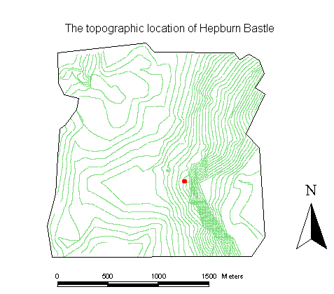
The surrounding topography of the bastle was derived in the first instance from the Ordnance Survey 1:25000 series base-map, with detailed enhancement undertaken by way of a total station survey in the direct vicinity of the bastle itself. The resultant LSS derived TIN was then exported into the Pioneer Pro modelling package, whilst a detailed contour representation was exported to the Arc/Info GIS package where it comprised the source input in the construction of a DEM of the study area.
The purpose of exporting the TIN's faceted surface model to Pioneer Pro was to enable the number of triangles used to encompass the varying topography of the area, the polygon count, to be reduced before implementing the model in VRML. Unlike simple buildings and artefacts, real landscapes can be infinitely complex in form, resulting in huge VRML models that are simply too large to export and render successfully on standard desktop computers. Pioneer Pro was used to generalise the original TIN to reduce the number of component triangles within it whilst still retaining the general topographic trends that characterise the landscape of the area under study.
The construction of the DEM in Arc/Info was undertaken to ensure that this generalisation procedure did not result in the loss or compromising of any significant micro-topographic detail in the resultant VRML world. The GIS- derived DEM was exported into the Vistapro fractal visualisation utility, where a highly detailed surface image of the study area, in all its complexity including detail no longer visible in the optimised TIN, was generated and saved in a JPeg image format.
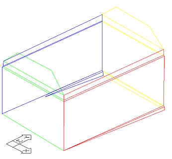
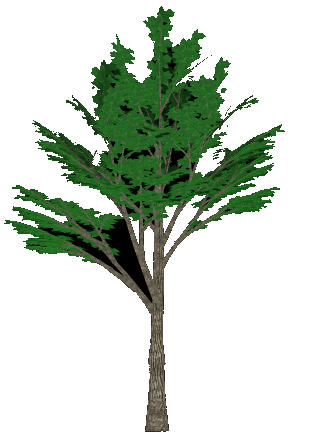
The final stage was to combine the various elements using the Truespace 3-dimensional modelling package, draping the detailed fractal image over the generalised topographical surface produced by Pioneer Pro, to yield a model that combines a high degree of visible detail with a remarkable compactness of size. The Photomodeller derived bastle was then added along with a number of trees in their exact locations as recorded on the original detailed survey (Figure 21). The resultant world was then implemented in VRML using Pioneer Pro (Figure 22 - in VRML).
© Internet Archaeology
URL: http://intarch.ac.uk/journal/issue1/gillings/part10b.html
Last updated: Tue Sep 5 1996