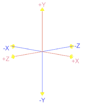
One very important issue in using VRML to implement archaeological models concerns the nature of the co-ordinate system utilised by the format. VRML uses a right-handed, three dimensional Cartesian co-ordinate system. The positive X-axis is to the right, the positive Y-axis up, and the positive Z-axis out towards the viewer.
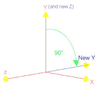
What must be realised, however, is the fact that whilst VRML files do exist within a single conceptual 'world' co-ordinate system where the scene is assembled, any transformation undertaken (e.g. movement, rotation or scaling) is referenced not to a single co-ordinate system origin, but to the last referenced co-ordinate system, creating in effect a new local system. Fuller details of this process can be found in the full VRML 1.0 specifications.
© Internet Archaeology
URL: http://intarch.ac.uk/journal/issue1/gillings/part9c.html
Last updated: Tue Sep 5 1996