Figure 1: John Speed's map of York (1610)
The Marks & Spencer premises, 44-45 Parliament Street, lie within the historic core of the City of York. Parliament Street was created in the 1830s when many buildings were demolished and properties were bisected to link the markets of Pavement and Thursday Market (St Sampson's Square). The plots affected between St Sampson's Square and Jubbergate are shown on a plan of 1833 drawn by P. Atkinson and Son. Thus there are no buildings earlier than the 1830s in the street today.
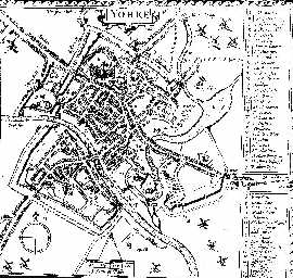
Prior to the creation of Parliament Street, properties ran in a continuous line along the northern edge of Pavement westwards to High Ousegate. Jacob Richard's map of 1683 shows gardens to the rear of these houses although these appear to have been infilled with buildings by the 1830s. The area was bounded to the west and east by Peter Lane and Shambles respectively although a number of smaller lanes gave access to the properties in back yards (where small tenements were located behind the buildings on the street frontage). The street pattern of Pavement, Jubbergate, Peter Lane and Shambles is seen consistently from the earliest anonymous map of c. 1545, through Speed's map of 1610 (Fig. 1) and in greatest detail on William White's plan of 1782, on which the owners of the various properties were listed. Fronting Pavement, close to the market cross, was group of small traders including a bookseller, baker, hatter, cutler, draper and upholsterer.
Figure 1: John Speed's map of York (1610)
Although not recorded until c. 1545 the medieval and earlier street plan was probably much the same. One significant difference is hinted at by a reference to St Swithin's Lane in 1436. The precise location of this street and the church to which it presumably led is not known but the discovery of burials in the 19th century suggests that it is somewhere in the vicinity of the existing Marks & Spencer store. The boundaries of the graveyard, finds from which suggest that it was in use between late Saxon times and the 13th century, have never been defined. However, the lack of human skeletal material from deposits of the correct date suggests that this particular site is outside the burial ground.
Excavations at Lloyd's Bank, Pavement (approximately 50m to the south-east), in 1972-4, and observations along the line of the Parliament Street sewer (40m to the south-west), in 1976, strongly suggest a considerable depth of well-preserved deposits of medieval and Anglo-Scandinavian date within the general area (Addyman and Hall 1991).
Prior to this project taking place, there had been little controlled archaeological work on this site. Finds made in the 19th century and again in 1929, indicate that there was a large graveyard with coffined burials extending back from Parliament Street to Newgate market. Dudley Waterman also reported on material from the site during the construction works for the present Marks & Spencer store (1959). This indicates the presence of Anglo-Scandinavian and medieval deposits on the site.
The main archaeological observations in this area have been made at Lloyds Bank, Pavement, and at the Coppergate site. At the Lloyds Bank site, a deep, narrow trench was excavated in the basement of the Lloyds Bank building (Addyman and Hall 1991). It indicated a complex archaeological sequence, including post-medieval floor and construction deposits, a sequence of Anglo-Scandinavian wattle and timber buildings with associated occupation deposits, a build-up of organic silts during the Anglian period, and a phase of Roman construction activity. The sequence extended from 11.2m OD down to natural deposits at 3.75m OD, a depth of 7.45m of archaeological deposits (Addyman and Hall 1991).
At Coppergate a complex well-preserved sequence of deposits dating from the late 1st century to the 16th century was excavated by the York Archaeological Trust (Hall 1994). The most important archaeological sequence dated from the mid-late 9th century through to the late 11th century. It represented the emergence of a series of property boundaries, perhaps associated with the laying out of Coppergate, and the development of four tenements fronting on to Coppergate. A series of buildings exhibiting different construction techniques were excavated and evidence for the operation of iron-working and other trades on a commercial scale was also recovered Hall (1994 passim). This stratigraphic sequence was characterised by the accummulation of deep organic-rich deposits.
In terms of the archaeology of the Roman settlement, the site lies in the area between the Legionary Fortress and the River Foss, the so-called canabae. There has been relatively little modern archaeological investigation in this area. Therefore, discussion of the topography and use of this area has been of necessity speculative. A discussion of the evidence can be found in Brinklow (1995).
© Author(s). Content published prior to 2013 is not covered by CC-BY licence and requests for reproduction should usually go to the copyright holder (in most cases, the author(s)). For citation / fair-dealing purposes, please attribute the author(s), the title of the work, the Internet Archaeology journal and the relevant URL/DOI.
Last updated: Wed Mar 6 2002