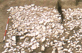
Image: B-A2-18
Location: Site B, Area 2
Plan of Saxon features | Plan of Medieval features | Plan of Site B
Aspect: View looking W
Detail of the surface of the intra-mural walkway, on the inside of the corner between the south and the west banks. The post-hole for the possible corner turret is to the left; the trench to the right is a recent field drain. The large stones to the bottom right, and some overlying the walkway, are from period 3A. (See further details of the surface in photo 2/17, and general views in 2/20, 2/21, and 2/22.)