In order to investigate the nature of tell-based visibility, GIS-based methods were applied to a study area containing a concentration of well-preserved tells. The study area lies in southern Romania, in the midst of the Romanian Plain, around 85 km southwest of the capital Bucureşti (see Fig. 1). More specifically, it is a 30 × 35km zone roughly centred on the modern town of Alexandria. Here there is exceptional visibility of tell mounds dating to the fifth millennium BC, or Late Neolithic/Early Bronze Age in local culture-history terms. Investigations here took place in collaboration with the Southern Romanian Archaeological Project (SRAP), a joint venture between Cardiff University and The National Museum, Bucureşti (Bailey et al. 1999; 2001; 2002).
The Romanian Plain forms much of the southern border of Romania, and is bounded to the south and west by the path of the Danube. To the east is the Black Sea littoral zone of Dobrogea, and to the north the land gently rises into the foothills of the Transylvanian Alps. Altitudes in the plain are generally less than 100m above sea level, with the very lowest elevations in the Danube´s floodplain. In keeping with the nature of the Plain, the study area is a generally flat and expansive landscape; however, within this monotony there are a number of deep and wide river valleys bisecting the terrace plateaux.
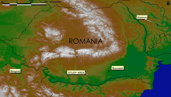
Figure 1: Elevation map of Romania, showing the location of the study area in the Romanian
Plain
Figure 2 shows the study area. The major rivers are the Vedea, which crosses the study area diagonally from northwest to southeast, and the Teleorman, which flows in a north to south direction along the eastern side of the study area. The Teleorman flows into the Vedea at their confluence in the southeastern sector of the study area, joining the Danube 20km downstream. The valley floors of the study area are between 1-4km in width, and meet the terraces in banks of high relief, with the floodplains up to 30m below the terrace edge (see Fig. 3).
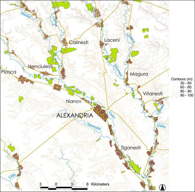
Figure 2: The modern geography of the study area. The villages labelled are those that occur in proximity to a prehistoric tell
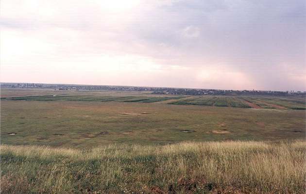
Figure 3: The floodplain at Vităneşti, viewed from the western terrace
© Internet Archaeology
URL: http://intarch.ac.uk/journal/issue16/7/7.html
Last updated: Thur Nov 11 2004